
Want to learn more about Volunteered Geographic Information (VGI) at onX?
You’ve come to the right place.
Only onX Backcountry and onX Offroad users are being asked to opt-in and share Volunteered Geographic Information (VGI) to help us improve our trail networks on the map.
Please note that onX Hunt does not collect VGI. Many onXers are hunters too, and we recognize that location privacy is nonnegotiable for the hunting community. For more information on onX’s commitment to user data privacy, please visit our privacy policy.
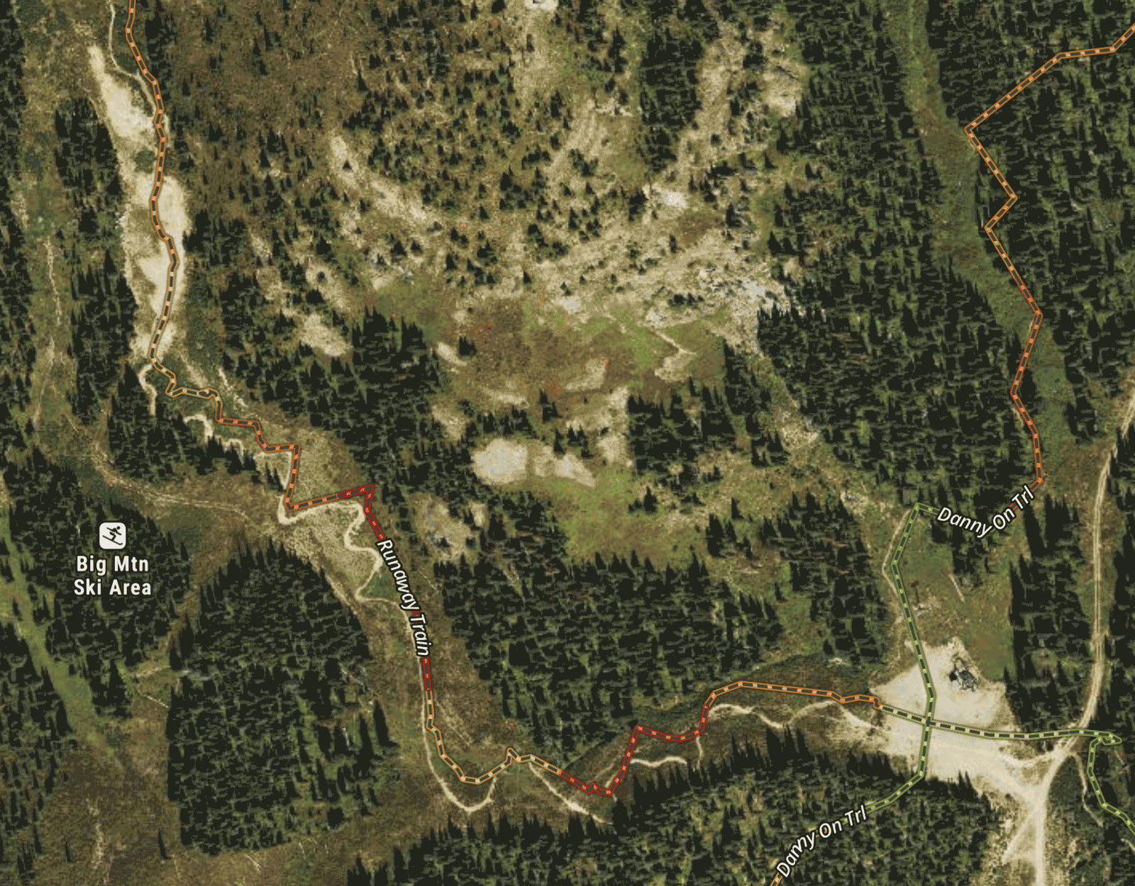
Above is an example of how VGI can help improve onX’s trail information.
VGI is user-generated location-based data. onX uses this data to help improve our local knowledge of an area–like trail networks, open and close dates, gate locations, and more.
With users’ permission, onX collects X and Y GPS coordinates every four seconds when the app is in use and in the foreground on a phone. For example, this can happen if a user is in the field, exploring a trail or an area, with the app open on their phone.
VGI is aggregated and anonymized, and not tied to a specific user. It does not include Waypoints or Tracks.
Yes. App users must actively give permission for onX to gather this information. At onX, we would never passively gather your location information without your explicit consent.
No. VGI is not personally identifiable or tied to any one user. It is aggregated and anonymized.
Access to this data is limited to authorized personnel within onX who use it strictly for analysis and map improvement purposes. This data is never shared with third parties. As a reminder, onX will never sell user data, ever.
onX plans to use this information to improve our maps in areas where we don’t have the most accurate or up-to-date information. As a mapping provider, one of the challenges we encounter are geographic areas that lack reliable data sources. Or, sometimes we have data for an area, but it doesn’t reflect real-time changes in terrain, trails, and land access (for example, if a trail is re-routed).
By gathering aggregated and anonymized user data, we are able to understand if there are places where we need to invest resources to make our maps more accurate and reliable. VGI can help us identify:
- Missing trails
- Trails that are no longer in use
- Stopping points, like lookouts and gate locations
- Deviations from suggested routes, due to trail washout or obstacles
- Time-based challenges, like open/close timeframes, busy days/times for an area, directional or preferred travel
It’s important to also note what onX is not doing with this data. We are not using it to automatically identify and bring trails directly into our maps. Instead, the information will be used to understand where we need more data and resources to build out a more comprehensive map.
This information, along with user-generated trail reports, helps us bring a better experience and comprehensive map to the onX community.
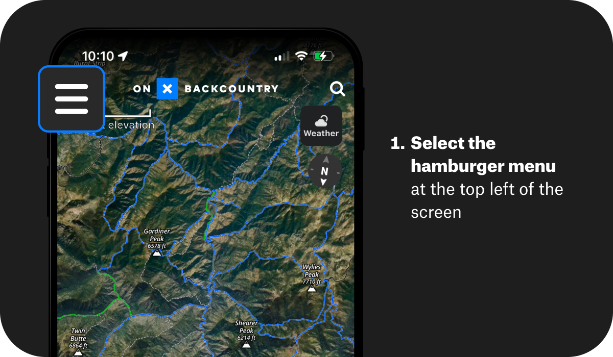
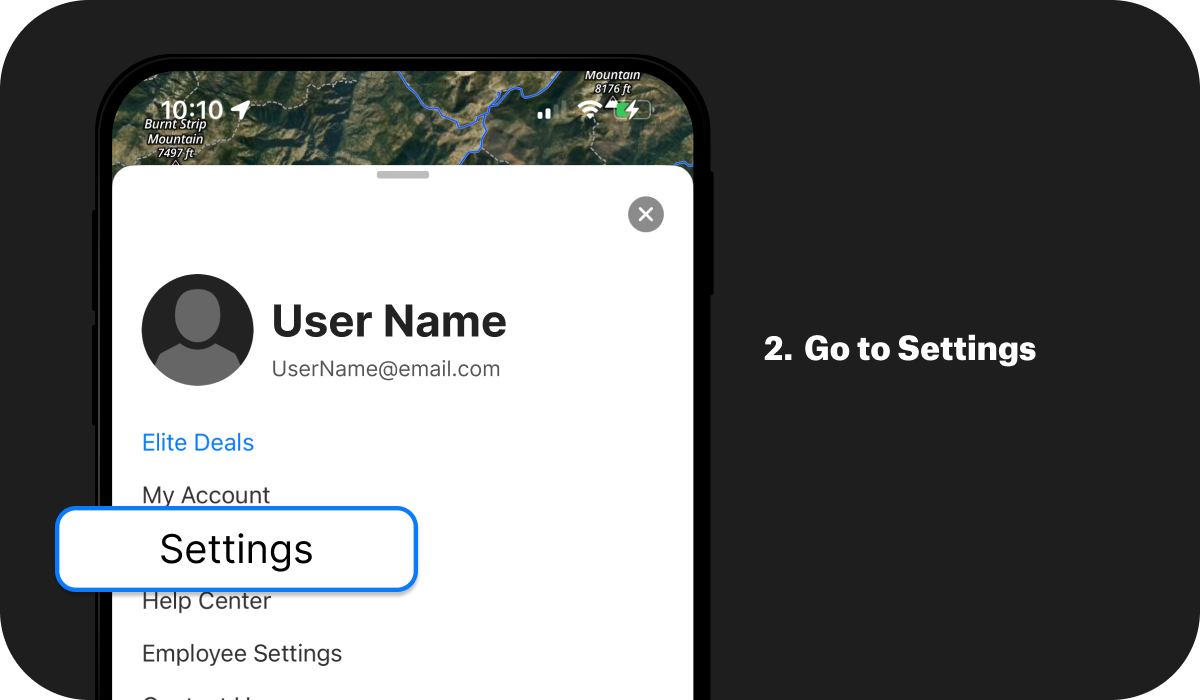
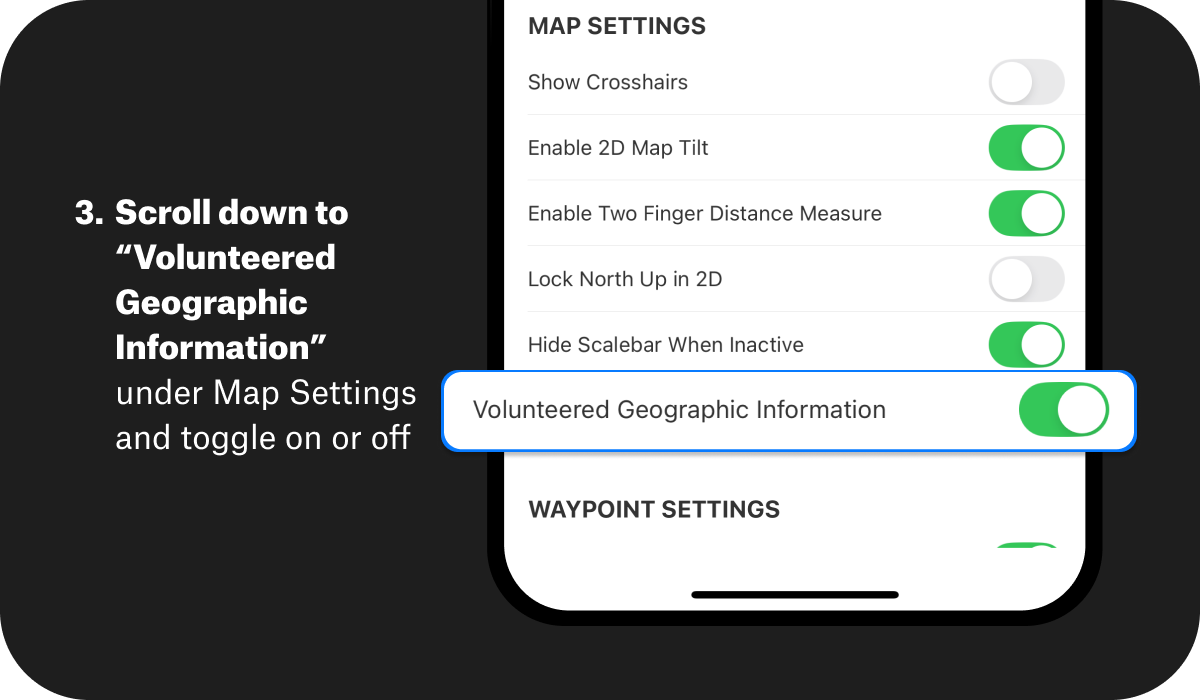
You can opt in or out at any time through the application’s settings menu. Click on the hamburger menu at the top left corner of your screen. Go to Settings and toggle Volunteered Geographic Information on or off. If you’re opting out, please note that your data will be archived one year after it is collected.