
Off-Road Trails in California
Discover off-road trails in California
Off-Road Trails in California
Discover the best off-road trails in California. Browse trail maps, check difficulty ratings, and find your next adventure — whether you're looking for a quick ride or an all-day expedition.
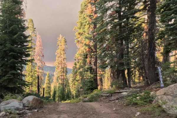
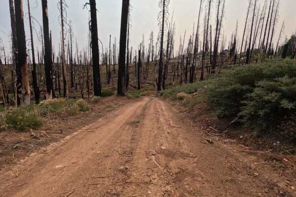
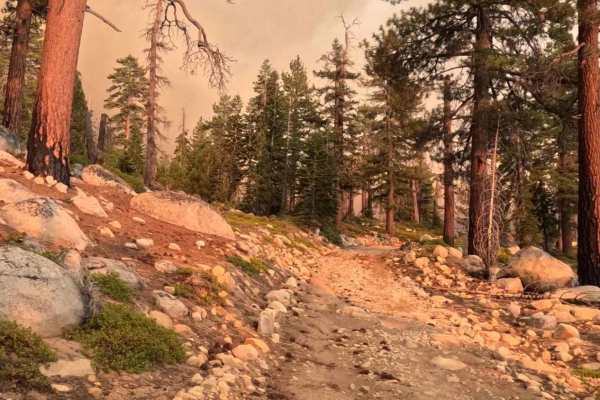
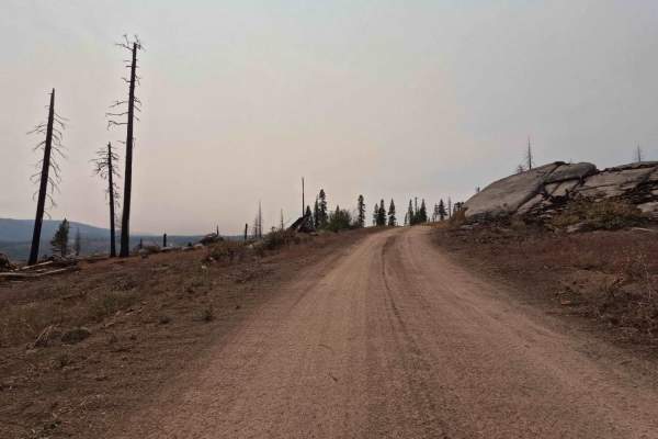
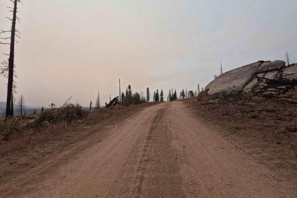
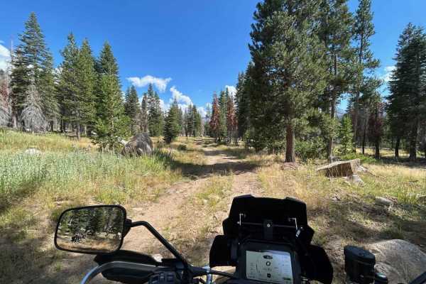
Snowball - FS 8S099
This is an easy, fast 2.3-mile forest service road that provides efficient transit from the high ridge network back down toward Highway 168. The road is a clear two-track with a primarily packed dirt and loose aggregate surface, allowing for fast descending speeds. The trail passes through a mixed-s...
Learn more about Snowball - FS 8S099
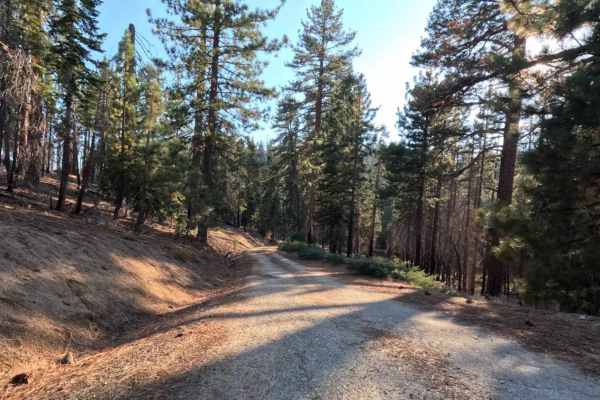
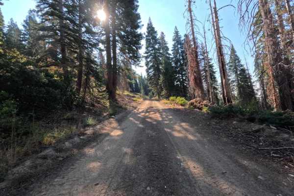
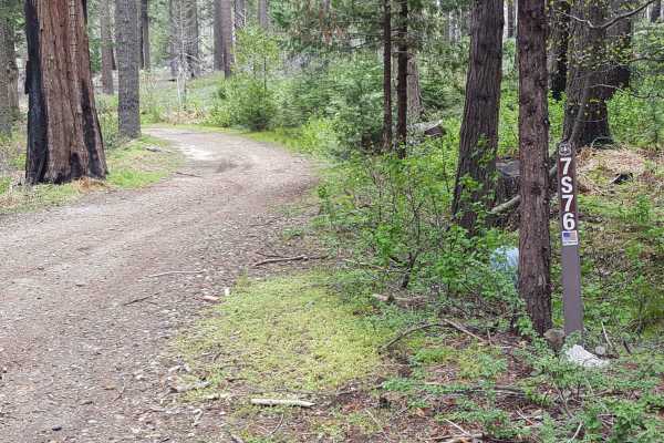
Stump Springs Road - FS 7S005
Stump Springs Road (FS 7S005) is a classic "tale of two roads." While the lower section lulls you with pavement, the real backcountry experience begins on the upper 10-mile stretch, where the asphalt ends and the Decomposed Granite (DG) begins. This route acts as a vital spine connector for the fore...
Learn more about Stump Springs Road - FS 7S005
Kaiser Loop - FS 6S002
This 15.5-mile high-country road is designed for speed. The main surface is wide and smooth, composed of fast, packed decomposed granite, allowing for quick transit. However, the entire route runs through the extensive 2020 Creek Wildfire burn scar, creating a stark, exposed, and hazardous environme...
Learn more about Kaiser Loop - FS 6S002
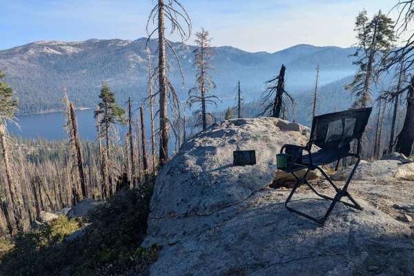
Hewn - FS 25E319
This 0.9-mile two-track is a smooth, easy trail in the high-country road network, serving as a direct continuation of the 8S035 (Boneridge) trail. It leads directly to a large, scenic group campsite located on an exposed granite ridge overlooking Huntington Lake below. The road traverses a mixed-sev...
Learn more about Hewn - FS 25E319
Bawdy - FS 9s040
This 1.6-mile forest service road is a high-elevation, single-lane administrative road designed for access to maintain an overhead power line passing through the area. The entire road traverses a highly exposed landscape within the 2020 Creek Wildfire burn scar, creating dramatic vistas but eliminat...
Learn more about Bawdy - FS 9s040
Boneridge - FS 8s035
This 2.0-mile trail is a smooth and fast single-lane road designed for scenic travel along the ridge, offering expansive views through the open canopy. The roadbed is predominantly composed of well-graded decomposed granite (DG) and packed dirt, making it ideal for covering distance quickly. However...
Learn more about Boneridge - FS 8s035
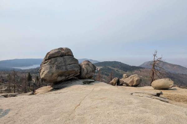
Snow Drift Spur - 8s098h
This is the perfect high-reward, low-effort trail for reaching a prime campsite. This extremely short 0.35-mile spur quickly climbs off the main ridge track (8S098) and dead-ends at a stunning viewpoint overlooking Huntington Lake and the valley below. The road is a narrow two-track, characterized b...
Learn more about Snow Drift Spur - 8s098h
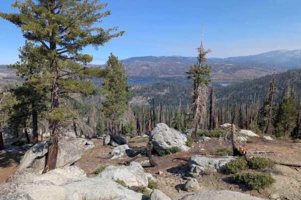
Snow Drift - FS 8s098
This is a fun, scenic, and easy 2.4-mile forest service road that climbs onto a ridge offering spectacular, high-elevation vistas, including an overlook of Huntington Lake and the nearby China Peak Ski Resort. The road surface is generally wide and fast, consisting primarily of smooth DG and packed ...
Learn more about Snow Drift - FS 8s098
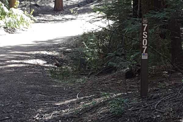
Fish Creek West - FS 7S007
This is a main FS road that will take you out towards Whiskey Ridge and through the Fish and Ross Creek areas, where you can access several other trailheads. Panoramic views of the surrounding forest are possible in sections of this route as it passes along the side of the mountain. The road is gene...
Learn more about Fish Creek West - FS 7S007
Gooseneck - FS 8s09g
This is an extremely short, single-lane dirt two-track that, together with 26E336 - Racoon, serves as a connector between the Snow Drift (8S098) and Redpole Spur (8S042A) roads, creating a longer bypass loop. The distance is minimal, but the entire route features a steep, loose climb that demands 4W...
Learn more about Gooseneck - FS 8s09g
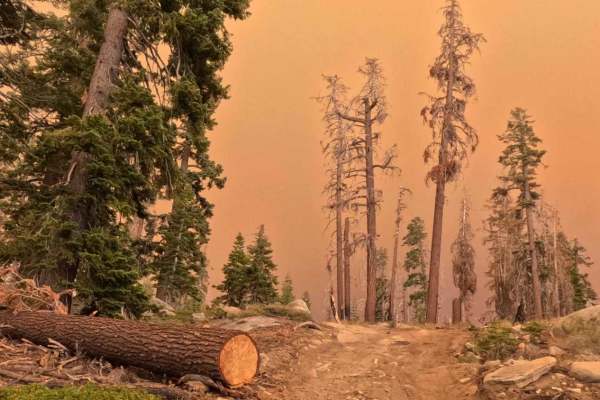
Kaiser Creek - FS 6S027
Kaiser Creek (FS 6S027) is a spirited backcountry weaver that offers a vivid lesson in forest ecology. This narrow two-track trail doesn't just simply connect two points; it climbs through a dramatic transition of landscapes. You will begin by threading your way through a stark, recovering burn zone...
Learn more about Kaiser Creek - FS 6S027
Raccoon - FS 26E336
This is an extremely short, single-lane 0.4-mile trail that connects to Gooseneck to create a longer connection between the Barbecue (8S056) route and the Snow Drift (8S098) road. The trail traverses a scenic, high-elevation area, transitioning through patchy sections of the 2020 Creek Wildfire burn...
Learn more about Raccoon - FS 26E336
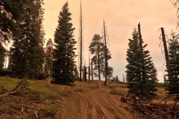
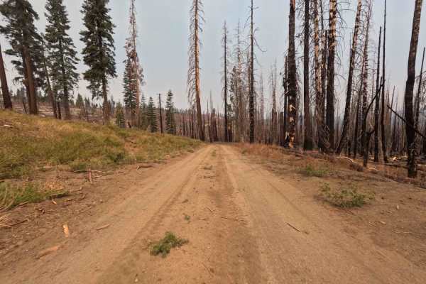
Red Mountain - FS 8S010
This is a fast, wide, graded forest service road that serves as the essential gateway to the highly challenging Mirror, Strawberry, and Coyote Lakes trail network. This major 6.2-mile high-country road is designed for speed, consisting mostly of fast, wide decomposed granite. However, the path frequ...
Learn more about Red Mountain - FS 8S010
Lower Tamarack - FS 9s026
This is an easy, wide 2.1-mile dirt forest service road designed for fast transit through the high country. The road runs through a massive, high-severity burn scar from the 2020 Creek Wildfire (visible in photos), leaving the area wide open and exposed. The roadbed is predominantly smooth, loose du...
Learn more about Lower Tamarack - FS 9s026
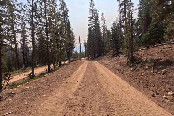
Lodgepole - FS 9s027
This 2.8-mile road is a key connector designed for efficient travel through the high country. The trail is a wide, smooth two-track that traverses a vast expanse of the 2020 Creek Wildfire burn scar (visible in photos), granting incredible exposure and panoramic views. The roadbed is predominantly s...
Learn more about Lodgepole - FS 9s027
Redpole Spur - FS 8S042A
This is the fast-track spur you need for quick access to high-country camping and is uniquely located right along the ridge above China Peak Mountain Resort. This 1.5-mile route is a well-defined single-lane track with a smooth surface of sandy decomposed granite, allowing for an efficient and quick...
Learn more about Redpole Spur - FS 8S042A
Mountain Top - FS 9S040A
This 0.7-mile trail is a high-elevation, single-lane Forest Service road that connects the top of Lodgepole over to Bawdy around the peak of Tamarack Mountain. The entire trail traverses a highly exposed landscape within the 2020 Creek Wildfire burn scar, creating dramatic vistas but eliminating mos...
Learn more about Mountain Top - FS 9S040A
Upper Tamarack Mountain - FS 9s028
This 1.1-mile two-track is a forest service road that provides a quick transit connector between other roads in this ridge system. The trail runs entirely through a vast, exposed landscape that was severely burned during the 2020 Creek Wildfire. The roadbed is wide and graded, consisting of smooth, ...
Learn more about Upper Tamarack Mountain - FS 9s028
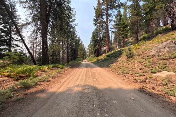
Tamarack Creek - FS 9s066
This 1.9-mile road is a dead-end spur. The trail is a clear one-lane track with a smooth, packed dirt and decomposed granite (DG) surface, allowing for quick speeds, confirmed by the efficient travel time. While this area was impacted by the 2020 Creek Wildfire, it avoided the highest severity, leav...
Learn more about Tamarack Creek - FS 9s066
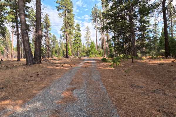
South Fork Tamarack - FS 9s069
This 7.9-mile road is a high-elevation artery providing fast, efficient access to the heart of the high-country trail network, including hiking trails accessing the Dinkey Lakes Wilderness. This road connects between CA 168 and FS 9S009 - Rock Creek Road. The road is a wide, smooth two-lane track wi...
Learn more about South Fork Tamarack - FS 9s069
ATV trails in California
Explore ATV-friendly trails in California. These trails are accessible for vehicles up to 50 inches wide, perfect for ATVs and smaller off-road machines.
Fish Creek West - FS 7S007
This is a main FS road that will take you out towards Whiskey Ridge and through the Fish and Ross Creek areas, where you can access several other trailheads. Panoramic views of the surrounding forest are possible in sections of this route as it passes along the side of the mountain. The road is gene...
Learn more about Fish Creek West - FS 7S007
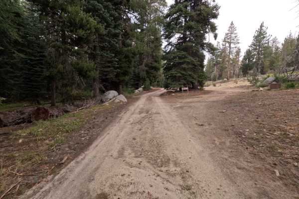
Sample Meadow Campground
This is a easy two track dirt road that passes a hiking trailhead and eventually leads to a nice Campground by a creek. From there you can explore ample of more National Forest Roads and Hiking Trails. Beautiful, calm and secluded part of sierra high country within Sierra National Forest.
Learn more about Sample Meadow Campground
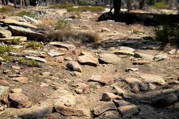
23E267
This is a 0.8-mile-long ATV trail that starts out halfway through 23E281, and goes east on a more primitive trail that looks a bit overgrown and grassy. It’s full of embedded flat rocks and small boulders that you have to ride over, and bigger slabs of rock that sometimes make a 1-foot-tall ledge. I...
Learn more about 23E267
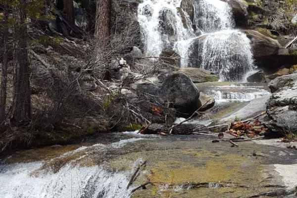
Whiskey Falls West - FS 8S70
This is a point-to-point route running from the main Peckinpah Road, past the Whiskey Falls campground and Whiskey Falls, and out into the Roush Creek area. The trail mostly consists of packed dirt, but also has short stretches of large gravel and asphalt/concrete where runoff water can be present. ...
Learn more about Whiskey Falls West - FS 8S70
UTV/side-by-side trails in California
Find UTV and side-by-side trails in California. These trails accommodate vehicles up to 60 inches wide, ideal for UTVs, side-by-sides, and wider off-road rigs.
Fish Creek West - FS 7S007
This is a main FS road that will take you out towards Whiskey Ridge and through the Fish and Ross Creek areas, where you can access several other trailheads. Panoramic views of the surrounding forest are possible in sections of this route as it passes along the side of the mountain. The road is gene...
Learn more about Fish Creek West - FS 7S007
Sample Meadow Campground
This is a easy two track dirt road that passes a hiking trailhead and eventually leads to a nice Campground by a creek. From there you can explore ample of more National Forest Roads and Hiking Trails. Beautiful, calm and secluded part of sierra high country within Sierra National Forest.
Learn more about Sample Meadow Campground
Whiskey Falls West - FS 8S70
This is a point-to-point route running from the main Peckinpah Road, past the Whiskey Falls campground and Whiskey Falls, and out into the Roush Creek area. The trail mostly consists of packed dirt, but also has short stretches of large gravel and asphalt/concrete where runoff water can be present. ...
Learn more about Whiskey Falls West - FS 8S70
Ellis Meadow - FS 7S076
This point-to-point connector trail runs through wooded sections and a large meadow area near Roush Creek. The route is at least as wide as a full-size vehicle and has wider areas to allow vehicles to pass each other easily. The surface is primarily dirt with small embedded rocks. There can be occas...
Learn more about Ellis Meadow - FS 7S076
The onX Offroad Difference
onX Offroad combines trail photos, descriptions, difficulty ratings, width restrictions, seasonality, and more in a user-friendly interface. Available on all devices, with offline access and full compatibility with CarPlay and Android Auto. Discover what you're missing today!
Open Trail Map