
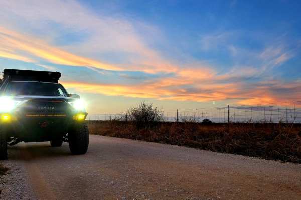
Off-Road Trails
Near San Saba, Texas
Off-Road Trails Near San Saba, Texas
Discover the best offroad trails near you. Browse trail maps, check difficulty ratings, and find your next adventure — whether you're looking for a quick ride or an all-day expedition.
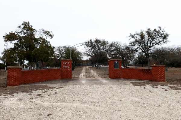
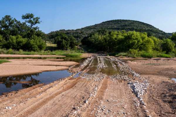
Saba Stroll
Cutting from Hwy 16 to Hwy 190 around the town of San Saba and over the San Saba River, this quick drive offers beautiful views of the Texas countryside. A long straight stretch through grazing fields and under power lines leads to a grave yard flanked by a large power station, offering a stark cont...
Learn more about Saba Stroll
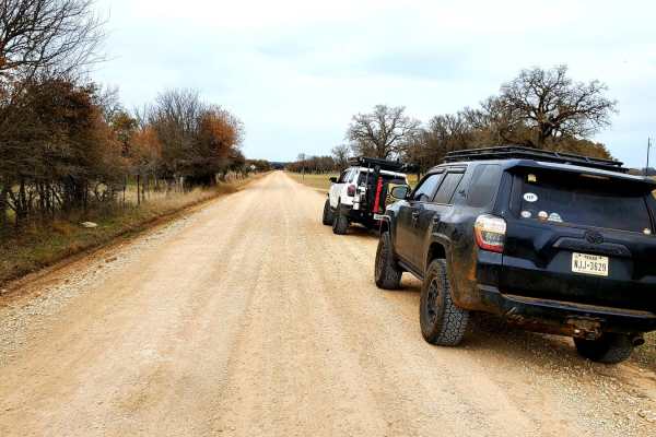
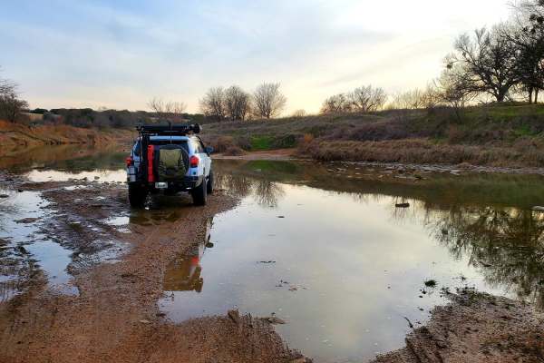
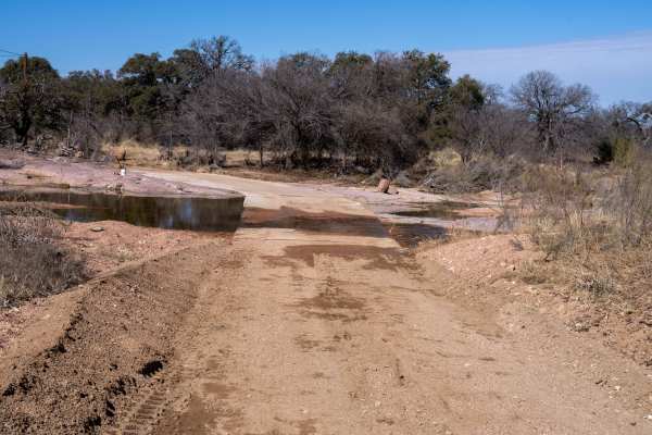
Double Ford
Step off the beaten path and explore the area flanking the Colorado River between San Saba and Goldthwaite. Starting near Hwy 190 in Lometa, this trail begins with a short dirt stretch and then transitions to a few miles of paved county road. Once the road passes the train tracks, it becomes dirt wi...
Learn more about Double Ford
Cherokee Creek
Meander through the north end of the Texas Hill Country along Cherokee Creek following unpaved county roads. Starting in the small town of Cherokee, this trail begins by turning onto County Road 409 from Hwy 16. Around the first bend in the road, pavement quickly turns to dirt and stays that way for...
Learn more about Cherokee Creek
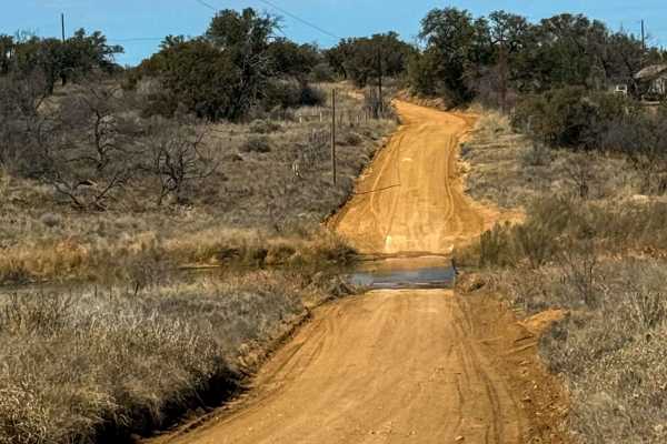
Goldthwaite Gallop
Beginning just south of the town of Goldthwaite, the trail begins at Ranch Road 3023 off of Hwy 16. A few miles of paved road abruptly ends and becomes a dirt road leading south towards Shaw Bend of the Colorado River. The long sweeping straightaways of the county road end after turning on to County...
Learn more about Goldthwaite Gallop
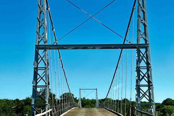
Regency Bridge (CR 433)
This is an easy gravel road that runs from FM 574 to FM 500. It's close to Goldthwaite, Brownwood, and San Saba, Texas. What makes the trail worth driving is the Regency Bridge which crosses the Colorado River. It is a single-lane suspension bridge with a wooden road deck, which was built in 1939 an...
Learn more about Regency Bridge (CR 433)
Priddy Windmills
Take a quick detour off of Hwy 16 to stroll through the Flat Top wind farm between Goldthwaite and Priddy. With a total of 100 wind turbines, this site can produce up to 200 megawatts of electricity. Consisting of dirt and gravel county roads, this easy drive provides beautiful scenic views of the T...
Learn more about Priddy Windmills
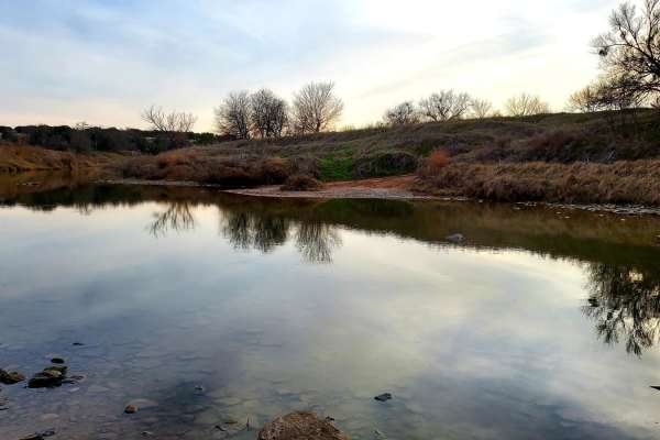
Rivers and Ribeyes
This trail is a scenic side trip to the Texas Hill Country Tour or the Texas Traverse. The roads are mostly graded dirt but flank the river's cool waters, making it a perfect detour if you want to cool off or do a little fishing. Of course, there's an even better reason to ride this road: the Castel...
Learn more about Rivers and Ribeyes
Chisholm Trail Byway
Sandy Creek Crossing
Nestled in the heart of the Texas Hill Country, this scenic 4.9-mile dirt and gravel trail runs along County Road 315 and offers a peaceful drive with sweeping countryside views. In March and April, the landscape comes alive with vibrant displays of bluebonnets, making it an especially picturesque t...
Learn more about Sandy Creek Crossing
House Mountain Road
House Mountain Road offers a nice drive through the heart of the Texas Hill Country. It connects FM 2323 and State Highway 87 via a scenic stretch of Loyal Valley Road and House Mountain Road. As the route traverses the border between Llano and Mason counties, travelers are treated to awesome views ...
Learn more about House Mountain Road
Simonsville Road
Simonsville Road offers a picturesque 8.5-mile trek through the Texas Hill Country, located just off State Highway 87 near Mason. This scenic backroad is not technically challenging under dry conditions, making it an ideal choice for a relaxing drive. The route features two notable low-water crossin...
Learn more about Simonsville Road
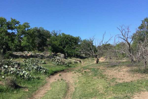
Honey Creek Trail #14
Trail #14 on K2 paper map. Honey Creek Trail is an easy road for the stock vehicle. It is a scenic access to more difficult areas, and can be run either direction. Starting near the Hoffman Gate, this road skirts the granite escarpment, ending near the Hannibal Lector trail. Mostly smooth dirt, the...
Learn more about Honey Creek Trail #14
Easy Street
Easy Street starts off of Honey Creek Trail and is a very short, easy dirt trail that runs along a dry creek bottom and is a crossover to other trails in the park. Along the way is access to two extreme trails - Train Wreck and Dark Side. After rains, Easy Street can have muddy sections in the creek...
Learn more about Easy Street
Lambourghini Lane
Lambourghini Lane is rated an easy Green trail, which for the most part is correct. There is 2-way traffic so it can be accessed from Honey Creek Trail or the Blue-rated section of Cyclops. The trail is a mixture of dirt, rock shelves, and boulder fields and there are no bypasses. If coming in at th...
Learn more about Lambourghini Lane
Devils Draw - Harder Section
Trail #7 on K2 paper map. This section is rated moderate because it is a rough, rubble field of a road. But it accesses numerous trails and necessary to navigate different sections. You can run this trail in either direction, and one end connects to Ranch Road #1.
Learn more about Devils Draw - Harder Section
FENCELINE #11
Trail #11 on K2 paper map. (BLUE - MODERATE) This trail can be run in either direction. It is a popular trail with access to optional lines. It's very open, with good visability to other areas, especially the Skinny Minny and Nutty Buddies trails. It runs directly into School Bus trail, making a ni...
Learn more about FENCELINE #11
Cyclops Access
Trail #3 on K2 paper map. This is a difficult section that accesses the more extreme sections of Cyclops, and also the easier Lamborghini Lane. It has one 3-foot rock pile to navigate, and most of the route is very rocky.
Learn more about Cyclops Access
Easter Eggs #16
Trail #16 on the K2 paper map. Easy road, but rocky and rough with monster size rocks. Access to Cyclops, Bluebonnet Gang and King of the Hill area. Easter Eggs can be traveled either direction.
Learn more about Easter Eggs #16
Bluebonnet Gang
Bluebonnet Gang can be accessed from Easter Egg Trail or the Park's Ranch Road. It is a dirt/rock Green-rated easy trail, however, it has a Blue-rated moderate obstacle at the very beginning (or end depending on which direction it is approached) in the form of a 3 foot ledge. Lockers and a minimum o...
Learn more about Bluebonnet Gang
Most Wanted
Most Wanted is rated a moderate Blue trail by the park. It is one-way only and starts at the somewhat hidden trail sign on the ranch road. There are 2 ways to run this trail--the easy way through the bypasses or the hard way. At the entrance, you must carefully pick your way thru the large boulder f...
Learn more about Most Wanted
ATV trails near San Saba, Texas
Explore ATV-friendly trails near you. These trails are accessible for vehicles up to 50 inches wide, perfect for ATVs and smaller off-road machines.
North Peak
At just 0.3 miles in length, this trail is more of an obstacle in itself. Most of the trail has large erosion down the middle that will test the limits of just about any suspension setup. You will find two sets of rock ledges to work over along the way. There are bypasses to each of these for those ...
Learn more about North Peak
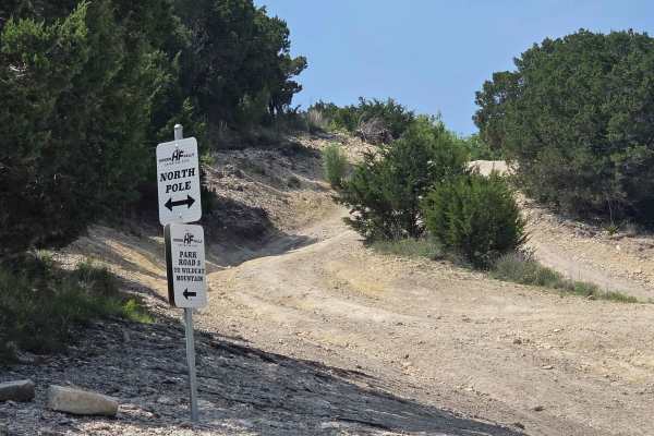
North Pole
Bumps, dirt, crawling, off camber, and everything in between. Take your time and enjoy the sights. This is a 1-2 hour excursion, depending on group size and lines picked. This trail is somewhere between a 2-6 depending on what you choose to do on the off-camber shoots.
Learn more about North Pole
West ATV/UTV
The West ATV/UTV Trail primarily follows the park’s western boundary line and serves as a key access route to several of the more challenging ATV/UTV trails within the park. Because it passes through a major trail network intersection, it is commonly used by riders traveling between multiple trail s...
Learn more about West ATV/UTV
Park Road 3 Spur
Park Road 3 Spur is primarily a dirt road extension of Park Road 3, serving as a connector through the northern section of the park. It’s commonly used to access the park’s northern areas or to reach the main overlook when coming from the North Pole. The route is generally straightforward, but it do...
Learn more about Park Road 3 Spur
UTV/side-by-side trails near San Saba, Texas
Find UTV and side-by-side trails near you. These trails accommodate vehicles up to 60 inches wide, ideal for UTVs, side-by-sides, and wider off-road rigs.
North Peak
At just 0.3 miles in length, this trail is more of an obstacle in itself. Most of the trail has large erosion down the middle that will test the limits of just about any suspension setup. You will find two sets of rock ledges to work over along the way. There are bypasses to each of these for those ...
Learn more about North Peak
North Pole
Bumps, dirt, crawling, off camber, and everything in between. Take your time and enjoy the sights. This is a 1-2 hour excursion, depending on group size and lines picked. This trail is somewhere between a 2-6 depending on what you choose to do on the off-camber shoots.
Learn more about North Pole
West ATV/UTV
The West ATV/UTV Trail primarily follows the park’s western boundary line and serves as a key access route to several of the more challenging ATV/UTV trails within the park. Because it passes through a major trail network intersection, it is commonly used by riders traveling between multiple trail s...
Learn more about West ATV/UTV
Park Road 3 Spur
Park Road 3 Spur is primarily a dirt road extension of Park Road 3, serving as a connector through the northern section of the park. It’s commonly used to access the park’s northern areas or to reach the main overlook when coming from the North Pole. The route is generally straightforward, but it do...
Learn more about Park Road 3 Spur
The onX Offroad Difference
onX Offroad combines trail photos, descriptions, difficulty ratings, width restrictions, seasonality, and more in a user-friendly interface. Available on all devices, with offline access and full compatibility with CarPlay and Android Auto. Discover what you're missing today!
Open Trail Map