
Off-Road Trails
Near Houston, British Columbia
Off-Road Trails Near Houston, British Columbia
Discover the best offroad trails near you. Browse trail maps, check difficulty ratings, and find your next adventure — whether you're looking for a quick ride or an all-day expedition.
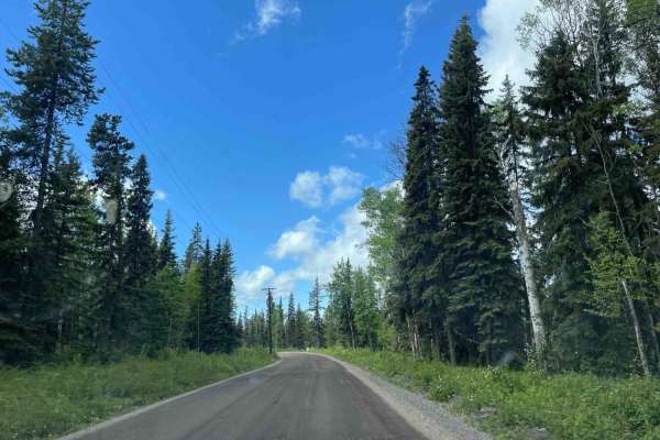
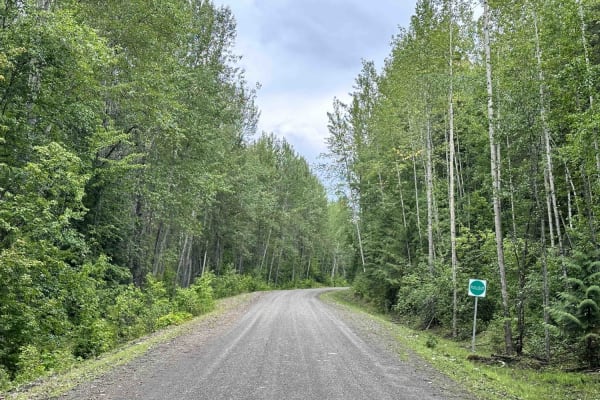
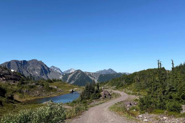
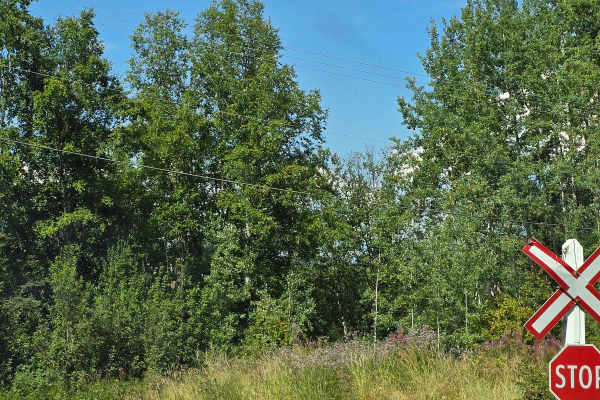
Telkwa 1000 Road
Telkwa 1000 Road starts at a low elevation and works its way along an existing 500kv transmission line corridor. There are a number of small spur roads that you can adventure, but most go to the transmission line structures. Beautiful part of the province with awesome views as well.
Learn more about Telkwa 1000 Road
The Microwave
This trail begins by turning off of the Telkwa River FSR, known as the famed Telkwa Pass.
It starts as a well-maintained dirt road. You climb through a few switchbacks that lead you into the alpine. There are some steep and rough spots near the top requiring high clearance, as well as a small water...
Learn more about The Microwave
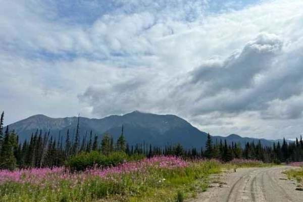
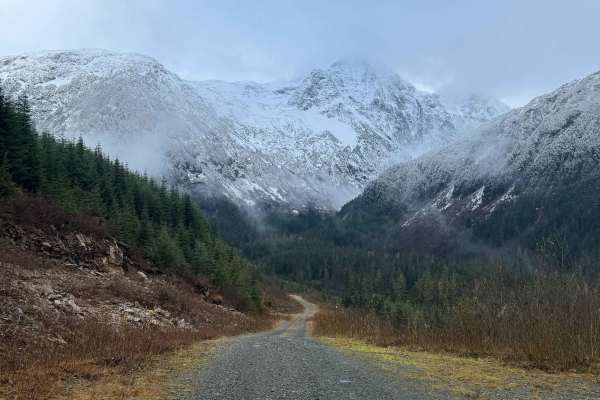
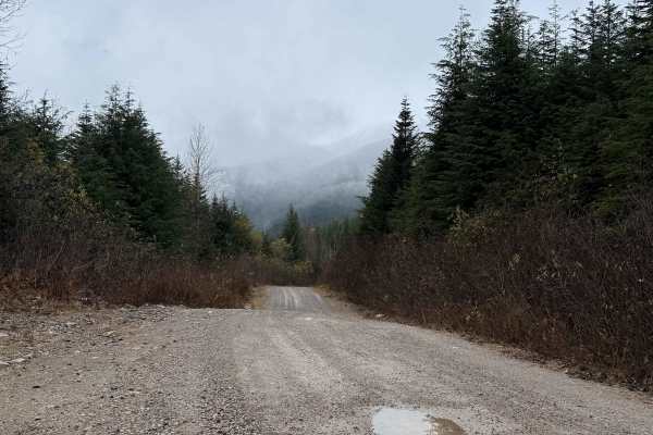
Telkwa Pass
The Telkwa Pass is one trail in the Northwest of British Columbia that every Four Wheel Drive enthusiast should do once. Coming from Telkwa/Smithers, the road starts as a regular, easy Forest Service road. At the midpoint of this route, you will find a sign giving some information on the Telkwa Pass...
Learn more about Telkwa Pass
Telkwa 116 Road
116 Road is a spur off the mainline route that travels up and over a known Ancient Landslide called the "Bulbus Toe". A lot of great views with areas to camp just off the roadway. The area will make for good hunting as well. This road was created to accommodate a transmission line relocation.
Learn more about Telkwa 116 Road
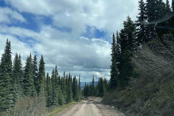
Blunt Creek FSR
Blunt Creek is one of numerous routes in the interior near Smithers, British Columbia. The mainline road is well maintained for about 75% of the track until it narrows, as there is a less-traveled portion near the end of the route. A lot of old logging cut blocks in the area have provided a vast amo...
Learn more about Blunt Creek FSR
Grower Road
Grower Road is a made-up name as there is no road name or markings for it. It is one of the main spur roads off the Blunt Creek FSR and takes you to the top of a ridge, where you have a fantastic view of the surrounding mountains in the area. There are lots of little spots to set up camp or explore ...
Learn more about Grower Road
Clore Forest Service Road
This road is an easy gravel road that travels along the Clore River. As you follow the river, there are a few sections where the road has seen slide activity. There are also sections where logs and or rocks have fallen onto the road. At 13 kilometers (8 miles), there is a small Recreational site tha...
Learn more about Clore Forest Service Road
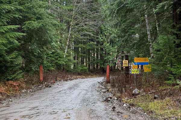
Williams Creek Trail
Williams Creek Trail starts as an easy gravel road that travels along Williams Creek. Up to a point, it is an active logging road, but then it turns into a narrow trail. There are a number of side roads that are steep, with some being deactivated. As the road progresses, it becomes very narrow and b...
Learn more about Williams Creek Trail
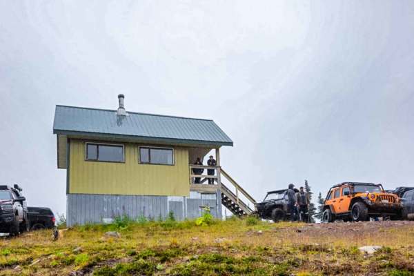
Trapper Mainline
The Trapper Mainline is a maintained gravel road that services a repeater station on Trapper Mountain. The road is a single-lane gravel road, full of loose rocks and ruts. Most All Wheel Drive vehicles should have little difficulty with this route, but some clearance will be helpful, as erosion has ...
Learn more about Trapper Mainline
Hoult Creek Road
Hoult Creek Road is an easy gravel road used by oil and gas. There is an open gate near the start of the road and a closed gate at the end. The road itself is loose gravel with a few narrow, steep, and rocky sections. Most AWD vehicles should have little difficulty with this road. Near the end of th...
Learn more about Hoult Creek Road
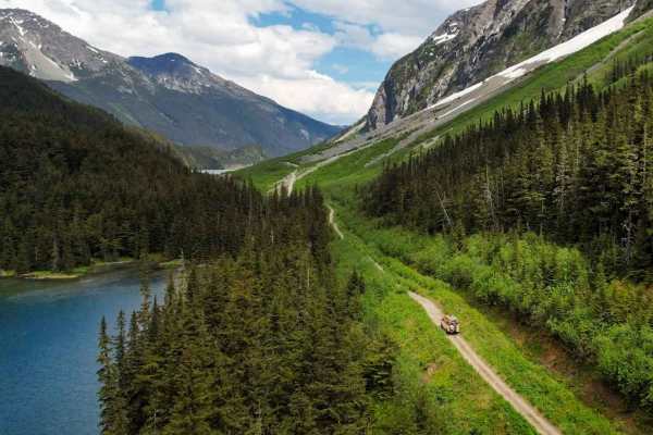
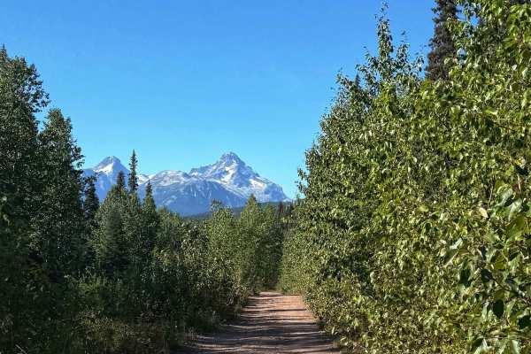
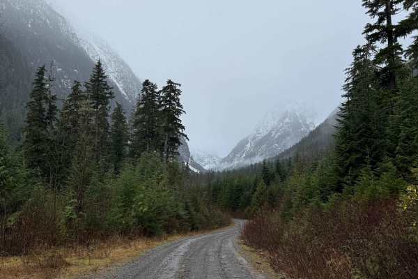
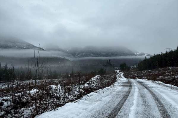
Telkwa Pass - Terrace to Top Lake
The Telkwa Pass offroad route is a scenic and challenging trail located in the Bulkley Valley of British Columbia, Canada. This route, known for its rugged terrain and stunning natural beauty, spans approximately 50 kilometers through the Coast Mountains. Off-road enthusiasts traverse narrow rocky p...
Learn more about Telkwa Pass - Terrace to Top Lake
Seeley Lake Tower Road
The road is a single lane two-track trail that begins to climb as soon as you leave the highway, taking you into second-growth forest and up the mountain. There are some tight turns, but it is easily doable with a full-size rig. The road is narrow and is not recommended to attempt with anything bigg...
Learn more about Seeley Lake Tower Road
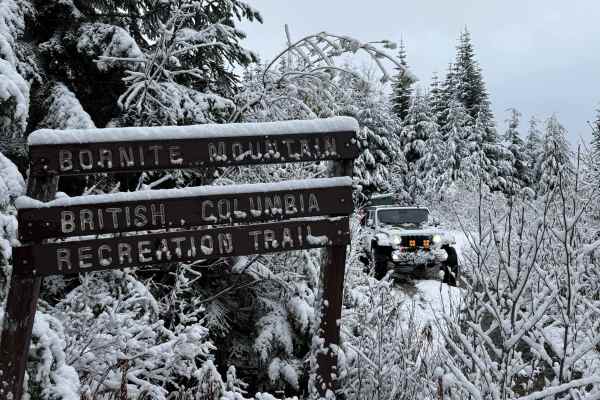
Bornite Mountain Trail
Bornite Mountain Trail is a spur road off the Kleanza Forest Service Road. This is a narrow, single-lane road with many stream crossings and steep hills. There is a sign at the bottom of the trail that warns of a washout, but as of November 2025, it seems to be fixed. As this is a narrow trail, expe...
Learn more about Bornite Mountain Trail
Keynton Lake Trail
This trail starts where the Kitwanga - Hazelton backroad ends at 19. You turn onto zero km on the Burdick Forrest Service Road. This road is radio-controlled on channel RR 6. There is some logging traffic this week, but weekends are generally less busy. At 1.3 km, you will see the sign for the turno...
Learn more about Keynton Lake Trail
Kitwanga - Hazelton Backroad
This is a well-maintained logging road with some logging traffic. There are a few steep sections and tight turns. The road is radio-controlled on channel RR 4. The best times to use the trail are weekends and holidays because the logging traffic generally slows down. There are many spurs and other b...
Learn more about Kitwanga - Hazelton Backroad
Oliver Creek Trail
This is an easy gravel road that was used by the British Columbia Forest Service to fight a fire in 2023. The trail is steep and rocky with many spur trails that don't really go anywhere. Users will find spectacular views of the Skeena River and some interesting landscapes from the 2023 Forest fire ...
Learn more about Oliver Creek Trail
Anderson Flats
Anderson Flats starts in South Hazelton at the train track crossing. You enter the park right on the other side. The road is well-maintained year-round. There are a few properties down here, so it is important to take it easy, especially when it's dry and dusty. Once you get down to the river, there...
Learn more about Anderson Flats
Kleanza Forest Service Road
The Kleanza Forest Service road is a gravel logging road that gives you access to some good views and spur roads to explore. The first section has many deep potholes, which make for slow going. At Kilometer 4 (Mile 2.5), there is a spur road that takes you to the Bornite Mountain hike (see Bornite M...
Learn more about Kleanza Forest Service Road
Copper River Road
Copper River road runs along the Zymoetz River and active cut blocks. As you drive, you will also pass under a power line. The road is a gravel forest service road with numerous potholes and several washouts. While generally an easy route, the washout can be moderately deep, requiring a vehicle with...
Learn more about Copper River Road
Copper Mountain Trail
This short but steep trail offers some of the best views of the Skeena Valley. You start the trail on a well-groomed single-lane road that quickly becomes steep with multiple switchbacks. Longer vehicles may have to complete multiple point turns. Much of the trail contains loose gravel and medium-si...
Learn more about Copper Mountain Trail
ATV trails near Houston, British Columbia
Explore ATV-friendly trails near you. These trails are accessible for vehicles up to 50 inches wide, perfect for ATVs and smaller off-road machines.
Telkwa 1000 Road
Telkwa 1000 Road starts at a low elevation and works its way along an existing 500kv transmission line corridor. There are a number of small spur roads that you can adventure, but most go to the transmission line structures. Beautiful part of the province with awesome views as well.
Learn more about Telkwa 1000 Road
The Microwave
This trail begins by turning off of the Telkwa River FSR, known as the famed Telkwa Pass.
It starts as a well-maintained dirt road. You climb through a few switchbacks that lead you into the alpine. There are some steep and rough spots near the top requiring high clearance, as well as a small water...
Learn more about The Microwave
Telkwa Pass
The Telkwa Pass is one trail in the Northwest of British Columbia that every Four Wheel Drive enthusiast should do once. Coming from Telkwa/Smithers, the road starts as a regular, easy Forest Service road. At the midpoint of this route, you will find a sign giving some information on the Telkwa Pass...
Learn more about Telkwa Pass
Telkwa 116 Road
116 Road is a spur off the mainline route that travels up and over a known Ancient Landslide called the "Bulbus Toe". A lot of great views with areas to camp just off the roadway. The area will make for good hunting as well. This road was created to accommodate a transmission line relocation.
Learn more about Telkwa 116 Road
UTV/side-by-side trails near Houston, British Columbia
Find UTV and side-by-side trails near you. These trails accommodate vehicles up to 60 inches wide, ideal for UTVs, side-by-sides, and wider off-road rigs.
Telkwa 1000 Road
Telkwa 1000 Road starts at a low elevation and works its way along an existing 500kv transmission line corridor. There are a number of small spur roads that you can adventure, but most go to the transmission line structures. Beautiful part of the province with awesome views as well.
Learn more about Telkwa 1000 Road
The Microwave
This trail begins by turning off of the Telkwa River FSR, known as the famed Telkwa Pass.
It starts as a well-maintained dirt road. You climb through a few switchbacks that lead you into the alpine. There are some steep and rough spots near the top requiring high clearance, as well as a small water...
Learn more about The Microwave
Telkwa Pass
The Telkwa Pass is one trail in the Northwest of British Columbia that every Four Wheel Drive enthusiast should do once. Coming from Telkwa/Smithers, the road starts as a regular, easy Forest Service road. At the midpoint of this route, you will find a sign giving some information on the Telkwa Pass...
Learn more about Telkwa Pass
Telkwa 116 Road
116 Road is a spur off the mainline route that travels up and over a known Ancient Landslide called the "Bulbus Toe". A lot of great views with areas to camp just off the roadway. The area will make for good hunting as well. This road was created to accommodate a transmission line relocation.
Learn more about Telkwa 116 Road
The onX Offroad Difference
onX Offroad combines trail photos, descriptions, difficulty ratings, width restrictions, seasonality, and more in a user-friendly interface. Available on all devices, with offline access and full compatibility with CarPlay and Android Auto. Discover what you're missing today!
Open Trail Map