
Dirt Bike Trails
Near Wolf Creek, Montana
Explore All Dirt Bike Trails Near Wolf Creek, Montana
Dirt Bike Trails Near Wolf Creek, Montana
Discover the best dirt bike trails near you. Browse trail maps, check difficulty ratings, and find your next adventure — whether you're looking for a quick ride or an all-day expedition.
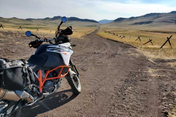
Dead Man Gulch
Dead Man Gulch is a fast, flowy 5.1-mile dirt connector road linking Montana Highway 434 and U.S. Highway 287, offering a scenic and dirt-friendly alternative to pavement for adventure motorcycle riders, four-wheel-drive vehicles, and SxSs. Originally a rutted, eroded track, the route has been recen...
Learn more about Dead Man Gulch
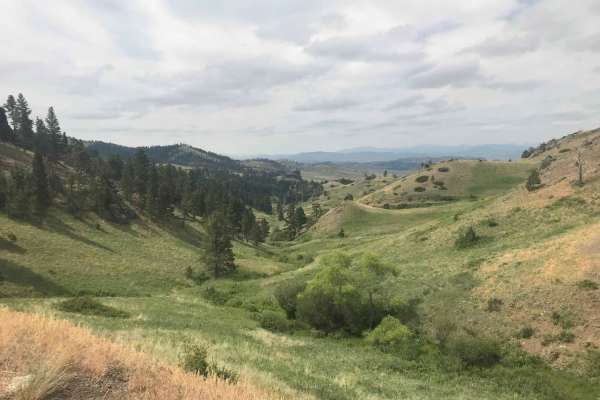
St. Peters Mission
The Adel Mountains are a geologist's dream to experience. Filled with small laccoliths and dikes, this igneous complex dates to approximately 65 million years ago. The resulting topography is that of rolling hills, lush had meadow valleys, and prominent igneous ridges and buttes. A beautiful vista i...
Learn more about St. Peters Mission
Little Wolf Creek Road
Little Wolf Creek Road is a scenic 14.9-mile point-to-point mountain trail near Wolf Creek, Montana, offering adventure motorcycle riders, high-clearance four-wheel-drive vehicles, and SxSs a moderately challenging climb through the Helena National Forest. Climbing from 3,790 feet to a peak of 5,949...
Learn more about Little Wolf Creek Road
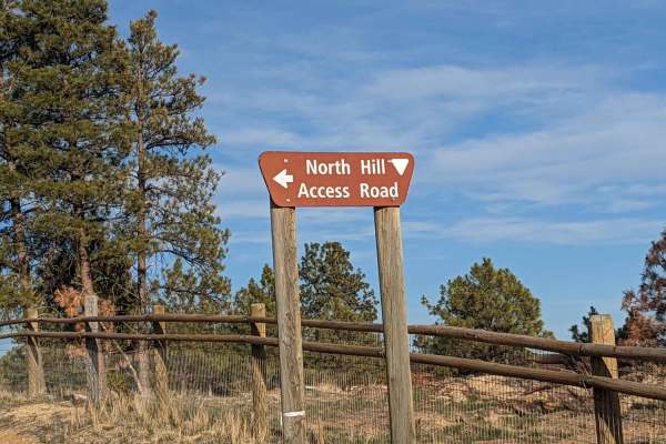
North Hills Recreation Area
The North Hills Recreation Area trail is a scenic, beginner-friendly route near Helena, Montana, offering gorgeous panoramic views of the surrounding valley and the distant Garnet Range. Stretching approximately 2.6 miles, this unpaved dirt road climbs gently to a maximum elevation of 4,658 feet fro...
Learn more about North Hills Recreation Area
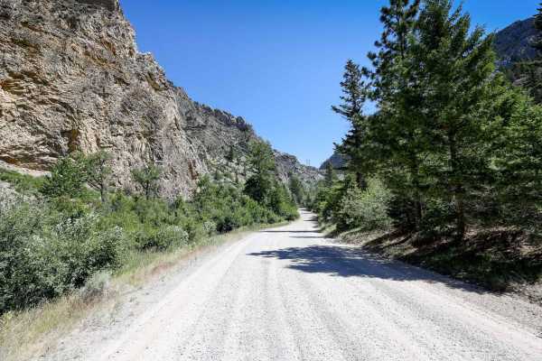
Beaver Creek - Indian Creek FS 138
This route on Forest Service Road 138 travels from Nelson, Montana, to the Indian Flats Forest Service Cabin along Indian Creek. The route has multiple dispersed camping sites along Beaver Creek and also higher up, closer to the Indian Flats Cabin. The route does pass through a parcel of private la...
Learn more about Beaver Creek - Indian Creek FS 138
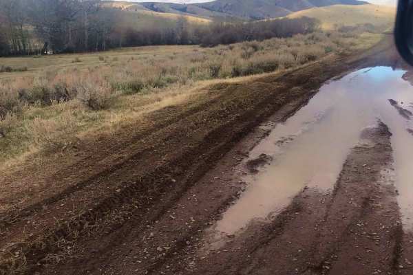
Gravelly Lake
This trail remains open through a block management agreement with the State of Montana and the Grady Livestock Company. Please be respectful, obey all posted signs and tread lightly. In the fall, this trail is popular with hunters. While the lake provides a scenic backdrop and a great place to stop ...
Learn more about Gravelly Lake
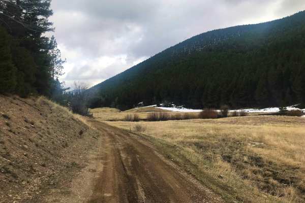
Marsh Creek
Marsh Creek Trail is a popular access point to Granite Peak Lookout in the Helena National Forest. This trail is also part of the Continental Divide Route, so in the summer be on the lookout for mountain bikers, Jeeps and adventure motorcycles. It is not uncommon to see deer and elk while on this tr...
Learn more about Marsh Creek
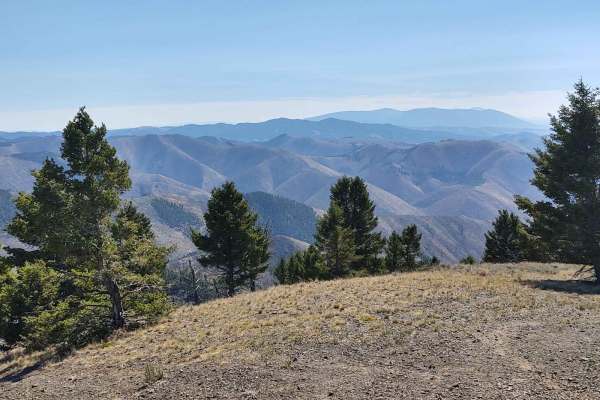
Owl Gulch Loop
This 3-mile loop connects the Favorite Gulch Trail via Owl Gulch to the Pipeline Trail and Pipeline Loop. Private property crossings are allowed if you stay on the trail. The scenery is spectacular, the forest is healthy and well-maintained, and the wildlife includes deer, elk, moose, and bears. You...
Learn more about Owl Gulch Loop
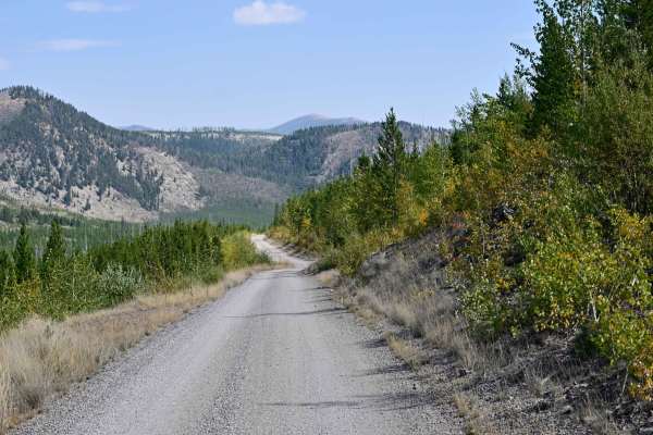
Copper Creek Road - FS 330
Copper Creek Road is an out-and-back, well-maintained Forest Service Road that leads to multiple points of interest, including the trailhead spur to Indian Meadows Trail/Indian Meadows campground and the Indian Meadows Guard station, which is available for rent in the winter months, catering mainly ...
Learn more about Copper Creek Road - FS 330

Poorman Creek
This is a reasonably rocky two-track connector trail that leads from Stemple Pass Road to Forest Service Road 485 just south of the intersection with Granite Butte Lookout. The idea was to find a bit more technical trail in the area than gravel Forest roads, and this one delivered. Fun, rocky two-tr...
Learn more about Poorman Creek

Birdseye-Mullan Road
This exciting trail generally follows the railroad route over the Continental Divide. Fans of train watching have six railroad crossings, a trestle bridge and multiple miles of track in view from the trail. Keep an eye out for one of the many freight or coal trains that pass along this route daily. ...
Learn more about Birdseye-Mullan Road
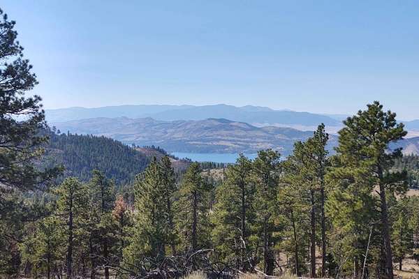
Nelson Road
Nelson Road offers a scenic and highly accessible offroad driving experience near Helena, Montana, making it perfect for beginners, families, and anyone hoping to spot local wildlife in a healthy, well-maintained forest. Spanning approximately 5.7 miles, this route climbs from an elevation of 3,983 ...
Learn more about Nelson Road
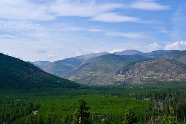
Indian Meadows
Indian Meadows is a hiking, camping, and equestrian destination area off Copper Creek Road. It's a multipurpose area that serves as a basecamp for local outfitters, trailhead parking for several hiking trails, and the Indian Meadows USFS guard station, which is available for rent via recreation.gov....
Learn more about Indian Meadows
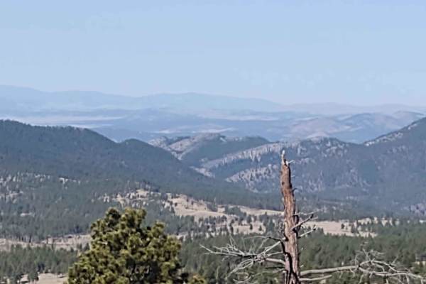
Oregon Gulch
This 5-mile trail connects Kingsbury Spur Trail to York Gulch Trail. You gain almost 2,000 feet in elevation, rising to 6,329 feet at the highest point. The scenery is spectacular, the forest is healthy and well-maintained, and the wildlife includes deer, elk, moose, and bears. All private property ...
Learn more about Oregon Gulch
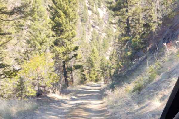
York Gulch
The York Gulch Trail connects York Road to Hedges Mountain, Oregon Gulch, Kingsberry Spur, and the Magpie Creek to Avalanche Creek Trails. You go from 3900 feet to just over 6200 feet in the Helena National Forest. The scenery is spectacular, the forest is healthy and well-maintained, and the wildli...
Learn more about York Gulch
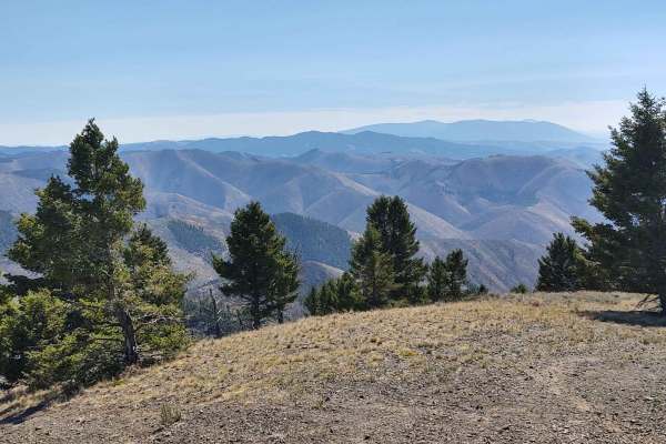
Hedges Mountain
This 3-mile RT track takes you to Hedges Mountain in the Helena National Forest at an elevation of 7131 feet. The scenery is spectacular, the forest is healthy and well-maintained, and the wildlife includes deer, elk, moose, and bears. All private property crossings are allowed if you stay on the tr...
Learn more about Hedges Mountain

Sucker Creek - FS 1800
As are most of the trails in the Lincoln, Montana area, this is a fairly smooth connector that branches into a series of other trails that traverse the Flathead Range north of Lincoln. Many of these trails evolve into snowmobile trails in the winter, which this area of Montana has no shortage of. Si...
Learn more about Sucker Creek - FS 1800
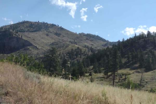
Magpie Gulch
Magpie Gulch is an ideal scenic route for beginner offroaders, scenic tourers, and families looking to explore the beautiful Helena National Forest with stunning views of Canyon Ferry Lake. This 7.5-mile point-to-point track connects the Magpie Ridge Trail to the Magpie Creek to Avalanche Creek Trai...
Learn more about Magpie Gulch
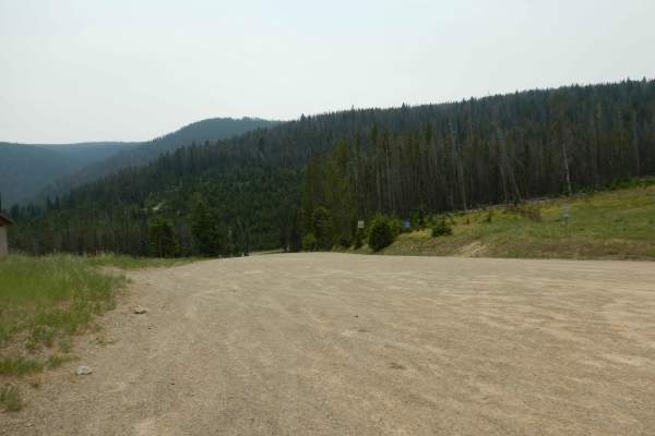
Stemple Pass
Stemple Pass is an ideal, scenic dirt-and-gravel route for beginners, families, and dual-sport riders seeking a straightforward mountain escape near Lincoln, Montana. Spanning approximately 23 miles between Highway 200 and Highway 279, this well-maintained corridor traverses the scenic peaks of the ...
Learn more about Stemple Pass
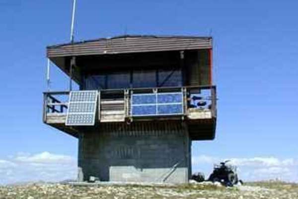
Stonewall Mountain Lookout
One of the more popular trails in the Lincoln Ranger District, the Stonewall Mountain trail takes visitors seemingly to the top of the world, with fantastic views of the Scapegoat Wilderness and the Upper Blackfoot Valley spread out below. The trail can either be started from the Keep Cool Connector...
Learn more about Stonewall Mountain Lookout
ATV trails near Wolf Creek, Montana
Explore ATV-friendly trails near you. These trails are accessible for vehicles up to 50 inches wide, perfect for ATVs and smaller off-road machines.
Dead Man Gulch
Dead Man Gulch is a fast, flowy 5.1-mile dirt connector road linking Montana Highway 434 and U.S. Highway 287, offering a scenic and dirt-friendly alternative to pavement for adventure motorcycle riders, four-wheel-drive vehicles, and SxSs. Originally a rutted, eroded track, the route has been recen...
Learn more about Dead Man Gulch
St. Peters Mission
The Adel Mountains are a geologist's dream to experience. Filled with small laccoliths and dikes, this igneous complex dates to approximately 65 million years ago. The resulting topography is that of rolling hills, lush had meadow valleys, and prominent igneous ridges and buttes. A beautiful vista i...
Learn more about St. Peters Mission
Little Wolf Creek Road
Little Wolf Creek Road is a scenic 14.9-mile point-to-point mountain trail near Wolf Creek, Montana, offering adventure motorcycle riders, high-clearance four-wheel-drive vehicles, and SxSs a moderately challenging climb through the Helena National Forest. Climbing from 3,790 feet to a peak of 5,949...
Learn more about Little Wolf Creek Road
North Hills Recreation Area
The North Hills Recreation Area trail is a scenic, beginner-friendly route near Helena, Montana, offering gorgeous panoramic views of the surrounding valley and the distant Garnet Range. Stretching approximately 2.6 miles, this unpaved dirt road climbs gently to a maximum elevation of 4,658 feet fro...
Learn more about North Hills Recreation Area
UTV/side-by-side trails near Wolf Creek, Montana
Find UTV and side-by-side trails near you. These trails accommodate vehicles up to 60 inches wide, ideal for UTVs, side-by-sides, and wider off-road rigs.
Dead Man Gulch
Dead Man Gulch is a fast, flowy 5.1-mile dirt connector road linking Montana Highway 434 and U.S. Highway 287, offering a scenic and dirt-friendly alternative to pavement for adventure motorcycle riders, four-wheel-drive vehicles, and SxSs. Originally a rutted, eroded track, the route has been recen...
Learn more about Dead Man Gulch
St. Peters Mission
The Adel Mountains are a geologist's dream to experience. Filled with small laccoliths and dikes, this igneous complex dates to approximately 65 million years ago. The resulting topography is that of rolling hills, lush had meadow valleys, and prominent igneous ridges and buttes. A beautiful vista i...
Learn more about St. Peters Mission
Little Wolf Creek Road
Little Wolf Creek Road is a scenic 14.9-mile point-to-point mountain trail near Wolf Creek, Montana, offering adventure motorcycle riders, high-clearance four-wheel-drive vehicles, and SxSs a moderately challenging climb through the Helena National Forest. Climbing from 3,790 feet to a peak of 5,949...
Learn more about Little Wolf Creek Road
North Hills Recreation Area
The North Hills Recreation Area trail is a scenic, beginner-friendly route near Helena, Montana, offering gorgeous panoramic views of the surrounding valley and the distant Garnet Range. Stretching approximately 2.6 miles, this unpaved dirt road climbs gently to a maximum elevation of 4,658 feet fro...
Learn more about North Hills Recreation Area
The onX Offroad Difference
onX Offroad combines trail photos, descriptions, difficulty ratings, width restrictions, seasonality, and more in a user-friendly interface. Available on all devices, with offline access and full compatibility with CarPlay and Android Auto. Discover what you're missing today!
Open Trail Map