
Dirt Bike Trails
Near Vinton, Ohio
Explore All Dirt Bike Trails Near Vinton, Ohio
Dirt Bike Trails Near Vinton, Ohio
Discover the best dirt bike trails near you. Browse trail maps, check difficulty ratings, and find your next adventure — whether you're looking for a quick ride or an all-day expedition.
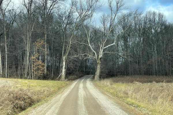
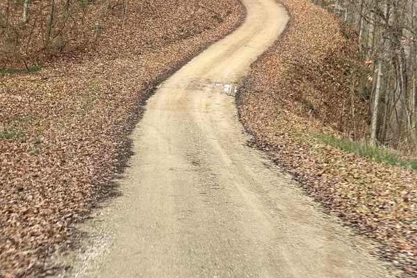
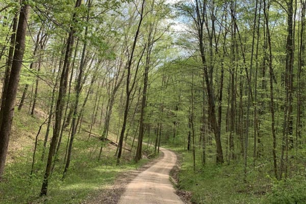
Vinton County Tunnel Tour Part 3
This trail is Wikesville to Cone/Appalachia Highway Vinton County Tunnel Loop East. This section starts at Wikesville, Ohio, and runs counterclockwise north through Vinton County, stopping at Moonville Tunnel and Kings Hollow Tunnel which was recently added as the Rails to Trails Hiking pathway thro...
Learn more about Vinton County Tunnel Tour Part 3
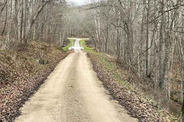
Vinton County Tunnels Tour Part 2
This is Radcliff to Campbell Tunnel Vinton County Tunnel Loop West. This starts at Lake Hope in this section and runs counterclockwise south through Vinton county passing Campbell Tunnel which was recently closed through the Appalachian Foothills. Gas and food can be found along the way. Good for a ...
Learn more about Vinton County Tunnels Tour Part 2
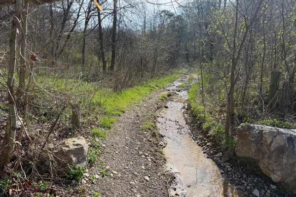
Vernon-Painter Creek Road
Turn right off Telegraph Hill Road onto Vernon-Painter Creek Road. Along the route, a small pull-off provides access to an ATV path leading to an abandoned CH&P railroad tunnel, one of several in the area. Continue through the deep, dark forest, then turn left onto the side road and follow the unmai...
Learn more about Vernon-Painter Creek Road
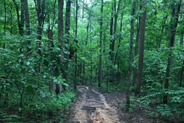
Brady Fork
This trail features giant rock formations, partially washed-out roads, deep ravines, high-water crossings, and muddy ruts. After turning right onto Brady Fork Road, keep right where the left side has washed away, as the drop leads into a deep ravine running alongside the road. Multiple pull-off area...
Learn more about Brady Fork
Vinton County Tunnels Tour Part 1
This trail is from Lake Hope to Zaleski Vinton County Tunnel Loop West. This starts at Lake Hope and runs counterclockwise south through Vinton County, passing Campbell Tunnel which was recently closed through the Appalachian Foothills. Gas and food can be found along the way and the route is good f...
Learn more about Vinton County Tunnels Tour Part 1
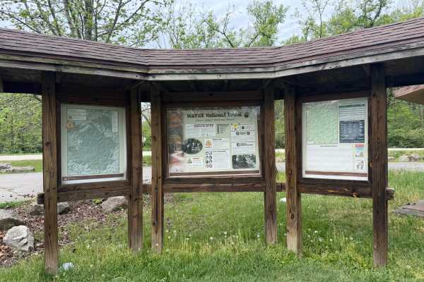
Telegraph Trail
Telegraph Trail (FS 15) is a solid choice for ATV and dirtbike riders looking for a moderately challenging OHV trail in southeastern Ohio. Winding through the Ironton Ranger District of Wayne National Forest, this route delivers classic Appalachian terrain with just enough technical features to keep...
Learn more about Telegraph Trail

Wolcott Trail
This trail has ups and downs, switchbacks, mud, water, and a few high-speed straights on the ridge tops. The trail is generally wide enough to allow other riders to pass. The Trail cuts through Pine Creek Wetland and can offer some great wildlife viewing. There are some beautiful views from the ridg...
Learn more about Wolcott Trail
Bear Claw Trail
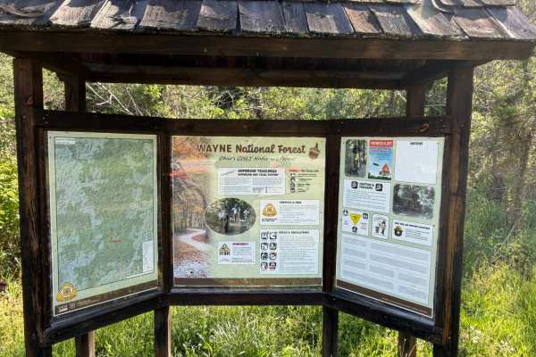
Welcome to the Wayne National Forest Superior OHV Trail System. Wayne National Forest OHV trails require a trail pass that can be purchased from Forest headquarters or local vendors. All trails are limited to a width of 50 inches or less. All trails are two-way. The Bear Claw Trail has a few mud hol...
Learn more about Bear Claw Trail
Wolcott Loop
This trail is a short loop with a spur that connects the Wolcott Trailhead with the rest of the main trail system. Coming from the trailhead, the north side offers a steep rocky ascent, and the south leg takes you across the bottoms to the Walcott Trail Connector, which in turn takes you to the Bear...
Learn more about Wolcott Loop
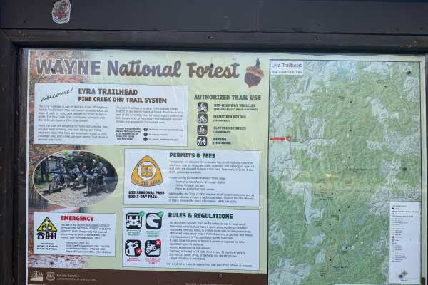
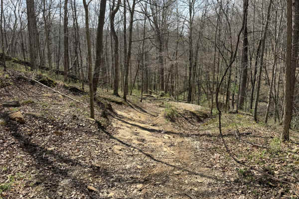
Lyra Trail
Lyra Trail is a solid pick for ATV and dirtbike riders looking for a moderate challenge deep in the Ironton Ranger District of Wayne National Forest. Twisting through southeastern Ohio’s wooded hills, this narrow forest route delivers a mix of rutted dirt, rocky patches, and the occasional muddy was...
Learn more about Lyra Trail
Bear Top Loop
This is one of my favorite loops. It has a bit of everything. Run it clockwise, and it has steep descents. Run it counter-clockwise, and it has a nice hill climb in loose large rocks with a couple of small ledges. The trail also has tight encroaching brush and tight turns, and varying surfaces. All ...
Learn more about Bear Top Loop
Superior Connector
Welcome to the Wayne National Forest Superior OHV Trail System. Wayne National Forest OHV trails require a trail pass that can be purchased from Forest headquarters or local vendors. All trails are limited to a width of 50 inches or less. All trails are two-way. As the name suggests, the trail conne...
Learn more about Superior Connector
Superior Corridor Trail
The Superior Corridor Trail is the longest trail in the Ironton Ranger District of Wayne National Forest. All OHV trails in Wayne National Forest are width-restricted to a maximum of 50 inches and require a pass that can be purchased from the Wayne National Forest Headquarters or select local vendor...
Learn more about Superior Corridor Trail
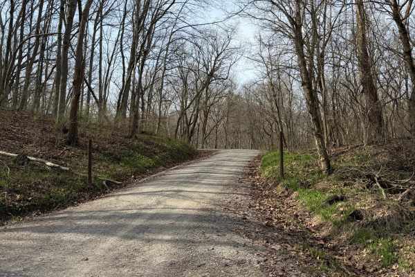
South Ridge Road
In Scioto Trail State Park, South Ridge Road snakes its way along the high south ridge of the park. The road is gravel and generally single-lane. There are multiple sidings and turnouts to let vehicles pass or just stop and enjoy the scenery. The road is not maintained in the winter months. The road...
Learn more about South Ridge Road
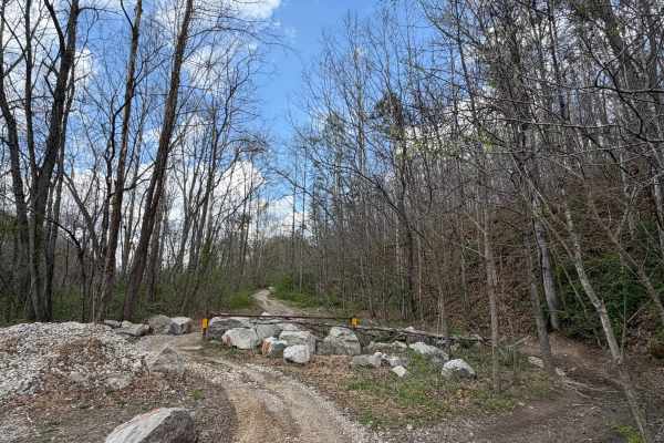
Pine Cutoff
The Pine Cut off is just what its name says. If you need to get back to the trail head or latrine in a hurry from the Power Line Trail, this trail will get you there. This trail is wide and easy. It does come in handy if you need to get back to the parking lot quickly. Also can be used to re-ride yo...
Learn more about Pine Cutoff
Lake View Trail
Welcome to the Wayne National Forest Hanging Rock OHV Trail System. Wayne National Forest OHV trails require a trail pass that can be purchased from Forest headquarters or local vendors. All trails are limited to a width of 50 inches or less. All trails are two-way. The Lake View Trail twists its wa...
Learn more about Lake View Trail
Saw Mill Trail
Welcome to the Wayne National Forest Hanging Rock OHV Trail System. Wayne National Forest OHV trails require a trail pass that can be purchased from Forest headquarters or local vendors. All trails are limited to a width of 50 inches or less. All trails are two-way. This short trail cuts off the eas...
Learn more about Saw Mill Trail
Park Road 39
This route is for anyone that wants to rip a rally-like road, and experience the great scenery and wildlife Ohio can offer! This gravel route is very loose and has a few washouts. It also has two hairpin turns that may require some two-point turns for big or full-sized rigs. This trail is accessible...
Learn more about Park Road 39
Gas Well Loop
Gas Well Loop (FS 20) is a solid pick for intermediate riders looking to explore southeastern Ohio's Wayne National Forest on an ATV or dirtbike. The loop starts at the Hanging Rock Trailhead and winds southeast through mixed hardwood forest, offering a mix of terrain that keeps things interesting w...
Learn more about Gas Well Loop

Hanging Rock Trail
Welcome to the Wayne National Forest Hanging Rock OHV Trail System. Wayne National Forest OHV trails require a trail pass that can be purchased from Forest headquarters or local vendors. All trails are limited to a width of 50 inches or less. All trails are two-way. The Hanging Rock Trail is the pri...
Learn more about Hanging Rock Trail
ATV trails near Vinton, Ohio
Explore ATV-friendly trails near you. These trails are accessible for vehicles up to 50 inches wide, perfect for ATVs and smaller off-road machines.
Brady Fork
This trail features giant rock formations, partially washed-out roads, deep ravines, high-water crossings, and muddy ruts. After turning right onto Brady Fork Road, keep right where the left side has washed away, as the drop leads into a deep ravine running alongside the road. Multiple pull-off area...
Learn more about Brady Fork
Telegraph Trail
Telegraph Trail (FS 15) is a solid choice for ATV and dirtbike riders looking for a moderately challenging OHV trail in southeastern Ohio. Winding through the Ironton Ranger District of Wayne National Forest, this route delivers classic Appalachian terrain with just enough technical features to keep...
Learn more about Telegraph Trail
Wolcott Trail
This trail has ups and downs, switchbacks, mud, water, and a few high-speed straights on the ridge tops. The trail is generally wide enough to allow other riders to pass. The Trail cuts through Pine Creek Wetland and can offer some great wildlife viewing. There are some beautiful views from the ridg...
Learn more about Wolcott Trail
Bear Claw Trail
Welcome to the Wayne National Forest Superior OHV Trail System. Wayne National Forest OHV trails require a trail pass that can be purchased from Forest headquarters or local vendors. All trails are limited to a width of 50 inches or less. All trails are two-way. The Bear Claw Trail has a few mud hol...
Learn more about Bear Claw Trail
UTV/side-by-side trails near Vinton, Ohio
Find UTV and side-by-side trails near you. These trails accommodate vehicles up to 60 inches wide, ideal for UTVs, side-by-sides, and wider off-road rigs.
Brady Fork
This trail features giant rock formations, partially washed-out roads, deep ravines, high-water crossings, and muddy ruts. After turning right onto Brady Fork Road, keep right where the left side has washed away, as the drop leads into a deep ravine running alongside the road. Multiple pull-off area...
Learn more about Brady Fork
Park Road 39
This route is for anyone that wants to rip a rally-like road, and experience the great scenery and wildlife Ohio can offer! This gravel route is very loose and has a few washouts. It also has two hairpin turns that may require some two-point turns for big or full-sized rigs. This trail is accessible...
Learn more about Park Road 39
James Road
You'll find a couple of small water crossings on this easy trail. It will be slippery when wet or snowy. It's right off of a gravel road and takes you to some very nice ponds. It does have couple of steep hills with ruts and is narrow. Full-size vehicles will fit but you may get some scratches.
Learn more about James Road
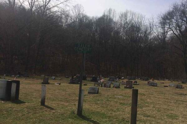
Salem
If you're into driving down some old back roads and running the outskirts of Wayne National Forest this trail has a lot to offer you. Even though it's an easy trail you will find yourself driving through gravel roads with all kinds of unique rock formations and some of the most beautiful trees. At s...
Learn more about Salem
The onX Offroad Difference
onX Offroad combines trail photos, descriptions, difficulty ratings, width restrictions, seasonality, and more in a user-friendly interface. Available on all devices, with offline access and full compatibility with CarPlay and Android Auto. Discover what you're missing today!
Open Trail Map