
Dirt Bike Trails
Near Veyo, Utah
Explore All Dirt Bike Trails Near Veyo, Utah
Dirt Bike Trails Near Veyo, Utah
Discover the best dirt bike trails near you. Browse trail maps, check difficulty ratings, and find your next adventure — whether you're looking for a quick ride or an all-day expedition.
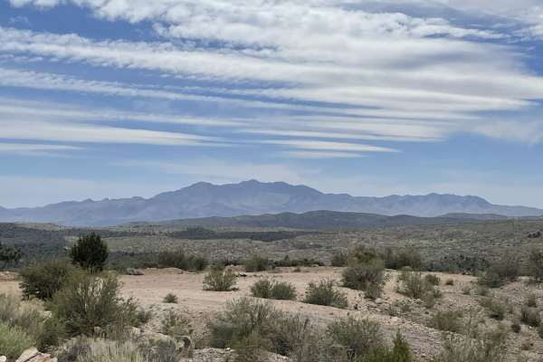
Lower Enterprise Lakes / Veyo Road
This easy two-lane washboard road heads up into the hills towards enterprise lakes and is almost all uphill. Once in the National Forest, the trail narrows to a single width with pullouts to pass oncoming traffic. There are many camping opportunities along the way down the many different pullouts. A...
Learn more about Lower Enterprise Lakes / Veyo Road
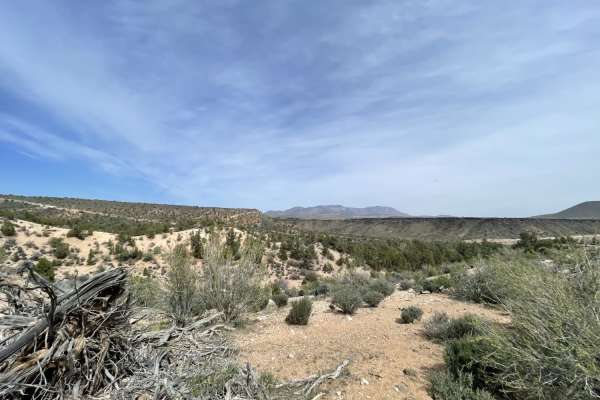
Northside Tobin Bench
Northside Tobin Bench is a scenic, moderately challenging two-mile trail designed for offroaders seeking a deserty, canyon-like driving experience with a few technical elements. Navigating this route provides a stark contrast to the ridgeline views on the southern side of the bench, guiding drivers ...
Learn more about Northside Tobin Bench
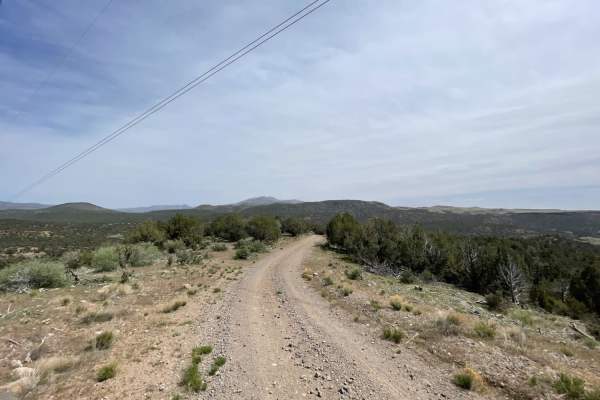
Cove Wash To Magotsu Creek
This mostly easy rip over the hill follows the utility lines as it twists, turns, rises, and falls along the mountains. There are long loose hill climbs, tight short turns, and some deeply rutted sections that may be impassable when wet. There are a few nice camping spots on the west side by Cove Wa...
Learn more about Cove Wash To Magotsu Creek
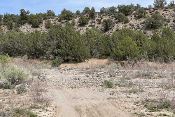
Dead End at Bowler Ranch
This short run down the side of the hill starts at Enterprise Reservoirs Road and abruptly traverses down the side of the hill. At the bottom, there are a few nice dispersed campsites before it crosses the sandy, rocky, vast wash. Do not enter when water is flowing, and be aware of heavy summer stor...
Learn more about Dead End at Bowler Ranch
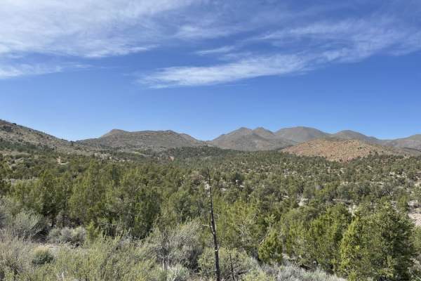
Bull Valley Mountain ATV Trail Entrance Loop
The northern section of this loop is the access for ATVs 50" or less and dirtbikes to enter. It's narrow with tight turns and very off-camber sections, but quite pretty to run and a very enjoyable road surface. The southern leg is wider and may lead to a staging area. But even though it's been grade...
Learn more about Bull Valley Mountain ATV Trail Entrance Loop
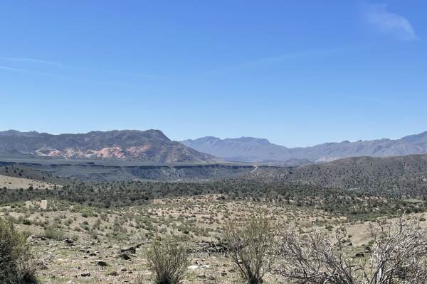
A Ridgeline Romp
This stunning two-track trail runs along the Ridgeline to the valley below. For the best views, it's recommended to take it from top to bottom. There are a few flat spots for camping. However, no fire rings were noticed except near the bottom in these spots. There are rocky sections and small off-ca...
Learn more about A Ridgeline Romp
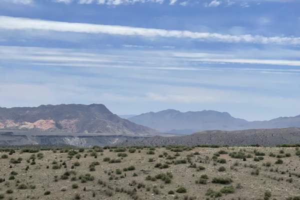
Southside Tobin Bench
Southside Tobin Bench is a scenic 2.7-mile downward route perfect for beginner to intermediate offroaders looking for a quick, scenic descent from Tobin Bench toward the Enterprise Reservoirs. Traversing a mesa top at elevations ranging between 4,009 and 4,495 feet, this trail offers impressive pano...
Learn more about Southside Tobin Bench
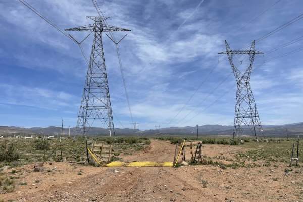
Twisty Turny Teeth Chattering Powerline Trail
Twisty Turny Teeth Chattering Powerline Trail is a moderately easy 3.8-mile trail ideal for high-clearance four-wheel-drive vehicles, SxSs, and ATVs looking to navigate a bumpy, rocky route with panoramic desert views. Winding alongside major utility lines, this route features a primarily rocky surf...
Learn more about Twisty Turny Teeth Chattering Powerline Trail
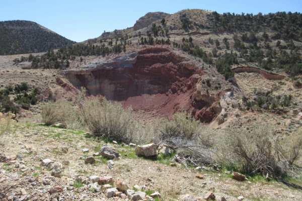
Goldstrike
This is a fun day trip that will take you above 6,000 feet in elevation with some superb panoramic views of the area. Along the way you will see Square Top Mountain where a B-52 crashed in 1983, a great probability for wildlife, the Veyo Cinder Cone, Pine mountains, and the Goldstrike mining area. T...
Learn more about Goldstrike
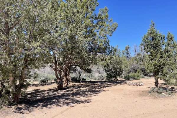
8-Mile Springs
This trail heads up a canyon where a short hike would lead to 8-mile springs. There is plenty of dispersed camping spots and fire rings. Choose whether you prefer a view or some lovely shade trees. The only way to get to the springs would be a hike up the canyon; the trail does not reach them with a...
Learn more about 8-Mile Springs
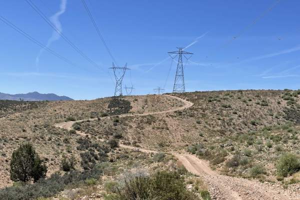
Gas & Power Line Traverse
This fun rip across the hills dips and dives, climbs and twists across the Ridgeline. For a minute, it follows the high voltage lines. Then it follows the gas line, then it just kind of winds its way around and ends down in the Juniper trees. There are long loose hill climbs and descents with tight ...
Learn more about Gas & Power Line Traverse
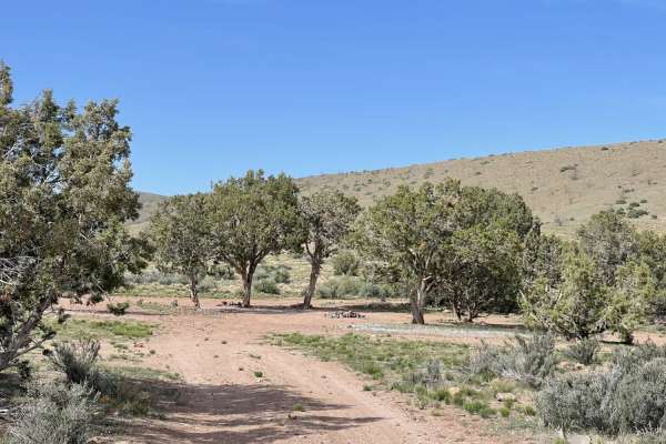
Grapevine Wash Connector
This short twisty run connects Grapevine Wash toward Oak Patch Wash trail. It's a nice little challenging route for one who wants to stay off the graders and prefers more of a challenge. There are some rocky off-camber parts. Big boulders a deep washed-out wash and loose hill climbs. There's even a ...
Learn more about Grapevine Wash Connector
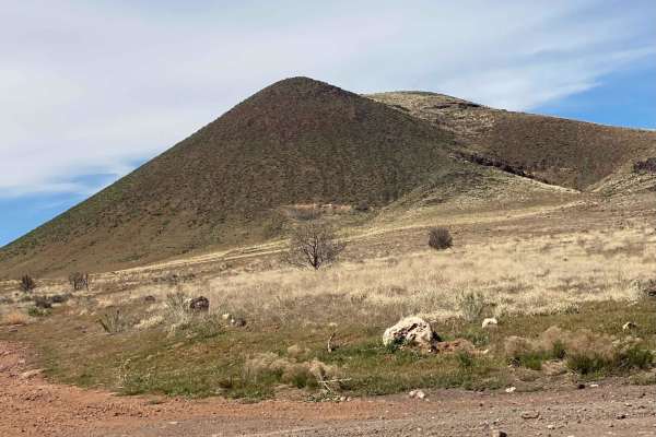
Veyo Volcano
Connector between trails on the east side of Veyo, and trails into the National Forest near Gunlock State Park. Easy road with some sites of interest including Veyo Volcano which is an intact cinder cone, Upper Sand Cove Dam;a decently trafficked rock climbing area, and borders on Red Mountain Wilde...
Learn more about Veyo Volcano
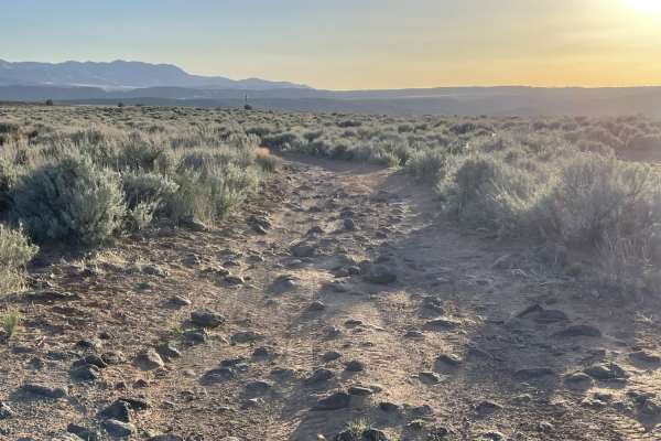
Lava Rock Lookout
This short out and back features a few dispersed camping spots that may not be allowed except in the little corner of BLM land. It appears to be private property, but no gate blocks access. It's best to check beforehand. There are fields of sagebrush. You'll notice all kinds of nice rock formations ...
Learn more about Lava Rock Lookout
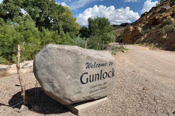
Lower Sand Cove Dam
Lower Sand Cove Dam is a scenic, beginner-friendly 2.5-mile route ideal for families and casual offroaders looking for an easy drive with rewarding water recreation. Starting just outside of Gunlock, Utah, the trail begins near the Santa Clara River before climbing a series of gentle switchbacks tha...
Learn more about Lower Sand Cove Dam
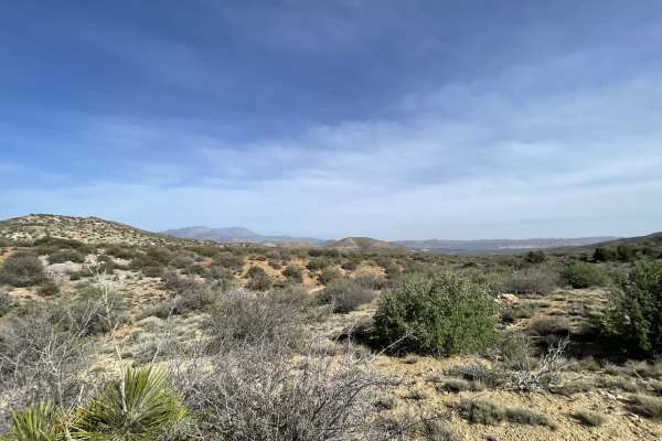
Pass On This One
This seldom-traveled offshoot trail is quite narrow and appears to be used more by livestock than by vehicular travel. There are steep, long, off-camber loose sections with very tight turns. The washouts are pretty deep and G-out your suspension if you hit them too quickly. There are soft off-camber...
Learn more about Pass On This One
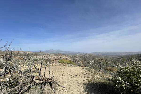
Up & Out Of Oak Patch Wash
Up & Out Of Oak Patch Wash is a challenging, narrow three-mile out-and-back trail ascending from the Oak Patch Wash area into the rugged hills of southwestern Utah, offering spectacular panoramic views for experienced drivers. Ideal for smaller four-wheel-drive vehicles and SxSs, this route climbs f...
Learn more about Up & Out Of Oak Patch Wash
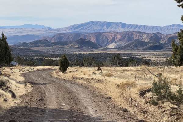
Diamond Valley-Lone Pine-Cottonwood Loop
This is a fun, easy trail with fantastic views of the surrounding area. On the Diamond Valley side you will have views of cinder cones, a dormant volcano with crater, hundreds of square miles to the west. Lone Pine Canyon has an oddity with a dead tall single pine with the backdrop of white mountain...
Learn more about Diamond Valley-Lone Pine-Cottonwood Loop
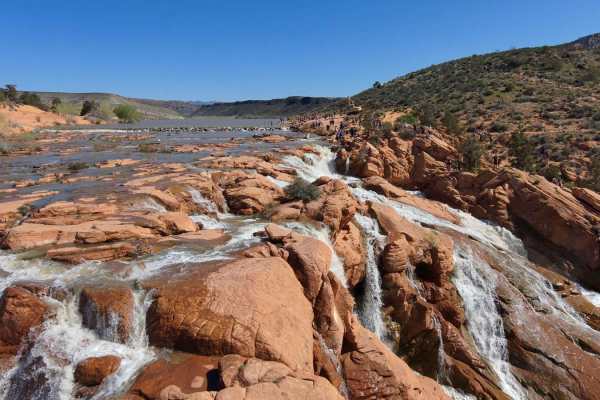
Gunlock Falls Backside
Looking for a way to get to the back of Gunlock Falls, away from the crowds who have access from Gunlock Road? This is it! It's a roughly 3-mile trail that goes down from Red Canyon 2.5 to the reservoir, then you skirt around the edge of the reservoir, over some slick rock formations and to the fa...
Learn more about Gunlock Falls Backside
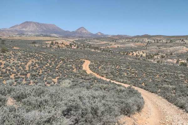
Red Canyon 2.5
For this ride, you can stage near the Santa Clara River crossing. There was a dirt bridge when we were there, but if it washes out, or if the water is too high in the springtime, it may be a water crossing. You go northwest alongside Miners Canyon with a beautiful view of Square Top Mountain and Jac...
Learn more about Red Canyon 2.5
ATV trails near Veyo, Utah
Explore ATV-friendly trails near you. These trails are accessible for vehicles up to 50 inches wide, perfect for ATVs and smaller off-road machines.
Lower Enterprise Lakes / Veyo Road
This easy two-lane washboard road heads up into the hills towards enterprise lakes and is almost all uphill. Once in the National Forest, the trail narrows to a single width with pullouts to pass oncoming traffic. There are many camping opportunities along the way down the many different pullouts. A...
Learn more about Lower Enterprise Lakes / Veyo Road
Northside Tobin Bench
Northside Tobin Bench is a scenic, moderately challenging two-mile trail designed for offroaders seeking a deserty, canyon-like driving experience with a few technical elements. Navigating this route provides a stark contrast to the ridgeline views on the southern side of the bench, guiding drivers ...
Learn more about Northside Tobin Bench
Cove Wash To Magotsu Creek
This mostly easy rip over the hill follows the utility lines as it twists, turns, rises, and falls along the mountains. There are long loose hill climbs, tight short turns, and some deeply rutted sections that may be impassable when wet. There are a few nice camping spots on the west side by Cove Wa...
Learn more about Cove Wash To Magotsu Creek
Dead End at Bowler Ranch
This short run down the side of the hill starts at Enterprise Reservoirs Road and abruptly traverses down the side of the hill. At the bottom, there are a few nice dispersed campsites before it crosses the sandy, rocky, vast wash. Do not enter when water is flowing, and be aware of heavy summer stor...
Learn more about Dead End at Bowler Ranch
UTV/side-by-side trails near Veyo, Utah
Find UTV and side-by-side trails near you. These trails accommodate vehicles up to 60 inches wide, ideal for UTVs, side-by-sides, and wider off-road rigs.
Lower Enterprise Lakes / Veyo Road
This easy two-lane washboard road heads up into the hills towards enterprise lakes and is almost all uphill. Once in the National Forest, the trail narrows to a single width with pullouts to pass oncoming traffic. There are many camping opportunities along the way down the many different pullouts. A...
Learn more about Lower Enterprise Lakes / Veyo Road
Northside Tobin Bench
Northside Tobin Bench is a scenic, moderately challenging two-mile trail designed for offroaders seeking a deserty, canyon-like driving experience with a few technical elements. Navigating this route provides a stark contrast to the ridgeline views on the southern side of the bench, guiding drivers ...
Learn more about Northside Tobin Bench
Cove Wash To Magotsu Creek
This mostly easy rip over the hill follows the utility lines as it twists, turns, rises, and falls along the mountains. There are long loose hill climbs, tight short turns, and some deeply rutted sections that may be impassable when wet. There are a few nice camping spots on the west side by Cove Wa...
Learn more about Cove Wash To Magotsu Creek
Dead End at Bowler Ranch
This short run down the side of the hill starts at Enterprise Reservoirs Road and abruptly traverses down the side of the hill. At the bottom, there are a few nice dispersed campsites before it crosses the sandy, rocky, vast wash. Do not enter when water is flowing, and be aware of heavy summer stor...
Learn more about Dead End at Bowler Ranch
The onX Offroad Difference
onX Offroad combines trail photos, descriptions, difficulty ratings, width restrictions, seasonality, and more in a user-friendly interface. Available on all devices, with offline access and full compatibility with CarPlay and Android Auto. Discover what you're missing today!
Open Trail Map