
Dirt Bike Trails
Near Talpa, New Mexico
Explore All Dirt Bike Trails Near Talpa, New Mexico
Dirt Bike Trails Near Talpa, New Mexico
Discover the best dirt bike trails near you. Browse trail maps, check difficulty ratings, and find your next adventure — whether you're looking for a quick ride or an all-day expedition.
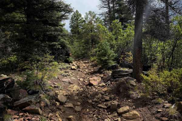
Ojito Maes Trail - FS 182
Ojito Maes Trail is a long trail in the Carson National Forest with varied terrain and scenic views through the Sangre de Cristo Mountains. The west end starts at the Amole Trailhead on FS Road 703, and it starts as an easy, wide, and smooth ATV trail through a forest of scrub oak and ponderosa pine...
Learn more about Ojito Maes Trail - FS 182
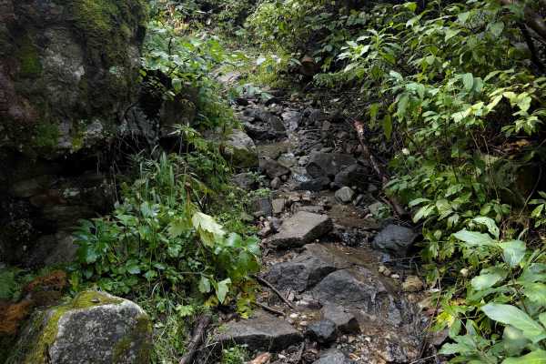
Osha Canyon Trail - FS 20
Trail 20 is a long and technical ATV trail in the Carson National Forest that is more suitable for dirt bikes only. It does not look trafficked by ATVs, and many spots would likely be too narrow and technical for ATVs, as many segments are more like single track. The entire 6-mile route is extremely...
Learn more about Osha Canyon Trail - FS 20
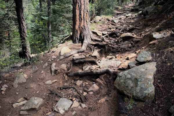
Maes Canyon Trail - FS 5
Maes Canyon Trail #5 is a rugged and technical ATV trail that is extremely rocky. It starts at the Maes Canyon Trailhead and immediately starts climbing up a steep slope covered in loose and embedded rocks of all sizes. It’s a very chunky ride, the rocks constantly pinging you around, with slippery ...
Learn more about Maes Canyon Trail - FS 5
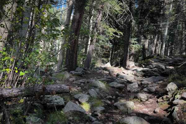
Gallegos Trail - FS 4
Gallegos Trail is an intermediate dirt bike route in the Carson National Forest, full of chunky rock challenges. The south end of the trail starts directly off of Highway 518 with no parking area. It side-hills along a dry hillside in scrub oak, with a rocky switchback obstacle right away, with an e...
Learn more about Gallegos Trail - FS 4
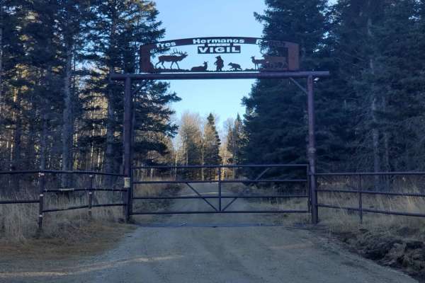
Osha Pass - FS 70b
This route is the main forest road that provides access to the 70 Moto Trail, which is a width-restricted motorized trail that climbs to Osha Pass. This trail also provides access to the Elliot Barker Trail 1, a hike, bike, horse trail that runs 12 miles along the east edge of the National Forest. I...
Learn more about Osha Pass - FS 70b
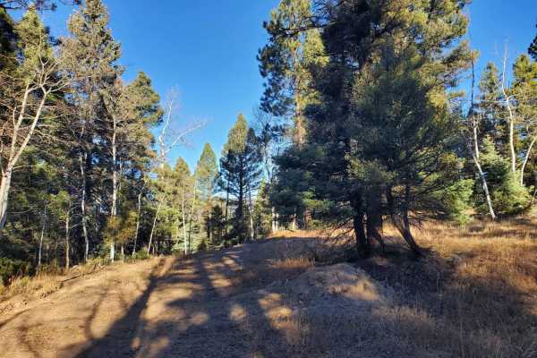
Apache Trail
This trail is an offshoot of Forest Road 70/Osha Pass trail. It leaves the main trail and tracks along the boundary of public and private land for a short while before climbing the mountainside and tracking further north into the National Forest. It provides access to a network of logging roads in t...
Learn more about Apache Trail
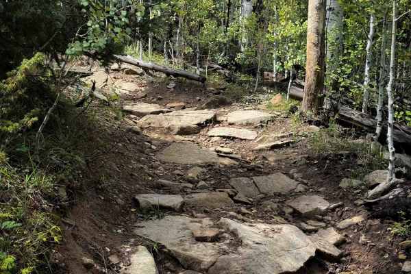
La Cueva Trail - FS 8
La Cueva Trail 8 is a 3.3-mile-long rugged and rocky ATV trail in the Carson National Forest. The south end starts on FS Road 76 across from a staging area and campsites. The trail is full of intermediate challenges, including blunt root ledges, big embedded boulder faces, slippery roots, and steep ...
Learn more about La Cueva Trail - FS 8
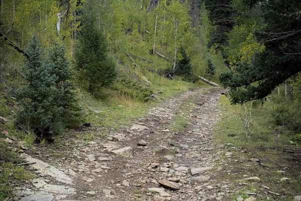
Sardinas Canyon Trail - FS 12
Sardinas Canyon Trail 12 is a wide and rocky route through the Carson National Forest, off of Forest Road 76. Per the MVUM, the trail is designated for 50-inch vehicles, but there are no sign designations at the entrances of the trail, and it looks more like a full-width road, so you may see wider v...
Learn more about Sardinas Canyon Trail - FS 12
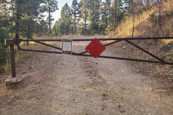
La Junta Canyon
La Junta Canyon is an easy-going, scenic drive ideal for beginners, families, and high-clearance passenger vehicles looking to explore the beautiful Carson National Forest near Taos, New Mexico. Spanning approximately 1.0 mile with an easy climb of about 354 feet, this trail winds through lush pine ...
Learn more about La Junta Canyon
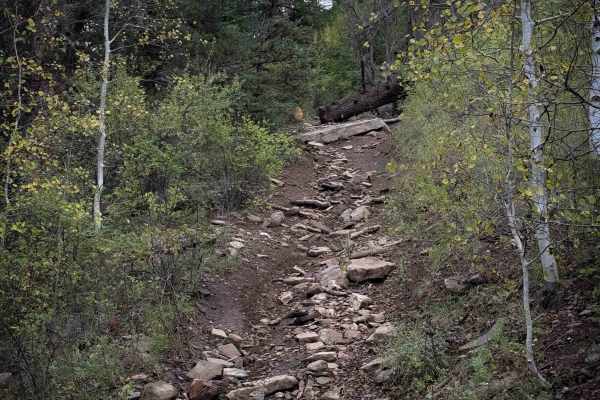
La Cueva Canyon Trail - FS 492
La Cueva Canyon Trail 492 is a great dirt bike trail in the Carson National Forest. The south end starts off of New Mexico Highway 518 in Tres Ritos, behind several private cabins. Please be respectful and quiet while passing the private land. It has a rocky and steep entrance from the south end, bu...
Learn more about La Cueva Canyon Trail - FS 492
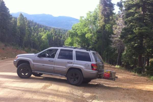
Slope to Slope
Slope to Slope is a scenic, approximately 30-mile point-to-point offroad route tailored for intermediate four-wheel-drive vehicles and SxSs, connecting Sipapu Ski Resort on the south to the vicinity of Angel Fire Ski Resort on the north. Traversing the scenic Sangre de Cristo Mountains within the Ca...
Learn more about Slope to Slope
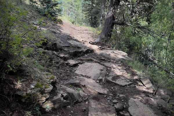
Policarpio Trail - FS 13
Trail 13 is a rugged and rocky ATV trail through the Carson National Forest, making a nearly 7-mile-long loop off of FS Road 76. There are small parking lots at both trailheads. When riding counterclockwise, the first three miles of trail are like an endless rock garden. The trail is a mix of wide s...
Learn more about Policarpio Trail - FS 13
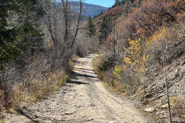
Rio Chaquito
This route is generally easy, with only a few areas requiring moderate ground clearance. It offers excellent scenery, including wetlands created by beavers along the Rio Chiquito. Numerous scenic campsites can be found beside the river. Trailers are not recommended, and cell service is limited for m...
Learn more about Rio Chaquito
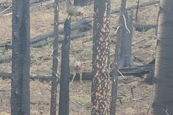
Luna Creek Trail
This trail leads from the border of the Carson National Forest through the Luna Creek Fire burn scar to its intersection with the Slope to Slope trail, also known as Forest Road 75. Max grade observed on the trail was 12deg, and there is one water crossing of Luna Creek, which could be dangerous dep...
Learn more about Luna Creek Trail
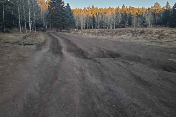
La Jara Canyon
This trail is a well-maintained forest road that leads from US 64 to some logging trails along the border of the Taos Pueblo. The road is closed near the logging trails as its condition deteriorates and has many dispersed camping sites along the length of it. Use caution for wetlands near the creek,...
Learn more about La Jara Canyon
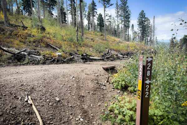
Bear Canyon Trail 28
Bear Canyon is an easy ATV trail in the Carson National Forest that connects Trail 22 to Forest Road 1877. It is a wide, single-lane, road-width path that looks like it’s been bulldozed as a fire break and for logging. There are big log piles off to the side of the trail, and clear-cut hillsides. I...
Learn more about Bear Canyon Trail 28
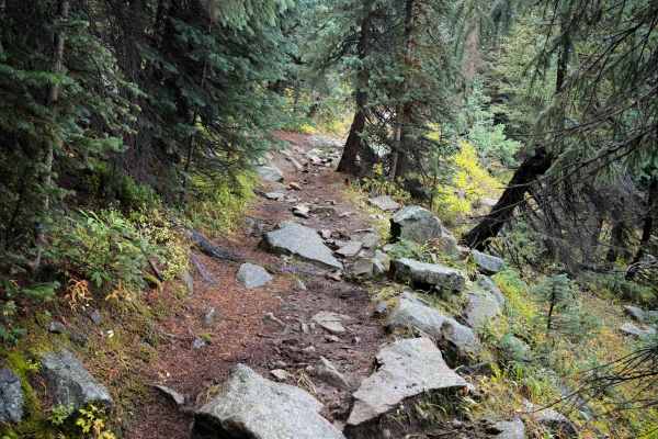
Comales Cutoff Trail
The Comales Cutoff Trail is a 4.4-mile-long, narrow, and rocky ATV trail that connects Comales Trail to Agua Piedra Trail. Although 50-inch vehicles are legally allowed on this trail, it is best suited to dirt bikes and is likely too narrow for ATVs because there are many single track segments, and ...
Learn more about Comales Cutoff Trail
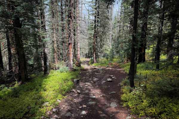
Trail 22A
22A is a short spur that connects Trail 22 to the Comales Canyon Cutoff Trail. It goes through a high alpine forest of white firs covered in moss, on a dirt ATV path that is consistently rocky, with large, embedded chunky rocks in the trail that make it a slow and bumbling ride. The trail is a steep...
Learn more about Trail 22A
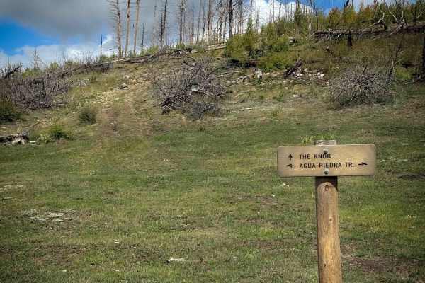
The Knob - FS 19D
The Knob is a short spur off of Agua Piedra Trail that climbs up to a great overlook of the Sangre De Cristo Mountains, making a great lunch spot. The route is 1 mile each way and will be ridden as an out-and-back, making a short and worthwhile detour from your ride. It climbs up from a grassy saddl...
Learn more about The Knob - FS 19D
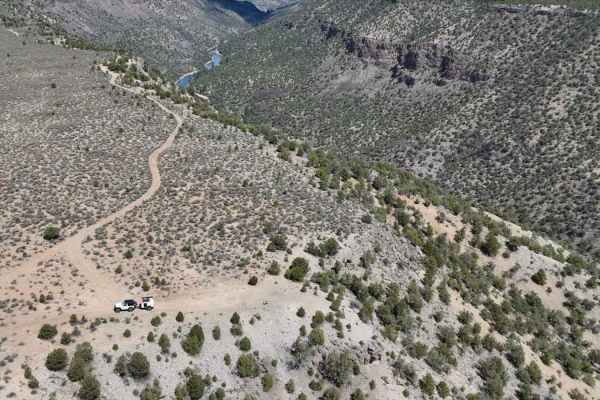
West Rim Trail
Difficulty: 2 (Easy) The West Rim trail offers 3.2 miles of scenic desert driving with spectacular canyon overlooks along the western edge of Rio Grande del Norte National Monument. Accessible from Taos Valley Road, this BLM route typically requires 45 minutes to complete, making it perfect for thos...
Learn more about West Rim Trail
ATV trails near Talpa, New Mexico
Explore ATV-friendly trails near you. These trails are accessible for vehicles up to 50 inches wide, perfect for ATVs and smaller off-road machines.
Ojito Maes Trail - FS 182
Ojito Maes Trail is a long trail in the Carson National Forest with varied terrain and scenic views through the Sangre de Cristo Mountains. The west end starts at the Amole Trailhead on FS Road 703, and it starts as an easy, wide, and smooth ATV trail through a forest of scrub oak and ponderosa pine...
Learn more about Ojito Maes Trail - FS 182
Osha Canyon Trail - FS 20
Trail 20 is a long and technical ATV trail in the Carson National Forest that is more suitable for dirt bikes only. It does not look trafficked by ATVs, and many spots would likely be too narrow and technical for ATVs, as many segments are more like single track. The entire 6-mile route is extremely...
Learn more about Osha Canyon Trail - FS 20
Maes Canyon Trail - FS 5
Maes Canyon Trail #5 is a rugged and technical ATV trail that is extremely rocky. It starts at the Maes Canyon Trailhead and immediately starts climbing up a steep slope covered in loose and embedded rocks of all sizes. It’s a very chunky ride, the rocks constantly pinging you around, with slippery ...
Learn more about Maes Canyon Trail - FS 5
Osha Pass - FS 70b
This route is the main forest road that provides access to the 70 Moto Trail, which is a width-restricted motorized trail that climbs to Osha Pass. This trail also provides access to the Elliot Barker Trail 1, a hike, bike, horse trail that runs 12 miles along the east edge of the National Forest. I...
Learn more about Osha Pass - FS 70b
UTV/side-by-side trails near Talpa, New Mexico
Find UTV and side-by-side trails near you. These trails accommodate vehicles up to 60 inches wide, ideal for UTVs, side-by-sides, and wider off-road rigs.
Osha Pass - FS 70b
This route is the main forest road that provides access to the 70 Moto Trail, which is a width-restricted motorized trail that climbs to Osha Pass. This trail also provides access to the Elliot Barker Trail 1, a hike, bike, horse trail that runs 12 miles along the east edge of the National Forest. I...
Learn more about Osha Pass - FS 70b
Apache Trail
This trail is an offshoot of Forest Road 70/Osha Pass trail. It leaves the main trail and tracks along the boundary of public and private land for a short while before climbing the mountainside and tracking further north into the National Forest. It provides access to a network of logging roads in t...
Learn more about Apache Trail
La Junta Canyon
La Junta Canyon is an easy-going, scenic drive ideal for beginners, families, and high-clearance passenger vehicles looking to explore the beautiful Carson National Forest near Taos, New Mexico. Spanning approximately 1.0 mile with an easy climb of about 354 feet, this trail winds through lush pine ...
Learn more about La Junta Canyon
Rio Chaquito
This route is generally easy, with only a few areas requiring moderate ground clearance. It offers excellent scenery, including wetlands created by beavers along the Rio Chiquito. Numerous scenic campsites can be found beside the river. Trailers are not recommended, and cell service is limited for m...
Learn more about Rio Chaquito
The onX Offroad Difference
onX Offroad combines trail photos, descriptions, difficulty ratings, width restrictions, seasonality, and more in a user-friendly interface. Available on all devices, with offline access and full compatibility with CarPlay and Android Auto. Discover what you're missing today!
Open Trail Map