
Dirt Bike Trails
Near Sawyer, Oklahoma
Explore All Dirt Bike Trails Near Sawyer, Oklahoma
Dirt Bike Trails Near Sawyer, Oklahoma
Discover the best dirt bike trails near you. Browse trail maps, check difficulty ratings, and find your next adventure — whether you're looking for a quick ride or an all-day expedition.
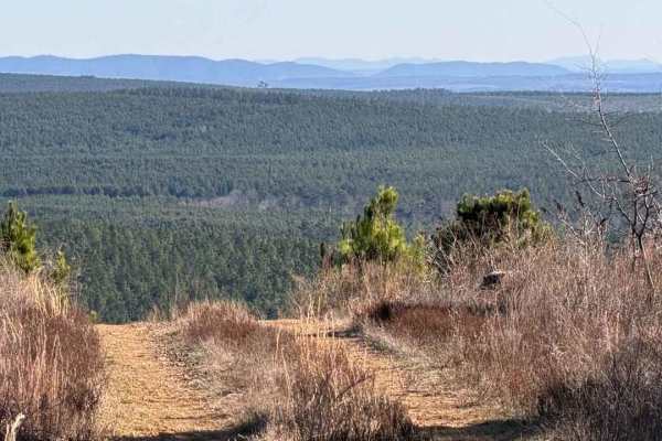
East Signal Mountain
This is a beautiful area of North Western McCurtain County; it is highly isolated, and the terrain for most of the trail is just hilltop roads and small creek valleys. There are some pine farms in the area, but the land near the top, which is over 1400 feet high, is probably a Rating 3 to 5, too muc...
Learn more about East Signal Mountain
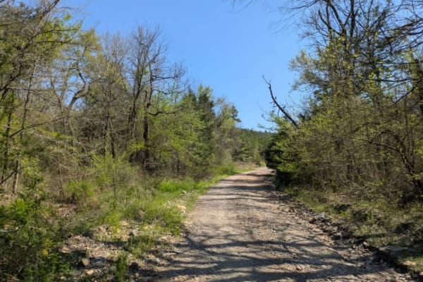
Ouachita National Forest Access Road
This scenic off-road route follows a well-maintained gravel surface that is typically wide yet tapers to narrower sections at times. You will notice drainage ditches running along its edges, and during April there is considerable flowing water. The trail features expansive quarries that serve as pos...
Learn more about Ouachita National Forest Access Road
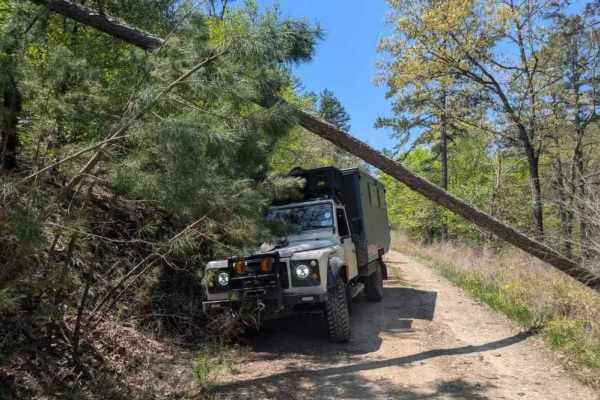
53250
This off-road trail winds through a dense forest, revealing a narrow track that shows signs of limited upkeep, particularly through overgrowth and numerous muddy, rock-bottomed holes often present during April. Several off-camber stretches and areas of water damage add challenges, alongside a few mo...
Learn more about 53250

Anderson Trail
This scenic off-road route, known as the Anderson Trail, serves as a primary connector between higher and lower trails in the region. Although it is predominantly well-maintained gravel, a handful of rocky sections and muddy puddles--particularly in April--add an element of challenge. Two vehicles c...
Learn more about Anderson Trail

Shell Rock Road
This road is mostly rock/shale/gravel Forest Service Road. It is a rough rocky road with deep shoulder drop-offs from 3' to 30' in some areas. There is Shell Rock creek that runs along it. The foliage in the fall makes for an excellent trail. Wildlife is out along this trail. The trail can be run in...
Learn more about Shell Rock Road
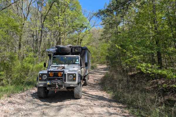
52420
This route commences with a rocky, off-camber descent toward a low-level water crossing, after which the path narrows and becomes increasingly rugged, requiring slow travel in low gear. Water damage has significantly eroded the surface, forming deep, off-camber ruts and heavily rutted ascents and de...
Learn more about 52420
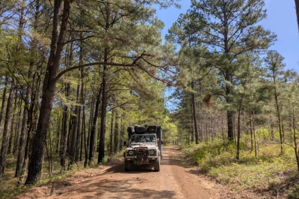
53140
This off-road route presents a scenic journey along a mostly flat, well-maintained gravel surface, although it is quite narrow with trees lining the edges. The trail features a deceptively steep ascent that may require some vehicles to shift into a lower gear for optimal performance. Once past the c...
Learn more about 53140
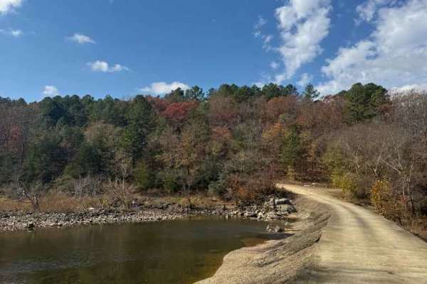
Jones Ranch Trail
Easy route that crossed the Glover River. This could be washed out with heavy rain and become muddy. Otherwise, this is a nice connection to other trails, or even a back way to bypass Broken Bow on your way home. No camping options available on this trail.
Learn more about Jones Ranch Trail
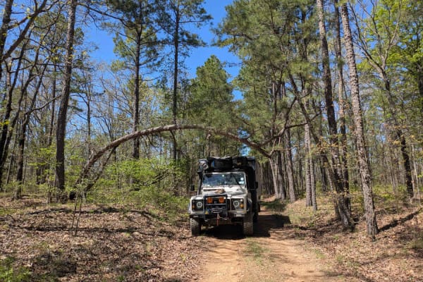
53350
This off-road trail presents a rugged challenge with its rocky surface that gradually narrows while becoming off-camber, showing clear signs of water damage. In several areas, the forest is encroaching on the path, increasing the risk of pinstriping, and fallen trees are scattered along the route. N...
Learn more about 53350
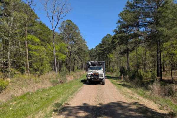
53500 Creek Trail
This narrow, short, and flat trail is exceptionally beautiful and offers a delightful experience for off-road enthusiasts. The route winds through a pristine forest before reaching a clear creek featuring a submerged concrete passway. At the trail's end, a sign--indicating the trail opens in October...
Learn more about 53500 Creek Trail
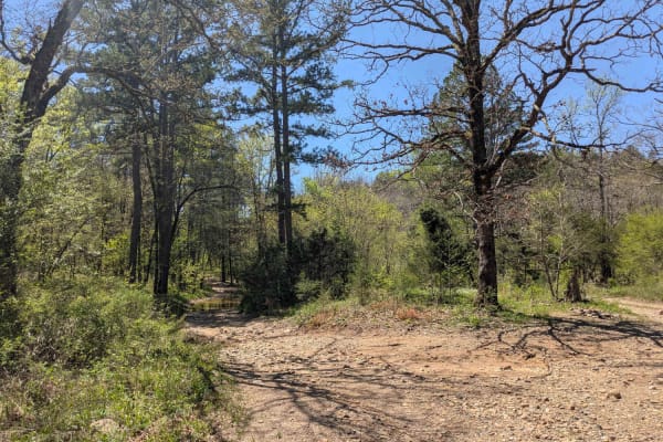
52750
This narrow, short, and flat trail is exceptionally beautiful and offers a delightful experience for off-road enthusiasts. The route winds through a pristine forest before reaching a clear creek featuring a submerged concrete passway. At the trail's end, a sign--indicating the trail opens in October...
Learn more about 52750
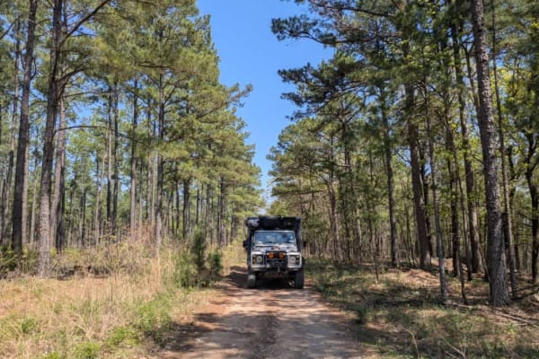
53150
This off-road route is both picturesque and adventurous, with a narrow, winding, and rocky path that demands patience to navigate. About halfway through, you will discover a sizable pond, the trail appears to be a well-kept secret, rarely visited by other travelers. In April, the terrain remains par...
Learn more about 53150
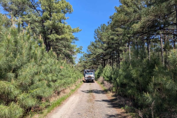
53146
This narrow and short off-road trail winds its way through a picturesque pine forest, eventually terminating in two distinct grassy fields that appear ideal for group camping. It is important to note that these open fields may become wet and muddy after rainfall. Additionally, a secondary trail exis...
Learn more about 53146
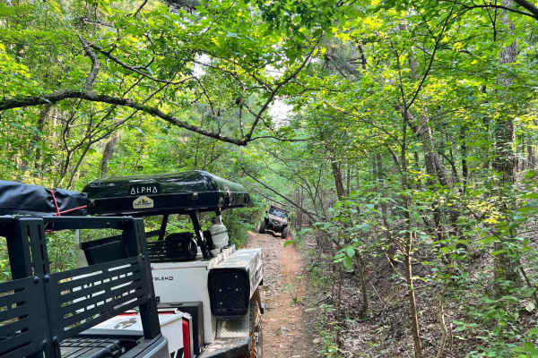
FR 53100
This trail was challenging, yet very doable. It is mostly rock, and very tight, with some big washout areas. Be prepared for low-hanging trees and tight technical off-camber turns in a larger vehicle. Passing side by sides or other vehicles on this trail is nearly impossible.
Learn more about FR 53100
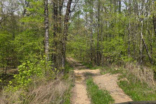
Golf Course Trail
This trail is a fun, thrilling, and yet technical trail that follows parallel to the Golf Course Road, which leads to Cedar Greek Golf Course. There are several spots filled with mud and water about 1 feet deep. Towards the 3rd quarter of the way, the trail gets narrow with lots of overhanging bushe...
Learn more about Golf Course Trail
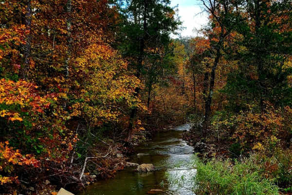
Cedar Creek Trail
This trail is a dirt/gravel road that is well maintained. There are several low water crossing along this trail with 3'' to 8'' of water to cross and all with concrete drive-throughs. The gravel road has loose rocks and some washouts/mud holes. Cedar Creek runs along the side of the entire trail. To...
Learn more about Cedar Creek Trail
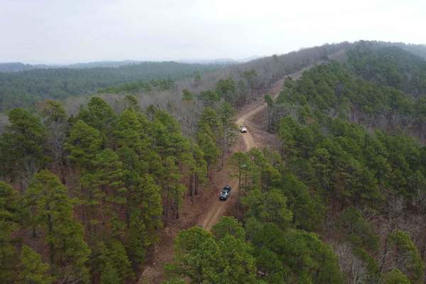
Holly Mountain Trail
This trail begins on US259 and FR 54000. It will then connect to FR54256, which will lead you to FR54262, the "Holly Mountain Trail". This loose gravel road, with some minor rocky terrain, will have some minor climbs, so 4WD is recommended. Any stock vehicle with 6-8 inches of clearance can make it ...
Learn more about Holly Mountain Trail
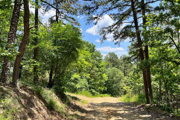
FR 5400 to 54037
This trail is right off of the main HWY 259, and has plenty of amazing views and off shoot trails to explore. This trail is also seasonal so please check the maps and signs. It appears to have a decent camping spot at the end near the water, but it would only be accessible for smaller well built 4...
Learn more about FR 5400 to 54037
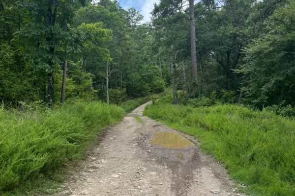
East High Peak Trail
This is a wide, open section featuring a single-lane rock road that winds through the beautiful Kiamichi Mountains. There are no major obstacles along this stretch, making it suitable for most stock 2WD or 4WD vehicles. It's a great opportunity to enjoy the scenery, get comfortable on the trail, and...
Learn more about East High Peak Trail
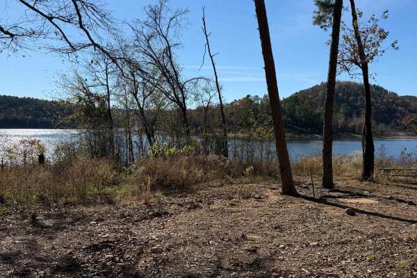
Johnny Beavers Trail to Holly Creek Landing
This wonderful trailt is very scenic and runs through some locally owned areas and some with pine plantations. It eventually ends in a national forest area and on Oklahoma Wildlife Department land when you get near the Mountain Fork River--well-maintained roads in places. Beware of the open yellow g...
Learn more about Johnny Beavers Trail to Holly Creek Landing
ATV trails near Sawyer, Oklahoma
Explore ATV-friendly trails near you. These trails are accessible for vehicles up to 50 inches wide, perfect for ATVs and smaller off-road machines.
East Signal Mountain
This is a beautiful area of North Western McCurtain County; it is highly isolated, and the terrain for most of the trail is just hilltop roads and small creek valleys. There are some pine farms in the area, but the land near the top, which is over 1400 feet high, is probably a Rating 3 to 5, too muc...
Learn more about East Signal Mountain
Ouachita National Forest Access Road
This scenic off-road route follows a well-maintained gravel surface that is typically wide yet tapers to narrower sections at times. You will notice drainage ditches running along its edges, and during April there is considerable flowing water. The trail features expansive quarries that serve as pos...
Learn more about Ouachita National Forest Access Road
53250
This off-road trail winds through a dense forest, revealing a narrow track that shows signs of limited upkeep, particularly through overgrowth and numerous muddy, rock-bottomed holes often present during April. Several off-camber stretches and areas of water damage add challenges, alongside a few mo...
Learn more about 53250
Anderson Trail
This scenic off-road route, known as the Anderson Trail, serves as a primary connector between higher and lower trails in the region. Although it is predominantly well-maintained gravel, a handful of rocky sections and muddy puddles--particularly in April--add an element of challenge. Two vehicles c...
Learn more about Anderson Trail
UTV/side-by-side trails near Sawyer, Oklahoma
Find UTV and side-by-side trails near you. These trails accommodate vehicles up to 60 inches wide, ideal for UTVs, side-by-sides, and wider off-road rigs.
East Signal Mountain
This is a beautiful area of North Western McCurtain County; it is highly isolated, and the terrain for most of the trail is just hilltop roads and small creek valleys. There are some pine farms in the area, but the land near the top, which is over 1400 feet high, is probably a Rating 3 to 5, too muc...
Learn more about East Signal Mountain
Ouachita National Forest Access Road
This scenic off-road route follows a well-maintained gravel surface that is typically wide yet tapers to narrower sections at times. You will notice drainage ditches running along its edges, and during April there is considerable flowing water. The trail features expansive quarries that serve as pos...
Learn more about Ouachita National Forest Access Road
53250
This off-road trail winds through a dense forest, revealing a narrow track that shows signs of limited upkeep, particularly through overgrowth and numerous muddy, rock-bottomed holes often present during April. Several off-camber stretches and areas of water damage add challenges, alongside a few mo...
Learn more about 53250
Anderson Trail
This scenic off-road route, known as the Anderson Trail, serves as a primary connector between higher and lower trails in the region. Although it is predominantly well-maintained gravel, a handful of rocky sections and muddy puddles--particularly in April--add an element of challenge. Two vehicles c...
Learn more about Anderson Trail
The onX Offroad Difference
onX Offroad combines trail photos, descriptions, difficulty ratings, width restrictions, seasonality, and more in a user-friendly interface. Available on all devices, with offline access and full compatibility with CarPlay and Android Auto. Discover what you're missing today!
Open Trail Map