Travis F
Jul 08, 2026
Open
DustyRough/DeterioratedWashboard
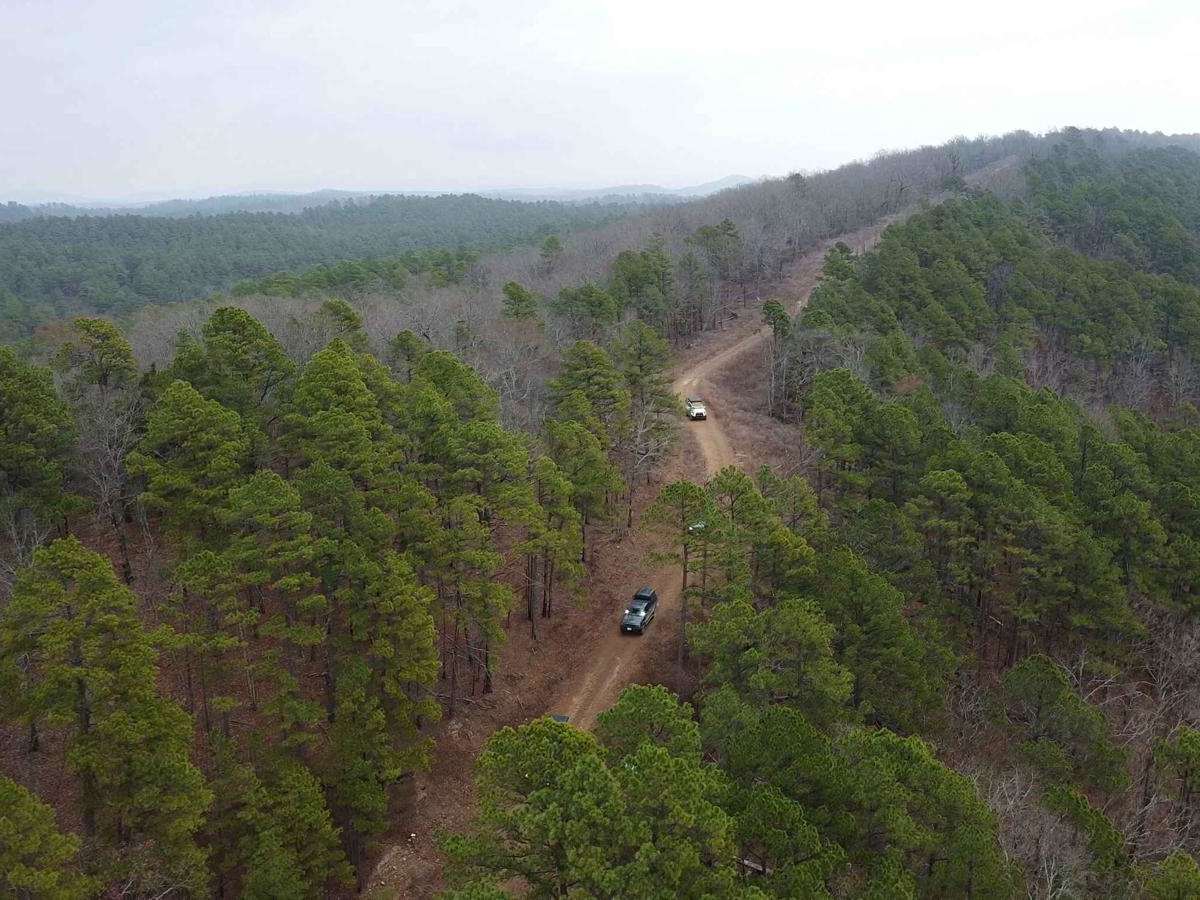
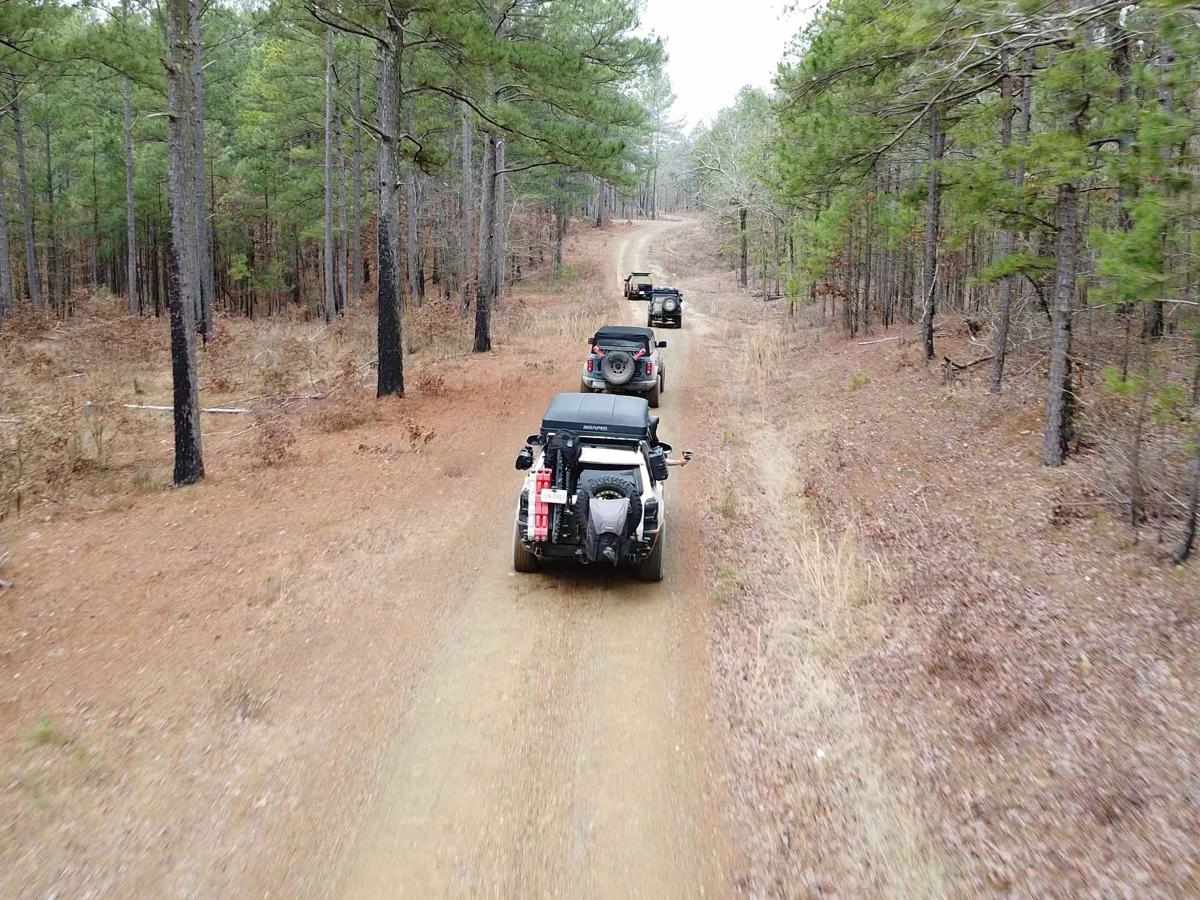
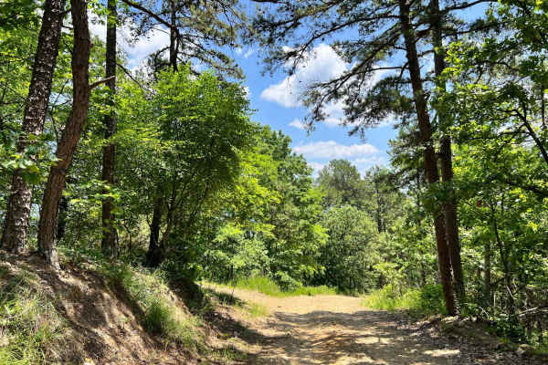
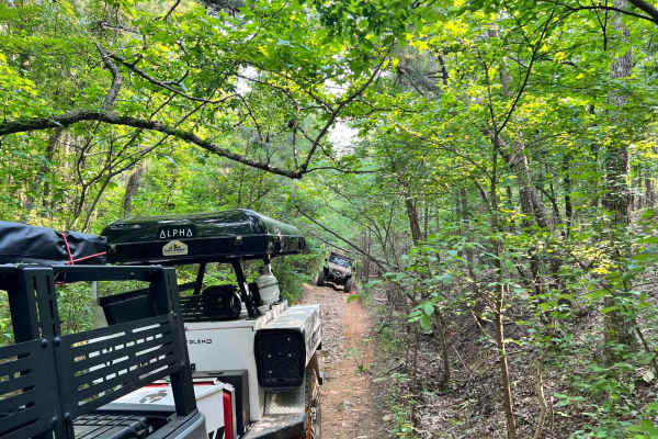
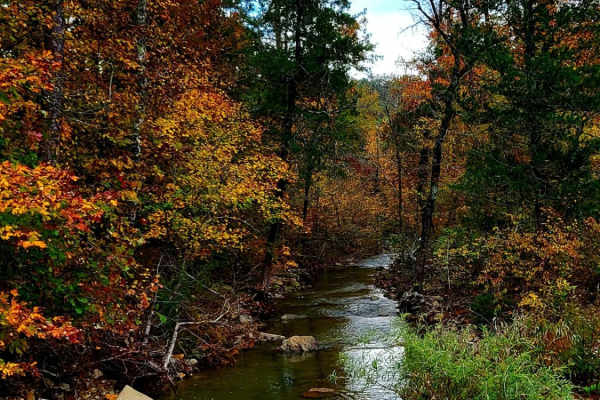
Simple trail, couple spots with washboards and large loose rocks. Never left 2x4, kept it slow and never had an issue.
Kyle
Jun 28, 2026
2026 Toyota Tacoma
Open
Rough/DeterioratedWashboard
I did this trail in a stock 2026 Toyota Tacoma SR5 4x4. Trail was more technical than expected from the rating and reviews. There are sections with large rocks, washed out ruts, and loose rock, ledges, and steep climbs. I made it till I came across a very steep incline and decided it was best to turn around. Never lost traction and my truck could’ve made it up but it was more than I wanted to test. I wouldn’t do this trail solo or without larger tires and maybe even a locker. Definitely wouldn’t attempt without four high and low. I would rate this trail a 3 or higher. I wouldn’t recommend for beginners.
Graham the man
Jun 13, 2026
2003 toyota tundra
Open
WashboardRough/Deteriorated
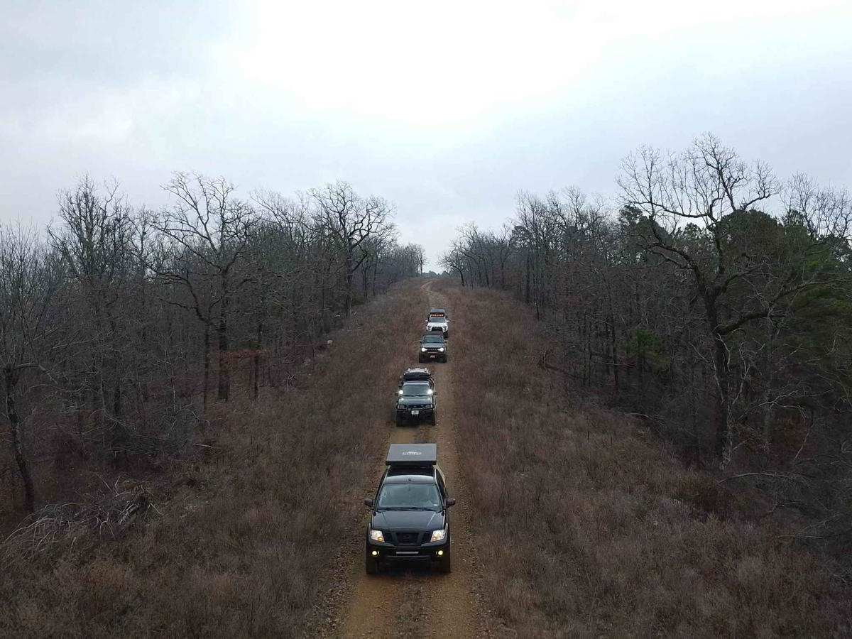
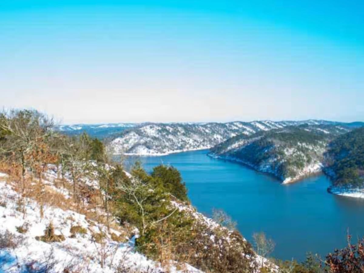
We left from 259 and made our way to the eagles nest and back. We only saw 2 other SXS headed back when we were heading in to watch the sunset. The trail was pretty straight forward and had an amazing view at the end. Not too complicated, however, there are 2 or 3 inclines that are pretty steep, lots of dashboard roads and loose rocks towards the end. You can make it with and or even 2wd with enough clearance and torque for the hills. We took our time and it took about 90 minutes each way. I'd do it again, watching the sunset over the lake and the stars was beautiful. Take your time with rocky, washboard roads and you'll be fine.
Garry Jeffries
May 18, 2026
2026 Honda Passport Trailsport
Open
Dusty
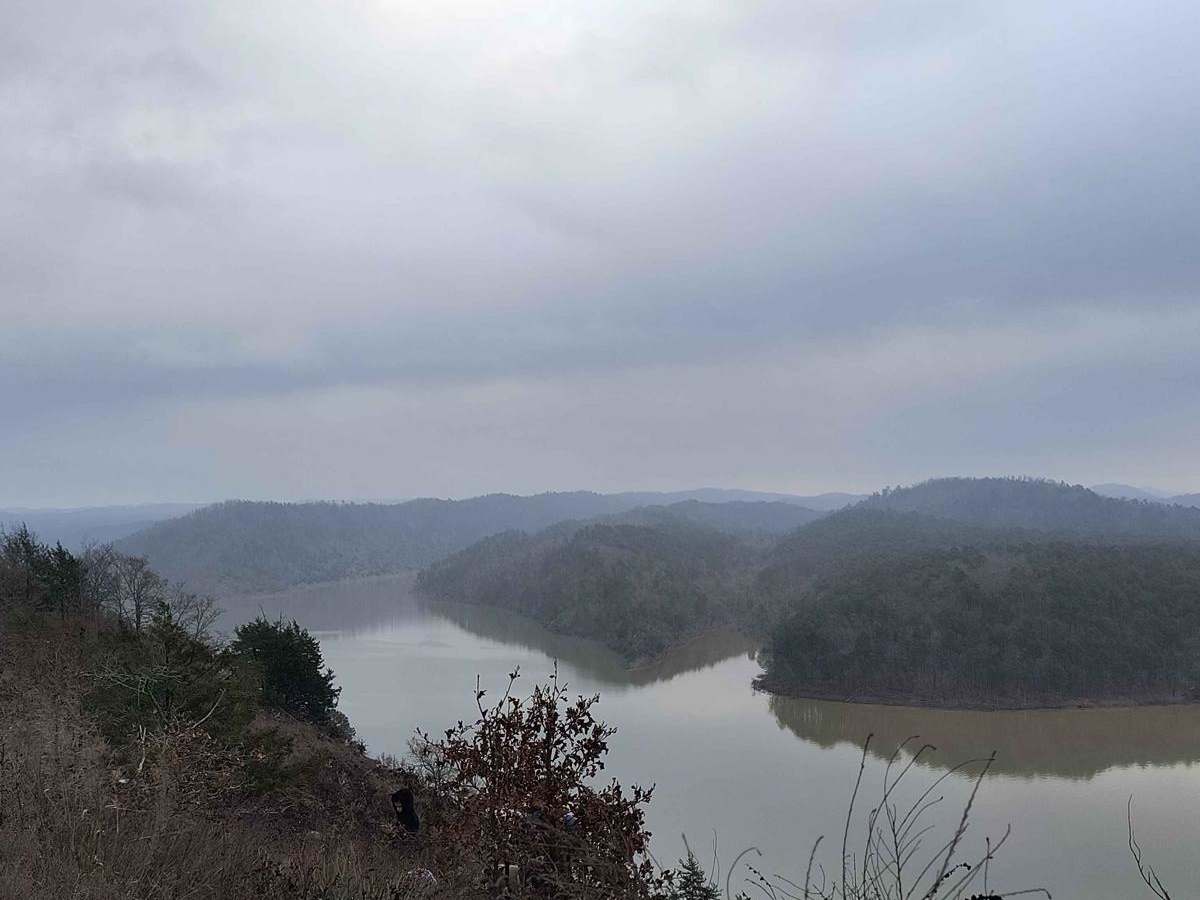
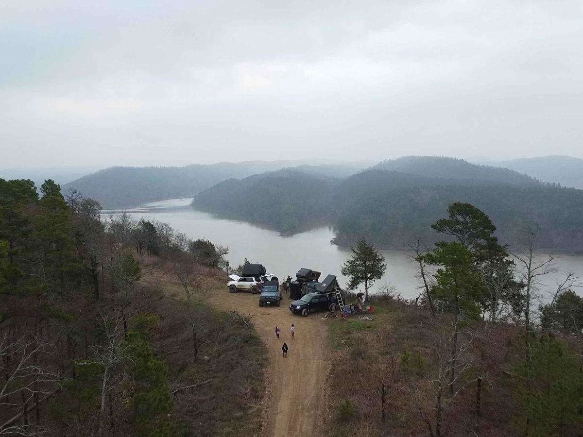
Starts smooth but quickly becomes rocky. Lots of pines ending on a Bluff overlooking the lake. Great View. Had no issues with my 2026 Passport with 8.3 inches of ground clearance. Some decent hill climbs.
Cody Sowell
May 17, 2026
2017 Yamaha XT 250
Open
Normal
Fun road for a novice dual sport rider! Definitely tons of sharp and rounded softball sized rocks. Some ruts, but not too bad. Most difficult sections were two big declines with loose rocks. View at the end was killer.
Jordan Pearce
May 09, 2026
2021 RAM 1500
Open
NormalDusty
Easy trail. Didnt need 4x4, if it was rainy some of the steeper hills might have needed it but likely not. About an hour round trip.
Matt Smith
Mar 20, 2026
Open
NormalDusty
Great trail! Pretty rocky but no need to air down. Spent the night at the overlook.
Terry Tobias
Mar 20, 2026
2024 Ford Bronco
Open
DustyWashboard
Maintained road with moderate climbs and turns, ends with a stunning view.
Zdravko T
Mar 13, 2026
2025 Subaru Outback Wilderness
Open
Normal
Great trail. Had no issues with our Outback Wilderness. Saw a couple jeeps and a frw side by sides
Johan v
Feb 28, 2026
2024 Ford F-Series
Open
NormalDustyWashboard
Trail was open, signs of recent control burns where around.
Frank Graffagnino
Feb 15, 2026
2021 Jeep Gladiator
Open
Muddy/Wet
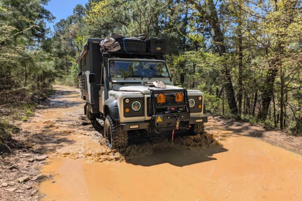
Trail is in good shape with a few puddles, but all with hard bottoms. Biggest hazard is probably sharp rocks off the path. Should be pretty easy for any 4WD vehicle. Great payoff at the end with a stunning overlook point.
Sheb Steiniger
Jan 10, 2026
2018 Toyota Tundra
Open
Normal
Ran into two vehicles as we headed back towards the highway. No traffic at all. Beautiful morning on the trail.
Jarrod Ross
Dec 28, 2025
Open
Normal
Trail was dry all the way up. Drove it all in 2WD. Beautiful view at the top.
Marco Van Der Westhuizen
Dec 23, 2025
2012 Ford F-Series
Open
Normal
The trail was super open, wide vehicles should fit fine. Majority of the trail is super easy, only concerns were some bigger sharp rocks to watch out for and incline. My 2wd F-150 took the inclines just fine but do be cautious as you may experience slip. But overall I rate it a 10/10 trail since the views were stunning.
Brandon Box
Nov 08, 2025
Open