
Dirt Bike Trails
Near Rosamond, California
Explore All Dirt Bike Trails Near Rosamond, California
Dirt Bike Trails Near Rosamond, California
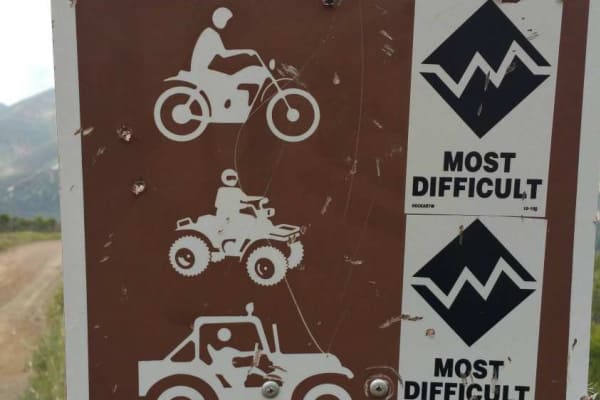
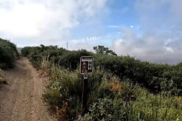
Discover the best dirt bike trails near you. Browse trail maps, check difficulty ratings, and find your next adventure — whether you're looking for a quick ride or an all-day expedition.
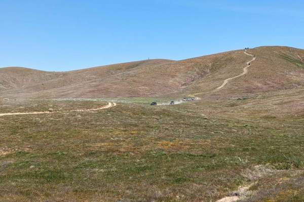
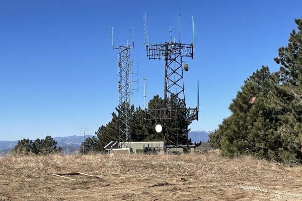
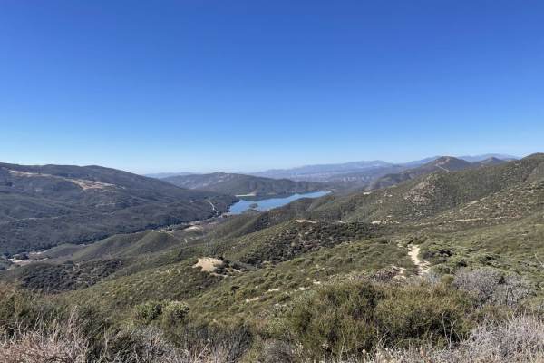
Fairmont Peak Summit
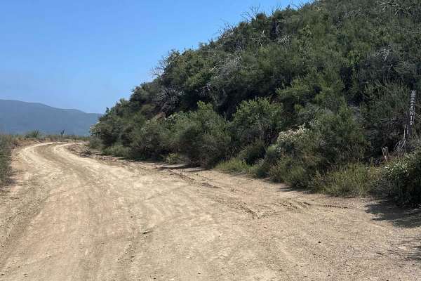
This trail climbs over 500 feet to the top of Fairmont Peak Tower. The route is rocky and uneven. Although a shorter route, airing down is highly recommended. Slow speeds are also recommended. Many rocks are sharp. Flats have been known to happen. There are views of solar arrays, adjacent valleys, a...
Learn more about Fairmont Peak Summit
Lake Hughes/Grass Mountain Connector Trail
This short trail connects the Lake Hughes Truck Trail with Grass Mountain, FS 6N04. It is a mostly uneventful and short trail that, unlike others in the area, has quite a bit of shade thanks to young pine trees. There are a few switchbacks, ruts, and loose gravel, especially on the northern side of ...
Learn more about Lake Hughes/Grass Mountain Connector Trail
Maxwell Road
This is an off-road connector between Lake Hughes Road and the Liebre Mountain and Sawmill Motor Way (USFS Route 7N23). It takes you through the western Sierra Pelona Range, which is the lower elevation mountain range in western Los Angeles County, California. Much of this area was burned in the Lak...
Learn more about Maxwell Road
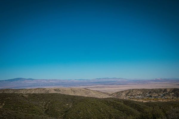
Grass Mountain Summit
This is a short but scenic ride to the summit of Grass Mountain, which provides a great view of the Green Valley area, the Leona Valley, Antelope Valley, and the high desert to the north and northeast. Access this trail via San Francisquito Canyon Road by taking Forest Route 6N04, making a left onto...
Learn more about Grass Mountain Summit
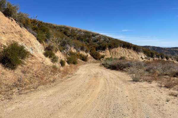
Leona Divide
This is a relatively easy scenic drive down Forest Route 6N04, also known as Leona Divide. It can be run in both directions, beginning at either the trailhead on Bouquet Canyon Road or San Francisquito Canyon Road. There are quite a few scenic overlooks, switchbacks and steep climbs and descents. Th...
Learn more about Leona Divide
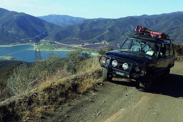
Sierra Pelona Ridge/Rowher OHV
Sierra Pelona Ridge/Rowher OHV is a prime destination for stock four-wheel-drive vehicles, high-clearance SUVs, and SxSs seeking a scenic ridgetop drive with panoramic mountain vistas. The route begins near the Rowher Flat OHV Area, climbing up a single-lane shelf road that is moderately steep in se...
Learn more about Sierra Pelona Ridge/Rowher OHV

FS 3415W05
Great single-track trail off of San Francisquito Canyon Road. Signs say motorcycle or ATV, but take a look at the pictures, not sure how a quad is fitting down this trail. Regardless, the trail is super fun, tight, but not too technical. It does not appear that this trail sees much traffic, as the b...
Learn more about FS 3415W05
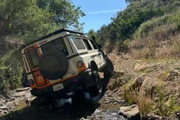
Rowher 4x4 Trail - FS 3414W19
Rowher 4x4 Trail is a short but technical OHV route located within the Rowher Flat OHV Area near Santa Clarita, California. This trail is purpose-built for off-road vehicles and offers a concentrated mix of steep climbs, loose decomposed granite, rutted sections, and off-camber lines that test tract...
Learn more about Rowher 4x4 Trail - FS 3414W19
King Snake
King Snake Trail is no joke. This is a dirt bike-only trail in the upper section of Rowher Flats OHV. Riding from west to east, this trail begins off the Sierra OHV Trail. The trail is a rugged mix of sharp rocks and deeply rutted sections, where your line choice matters just as much as your throttl...
Learn more about King Snake
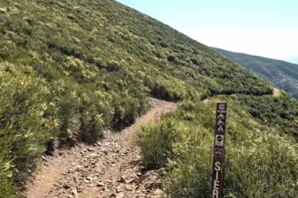
Sierra OHV Trail
Sierra OHV Trail is a popular dirt bike and ATV route located in the northern section of the Rowher Flats OHV Area. The trail follows the hillside just below Pelona Ridge, offering riders scenic views throughout the entire route. This is a two-way trail that is enjoyable in either direction. From th...
Learn more about Sierra OHV Trail
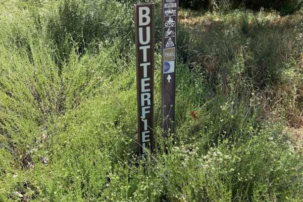
Butterfield
Butterfield Trail delivers a diverse and engaging 4x4 experience just off San Francisquito Canyon Road, offering a medium-difficulty route that combines varied terrain with scenic surroundings. It’s a well-balanced trail that gives drivers a taste of technical off-roading without pushing into extrem...
Learn more about Butterfield
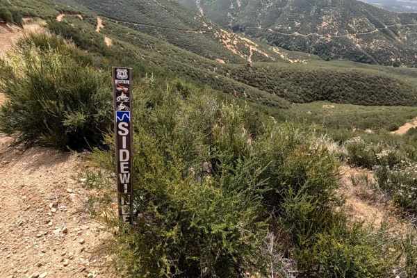
Sidewinder OHV Trail
Sidewinder OHV Trail offers a balanced mix of challenge and flow, making it great for intermediate riders looking to sharpen their skills without the relentless punishment of more advanced routes. This trail is marked for dirt bikes and ATVs only; however, some sections are really tight, and an ATV ...
Learn more about Sidewinder OHV Trail
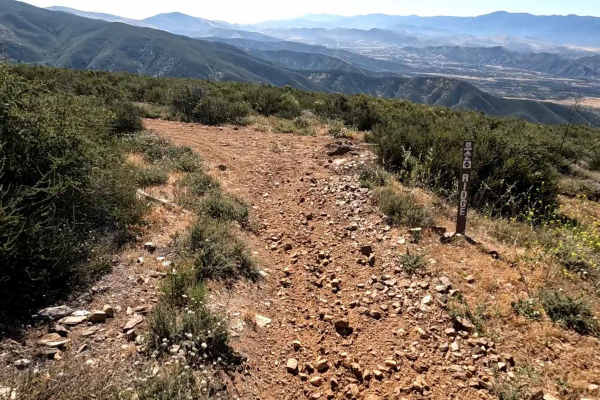
Ridge Trail
A great trail in the upper north section of Rowher Flats OHV. Listed for both dirt bikes and ATVs however ATVs might find some sections tight and/or impassible so keep this in mind if you are on a quad. There are a few sections with steep drop offs to the side but for the most part the trail is fun ...
Learn more about Ridge Trail
Quarry Road 6N19
This trail is a short connector and gatekeeper to Del Sur Ridge 6N18. A couple of points feature nice views of surrounding canyons and chaparral. The trail is also quite steep in certain spots. Deep ruts and erosion give this trail a bit of difficulty, and high clearance is strongly recommended. To ...
Learn more about Quarry Road 6N19
Bouquet Trail
Bouquet Trail (3414W27) is a great "back door" for dirt bikes and ATVs into the Rowher Flats OHV area. This trail is uphill all the way from the staging area located on Bouquet Canyon Road. Lots of twists and turns, and you make your ascent to the upper north area of Rowher Flats OHV area. Take caut...
Learn more about Bouquet Trail
Knob OHV Trail
Knob OHV Trail is an enjoyable dirt bike and ATV route with easy access from Staging Area #2 in the Rowher Flats OHV Area. This two-way trail runs primarily north to south and can be ridden comfortably in either direction. From the south, it begins at Staging Area #2, and on the northern end, it con...
Learn more about Knob OHV Trail
Tule Canyon
The eastern end of this trail connects with the Tule Divide Trail, which is rated 3/10 (4+/10 if wet). Once you split off Tule Divide, this trail immediately becomes 4/10 (if wet, probably a 5+/10). It's mostly hardpack dirt (with high clay content making it very slick when wet) with sections of san...
Learn more about Tule Canyon
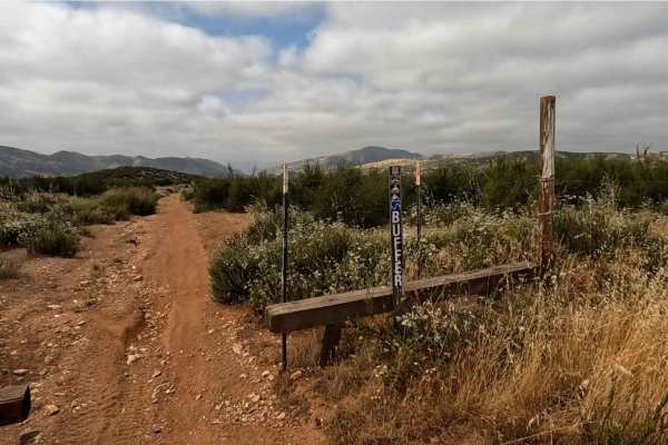
Buffer OHV Trail
Buffer OHV Trail is an easy, enjoyable route located near Staging Area #3 in the Rowher Flats OHV Area. The trail forms a loop around the open riding area just south of the staging area, making it a convenient and accessible option. This two-way trail is designated for dirt bikes and ATVs only and f...
Learn more about Buffer OHV Trail
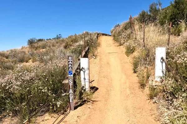
Stage OHV Trail
Stage OHV Trail (FS 3414W10) is a two-way dirt bike and ATV-only trail. One end begins at Staging Area #2, and the other is off of Texas Canyon Road. This is a fun trail for all skill levels, with only a couple of steep sections that shouldn't pose too much of a challenge for beginner riders. There ...
Learn more about Stage OHV Trail
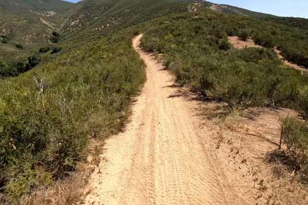
Coyote OHV Trail
Coyote OHV Trail is a short but highly enjoyable climb that packs a surprising amount of character into its compact length. Designed for dirt bikes and ATVs, this medium-difficulty trail is mostly uphill, delivering a steady ascent that encourages momentum from start to finish. The trail’s defining ...
Learn more about Coyote OHV Trail
ATV trails near Rosamond, California
Explore ATV-friendly trails near you. These trails are accessible for vehicles up to 50 inches wide, perfect for ATVs and smaller off-road machines.
Fairmont Peak Summit
This trail climbs over 500 feet to the top of Fairmont Peak Tower. The route is rocky and uneven. Although a shorter route, airing down is highly recommended. Slow speeds are also recommended. Many rocks are sharp. Flats have been known to happen. There are views of solar arrays, adjacent valleys, a...
Learn more about Fairmont Peak Summit
Maxwell Road
This is an off-road connector between Lake Hughes Road and the Liebre Mountain and Sawmill Motor Way (USFS Route 7N23). It takes you through the western Sierra Pelona Range, which is the lower elevation mountain range in western Los Angeles County, California. Much of this area was burned in the Lak...
Learn more about Maxwell Road
Grass Mountain Summit
This is a short but scenic ride to the summit of Grass Mountain, which provides a great view of the Green Valley area, the Leona Valley, Antelope Valley, and the high desert to the north and northeast. Access this trail via San Francisquito Canyon Road by taking Forest Route 6N04, making a left onto...
Learn more about Grass Mountain Summit
Leona Divide
This is a relatively easy scenic drive down Forest Route 6N04, also known as Leona Divide. It can be run in both directions, beginning at either the trailhead on Bouquet Canyon Road or San Francisquito Canyon Road. There are quite a few scenic overlooks, switchbacks and steep climbs and descents. Th...
Learn more about Leona Divide
UTV/side-by-side trails near Rosamond, California
Find UTV and side-by-side trails near you. These trails accommodate vehicles up to 60 inches wide, ideal for UTVs, side-by-sides, and wider off-road rigs.
Fairmont Peak Summit
This trail climbs over 500 feet to the top of Fairmont Peak Tower. The route is rocky and uneven. Although a shorter route, airing down is highly recommended. Slow speeds are also recommended. Many rocks are sharp. Flats have been known to happen. There are views of solar arrays, adjacent valleys, a...
Learn more about Fairmont Peak Summit
Maxwell Road
This is an off-road connector between Lake Hughes Road and the Liebre Mountain and Sawmill Motor Way (USFS Route 7N23). It takes you through the western Sierra Pelona Range, which is the lower elevation mountain range in western Los Angeles County, California. Much of this area was burned in the Lak...
Learn more about Maxwell Road
Sierra Pelona Ridge/Rowher OHV
Sierra Pelona Ridge/Rowher OHV is a prime destination for stock four-wheel-drive vehicles, high-clearance SUVs, and SxSs seeking a scenic ridgetop drive with panoramic mountain vistas. The route begins near the Rowher Flat OHV Area, climbing up a single-lane shelf road that is moderately steep in se...
Learn more about Sierra Pelona Ridge/Rowher OHV
Rowher 4x4 Trail - FS 3414W19
Rowher 4x4 Trail is a short but technical OHV route located within the Rowher Flat OHV Area near Santa Clarita, California. This trail is purpose-built for off-road vehicles and offers a concentrated mix of steep climbs, loose decomposed granite, rutted sections, and off-camber lines that test tract...
Learn more about Rowher 4x4 Trail - FS 3414W19
The onX Offroad Difference
onX Offroad combines trail photos, descriptions, difficulty ratings, width restrictions, seasonality, and more in a user-friendly interface. Available on all devices, with offline access and full compatibility with CarPlay and Android Auto. Discover what you're missing today!
Open Trail Map