
Dirt Bike Trails
Near Rockville, Utah
Explore All Dirt Bike Trails Near Rockville, Utah
Dirt Bike Trails Near Rockville, Utah
Discover the best dirt bike trails near you. Browse trail maps, check difficulty ratings, and find your next adventure — whether you're looking for a quick ride or an all-day expedition.
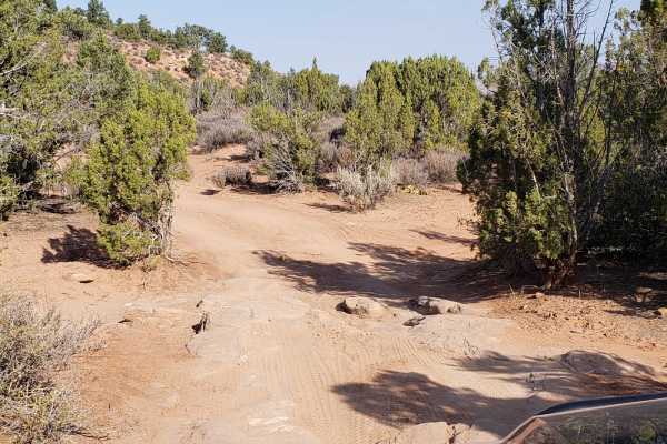
Wire Mesa
Wire Mesa is a scenic, 1.4-mile dirt route traversing a high desert plateau near Rockville, Utah, offering exceptional views of the surrounding red rock landscape near Zion National Park. While the area is well-known as a premier mountain biking destination, this off-road trail continues past the ma...
Learn more about Wire Mesa
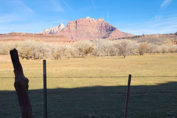
Grafton Road
This out-and-back road starts out as paved, with the last 2.5 miles turning to dirt. Easy enough for 2WD vehicles and wide enough for two vehicles to pass. It is nearly all private land on both sides of the road, so please be respectful. Towards the end, you will pass by the Grafton ghost town cemet...
Learn more about Grafton Road
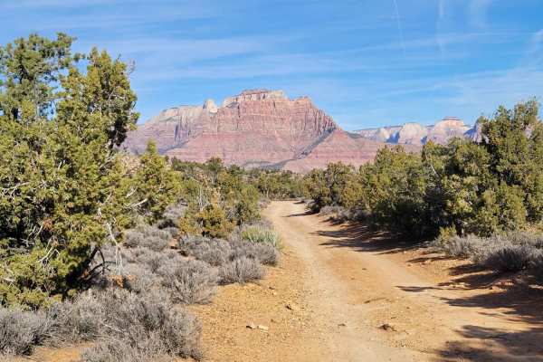
Grafton Mesa
This trail is definitely one of the more challenging ones in the area, especially for vehicles. At the entrance is the Grafton Mesa trailhead. Mountain bikers and hikers use this trail as well. For vehicles, it's a narrow, out-and-back trail. The first mile or so is easy with a few primitive camp sp...
Learn more about Grafton Mesa
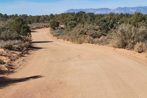
Gooseberry Mesa
Gooseberry Mesa and the surrounding area are a mecca for all things dirt biking and hiking. There is an endless network of trails in this region. Off this particular road, you'll find the Gooseberry Mesa trailhead and Windmill trailhead. The trail is easy enough for 2WD vehicles, but note that the t...
Learn more about Gooseberry Mesa
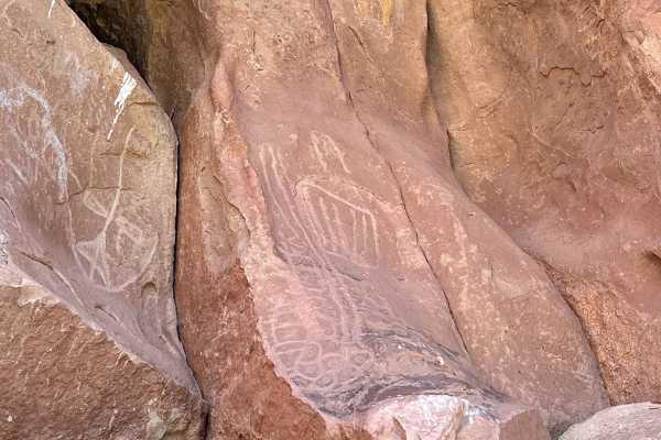
Yellowman/Gooseberry Mesa
Yellowman is a unique pictograph that when coupled with the nearby petroglyphs would allow you to come up with some great stories. This track goes through private land and there is a gate that should be closed. This route can be very challenging after rain or snow. The final approximately 0.5 miles ...
Learn more about Yellowman/Gooseberry Mesa
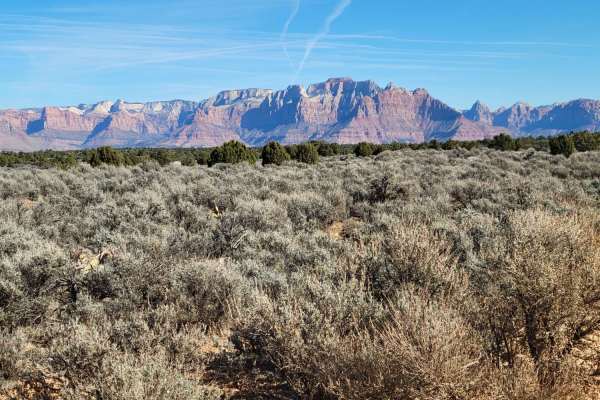
Gooseberry Mesa Spur
Gooseberry Mesa and the surrounding area are a mecca for all things dirt biking and hiking. There is an endless network of trails in this region. Off this particular road you'll find the White Trailhead. This section of trail is more damaged than the maintained road you take to get in. Large (mud) h...
Learn more about Gooseberry Mesa Spur
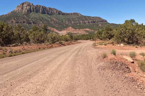
The Smithsonian Butte Backcountry Byway
The Smithsonian Butte Backcountry Byway is a main artery connecting Highway 59 to a local Rockville street. This street will take you to Route 9 which leads to the west entrance to Zion National Park. For those coming from the east on 59, this will cut almost an hour off your trip to Zion. A couple ...
Learn more about The Smithsonian Butte Backcountry Byway
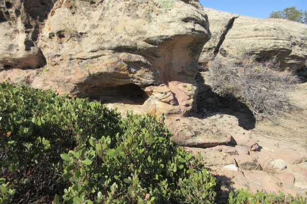
Little Creek Mesa
Little Creek Mesa is a hidden gem for anyone looking for fantastic views, widely varying terrain, history or something for the entire family. There are large areas of flat, slick rock that people use for biking, numerous areas with historic pit houses and other remnants from the early culture and pe...
Learn more about Little Creek Mesa
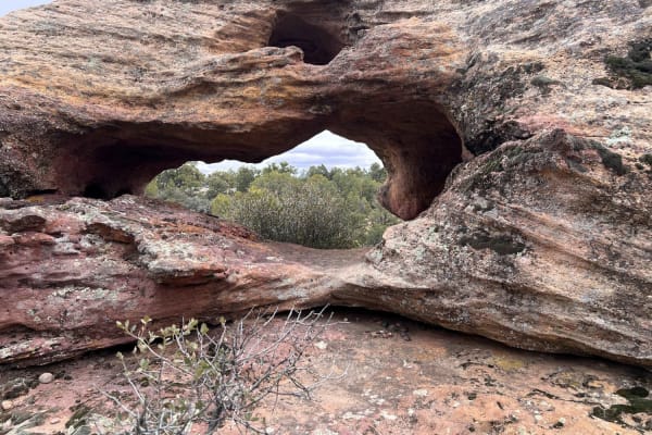
Windmill Arch
This short trail is a local secret with one of the most interesting arches to see. What initially appears to be a single arch is actually three separate and distinct arches in the same feature. There is also an additional hole through the rock that is a great scavenger hunt. Hint: look low. The trai...
Learn more about Windmill Arch

White Trail
The white trail is the only BLM-approved off-road motor vehicle trail within the Gooseberry Mesa National Recreation Trail system. The White Trail is a 6-mile out-and-back trail rated 3 out of 10 that starts at the end of the Gooseberry Mesa Spur. A parking corral and toilet facility are located at ...
Learn more about White Trail
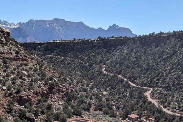
Dalton Wash Road
Dalton Wash Road is a 9-mile out-and-back dirt road that passes through Dalton Wash--a mix of red rock "canyon", dry desert slopes, juniper woodlands, and arid shrubland. Note: the best time of day to visit this trail is mid to late afternoon when the sun is to the west and shining on the mountain f...
Learn more about Dalton Wash Road
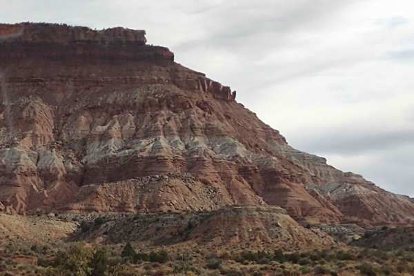
Rocky Top Little Creek Mesa
From the Little Creek Mesa Trail, this 4.5-mile track loops around to the rocky outcropping on top of the Mesa. It's great fun for dirt bikes, quads, 4x4s, and SXSs. The views of the valley from the top of the Mesa are beautiful. The views of Zion National Park are stunning. If it's snowed or rained...
Learn more about Rocky Top Little Creek Mesa

Smith Mesa To Rattlesnake Gulch
This 3-mile trail takes you along the side of Highway 9 between Smith Mesa and Rattlesnake Gulch or the Valley Gun Club without getting on the pavement. It follows the powerline in some areas, and there are a lot of hills. Some of the inclines and declines are steep. When riding in the Utah mountai...
Learn more about Smith Mesa To Rattlesnake Gulch
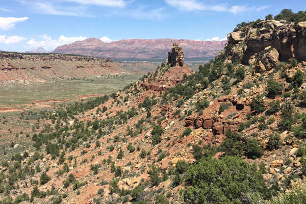
Little Creek
This trail is a back way from Apple Valley to the Lost Spring lookout area. It will pass through the desert and then begin the climb up the mesa, passing white rocks and beautiful scenery. The trail up the switchbacks is steep and, depending on trail conditions, can be challenging. The rest of the ...
Learn more about Little Creek
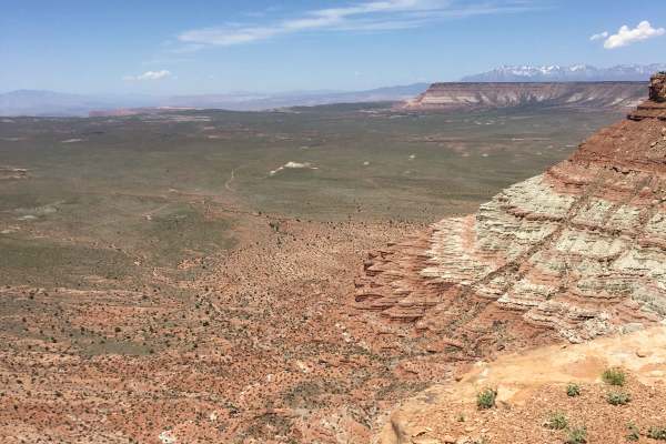
Little Creek Lookout Loop
This is a short loop where you’ll get a bird’s eye view of Southern Utah’s "geological staircase," including Fort Pierce, the Arizona Strip, and the towering heights of Zion National Park, Gooseberry, and Kolob. Accessible directly off Highway 59 via M4071 and BLM 2100, the terrain is a classic mix ...
Learn more about Little Creek Lookout Loop
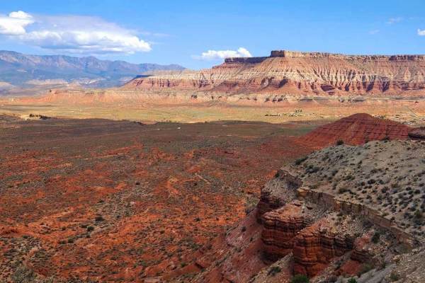
Oh The View - County Road 648
Oh The View is a 6.7-mile point-to-point trail rated 3 of 10 located on the Virgin Mesa within Washington County. The trail is a little-used ranch road consisting of hard-packed dirt, soft dirt washes, and a few rocky sections. The trail can be run in either direction, but is generally run from west...
Learn more about Oh The View - County Road 648
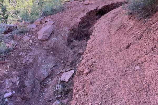
Virgin Overlook
Dry Creek Trail starts near the top of Hurricane Mesa near Virgin, Utah. The location has a very interesting history, as it is where the ejection seat test site of the 1960s is located. That area is still restricted today. Dry Creek Trail starts as a milder, narrow, winding trail through the cedar t...
Learn more about Virgin Overlook
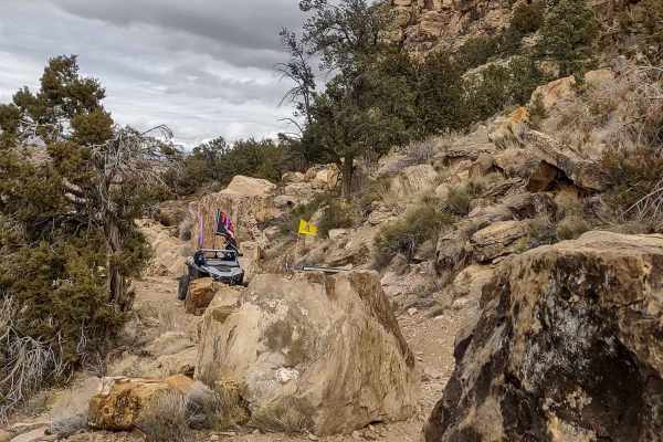
Cliffside Trail to Little Creek Mesa
We found a way to get on top of Little Creek Mesa without having to go clear around the mountain, but this trail is not for the faint of heart. It's narrow and steep, as it goes right up the side of the cliff. It's a rocky trail, with some very big rocks you have to maneuver around. In one spot, the...
Learn more about Cliffside Trail to Little Creek Mesa
Hurricane Cliffs Trail
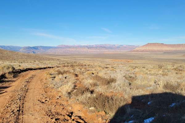
This trail takes you along the Hurricane cliffs and offers sweeping views of the desert landscape around you. Great views of the plateaus and Little Creek Mountain. Respect any and all gates - you are free to pass through closed ones so long as you close them after passing. Summer months may reach t...
Learn more about Hurricane Cliffs Trail
Gould's Rim Wanderings
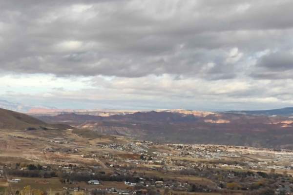
Gould's Rim on the east side of Hurricane is a mesa from which you can access Smith Mesa, Little Creek Mesa, Flying Monkey, and Rattlesnake Gulch to Toquerville Falls. You can go to Virgin or Toquerville for lunch, mostly on dirt, by using this path up and over Gould's Rim. Once on top of Gould's Ri...
Learn more about Gould's Rim Wanderings
ATV trails near Rockville, Utah
Explore ATV-friendly trails near you. These trails are accessible for vehicles up to 50 inches wide, perfect for ATVs and smaller off-road machines.
Wire Mesa
Wire Mesa is a scenic, 1.4-mile dirt route traversing a high desert plateau near Rockville, Utah, offering exceptional views of the surrounding red rock landscape near Zion National Park. While the area is well-known as a premier mountain biking destination, this off-road trail continues past the ma...
Learn more about Wire Mesa
Grafton Road
This out-and-back road starts out as paved, with the last 2.5 miles turning to dirt. Easy enough for 2WD vehicles and wide enough for two vehicles to pass. It is nearly all private land on both sides of the road, so please be respectful. Towards the end, you will pass by the Grafton ghost town cemet...
Learn more about Grafton Road
Grafton Mesa
This trail is definitely one of the more challenging ones in the area, especially for vehicles. At the entrance is the Grafton Mesa trailhead. Mountain bikers and hikers use this trail as well. For vehicles, it's a narrow, out-and-back trail. The first mile or so is easy with a few primitive camp sp...
Learn more about Grafton Mesa
Gooseberry Mesa
Gooseberry Mesa and the surrounding area are a mecca for all things dirt biking and hiking. There is an endless network of trails in this region. Off this particular road, you'll find the Gooseberry Mesa trailhead and Windmill trailhead. The trail is easy enough for 2WD vehicles, but note that the t...
Learn more about Gooseberry Mesa
UTV/side-by-side trails near Rockville, Utah
Find UTV and side-by-side trails near you. These trails accommodate vehicles up to 60 inches wide, ideal for UTVs, side-by-sides, and wider off-road rigs.
Grafton Road
This out-and-back road starts out as paved, with the last 2.5 miles turning to dirt. Easy enough for 2WD vehicles and wide enough for two vehicles to pass. It is nearly all private land on both sides of the road, so please be respectful. Towards the end, you will pass by the Grafton ghost town cemet...
Learn more about Grafton Road
Grafton Mesa
This trail is definitely one of the more challenging ones in the area, especially for vehicles. At the entrance is the Grafton Mesa trailhead. Mountain bikers and hikers use this trail as well. For vehicles, it's a narrow, out-and-back trail. The first mile or so is easy with a few primitive camp sp...
Learn more about Grafton Mesa
Gooseberry Mesa
Gooseberry Mesa and the surrounding area are a mecca for all things dirt biking and hiking. There is an endless network of trails in this region. Off this particular road, you'll find the Gooseberry Mesa trailhead and Windmill trailhead. The trail is easy enough for 2WD vehicles, but note that the t...
Learn more about Gooseberry Mesa
Yellowman/Gooseberry Mesa
Yellowman is a unique pictograph that when coupled with the nearby petroglyphs would allow you to come up with some great stories. This track goes through private land and there is a gate that should be closed. This route can be very challenging after rain or snow. The final approximately 0.5 miles ...
Learn more about Yellowman/Gooseberry Mesa
The onX Offroad Difference
onX Offroad combines trail photos, descriptions, difficulty ratings, width restrictions, seasonality, and more in a user-friendly interface. Available on all devices, with offline access and full compatibility with CarPlay and Android Auto. Discover what you're missing today!
Open Trail Map