
Dirt Bike Trails
Near North Syracuse, New York
Explore All Dirt Bike Trails Near North Syracuse, New York
Dirt Bike Trails Near North Syracuse, New York
Discover the best dirt bike trails near you. Browse trail maps, check difficulty ratings, and find your next adventure — whether you're looking for a quick ride or an all-day expedition.
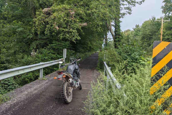
Oswego Recreational Trail
The Oswego Recreational Trail is an old railroad bed with various surface types and old road millings. Very flat with some whoops and potholes in places. It's a nice easy ride through wooded, shaded areas and runs through the three-mile bay wildlife area. There are a couple of restaurants, bars, and...
Learn more about Oswego Recreational Trail
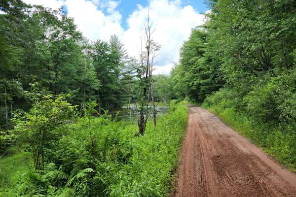
Happy Valley Road
Stony loamy trail connecting Route 26 and Stone Hill Road. The road goes through Happy Valley Wildlife Management Area. There is a pull-off access to Whitney Pond for fishing, hiking, or viewing wildlife. This road is part of the Oswego County ATV club so use caution for oncoming ATV traffic.
Learn more about Happy Valley Road
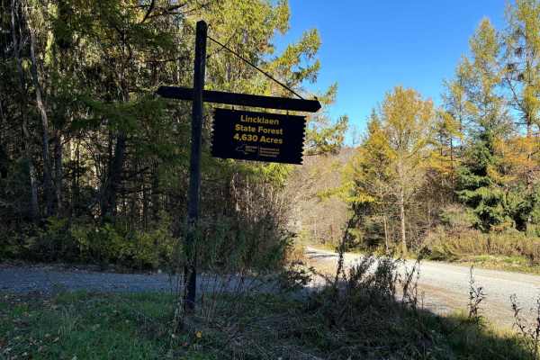
Linklaen State Forest
This route consists of seasonal gravel roads that are generally well-maintained in the summer. During the winter the roads are used for snowmobile trails. The roads lead to several side routes that are two-tracks, most are out-and-back routes and will add adventure to the ride. The main road is easi...
Learn more about Linklaen State Forest
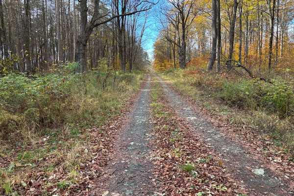
Cross Island Road
This is a seasonal gravel road that winds through the eastern section of Taylor Valley State Forest. The road starts with well-maintained gravel and transitions into a narrower two-track as it pushes deeper into the forest. Cross Island Road provides a scenic drive through mixed hardwoods and conife...
Learn more about Cross Island Road
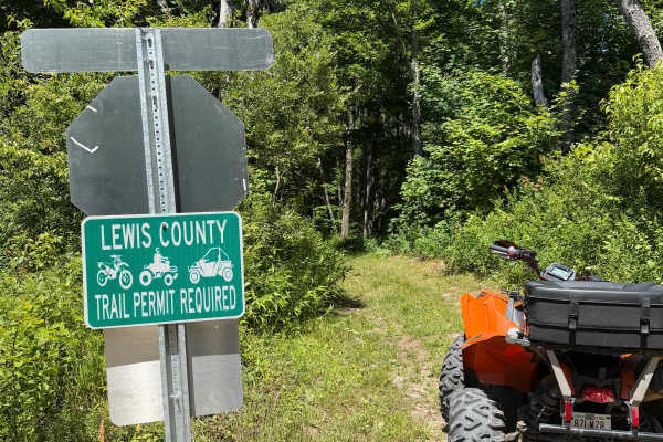
LC HMW-ORFF TRAIL
This route is a rugged two-track with a variety of terrain. Riders will encounter rocky sections, exposed roots, shallow climbs, and several long mud holes that can hold standing water during much of the riding season. While many puddles have bypasses, some water crossings span nearly the entire tra...
Learn more about LC HMW-ORFF TRAIL
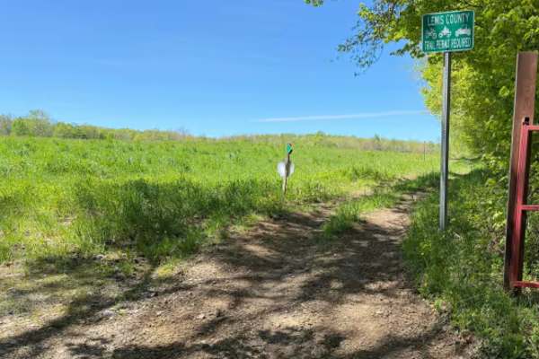
Pollock Run Trail
When traversing along this marked connector trail, riders will travel through a mix of open field edges and wooded terrain featuring a narrow two-track trail surface. The route primarily consists of hard-packed dirt and natural soil with light rutting, uneven sections, scattered loose stone, and occ...
Learn more about Pollock Run Trail
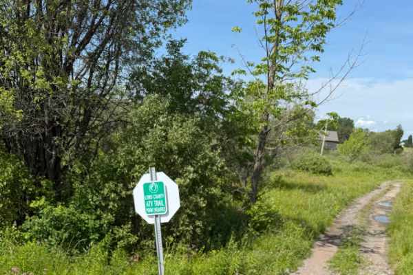
Zimmer Road Spur
This short connector trail provides access to cross New York State Route 26, where riders can use the designated on-road ATV route to connect with other sections of the Lewis County Trail System. The trail primarily serves as a link between riding areas and offers an easy transition to the county’s ...
Learn more about Zimmer Road Spur
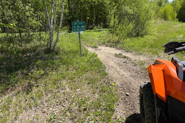
Bauer Wooded Spur Trail
When traveling along this marked connector trail, riders will pass through a mix of wooded terrain and open grass corridor sections featuring a primarily narrow two-track trail surface. Riders can expect mostly hard-packed dirt with shallow ruts, loose soil, scattered roots, and occasional muddy are...
Learn more about Bauer Wooded Spur Trail
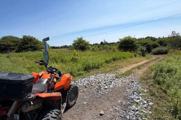
Byron Corners Rd Connector
This short spur connects the main trail to Byrons Corners Road, providing a convenient access point to the Lewis County ATV Trail System. The route follows an open corridor through fields and low brush on a maintained two-track with gentle rolling terrain. A Lewis County ORV permit is required.
Learn more about Byron Corners Rd Connector
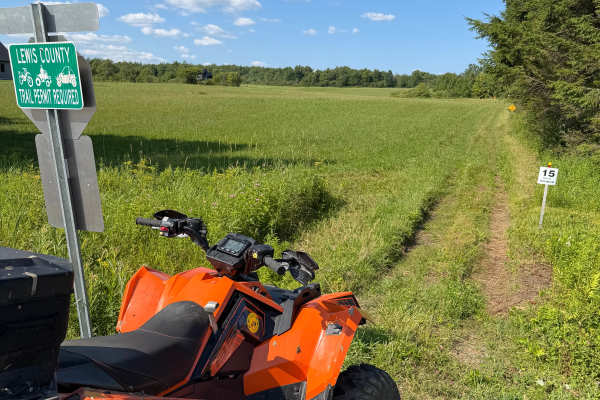
Highmarket Mackay Road Connector
This route is a connector trail within the Lewis County ATV Trail System. Riders can expect a mostly flat, grassy two-track that follows alongside a row of evergreen trees. The trail is well-defined and provides an easy connection between other sections of the trail system. As you approach the end o...
Learn more about Highmarket Mackay Road Connector
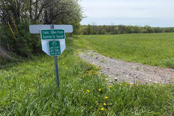
Grower Green Trail West
A scenic and moderately challenging Lewis County ATV trail route traveling through open farm fields, wooded corridors, and remote backcountry terrain. Riders will encounter a mix of hard-packed dirt, loose rock, shallow mud holes, rutted sections, and soft, low-lying areas depending on recent weathe...
Learn more about Grower Green Trail West
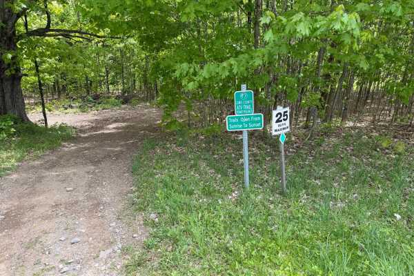
Grower Green Trail East - 1
A moderately easy wooded trail route traveling through classic Lewis County terrain featuring hard-packed dirt, shallow ruts, loose rock, exposed roots, and gradual elevation changes throughout. Riders will travel through dense hardwood forest sections with narrow trail corridors, rolling hills, and...
Learn more about Grower Green Trail East - 1
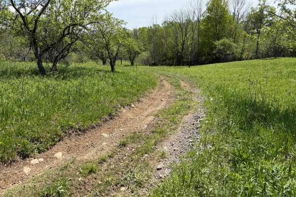
Grower Green Trail East - 2
As you traverse this trail, expect a moderately easy route winding through a mix of wooded terrain and open meadow sections. Riders can expect primarily hard-packed dirt with occasional shallow ruts, loose rock, exposed roots, soft grassy sections, slight off-camber descents, and scattered mud holes...
Learn more about Grower Green Trail East - 2
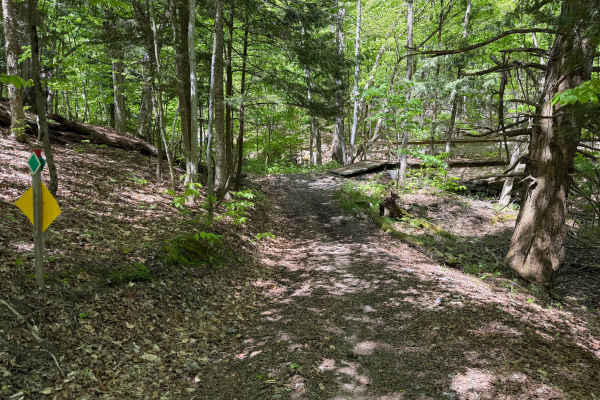
Grower Green Trail East - 3
While traversing through this route, riders will encounter a moderate wooded trail through rolling terrain featuring a mix of hard-packed dirt, loose rock, shallow ruts, and scattered root sections. Several narrow trail corridors wind through the forest with tight turns, small hill climbs and descen...
Learn more about Grower Green Trail East - 3
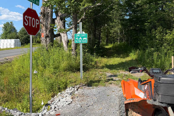
HMW Crofoot Hill–Mackay Trail
This route follows a maintained grassy trail corridor along the edges of an open field with short sections passing through wooded cover. The trail surface is primarily grass and packed soil with light two-track wear and occasional minor rutting. Riders will encounter mostly level terrain with wide ...
Learn more about HMW Crofoot Hill–Mackay Trail

Crofoot Whiskey Trail
The route begins at Crofoot Hill Road, where riders enter a maintained grassy corridor with a gradual incline. The initial climb is smooth overall, though riders may encounter light rutting near the crest. At the posted stop sign, the trail briefly follows Plumber Road before turning left to re-ente...
Learn more about Crofoot Whiskey Trail
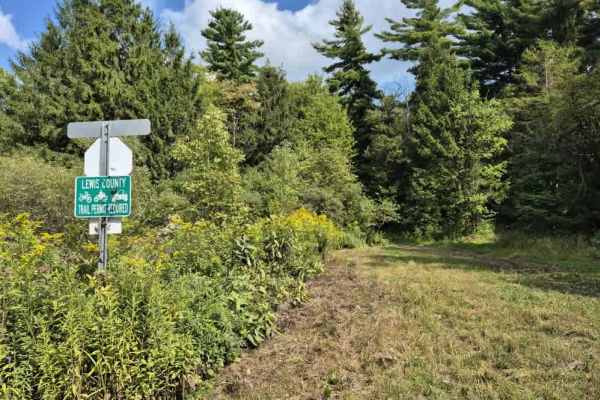
Culpepper Spur
Expect to see varying terrain as you creep through a mix of rocky trail and mud/dirt that traverses a mostly pine forest on the edge of O'Leary's pond. Lots of ruts and the potential for shallow water holes exist, especially after rain events. A Lewis County trail permit is required to use this trai...
Learn more about Culpepper Spur
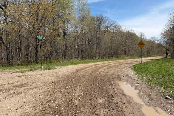
Plumber Road
This route travels through the Lesser Wilderness State Forest, featuring long straightaways, rolling hills, and light curves. The trail primarily consists of maintained gravel and dirt roads with sections of loose rock, shallow mud, and soft shoulders depending on recent weather conditions. Several ...
Learn more about Plumber Road
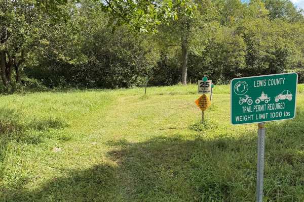
Morgan Run Trail
This route is a grassy two-track trail traveling along Moore Road in Lewis County on private property. Riders can expect a well-marked and maintained trail with plenty of signage throughout the route to help keep riders on the designated trail. Please stay on the marked route, respect the private pr...
Learn more about Morgan Run Trail
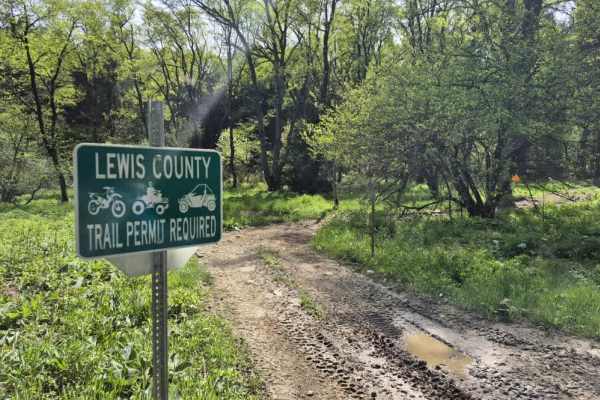
Worth Road Spur
Worth Road is a short, easy to moderate OHV connector in the Tug Hill Plateau designed for registered ATVs and compliant side-by-sides linking Worth Road and Culpepper Road within the Lewis County OHV Trail System. While not a destination trail on its own, it plays an important role in connecting la...
Learn more about Worth Road Spur
ATV trails near North Syracuse, New York
Explore ATV-friendly trails near you. These trails are accessible for vehicles up to 50 inches wide, perfect for ATVs and smaller off-road machines.
Oswego Recreational Trail
The Oswego Recreational Trail is an old railroad bed with various surface types and old road millings. Very flat with some whoops and potholes in places. It's a nice easy ride through wooded, shaded areas and runs through the three-mile bay wildlife area. There are a couple of restaurants, bars, and...
Learn more about Oswego Recreational Trail
Happy Valley Road
Stony loamy trail connecting Route 26 and Stone Hill Road. The road goes through Happy Valley Wildlife Management Area. There is a pull-off access to Whitney Pond for fishing, hiking, or viewing wildlife. This road is part of the Oswego County ATV club so use caution for oncoming ATV traffic.
Learn more about Happy Valley Road
Linklaen State Forest
This route consists of seasonal gravel roads that are generally well-maintained in the summer. During the winter the roads are used for snowmobile trails. The roads lead to several side routes that are two-tracks, most are out-and-back routes and will add adventure to the ride. The main road is easi...
Learn more about Linklaen State Forest
Cross Island Road
This is a seasonal gravel road that winds through the eastern section of Taylor Valley State Forest. The road starts with well-maintained gravel and transitions into a narrower two-track as it pushes deeper into the forest. Cross Island Road provides a scenic drive through mixed hardwoods and conife...
Learn more about Cross Island Road
UTV/side-by-side trails near North Syracuse, New York
Find UTV and side-by-side trails near you. These trails accommodate vehicles up to 60 inches wide, ideal for UTVs, side-by-sides, and wider off-road rigs.
Oswego Recreational Trail
The Oswego Recreational Trail is an old railroad bed with various surface types and old road millings. Very flat with some whoops and potholes in places. It's a nice easy ride through wooded, shaded areas and runs through the three-mile bay wildlife area. There are a couple of restaurants, bars, and...
Learn more about Oswego Recreational Trail
Happy Valley Road
Stony loamy trail connecting Route 26 and Stone Hill Road. The road goes through Happy Valley Wildlife Management Area. There is a pull-off access to Whitney Pond for fishing, hiking, or viewing wildlife. This road is part of the Oswego County ATV club so use caution for oncoming ATV traffic.
Learn more about Happy Valley Road
Linklaen State Forest
This route consists of seasonal gravel roads that are generally well-maintained in the summer. During the winter the roads are used for snowmobile trails. The roads lead to several side routes that are two-tracks, most are out-and-back routes and will add adventure to the ride. The main road is easi...
Learn more about Linklaen State Forest
Cross Island Road
This is a seasonal gravel road that winds through the eastern section of Taylor Valley State Forest. The road starts with well-maintained gravel and transitions into a narrower two-track as it pushes deeper into the forest. Cross Island Road provides a scenic drive through mixed hardwoods and conife...
Learn more about Cross Island Road
The onX Offroad Difference
onX Offroad combines trail photos, descriptions, difficulty ratings, width restrictions, seasonality, and more in a user-friendly interface. Available on all devices, with offline access and full compatibility with CarPlay and Android Auto. Discover what you're missing today!
Open Trail Map