
Dirt Bike Trails
Near Kingston, Tennessee
Explore All Dirt Bike Trails Near Kingston, Tennessee
Dirt Bike Trails Near Kingston, Tennessee
Discover the best dirt bike trails near you. Browse trail maps, check difficulty ratings, and find your next adventure — whether you're looking for a quick ride or an all-day expedition.
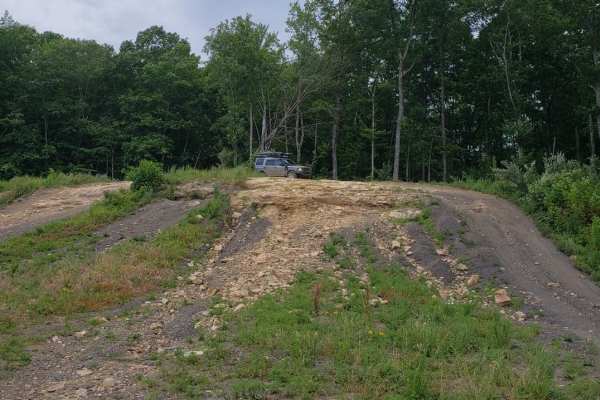
Catoosa Headrick Road
Catoosa Headrick Road offers an engaging 3.3-mile point-to-point journey across the scenic Cumberland Plateau, making it ideal for drivers of four-wheel-drive vehicles and SxSs looking for a mild yet diverse off-road experience. Rated as a 3 out of 10 in technical difficulty, this route climbs from ...
Learn more about Catoosa Headrick Road
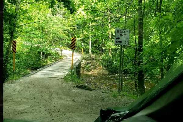
Catoosa WMA Noah Hambey
The Catoosa WMA Noah Hambey loop is a scenic, 17.7-mile gravel route winding through the southwestern reaches of the Catoosa Wildlife Management Area in Tennessee, ideal for beginners, families, or anyone seeking a relaxing, low-stress day in the woods. Rated as a mild 2 out of 10, this route is eas...
Learn more about Catoosa WMA Noah Hambey
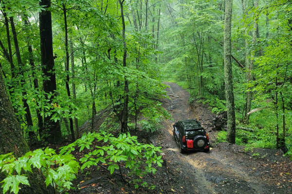
Trail 87 - Poplar Creek
Trail 87 is an easy rider's favorite. This blue trail according to the Windrock Parks Trail difficulty system would fall into the simpler blue trails the park has to offer. It offers light washouts and gradual elevation changes. Trail 87 is accessible from G6 on the south end and finishes on Trail ...
Learn more about Trail 87 - Poplar Creek
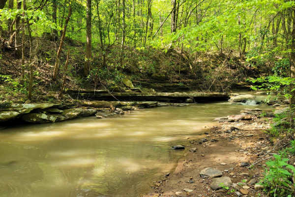
Trail 27 - Kener Gap
Trail 27- Kener Gap begins at the Rock Solid Pavilion at the end of Trail 26. This trail is much like its counterpart, but does not boast as many rock step formations. Expect more dirt roads with ruts and a minor rock bulge from the side of the trail. Water does quickly run off the mountain, and ha...
Learn more about Trail 27 - Kener Gap
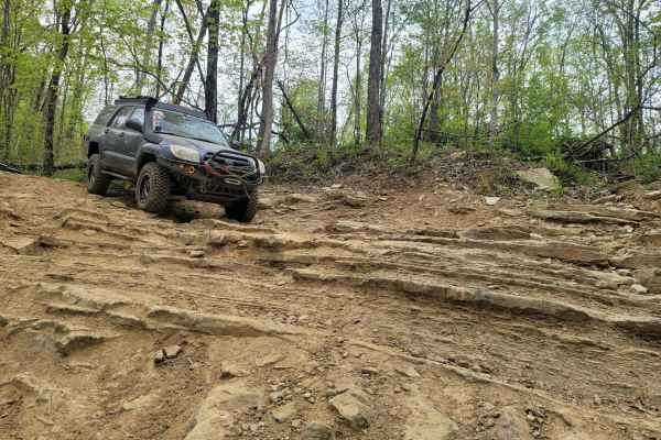
Trail 26 - Rock Solid
Jeepers, get your badges! This Jeep Badge of Honor trail is on the easier side with three short rock step formations and mud holes. This trail also runs simultaneously with Trail G26, should you need a quick exit. Trail 26 runs downhill for the first two rock steps from the East to West. It is full ...
Learn more about Trail 26 - Rock Solid

Campground Connector
Campground Connector is a fun way of getting from Windrock Park's Campground to the general store on P1. Make the most of your time winding through the woods. This trail also requires a land use permit, so if you're just camping, then you would not be allowed to take this route. Be advised that it c...
Learn more about Campground Connector
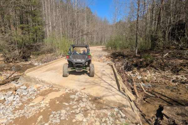
G6
G6 is a haul road that has a few small washouts and rock ledges. There are rocks along the trail up to 12 inches in size. This trail includes a long slow elevation change. There are many in and out trails along this route. The north end of this trail ends on New River Highway at a cemetery.
Learn more about G6
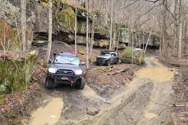
83 - American Knob Bypass
This fun trail gives insight into the area's natural wonders. These rock bluffs provide shelter to the caves beneath them, which you can go into if you are brave enough to explore them. The towering rock walls make mini-mountain ponds with lush moss patches and various fungi surrounding them. While ...
Learn more about 83 - American Knob Bypass
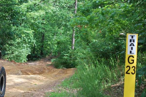
Trail G23 Windrock Park
Trail 23 will offer a pleasant and easy off-road experience for off-roaders of all skill levels. Nestled off of the long Trail 22 in Windrock Park, this trail provides a refreshing escape into nature without demanding advanced technical skills or equipment which takes you down to Indian Creek and Al...
Learn more about Trail G23 Windrock Park
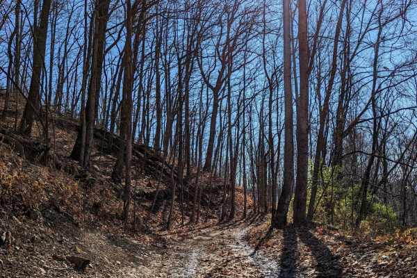
Trail 43
Trail 43 offers offroaders an engaging, scenic ridge-line run through the heart of the Cumberland Mountains, making it a perfect route for intermediate drivers seeking a mix of stunning vistas and moderate technical challenges. Spanning approximately 3.4 miles from Armes Gap near Highway 116, this t...
Learn more about Trail 43
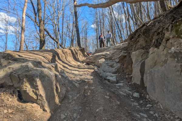
82
82 can be run in either direction, but most people run it from west to east. If run from east to west, it will be more difficult because there is a large rock formation to climb immediately as you enter the trail off of 83. This trail is scenic with rock faces on one side and a drop-off on the other...
Learn more about 82
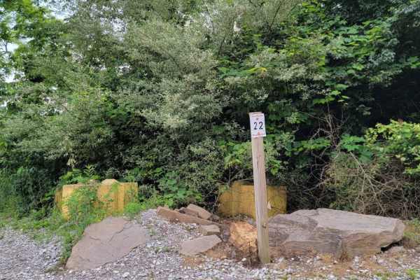
Trail 22
This trail combines hills, rocks, ruts, and off-camber riding. The trail was re-routed in June of 2021 to avoid underlying boulders. Elevation changes rapidly in some areas. This trail has several muddy rock ledges that exceed 10-12" stair steps for a distance of up to 20' at a time. ATV riders will...
Learn more about Trail 22
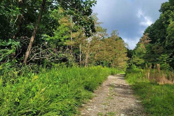
G3
This gravel trail lives up to its name with minimal troubles, but like all trails, they have unexpected occurrences such as down trees or washouts. Trail G3 is not to be confused with Trail 3, as there are major differences. Trail G3 is a mild gravel road; hence the "G" designation, and stays well m...
Learn more about G3
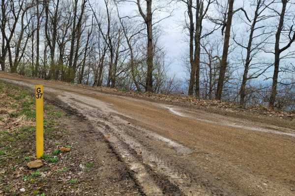
G37
Windrock's G37 is an easy Green connector trail that starts at the east side on trail G20 and provides access to the major intersection of trail numbers: G5, 5, G3, 33, and 45. In the middle of the trail, it gives access to trails 4 and 19. It is a simple gravel trail that will provide a beautiful v...
Learn more about G37
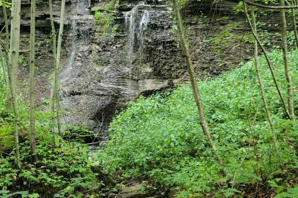
Trail 5 - Flat Gap
Trail 5 - Flat Gap begins at the major intersection of G37, G3, and G33. There isn't much elevation change on this trail, hence its name. This easy blue according to the Park's Map is smooth sailing and preferred by some to avoid the higher traveled G5 and G6 as they have gotten significantly worse ...
Learn more about Trail 5 - Flat Gap
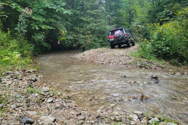
G21 - Skinned Ash Creek
G21 - Skinned Ash Creek gets its name from the waterway that runs parallel to it. This dead-end path cuts across a picturesque mountain side showing the power of nature. Water has cut large ruts into the trail side with depths as far as 2.5 feet deep. This tire-swallowing rut is easy to avoid in mos...
Learn more about G21 - Skinned Ash Creek
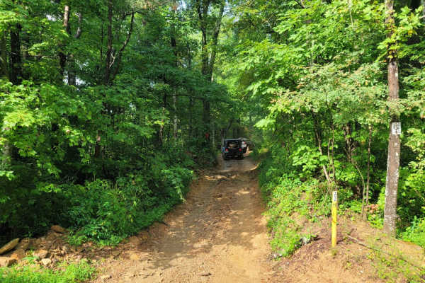
Trail 19 - Wolf Ridge
Trail 19 - Wolf Ridge is a moderately challenging, 1.5-mile route in Windrock Park, ideal for offroaders looking to transition from easy gravel roads to more technical dirt and rock terrain. Climbing through the Wolf Ridge area with an elevation gain of approximately 433 feet, this trail reaches a m...
Learn more about Trail 19 - Wolf Ridge
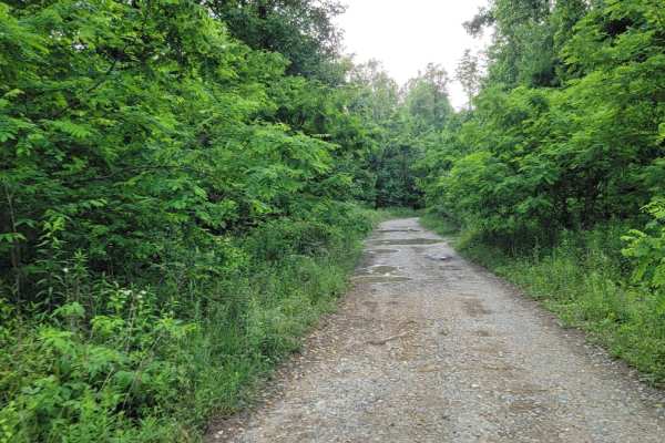
Trail G20
G20 is a connector trail from G2. This trail gives access to trail 4,19, and G37. The trail is a gravel roadway with shallow mud holes and blind curves on the trail with steep drop offs on the sides of the roadway. Roadway is only one lane wide.
Learn more about Trail G20
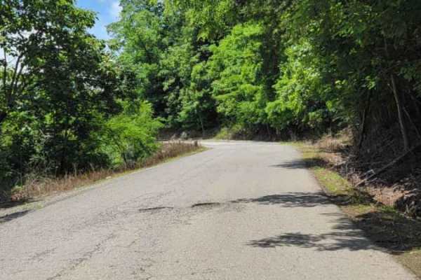
Trail P1
P1 is one of the main trail access roads from the General Store Parking lot. As you go up the mountain, be cautious of oncoming traffic. Several areas of the paved road have deteriorated over time. Most places coming down the mountain have no shoulder, or the roadway has given way. On the right side...
Learn more about Trail P1
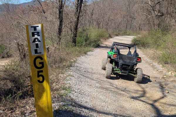
G5
G5 is a stone hall road that leads to many other trails including trails 22 and 38. There aren't any significant elevation changes. There are rock bottom mud puddles and small rocks around 6 inches in size. Otherwise, this is just a gravel road that can be travelled in any high clearance 4-wheel dri...
Learn more about G5
ATV trails near Kingston, Tennessee
Explore ATV-friendly trails near you. These trails are accessible for vehicles up to 50 inches wide, perfect for ATVs and smaller off-road machines.
Catoosa Headrick Road
Catoosa Headrick Road offers an engaging 3.3-mile point-to-point journey across the scenic Cumberland Plateau, making it ideal for drivers of four-wheel-drive vehicles and SxSs looking for a mild yet diverse off-road experience. Rated as a 3 out of 10 in technical difficulty, this route climbs from ...
Learn more about Catoosa Headrick Road
Catoosa WMA Noah Hambey
The Catoosa WMA Noah Hambey loop is a scenic, 17.7-mile gravel route winding through the southwestern reaches of the Catoosa Wildlife Management Area in Tennessee, ideal for beginners, families, or anyone seeking a relaxing, low-stress day in the woods. Rated as a mild 2 out of 10, this route is eas...
Learn more about Catoosa WMA Noah Hambey
Trail 87 - Poplar Creek
Trail 87 is an easy rider's favorite. This blue trail according to the Windrock Parks Trail difficulty system would fall into the simpler blue trails the park has to offer. It offers light washouts and gradual elevation changes. Trail 87 is accessible from G6 on the south end and finishes on Trail ...
Learn more about Trail 87 - Poplar Creek
Trail 27 - Kener Gap
Trail 27- Kener Gap begins at the Rock Solid Pavilion at the end of Trail 26. This trail is much like its counterpart, but does not boast as many rock step formations. Expect more dirt roads with ruts and a minor rock bulge from the side of the trail. Water does quickly run off the mountain, and ha...
Learn more about Trail 27 - Kener Gap
UTV/side-by-side trails near Kingston, Tennessee
Find UTV and side-by-side trails near you. These trails accommodate vehicles up to 60 inches wide, ideal for UTVs, side-by-sides, and wider off-road rigs.
Catoosa Headrick Road
Catoosa Headrick Road offers an engaging 3.3-mile point-to-point journey across the scenic Cumberland Plateau, making it ideal for drivers of four-wheel-drive vehicles and SxSs looking for a mild yet diverse off-road experience. Rated as a 3 out of 10 in technical difficulty, this route climbs from ...
Learn more about Catoosa Headrick Road
Catoosa WMA Noah Hambey
The Catoosa WMA Noah Hambey loop is a scenic, 17.7-mile gravel route winding through the southwestern reaches of the Catoosa Wildlife Management Area in Tennessee, ideal for beginners, families, or anyone seeking a relaxing, low-stress day in the woods. Rated as a mild 2 out of 10, this route is eas...
Learn more about Catoosa WMA Noah Hambey
Trail 87 - Poplar Creek
Trail 87 is an easy rider's favorite. This blue trail according to the Windrock Parks Trail difficulty system would fall into the simpler blue trails the park has to offer. It offers light washouts and gradual elevation changes. Trail 87 is accessible from G6 on the south end and finishes on Trail ...
Learn more about Trail 87 - Poplar Creek
Trail 27 - Kener Gap
Trail 27- Kener Gap begins at the Rock Solid Pavilion at the end of Trail 26. This trail is much like its counterpart, but does not boast as many rock step formations. Expect more dirt roads with ruts and a minor rock bulge from the side of the trail. Water does quickly run off the mountain, and ha...
Learn more about Trail 27 - Kener Gap
The onX Offroad Difference
onX Offroad combines trail photos, descriptions, difficulty ratings, width restrictions, seasonality, and more in a user-friendly interface. Available on all devices, with offline access and full compatibility with CarPlay and Android Auto. Discover what you're missing today!
Open Trail Map