
Dirt Bike Trails
Near Johnson Village, Colorado
Explore All Dirt Bike Trails Near Johnson Village, Colorado
Dirt Bike Trails Near Johnson Village, Colorado
Discover the best dirt bike trails near you. Browse trail maps, check difficulty ratings, and find your next adventure — whether you're looking for a quick ride or an all-day expedition.

Dud Bob's
This is a beautiful single-track trail winding through the Four Mile OHV Area. Dud Bob was named after a couple of riders who spearheaded the project to build the trail. The trail is a tight technical ride through the trees and rocks near Chinaman's Gultch outside of Buena Vista. Triad Ridge is also...
Learn more about Dud Bob's
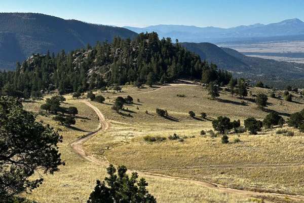
FS 376A Old Midland Cutoff
This route connects the Midland Bike Trail and FS 304 with Lenhardy Cutoff FS 376. The route is recommended for vehicles with 4WD and/or overland trailers. Rocks greater than 12 inches, some off-camber slopes, and switches are along the route. This route provides amazing views of the Collegiate Peak...
Learn more about FS 376A Old Midland Cutoff

Yansing Gulch
From Highway 24 in Johnson Village, take CR301 to CR300. A trail sign is at the entrance of CR 300 to the left. There are 2 gates for the entrance to the staging area that must be closed upon entering. The staging area is large with a Porta Potty and areas for dry camping. The beginning of the trail...
Learn more about Yansing Gulch
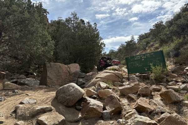
Carnage Canyon
Carnage Canyon or Carnage BV is a renowned extreme off-road trail that presents a series of formidable obstacles, each testing the limits of both vehicle and driver. It tightens quickly as it climbs the dry creek bed, forcing drivers into a wet and muddy waterfall that demands speed and traction to ...
Learn more about Carnage Canyon
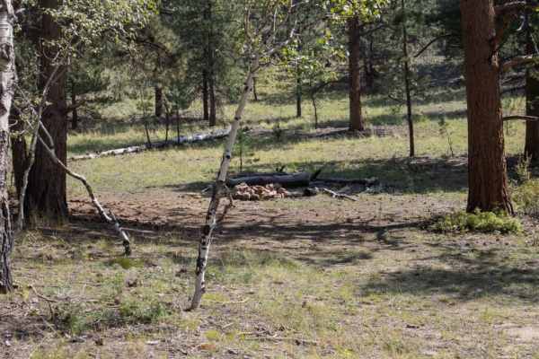
Arnold Gulch
Arnold Gulch is an easy, two-mile connector route ideal for beginners and those looking to link up different motorized networks in Chaffee County. The trail runs for 1.8 miles, ascending 391 feet from a starting elevation of 8,461 feet to a maximum of 8,853 feet. The surface is composed entirely of ...
Learn more about Arnold Gulch
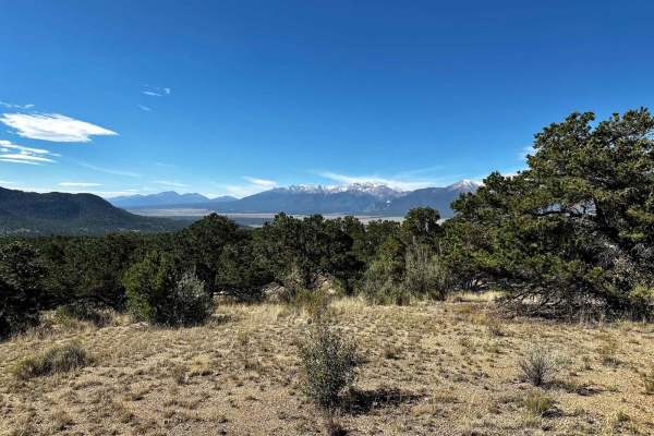
Lenhardy Cutoff FS 376
Lenhardy Cutoff connects the east side and west side of the Fourmile Area loop. Taking the cutoff allows for a complete loop during season closures. This trail is not as easy as other areas of the Fourmile Area;trailers are limited to small overland trailers and 4WD is required. There are some tight...
Learn more about Lenhardy Cutoff FS 376
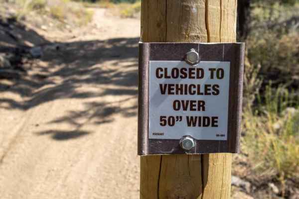
Triad Ridge East (ATV)
This trail is only open to vehicles 50" or less. This mild and quick mile and a half-mile route offers beautiful views of the surrounding area and neighboring mountain range. Nothing is challenging to note about this trail except for maybe the loose, sandy wash at the South entrance/exit.
Learn more about Triad Ridge East (ATV)
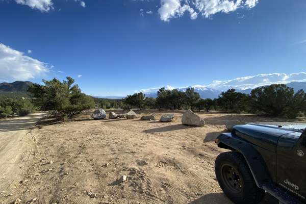
BLM 376
This trail is accessible off of BLM 375 "Four Mile Creek", BLM 311 and Lenhardy Cutoff. Approximately 2 miles in length, this trail starts out on the west end as easily accessible by most 4WD and high clearance 2WD vehicles, and gets progressively more difficult to where you will want to have 4WD. T...
Learn more about BLM 376
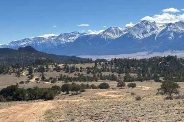
Sevenmile Creek Road
This trail connects the southern and northern portions of the Fourmile Area near Buena Vista. Along the way, you will see stunning views of the Collegiate Peaks, and there are plenty of dispersed camping opportunities. The road itself is dirt, typical of the area, with no major obstacles. Expect thi...
Learn more about Sevenmile Creek Road
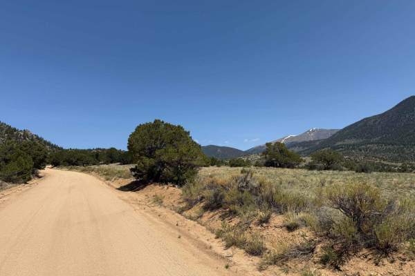
Fourmile Creek Road - 375
This road is generally easy and accessible by almost any vehicle except perhaps the lowest of riders. The dirt road is quite wide but narrows slightly as you proceed further along. The road surface is typical of the area--hardpack sandy dirt that could get soft and muddy with rain or snow. The trail...
Learn more about Fourmile Creek Road - 375
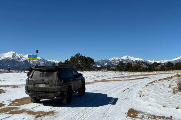
Shields Gulch
Shields Gulch enters the Four Mile off-roading area northwest of Buena Vista and is accessed directly from Highway 24, about 15 minutes before town. The road is generally mild, with only two sections that are slightly rocky and rutted, and resembles the typical dirt roads common in this area. Most s...
Learn more about Shields Gulch
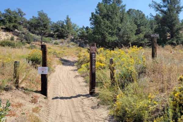
Rock N' Roll 1 (1434 A)
Closed to vehicles over 50" wide. This 2-mile track has a fun variety of just about everything - from dirt to sand to rock. There are one or two pretty technical spots that could be challenging for beginners. The trail splits at the Eastern end. You can either take the trail North, which will take y...
Learn more about Rock N' Roll 1 (1434 A)
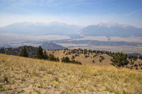
Bald Mountain Spur
This loop around Bald Mountain is definitely on the advanced side due to steep grades on very loose rocks. The Westside of the loop is easier than the Eastside. The Eastside offers more challenging sections with tighter switchbacks to navigate. The valley overlooks from the 9,600' summit is pretty a...
Learn more about Bald Mountain Spur
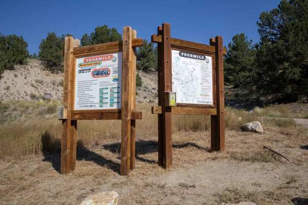
Bald Mountain Gulch 1
Section 1 of the Bald Mountain Gulch trail in the Four Mile OHV recreation area begins at a parking lot. There are two giant signs, one with a map of the area and the other with information regarding the area. High clearance, 4WD vehicles are recommended. Immediately after the first two switchbacks ...
Learn more about Bald Mountain Gulch 1

Little Cottonwood Cr.
Seasonal closure to motorized vehicles from December 1 - April 30. Horseback riding, hiking, and mountain biking are open year-round. The Western section of the trail is by far the most technical. There are a handful of very steep grades with rocks, roots, ruts, and loose surfaces. There are a coupl...
Learn more about Little Cottonwood Cr.
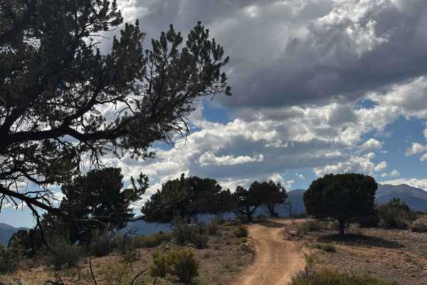
FS 376B
The trail begins at the intersection of Forest Service Roads 305, 376, and 376B in the middle of the Fourmile recreation area. The trail starts down a dirt road through groves of aspens and pines for the first mile. After the first mile, the trail opens up with small whoops and lots of dispersed cam...
Learn more about FS 376B
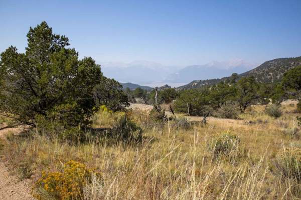
Triad Ridge West (ATV)
Triad Ridge West (ATV) is an exhilarating 4.5-mile point-to-point trail designed specifically for riders with vehicles 50 inches or less in width, offering sweeping panoramic views of the surrounding mountains and a dynamic mix of technical terrain. Starting at an elevation of 9,311 feet and descend...
Learn more about Triad Ridge West (ATV)
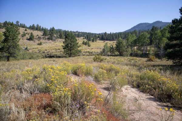
Bald Mountain Gulch 2
Section 2 of the Bald Mountain Gulch trail in the Four Mile OHV recreation area. This 3 mile section leads you past Little Cottonwood Creek and Arnold Gulch where ATV/dirt bike only trails are. Predominantly dirt and sandy washes. There are sections where water run-off has cut into the trail. Disper...
Learn more about Bald Mountain Gulch 2
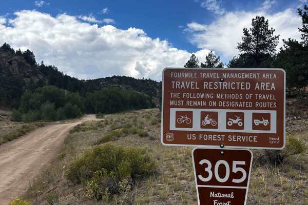
McGee Gulch - FS 305
The trail begins directly off Highway 285, with a staging area about a quarter mile in that offers parking, vehicle unloading, and information about the Four Mile Recreation Area. From there, the route ascends gradually on soft dirt with a few small rocks, winding through aspen groves and pine fores...
Learn more about McGee Gulch - FS 305
Rock N' Roll 2 (1434)
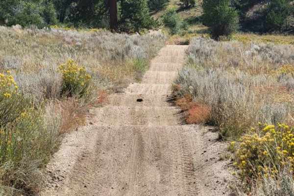
Rock N' Roll 2 (1434) is an exciting and diverse trail designed for riders of dirt bikes, ATVs, and 50-inch side-by-sides (SxSs) looking for a scenic climb through Colorado's Fourmile Travel Management Area. Spanning approximately 4.75 miles, this route offers a fantastic mix of terrain, transitioni...
Learn more about Rock N' Roll 2 (1434)
ATV trails near Johnson Village, Colorado
Explore ATV-friendly trails near you. These trails are accessible for vehicles up to 50 inches wide, perfect for ATVs and smaller off-road machines.
FS 376A Old Midland Cutoff
This route connects the Midland Bike Trail and FS 304 with Lenhardy Cutoff FS 376. The route is recommended for vehicles with 4WD and/or overland trailers. Rocks greater than 12 inches, some off-camber slopes, and switches are along the route. This route provides amazing views of the Collegiate Peak...
Learn more about FS 376A Old Midland Cutoff
Yansing Gulch
From Highway 24 in Johnson Village, take CR301 to CR300. A trail sign is at the entrance of CR 300 to the left. There are 2 gates for the entrance to the staging area that must be closed upon entering. The staging area is large with a Porta Potty and areas for dry camping. The beginning of the trail...
Learn more about Yansing Gulch
Carnage Canyon
Carnage Canyon or Carnage BV is a renowned extreme off-road trail that presents a series of formidable obstacles, each testing the limits of both vehicle and driver. It tightens quickly as it climbs the dry creek bed, forcing drivers into a wet and muddy waterfall that demands speed and traction to ...
Learn more about Carnage Canyon
Arnold Gulch
Arnold Gulch is an easy, two-mile connector route ideal for beginners and those looking to link up different motorized networks in Chaffee County. The trail runs for 1.8 miles, ascending 391 feet from a starting elevation of 8,461 feet to a maximum of 8,853 feet. The surface is composed entirely of ...
Learn more about Arnold Gulch
UTV/side-by-side trails near Johnson Village, Colorado
Find UTV and side-by-side trails near you. These trails accommodate vehicles up to 60 inches wide, ideal for UTVs, side-by-sides, and wider off-road rigs.
Yansing Gulch
From Highway 24 in Johnson Village, take CR301 to CR300. A trail sign is at the entrance of CR 300 to the left. There are 2 gates for the entrance to the staging area that must be closed upon entering. The staging area is large with a Porta Potty and areas for dry camping. The beginning of the trail...
Learn more about Yansing Gulch
Carnage Canyon
Carnage Canyon or Carnage BV is a renowned extreme off-road trail that presents a series of formidable obstacles, each testing the limits of both vehicle and driver. It tightens quickly as it climbs the dry creek bed, forcing drivers into a wet and muddy waterfall that demands speed and traction to ...
Learn more about Carnage Canyon
Arnold Gulch
Arnold Gulch is an easy, two-mile connector route ideal for beginners and those looking to link up different motorized networks in Chaffee County. The trail runs for 1.8 miles, ascending 391 feet from a starting elevation of 8,461 feet to a maximum of 8,853 feet. The surface is composed entirely of ...
Learn more about Arnold Gulch
Lenhardy Cutoff FS 376
Lenhardy Cutoff connects the east side and west side of the Fourmile Area loop. Taking the cutoff allows for a complete loop during season closures. This trail is not as easy as other areas of the Fourmile Area;trailers are limited to small overland trailers and 4WD is required. There are some tight...
Learn more about Lenhardy Cutoff FS 376
The onX Offroad Difference
onX Offroad combines trail photos, descriptions, difficulty ratings, width restrictions, seasonality, and more in a user-friendly interface. Available on all devices, with offline access and full compatibility with CarPlay and Android Auto. Discover what you're missing today!
Open Trail Map