
Dirt Bike Trails
Near Hooper, Utah
Explore All Dirt Bike Trails Near Hooper, Utah
Dirt Bike Trails Near Hooper, Utah
Discover the best dirt bike trails near you. Browse trail maps, check difficulty ratings, and find your next adventure — whether you're looking for a quick ride or an all-day expedition.
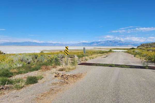
Southeast Promontory Road
This is a scenic drive that follows along shore of the Great Salt Lake and the Promontory Mountains in the high desert of Box Elder County down to the railroad causeway that splits the lake in half. All street-legal vehicles are capable of completing this road. There is nowhere to camp along this tr...
Learn more about Southeast Promontory Road
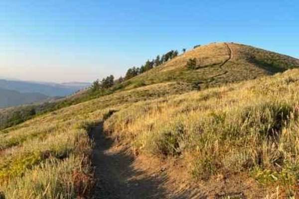
Lewis Peak (6041)
This single-track trail branches off from Skyline South and Coldwater Peak trails and dead-ends at Lewis Peak. The track is narrow with some plant overgrowth and little room for line selection. There aren't any cliffs alongside the trail, but most of the route crosses steep hillsides. As you ride to...
Learn more about Lewis Peak (6041)
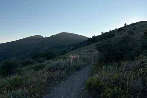
Coldwater Peak (6087)
Coldwater Peak is a short single-track trail that connects Skyline South and Lewis Peak trails. It runs west to east and side-hills across one of the peaks in this area. The track is very narrow without much room for picking a line. The plants along the trail are mostly short, but in some areas, tre...
Learn more about Coldwater Peak (6087)
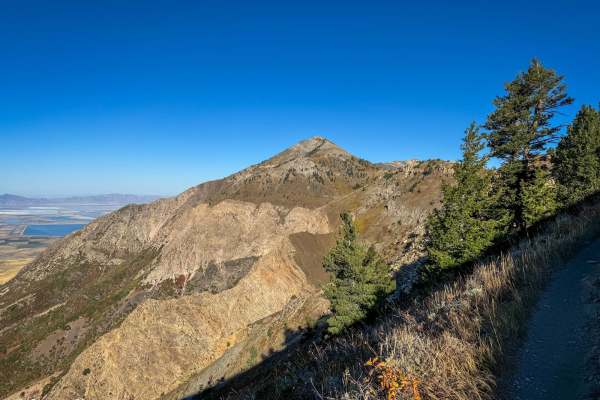
Skyline North Trail
Skyline North Trail near Ogden, Utah, is a thrilling ride for dirt bikers, offering a 10-mile (one-way) adventure with epic views. The trail climbs roughly 3,700 feet in elevation, leading you to Ben Lomond Peak at 9,682 feet and Willard Peak at 9,593 feet. The ride to Ben Lomond Peak covers about 8...
Learn more about Skyline North Trail
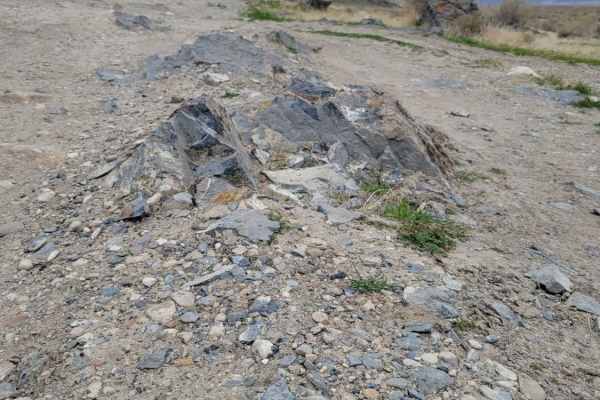
Shotgun Alley
A short route that leads past several shooting areas along the hillside. Lots of trash/shells were noted along the route, so if you decide to shoot here, please be sure to pack out any garbage that you bring. Predominantly easy dirt trail with some water pockets or mud holes possible. One or two sma...
Learn more about Shotgun Alley
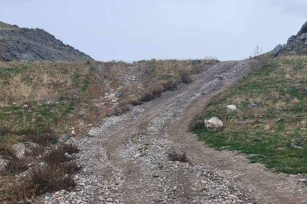
Salty Overlook
Although this trail is very short in length, it has a very steep grade up the hillside that bumps up the difficulty rating. 4WD, or even 4LO, is required to avoid spinning tires and damaging the trail. Aside from the steep section, the trail does not have any other difficulties or obstacles. The top...
Learn more about Salty Overlook
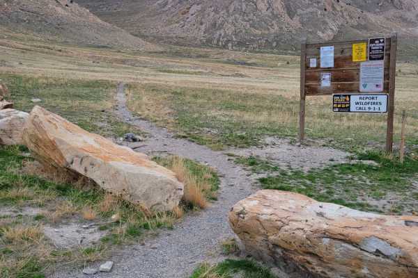
Stansbury Hike Trailhead
This trail leads from the main road to the Stansbury hiking trailhead with parking. Water/Mud holes may be present at the very beginning, but there is an alternative path around them if so. Fairly easy dirt road with one small rocky section right before the parking loop. Be advised that shooting ran...
Learn more about Stansbury Hike Trailhead

Farmington Firebreak Road
This is a short firebreak road that starts at the base of Farmington Canyon and dead ends shortly after a creek crossing. There are signs at the trailhead warning about a gate ahead, but this doesn't mean the road is closed; it just means you can't drive to the road that is after the gate. This trai...
Learn more about Farmington Firebreak Road
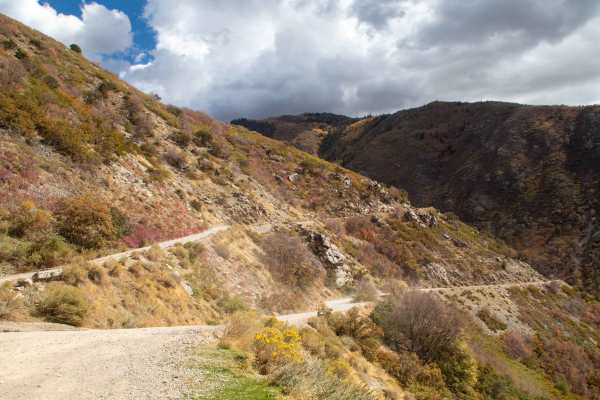
Farmington Canyon Trail
This trail is an easy well maintained road that starts in Farmington and heads up the canyon to where it ends at the start of Francis Peak Road and Skyline Drive. This trail stays about 2 vehicles wide but some spots may require larger vehicles to back up in order to find a good place to pass and ca...
Learn more about Farmington Canyon Trail
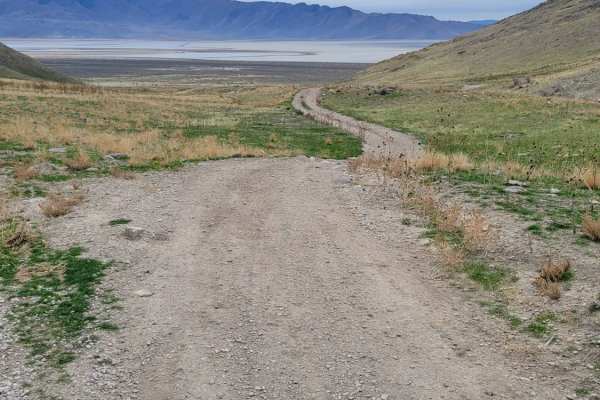
Round The Bend
This easy trail around the hillside connects Stansbury Gulch and Tabby's Canyon. There is nothing of major difficulty to note except where the trail dips down and up a ravine on the beginning of the Eastside. The west end of the trail is at a quarry/shooting area. Great views overlooking the Salt La...
Learn more about Round The Bend
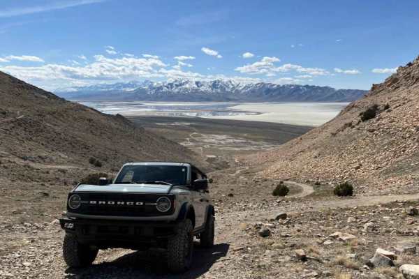
Stansbury Gulch A
Stansbury Gulch A is a short but engaging off-road climb on Stansbury Island perfect for four-wheel-drive vehicles and SxSs looking for scenic canyon views and a touch of technical challenge. Starting just above the popular target practice area in Stansbury Gulch on the left-hand side of the canyon,...
Learn more about Stansbury Gulch A
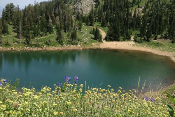
Smith Lakes
Choose your method of travel: foot, ATV, horse, truck or other. All are fun and acceptable (within reason). ATVs and motorcycles are king on this trail. You can rip down the trails at a good speed and enjoy the bends and jumps. Trucks with good clearance can bounce all the way to the third lake, if...
Learn more about Smith Lakes
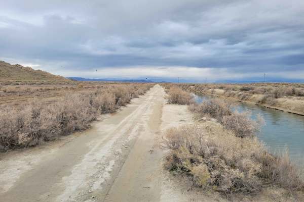
Canal Road
This straight-away trail leads to the furthest, Eastern part of the island's BLM land. It parallels one of the Great Salt Lake water canals and is in much better condition than many of the other trails in the area. A couple of ruts and mud holes are possible. There is no barrier to protect against f...
Learn more about Canal Road
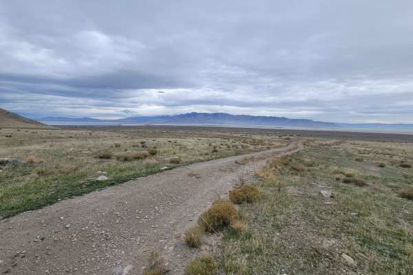
Tabby's Canyon
A narrow trail that winds its way up and back into the mountain. This trail is probably best suited for smaller machines, although a Tacoma made it up no problem. A couple of sections have large rocks to maneuver around, which bump up the technicality rating. The trail does keep going beyond where m...
Learn more about Tabby's Canyon
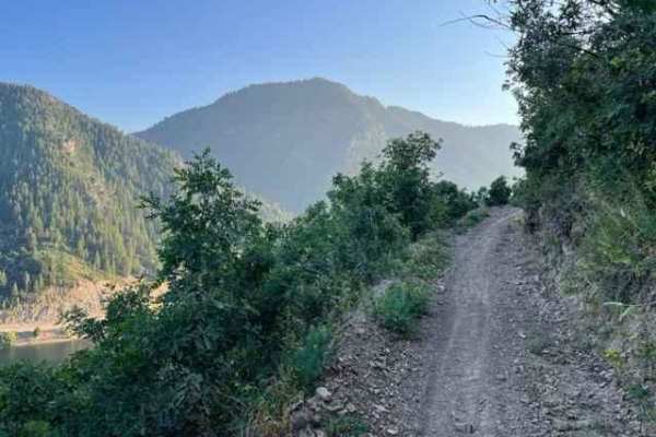
Skyline South (6002)
Skyline South trail traverses the mountain range between North Ogden Canyon Road and Route 158 at Pineview Reservoir. Parking is available at both ends-Windsurfer Beach at the south and North Ogden Divide at the north. Starting from the south, the trail crosses Route 158 and climbs the side of the m...
Learn more about Skyline South (6002)
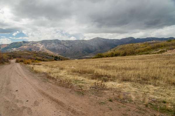
Liberty Avon Road
The Liberty-Avon Road is a great little off-road drive. This makes a scenic alternative between Ogden and Logan if you have extra time. It offers nice scenery and few different recreation options. This is also easily driven with a visit to Powder Mountain, which is also extremely scenic. The road is...
Learn more about Liberty Avon Road
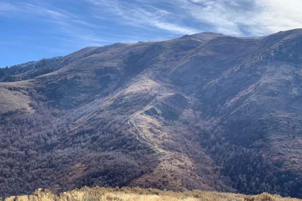
Dunns Canyon
Dunns Canyon is a really cool ride located just outside of Brigham City, Utah. It gives great views of the Great Salt Lake and the Wellsville Mountains. This trail climbs to Perry Peak and to an old ranch cabin, now called Old Pete's Cabin, which is above the town of Mantua. This trail is accessed f...
Learn more about Dunns Canyon
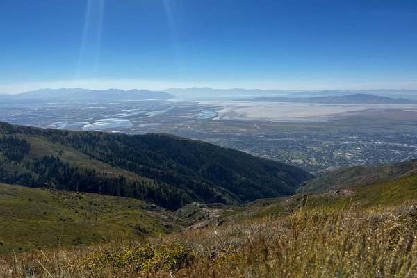
Holmes Creek Road (FR 260)
Holmes Creek Road starts at the end of Francis Peak Road as a very narrow, very rocky shelf road. There are not many areas to pull off for other vehicles, so proceed cautiously. As with many of the roads in the area, there are several blind curves. Due to larger, loose rocks, deep washouts, and eros...
Learn more about Holmes Creek Road (FR 260)
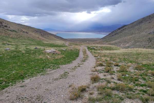
Dead End Pass
Dead End Pass is an easy, scenic route on Stansbury Island perfect for beginners, stock high-clearance four-wheel-drive vehicles, and SxSs looking for a quick climb with expansive views of the Great Salt Lake. Spanning approximately 0.86 miles with a steady elevation gain of about 384 feet, this sho...
Learn more about Dead End Pass
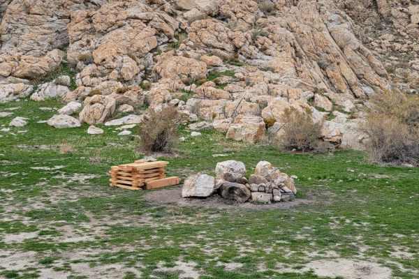
Dismal Finale
Dismal Finale is a short, rugged 0.6-mile trail on Stansbury Island tailored for four-wheel-drive vehicles, SxSs, and dirt bikes looking to reach the eastern boundary of public BLM land near the Great Salt Lake. This flat route, sitting at an elevation of roughly 4,220 feet, is highly susceptible to...
Learn more about Dismal Finale
ATV trails near Hooper, Utah
Explore ATV-friendly trails near you. These trails are accessible for vehicles up to 50 inches wide, perfect for ATVs and smaller off-road machines.
Southeast Promontory Road
This is a scenic drive that follows along shore of the Great Salt Lake and the Promontory Mountains in the high desert of Box Elder County down to the railroad causeway that splits the lake in half. All street-legal vehicles are capable of completing this road. There is nowhere to camp along this tr...
Learn more about Southeast Promontory Road
Shotgun Alley
A short route that leads past several shooting areas along the hillside. Lots of trash/shells were noted along the route, so if you decide to shoot here, please be sure to pack out any garbage that you bring. Predominantly easy dirt trail with some water pockets or mud holes possible. One or two sma...
Learn more about Shotgun Alley
Salty Overlook
Although this trail is very short in length, it has a very steep grade up the hillside that bumps up the difficulty rating. 4WD, or even 4LO, is required to avoid spinning tires and damaging the trail. Aside from the steep section, the trail does not have any other difficulties or obstacles. The top...
Learn more about Salty Overlook
Stansbury Hike Trailhead
This trail leads from the main road to the Stansbury hiking trailhead with parking. Water/Mud holes may be present at the very beginning, but there is an alternative path around them if so. Fairly easy dirt road with one small rocky section right before the parking loop. Be advised that shooting ran...
Learn more about Stansbury Hike Trailhead
UTV/side-by-side trails near Hooper, Utah
Find UTV and side-by-side trails near you. These trails accommodate vehicles up to 60 inches wide, ideal for UTVs, side-by-sides, and wider off-road rigs.
Southeast Promontory Road
This is a scenic drive that follows along shore of the Great Salt Lake and the Promontory Mountains in the high desert of Box Elder County down to the railroad causeway that splits the lake in half. All street-legal vehicles are capable of completing this road. There is nowhere to camp along this tr...
Learn more about Southeast Promontory Road
Shotgun Alley
A short route that leads past several shooting areas along the hillside. Lots of trash/shells were noted along the route, so if you decide to shoot here, please be sure to pack out any garbage that you bring. Predominantly easy dirt trail with some water pockets or mud holes possible. One or two sma...
Learn more about Shotgun Alley
Salty Overlook
Although this trail is very short in length, it has a very steep grade up the hillside that bumps up the difficulty rating. 4WD, or even 4LO, is required to avoid spinning tires and damaging the trail. Aside from the steep section, the trail does not have any other difficulties or obstacles. The top...
Learn more about Salty Overlook
Stansbury Hike Trailhead
This trail leads from the main road to the Stansbury hiking trailhead with parking. Water/Mud holes may be present at the very beginning, but there is an alternative path around them if so. Fairly easy dirt road with one small rocky section right before the parking loop. Be advised that shooting ran...
Learn more about Stansbury Hike Trailhead
The onX Offroad Difference
onX Offroad combines trail photos, descriptions, difficulty ratings, width restrictions, seasonality, and more in a user-friendly interface. Available on all devices, with offline access and full compatibility with CarPlay and Android Auto. Discover what you're missing today!
Open Trail Map