
Dirt Bike Trails
Near Gaylord, Michigan
Explore All Dirt Bike Trails Near Gaylord, Michigan
Dirt Bike Trails Near Gaylord, Michigan
Discover the best dirt bike trails near you. Browse trail maps, check difficulty ratings, and find your next adventure — whether you're looking for a quick ride or an all-day expedition.
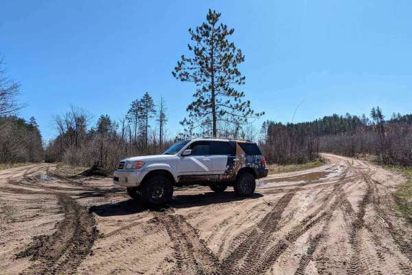
Mason Pit
This trail is sandy with a few large mud puddles. There are remnants of an old sand pit and chute that sits next to the trail on the south end, but it is located on private property. There is a bridge along the route that crosses over a little creek or river.
Learn more about Mason Pit
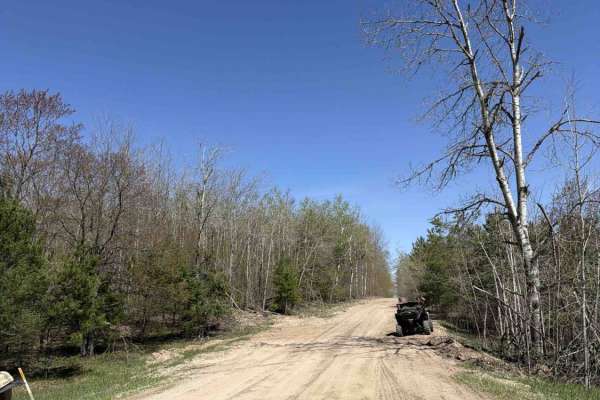
Calker
Calker is a versatile route accessible to all vehicle sizes, from robust 4x4s to nimble dirt bikes. The terrain is predominantly composed of sand and dirt, bordered by dense forests interspersed with open areas. However, larger vehicles may encounter challenges navigating through low-hanging brush a...
Learn more about Calker
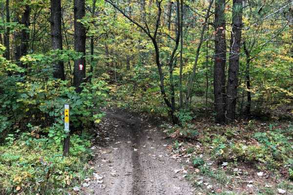
Crapo Creek Trail
Crapo Creek Trail (Pronounced Crap-oh) is a fifty-inch trail designed to be ridded by dirt bikes and quads. The general make up of this trail is black dirt with some sandy spots in fresh timber cut areas where the sun has had a chance to bake the ground. This is a relatively obstacle free trail. Som...
Learn more about Crapo Creek Trail
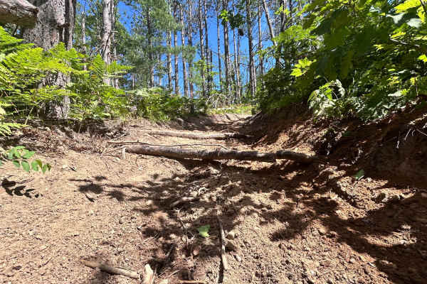
Big Bear Connector
Big Bear Connector is a fifty-inch trail designed to be ridden by 50-inch ATVs, dirtbikes, and quads. The general makeup of this trail is hard-packed sand with some soft sandy spots under a canopy of trees that connects Crapo Trail to Big Bear. There is only one section of the trail with a few expo...
Learn more about Big Bear Connector
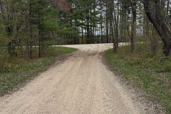
Mancelona Road Spur
Mancelona Road Spur is a single-lane dirt-and-sand route within the Gaylord Forest Management Unit. Passing through pine and hardwood forests, it offers opportunities to observe wildlife and enjoy a scenic area of northern Michigan. Expect occasional sandy and water-covered sections. The trail can b...
Learn more about Mancelona Road Spur
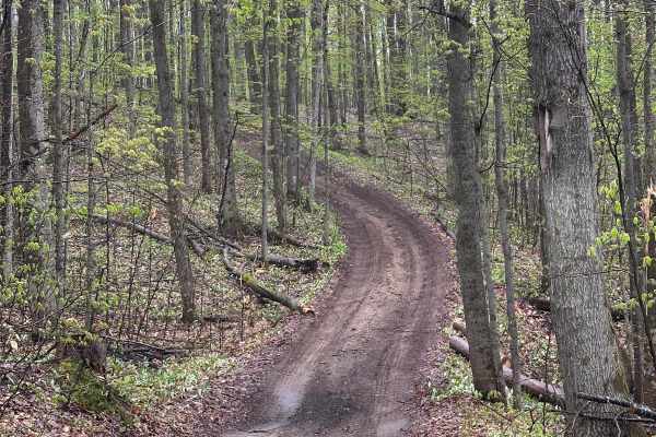
14634
14634 (15/16 degree grade) is a single-lane dirt/gravel/sand two-track that is narrow and windy in spots. The trail is part of the Gaylord/Traverse City Forest Management Unit and offers opportunities to see wildlife and explore the trail system in Northern Michigan. Sections are wide enough for ano...
Learn more about 14634
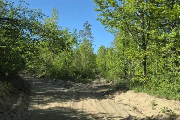
Wolf Run
This route begins off Charlevoix/Booth Lake Rd and runs toward Marl Creek Rd with an intersection tying into Wilderness Rd. It’s a mixed-use forest connector that shifts between sandy two-track, narrow wooded corridors, and more technical off-camber sections.
The trail starts sandy with light rock ...
Learn more about Wolf Run
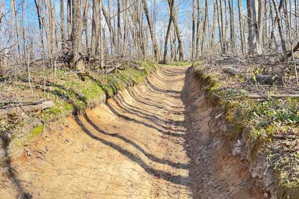
Tomahawk C loop Connector
This route consists of very deep sand, a deep trail cutout with high banks, and there is significant elevation change from one end to the other. It can become very rutted and uneven with rainfall. This route is shared with full-width off-road vehicles and connects the Tomahawk C loop from east to we...
Learn more about Tomahawk C loop Connector
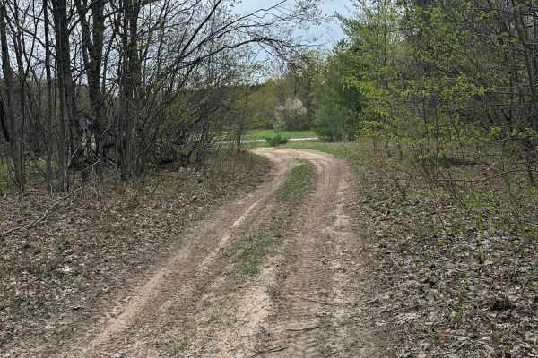
Trail 76
Trail 76 travels through the Gaylord Forest Management Unit on a single-lane dirt-and-sand road. Surrounded primarily by pine and hardwood forest, the route offers a relaxing ride and opportunities for wildlife viewing. Expect soft sand and ruts in places. The trail can be run in either direction an...
Learn more about Trail 76
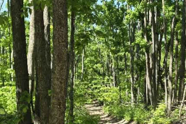
Dunham Rd
Dunham Road branches off the side of the Tomahawk C Loop and begins as a relatively easy hard-packed dirt trail before quickly narrowing into a more rugged two-track. The trail winds through dense forest, where low-hanging and fallen branches form a natural tunnel in several sections, creating a sec...
Learn more about Dunham Rd
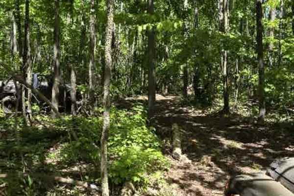
DJ's Hill Climb
This steep sandy hill is a fun challenge that can quickly test both driver skill and vehicle capability. The average grade is around 25 degrees, with sections reaching up to 34 degrees, making for a demanding climb. Off-camber angles of up to 10 degrees add another layer of difficulty as you work yo...
Learn more about DJ's Hill Climb
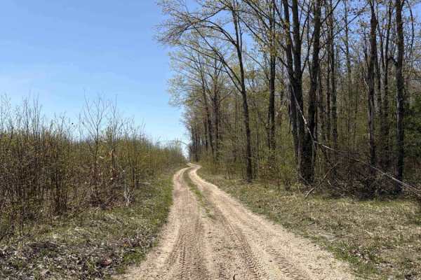
West Marker
West Marker is a trail accessible to vehicles of all sizes, from large 4x4s to dirt bikes. The trail consists of a sandy two-track and is surrounded by dense forests and some open areas. There are several spots along the route where you can stop, take photos, and enjoy the scenery. However, the trai...
Learn more about West Marker
White
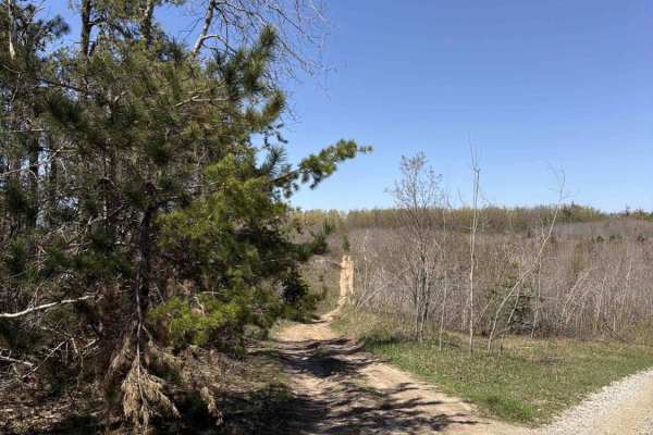
White is an ORV-friendly route that accommodates all sizes, from large 4x4s to dirt bikes. The trail is primarily composed of sandy two-tracks interspersed with patches of dirt, surrounded by dense forest. However, some sections may pose challenges for larger vehicles due to overhanging brush and br...
Learn more about White
Perry Road
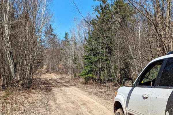
This a single-wide sandy trail. It starts as a groomed gravel road but narrows soon after. There are some slight elevation changes. There are also a couple of muddy areas that are not too deep. A portion of this trail is a snowmobile trail in the winter and has seasonal restrictions.
Learn more about Perry Road
Tomahawk C loop Southeast Leg
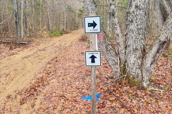
This leg of the trail consists of rocks, roots, sand, and loamy soil. There is a short section of “side hilling” where the trail rides along the side of a steep ravine, adding some challenge to the route. Switchbacks and medium-height berms make this section very fun and challenging. All of Tomahawk...
Learn more about Tomahawk C loop Southeast Leg
Tomahawk Motorcycle C Loop
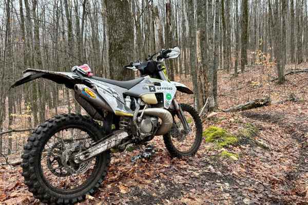
Tomahawk C Loop Motorcycle Trail is one of Michigan's dirt bike riding destinations. The 24-inch sections primarily consist of black dirt. The C loop is a tad more challenging than its brother, Tomahawk B Loop. This is a trail that is kept intentionally tight, twisty, and challenging. When riding th...
Learn more about Tomahawk Motorcycle C Loop
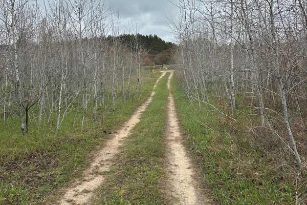
Post Road Cutover
Post Road Cutover is a 4.3-mile, single-lane two-track trail within the Grayling Forest Management Unit in northern Michigan. The route consists of dirt, gravel, and sand, winding through a forest of pines and hardwoods.
While some sections are wide enough to permit oncoming vehicles to pass, the tr...
Learn more about Post Road Cutover
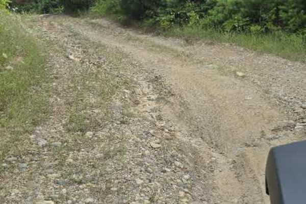
Southend Branch Line West
This route starts at the corner of Renkie Road. The entrance is poorly marked and almost looks like a driveway. Once you're on it, you'll follow a long, straight road for a while. In the wet seasons, this road is known to collect plenty of mud in potholes. Just past a small sandy area, you'll come t...
Learn more about Southend Branch Line West
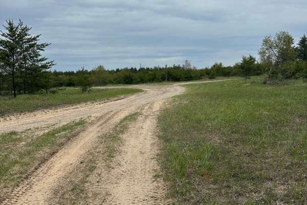
DR Cutover
DR Cutover is a single-lane dirt and sand two-track. The route is part of the Gaylord/Traverse City Forest Management Unit and allows users to see wildlife and enjoy a piece of pure Michigan. This is a nice ride with some sand and mud holes in spots. It can be run in either direction and ends at Dew...
Learn more about DR Cutover
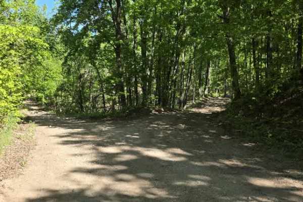
Backwoods Bypass
Backwoods Bypass branches off Wilderness Road and begins as a hard-packed dirt logging road winding through towering hardwoods and pines. During active logging operations, massive log walls line portions of the route, creating an impressive corridor through the forest. A large turnaround at the end ...
Learn more about Backwoods Bypass
ATV trails near Gaylord, Michigan
Explore ATV-friendly trails near you. These trails are accessible for vehicles up to 50 inches wide, perfect for ATVs and smaller off-road machines.
Mason Pit
This trail is sandy with a few large mud puddles. There are remnants of an old sand pit and chute that sits next to the trail on the south end, but it is located on private property. There is a bridge along the route that crosses over a little creek or river.
Learn more about Mason Pit
Calker
Calker is a versatile route accessible to all vehicle sizes, from robust 4x4s to nimble dirt bikes. The terrain is predominantly composed of sand and dirt, bordered by dense forests interspersed with open areas. However, larger vehicles may encounter challenges navigating through low-hanging brush a...
Learn more about Calker
Crapo Creek Trail
Crapo Creek Trail (Pronounced Crap-oh) is a fifty-inch trail designed to be ridded by dirt bikes and quads. The general make up of this trail is black dirt with some sandy spots in fresh timber cut areas where the sun has had a chance to bake the ground. This is a relatively obstacle free trail. Som...
Learn more about Crapo Creek Trail
Big Bear Connector
Big Bear Connector is a fifty-inch trail designed to be ridden by 50-inch ATVs, dirtbikes, and quads. The general makeup of this trail is hard-packed sand with some soft sandy spots under a canopy of trees that connects Crapo Trail to Big Bear. There is only one section of the trail with a few expo...
Learn more about Big Bear Connector
UTV/side-by-side trails near Gaylord, Michigan
Find UTV and side-by-side trails near you. These trails accommodate vehicles up to 60 inches wide, ideal for UTVs, side-by-sides, and wider off-road rigs.
Mason Pit
This trail is sandy with a few large mud puddles. There are remnants of an old sand pit and chute that sits next to the trail on the south end, but it is located on private property. There is a bridge along the route that crosses over a little creek or river.
Learn more about Mason Pit
Calker
Calker is a versatile route accessible to all vehicle sizes, from robust 4x4s to nimble dirt bikes. The terrain is predominantly composed of sand and dirt, bordered by dense forests interspersed with open areas. However, larger vehicles may encounter challenges navigating through low-hanging brush a...
Learn more about Calker
Mancelona Road Spur
Mancelona Road Spur is a single-lane dirt-and-sand route within the Gaylord Forest Management Unit. Passing through pine and hardwood forests, it offers opportunities to observe wildlife and enjoy a scenic area of northern Michigan. Expect occasional sandy and water-covered sections. The trail can b...
Learn more about Mancelona Road Spur
14634
14634 (15/16 degree grade) is a single-lane dirt/gravel/sand two-track that is narrow and windy in spots. The trail is part of the Gaylord/Traverse City Forest Management Unit and offers opportunities to see wildlife and explore the trail system in Northern Michigan. Sections are wide enough for ano...
Learn more about 14634
The onX Offroad Difference
onX Offroad combines trail photos, descriptions, difficulty ratings, width restrictions, seasonality, and more in a user-friendly interface. Available on all devices, with offline access and full compatibility with CarPlay and Android Auto. Discover what you're missing today!
Open Trail Map