
Dirt Bike Trails
Near Dover, Arkansas
Explore All Dirt Bike Trails Near Dover, Arkansas
Dirt Bike Trails Near Dover, Arkansas
Discover the best dirt bike trails near you. Browse trail maps, check difficulty ratings, and find your next adventure — whether you're looking for a quick ride or an all-day expedition.
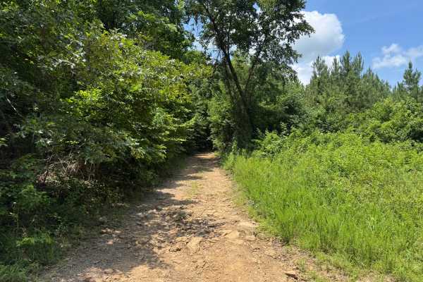
Dry Creek
This route branches off Millsap and reconnects with Wayne Scott Bottoms at the opposite end. The route begins on a narrow dirt surface and travels through an area that was actively logged several years ago. Dense brush has grown back along portions of the corridor, making pinstriping and paint scrat...
Learn more about Dry Creek

Seymor Road
Seymor Road is a well-maintained graded dirt road providing access to ATV trails at its eastern terminus near Campbell Hollow. The 3.5-mile route features gentle grades and minimal obstacles, making it suitable for all vehicle types including toy haulers and horse trailers. While not technically cha...
Learn more about Seymor Road
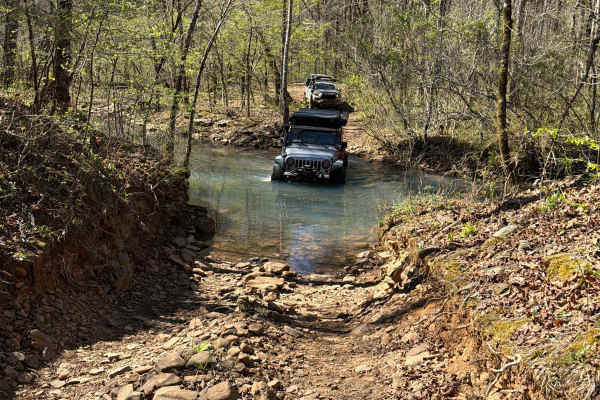
Felkins-Myer Bridge Road - FS 1322
Felkins-Myer Bridge Road - FS1322 is a connecting trail from Granny Gap 1 Road to Bear Hollow. From there, you can take FS 93052F to Barker Road or FS 93053A to Illinois Bayou Granite Luge. This trail has something for everyone. It is an unmaintained dirt road with rocky sections that follow Mill Cr...
Learn more about Felkins-Myer Bridge Road - FS 1322
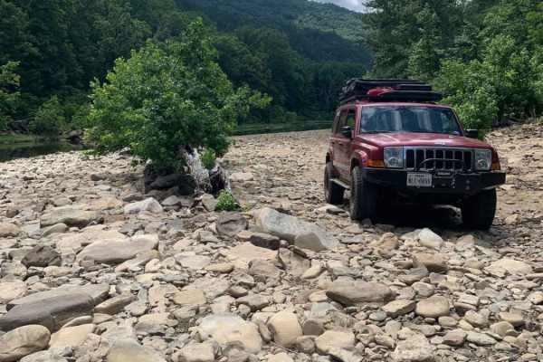
Wainscott Bottoms
Wainscott Bottoms is an exciting 5.9-mile adventure for intermediate four-wheel-drive enthusiasts looking to explore the scenic Big Piney Creek valley within the Ozark National Forest. Beginning as an easy, smooth gravel road, the route soon transitions into a rugged Forest Service two-track that wi...
Learn more about Wainscott Bottoms
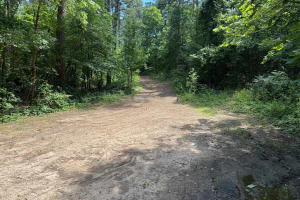
Howard
This route branches off Jake's Creek Road and begins as a wide, well-maintained forest road before narrowing into a single-lane trail beneath a canopy of mature hardwoods and towering pines. The lower section offers several pull-offs where oncoming vehicles can pass, but as the route climbs the moun...
Learn more about Howard

Black Oak Ridge Loop
This ATV loop in the Ozark National Forest is easy and scenic, but full of small features to keep the average rider on their toes. The southwest end of the trail starts at intersection N, and it descends through the forest through intersections S, Q, and P, until it ascends to the intersection L. T...
Learn more about Black Oak Ridge Loop
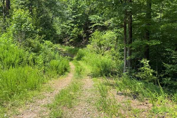
FS 93231A
This narrow forest connector winds through dense hardwoods and pines, creating a secluded drive with frequent stretches where brush and tree limbs crowd the trail. Pinstriping is likely, especially for full-size trucks. Along the way, you'll cross a shallow creek with a firm bottom that is not typic...
Learn more about FS 93231A
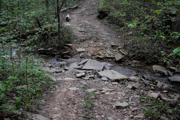
2307B
Beginning at the west end, this trail follows an easy two-track path through a forest of tall oaks and maples, with sharp curves weaving between the trees. Portions of the trail are covered with loose, flat cobblestone. The route descends to several small, rocky creek crossings, which feature large,...
Learn more about 2307B
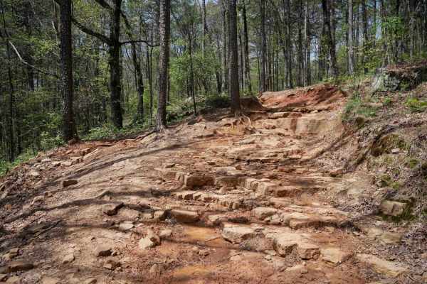
Black Oak Ridge Spur South
Continuing west from the intersection with Stave Mill Falls (intersection K), this stretch of ATV trail offers a wide, rocky path with scattered loose stones and plenty of overhanging branches to duck under. Big mud puddles appear regularly--some with go-arounds--while the terrain transitions to a d...
Learn more about Black Oak Ridge Spur South
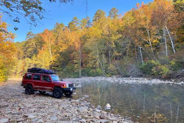
Freeman Road
Freeman Road follows the North Fork of the Illinois Bayou, and includes 3 water crossings, mud holes, rock scramblings, multiple campsites, and a Civil War Era cemetery. This route is a good starting point for the Illinois Bayou Granite Luge. During the fall season, the photo opportunities cannot be...
Learn more about Freeman Road
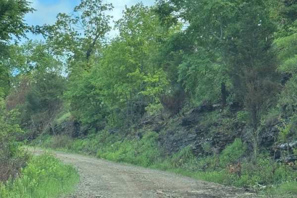
Pilot Rock Mountain Road
Pilot Rock Mountain Road provides a thrilling off-road experience, weaving through the Ozark National Forest. This road offers amazing views without extensive technical terrain. This road is very well-maintained and does not require 4WD in most cases. Expect washouts and light mud after a good rain....
Learn more about Pilot Rock Mountain Road
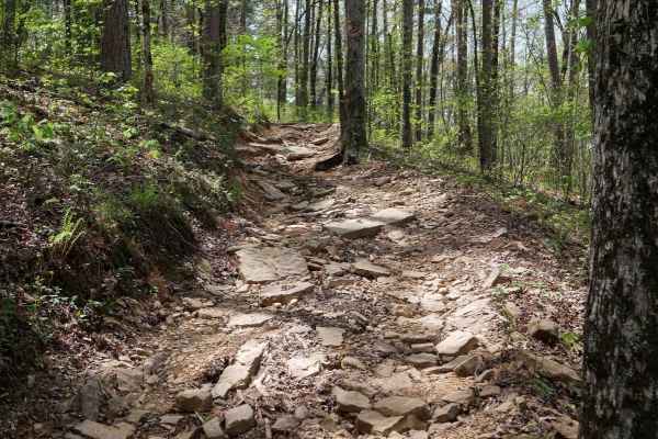
Black Oak Ridge
This ATV loop in the Ozark National Forest winds through a mix of hickories, sugar maples, and oaks, often with mud puddles spanning the width of the trail, and low branches to watch out for. There are lots of loose rocks and the occasional downed log. Riding counter-clockwise from intersection M th...
Learn more about Black Oak Ridge
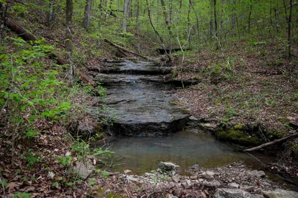
B
This trail starts at the west end with a wet and muddy stretch, winding through small rocks and rooty patches. Expect puddles and ruts up to a foot deep--picking the high points is key. Scattered small logs require a bit of technical handling, and steep little climbs add to the challenge as the trai...
Learn more about B
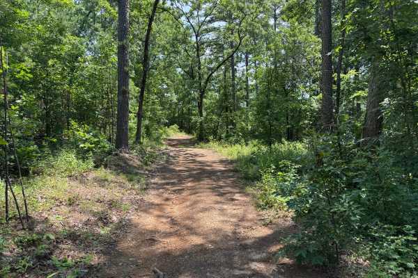
FS 93234E
This route is primarily a single-vehicle-wide dirt road winding through the Pine Wildlife Management Area. Several sections provide enough room to pull over and allow oncoming traffic to pass, while recently logged areas open up the landscape with wider views before the route returns to dense pine f...
Learn more about FS 93234E
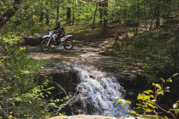
Stave Mill Falls
This loop is an easy ATV trail in the Ozark National Forest with a few features that make it more rugged and interesting for the average rider. The trail has several big downhills full of loose rocks with deep ruts and troughs, making it off-camber in sections, requiring careful navigation of the hi...
Learn more about Stave Mill Falls
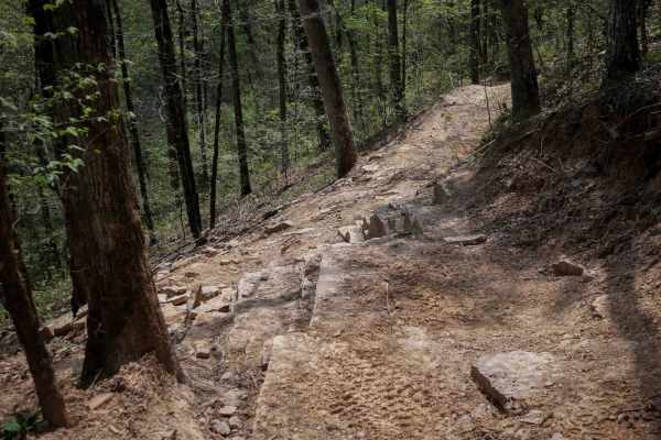
Q-O Connector
This short but moderately challenging connector between intersections Q and O offers a technical ride as it traverses the sides of the mountains, with sharp curves, and a bigger rock obstacle that will test your technical skills. The trail is shelfy in spots with mild exposure, with deep ruts runnin...
Learn more about Q-O Connector
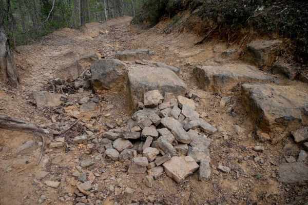
Black Oak Ridge Spur Northwest
This short spur connecting High Mountain Loop to Black Oak Ridge is under a mile, but it has several technical challenges and scenic views. The west end of the trail starts alongside Moccasin Creek, offering a gorgeous view of the strikingly clear blue water, and a creek crossing that's deeper than ...
Learn more about Black Oak Ridge Spur Northwest
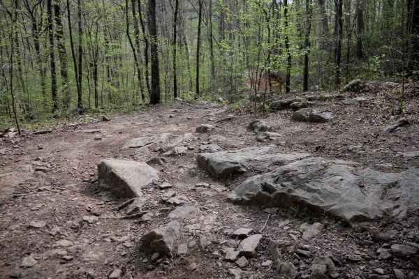
High Mountain Loop (South)
This trail weaves through a scenic forest full of shallow creeks, young pine trees, and tight, brushy corridors. It's got a little bit of everything--rocky spots with large boulders, most of which can be ridden over, flat slabs of rock, shelfy rocky sections, roots, and the occasional downed tree br...
Learn more about High Mountain Loop (South)
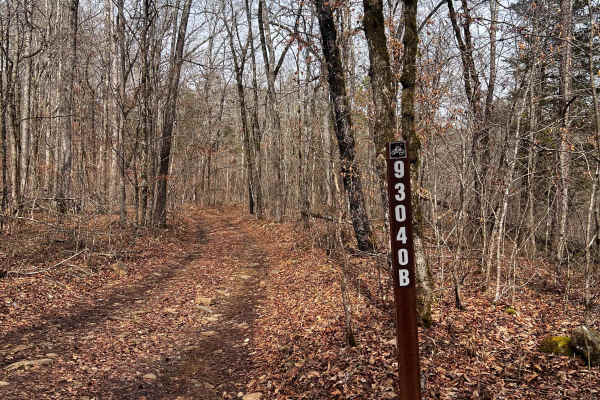
Hogg - FS 93040B
Hogg (FS 93040B) starts out flat as it follows Mill Creek for the first 300 yards, but quickly gains in elevation as it climbs through a wash and over rocky ledges for the first 1/8th mile after the start of the hill climb. The wash has a large rock that could be challenging for full-size rigs and t...
Learn more about Hogg - FS 93040B
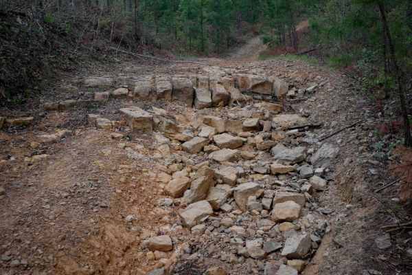
High Mountain Loop B
This loop in the Ozark National Forest circles High Mountain has a 1,493-foot peak. It gradually ascends in the counterclockwise direction. It goes through a mix of open forest with small young pine trees, then through a more dense forest of maple trees. Expect mud and deep ruts, including a bypass ...
Learn more about High Mountain Loop B
ATV trails near Dover, Arkansas
Explore ATV-friendly trails near you. These trails are accessible for vehicles up to 50 inches wide, perfect for ATVs and smaller off-road machines.
Dry Creek
This route branches off Millsap and reconnects with Wayne Scott Bottoms at the opposite end. The route begins on a narrow dirt surface and travels through an area that was actively logged several years ago. Dense brush has grown back along portions of the corridor, making pinstriping and paint scrat...
Learn more about Dry Creek
Seymor Road
Seymor Road is a well-maintained graded dirt road providing access to ATV trails at its eastern terminus near Campbell Hollow. The 3.5-mile route features gentle grades and minimal obstacles, making it suitable for all vehicle types including toy haulers and horse trailers. While not technically cha...
Learn more about Seymor Road
Felkins-Myer Bridge Road - FS 1322
Felkins-Myer Bridge Road - FS1322 is a connecting trail from Granny Gap 1 Road to Bear Hollow. From there, you can take FS 93052F to Barker Road or FS 93053A to Illinois Bayou Granite Luge. This trail has something for everyone. It is an unmaintained dirt road with rocky sections that follow Mill Cr...
Learn more about Felkins-Myer Bridge Road - FS 1322
Wainscott Bottoms
Wainscott Bottoms is an exciting 5.9-mile adventure for intermediate four-wheel-drive enthusiasts looking to explore the scenic Big Piney Creek valley within the Ozark National Forest. Beginning as an easy, smooth gravel road, the route soon transitions into a rugged Forest Service two-track that wi...
Learn more about Wainscott Bottoms
UTV/side-by-side trails near Dover, Arkansas
Find UTV and side-by-side trails near you. These trails accommodate vehicles up to 60 inches wide, ideal for UTVs, side-by-sides, and wider off-road rigs.
Dry Creek
This route branches off Millsap and reconnects with Wayne Scott Bottoms at the opposite end. The route begins on a narrow dirt surface and travels through an area that was actively logged several years ago. Dense brush has grown back along portions of the corridor, making pinstriping and paint scrat...
Learn more about Dry Creek
Seymor Road
Seymor Road is a well-maintained graded dirt road providing access to ATV trails at its eastern terminus near Campbell Hollow. The 3.5-mile route features gentle grades and minimal obstacles, making it suitable for all vehicle types including toy haulers and horse trailers. While not technically cha...
Learn more about Seymor Road
Felkins-Myer Bridge Road - FS 1322
Felkins-Myer Bridge Road - FS1322 is a connecting trail from Granny Gap 1 Road to Bear Hollow. From there, you can take FS 93052F to Barker Road or FS 93053A to Illinois Bayou Granite Luge. This trail has something for everyone. It is an unmaintained dirt road with rocky sections that follow Mill Cr...
Learn more about Felkins-Myer Bridge Road - FS 1322
Wainscott Bottoms
Wainscott Bottoms is an exciting 5.9-mile adventure for intermediate four-wheel-drive enthusiasts looking to explore the scenic Big Piney Creek valley within the Ozark National Forest. Beginning as an easy, smooth gravel road, the route soon transitions into a rugged Forest Service two-track that wi...
Learn more about Wainscott Bottoms
The onX Offroad Difference
onX Offroad combines trail photos, descriptions, difficulty ratings, width restrictions, seasonality, and more in a user-friendly interface. Available on all devices, with offline access and full compatibility with CarPlay and Android Auto. Discover what you're missing today!
Open Trail Map