
Dirt Bike Trails
Near Hector, Arkansas
Explore All Dirt Bike Trails Near Hector, Arkansas
Dirt Bike Trails Near Hector, Arkansas
Discover the best dirt bike trails near you. Browse trail maps, check difficulty ratings, and find your next adventure — whether you're looking for a quick ride or an all-day expedition.
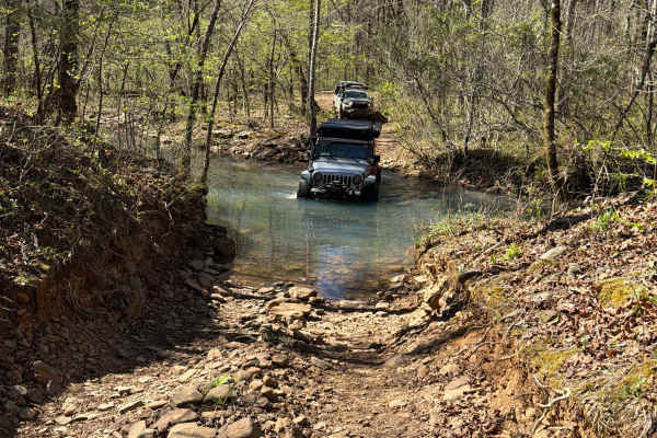
Felkins-Myer Bridge Road - FS 1322
Felkins-Myer Bridge Road - FS1322 is a connecting trail from Granny Gap 1 Road to Bear Hollow. From there, you can take FS 93052F to Barker Road or FS 93053A to Illinois Bayou Granite Luge. This trail has something for everyone. It is an unmaintained dirt road with rocky sections that follow Mill Cr...
Learn more about Felkins-Myer Bridge Road - FS 1322
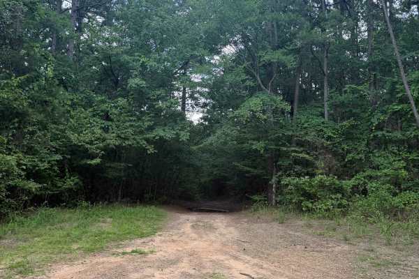
Petty Cord
Petty Cord starts as a smooth, easy-going trail heading through the dense woods. This trail heads North with a few small inclines and declines. The major obstacles for this trail would be the mud holes, whoops, and tight trees. The end of this trail stops at a creek bed with some really good camping...
Learn more about Petty Cord
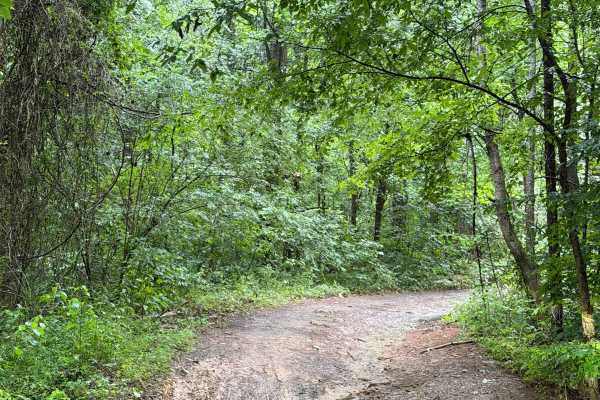
Bayou Run
This trail can be run from the North end or South end. If you are running from the North end (Highly recommended), you will get off Highway 27 and find yourself in front of several mud holes that are all hard bottom. These mud holes can get deep depending on recent rain, so be sure to check water le...
Learn more about Bayou Run
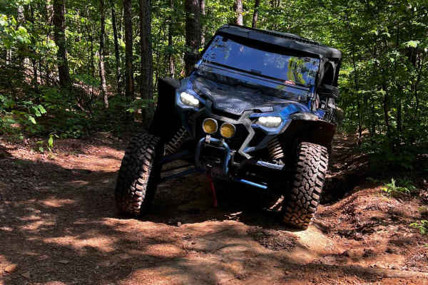
NFS 93053A Bear Hollow
NFS 93053A begins at the intersection of 1322 and 93052F. After crossing Mill Creek, the trail is flat for about 1/8th of a mile before it starts to climb to Adam Mountain Road. The steepest part of the climb is in the first ¼ mile. With loose rocks, ledges, and a steep drop on the west side of the ...
Learn more about NFS 93053A Bear Hollow
NFS 93052F
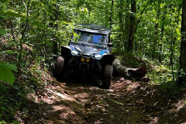
NFS 93052F begins at the intersection of 1322 and 93053A. Crossing Mill Creek at the start of the first of three crossings, as the trail parallels the creek with a few mud holes. These crossings are shallow most of the year, and in late summer can be nonexistent. Fall and spring can bring the water ...
Learn more about NFS 93052F
Hogg - FS 93040B
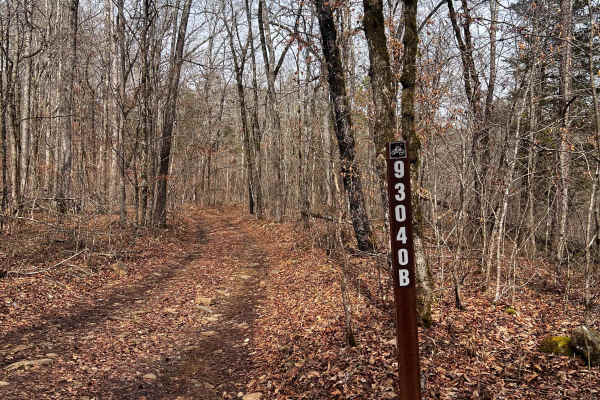
Hogg (FS 93040B) starts out flat as it follows Mill Creek for the first 300 yards, but quickly gains in elevation as it climbs through a wash and over rocky ledges for the first 1/8th mile after the start of the hill climb. The wash has a large rock that could be challenging for full-size rigs and t...
Learn more about Hogg - FS 93040B
Freeman Road
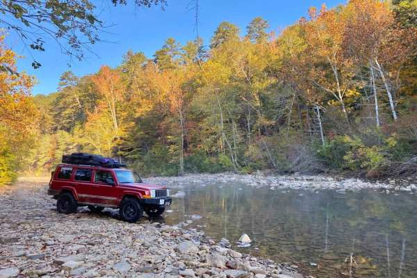
Freeman Road follows the North Fork of the Illinois Bayou, and includes 3 water crossings, mud holes, rock scramblings, multiple campsites, and a Civil War Era cemetery. This route is a good starting point for the Illinois Bayou Granite Luge. During the fall season, the photo opportunities cannot be...
Learn more about Freeman Road
NFS 93052A Baker
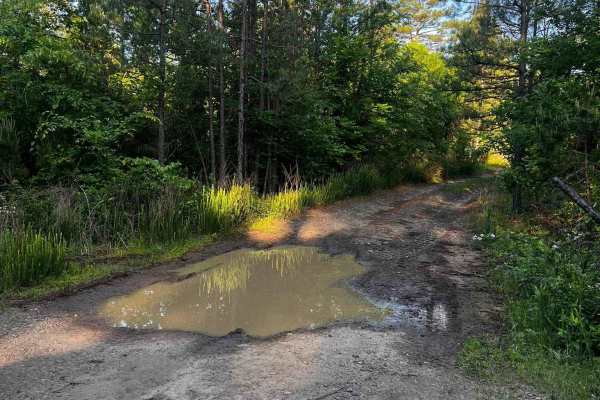
93052A is a great connector to the top of 93052F, 1322A, and Adams Mountain Road. Dropping in off Old Hwy 27, the trail gradually descends at first with a few shallow mud holes. The trail has a few switchbacks as its grade steepens. At the 1-mile mark is the upper trailhead of 93052A. The trail turn...
Learn more about NFS 93052A Baker

Seymor Road
Seymor Road is a well-maintained graded dirt road providing access to ATV trails at its eastern terminus near Campbell Hollow. The 3.5-mile route features gentle grades and minimal obstacles, making it suitable for all vehicle types including toy haulers and horse trailers. While not technically cha...
Learn more about Seymor Road
Cheyenne Road
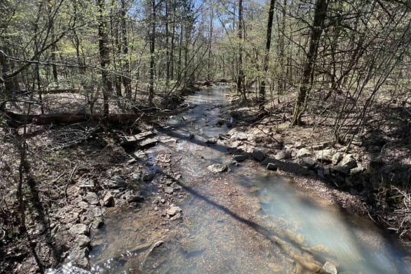
One of the great features of the Ozarks is the endless dedicated ATV, SxS, dirt bike, and off-roading areas. Cheyenne Road is one of those gateway trails that will lead you to the Mountain Man Trailhead riding area. It's an easy gravel however there are washed-out sections and creek crossings with b...
Learn more about Cheyenne Road
Brock 21
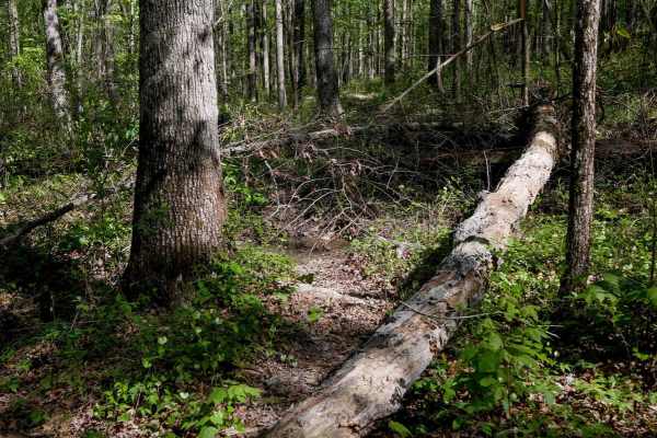
This 1.8-mile dirt bike loop off Brock 40 meanders through the forest with constant small elevation changes, mostly gradual ups and downs. The trail is faint in places, with overgrown brush and leaf coverage that can obscure the path. There are large downed logs, plus rocky sections that add difficu...
Learn more about Brock 21
Black Oak Ridge Spur South
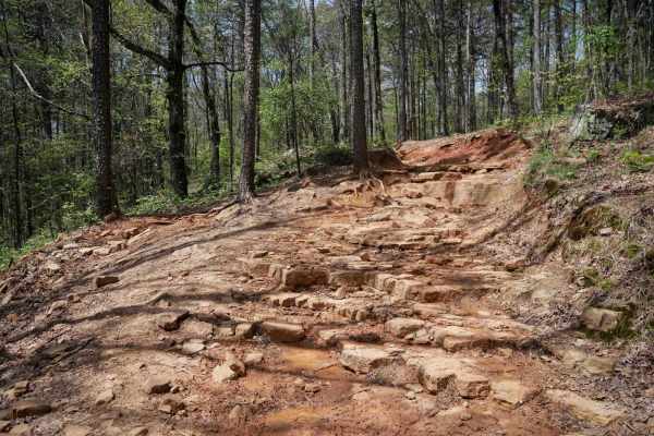
Continuing west from the intersection with Stave Mill Falls (intersection K), this stretch of ATV trail offers a wide, rocky path with scattered loose stones and plenty of overhanging branches to duck under. Big mud puddles appear regularly--some with go-arounds--while the terrain transitions to a d...
Learn more about Black Oak Ridge Spur South

Black Oak Ridge Loop
This ATV loop in the Ozark National Forest is easy and scenic, but full of small features to keep the average rider on their toes. The southwest end of the trail starts at intersection N, and it descends through the forest through intersections S, Q, and P, until it ascends to the intersection L. T...
Learn more about Black Oak Ridge Loop
A-B Connector
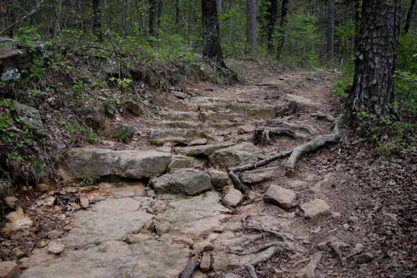
This is a short connector trail between Trails A and B, both of which are access trails from the Moccasin Gap trailhead, and are likely the first trails taken to start your ride in this trail system. This connector has a couple of notable rock sections, making it more difficult than A, but slightly ...
Learn more about A-B Connector
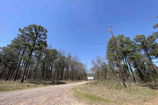
Rock Creek 1319
Rock Creek is an easy gravel road with creeks, campsites, and views for miles. It has eight spur trails for SxSs, ATVs, and 4x4 rigs. Griffin Mountain peaks at an elevation of 1004 feet giving you a taste of what the Ozarks has to offer. There are water crossings and lots of little creeks to play in...
Learn more about Rock Creek 1319

A
This ATV trail near Russellville, Arkansas, in the Ozark National Forest, starts at the Day Use Parking Area and gradually goes downhill until the J Intersection. It offers a mostly easy ride through a mix of sun and shade, through a forest of maples and oak trees. This is likely how most trail user...
Learn more about A
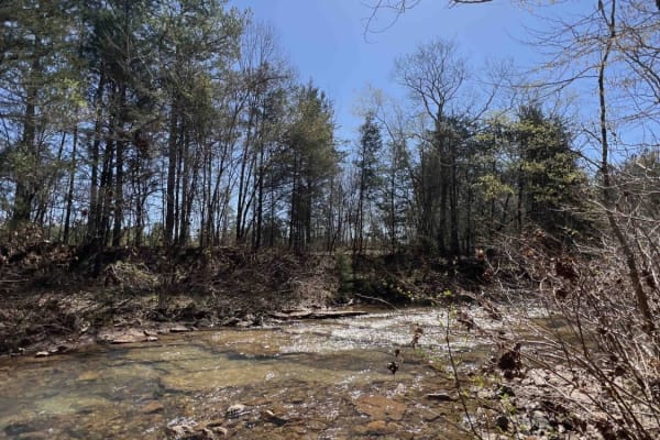
Liberty Springs 1334
Liberty Springs is the south entrance to the Brock Creek ATV Trail system, Brock Creek Campground, and Brock Creek Lake. This road is an easy dirt road with some gravel mixed in. There are beautiful spots to stop to have lunch before hitting the ATV trails. Brock Creek has a huge staging area big en...
Learn more about Liberty Springs 1334
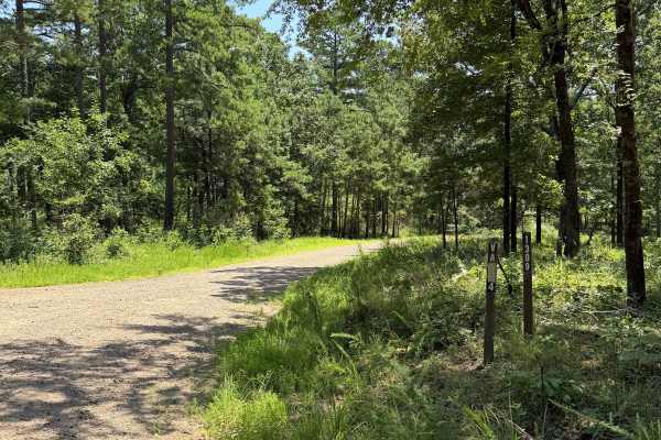
West Fork Scenic Drive
This is a point-to-point trail that passes several runoff trails. This is a maintained road that would be accessible for most vehicles. If you are driving this trail South to north, you will notice one of the first offshoots is a waterway that is used to help prevent flooding in the area, with a lot...
Learn more about West Fork Scenic Drive
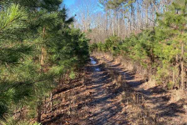
Middle Fork Illinois Bayou
Middle Fork Illinois Bayou is an exciting, tight-clearance trail perfect for four-wheel-drive vehicles and SxSs looking for a scenic descent into the heart of the Ozarks. Stretching nearly four miles, this route offers a challenging mix of steep elevation changes, ranging from 740 feet to nearly 1,7...
Learn more about Middle Fork Illinois Bayou
Perscillas Trail
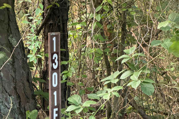
This trail is an in-and-out trail that is full of fun obstacles. You can only access this trail from White Oak Mountain Road and head west on the way in. Starting this trail, you will notice amazing camping spots, large mud holes, rutted-out areas, and tight vegetation/trees. Some of the mud holes o...
Learn more about Perscillas Trail
ATV trails near Hector, Arkansas
Explore ATV-friendly trails near you. These trails are accessible for vehicles up to 50 inches wide, perfect for ATVs and smaller off-road machines.
Felkins-Myer Bridge Road - FS 1322
Felkins-Myer Bridge Road - FS1322 is a connecting trail from Granny Gap 1 Road to Bear Hollow. From there, you can take FS 93052F to Barker Road or FS 93053A to Illinois Bayou Granite Luge. This trail has something for everyone. It is an unmaintained dirt road with rocky sections that follow Mill Cr...
Learn more about Felkins-Myer Bridge Road - FS 1322
Petty Cord
Petty Cord starts as a smooth, easy-going trail heading through the dense woods. This trail heads North with a few small inclines and declines. The major obstacles for this trail would be the mud holes, whoops, and tight trees. The end of this trail stops at a creek bed with some really good camping...
Learn more about Petty Cord
Bayou Run
This trail can be run from the North end or South end. If you are running from the North end (Highly recommended), you will get off Highway 27 and find yourself in front of several mud holes that are all hard bottom. These mud holes can get deep depending on recent rain, so be sure to check water le...
Learn more about Bayou Run
NFS 93053A Bear Hollow
NFS 93053A begins at the intersection of 1322 and 93052F. After crossing Mill Creek, the trail is flat for about 1/8th of a mile before it starts to climb to Adam Mountain Road. The steepest part of the climb is in the first ¼ mile. With loose rocks, ledges, and a steep drop on the west side of the ...
Learn more about NFS 93053A Bear Hollow
UTV/side-by-side trails near Hector, Arkansas
Find UTV and side-by-side trails near you. These trails accommodate vehicles up to 60 inches wide, ideal for UTVs, side-by-sides, and wider off-road rigs.
Felkins-Myer Bridge Road - FS 1322
Felkins-Myer Bridge Road - FS1322 is a connecting trail from Granny Gap 1 Road to Bear Hollow. From there, you can take FS 93052F to Barker Road or FS 93053A to Illinois Bayou Granite Luge. This trail has something for everyone. It is an unmaintained dirt road with rocky sections that follow Mill Cr...
Learn more about Felkins-Myer Bridge Road - FS 1322
Petty Cord
Petty Cord starts as a smooth, easy-going trail heading through the dense woods. This trail heads North with a few small inclines and declines. The major obstacles for this trail would be the mud holes, whoops, and tight trees. The end of this trail stops at a creek bed with some really good camping...
Learn more about Petty Cord
Bayou Run
This trail can be run from the North end or South end. If you are running from the North end (Highly recommended), you will get off Highway 27 and find yourself in front of several mud holes that are all hard bottom. These mud holes can get deep depending on recent rain, so be sure to check water le...
Learn more about Bayou Run
NFS 93053A Bear Hollow
NFS 93053A begins at the intersection of 1322 and 93052F. After crossing Mill Creek, the trail is flat for about 1/8th of a mile before it starts to climb to Adam Mountain Road. The steepest part of the climb is in the first ¼ mile. With loose rocks, ledges, and a steep drop on the west side of the ...
Learn more about NFS 93053A Bear Hollow
The onX Offroad Difference
onX Offroad combines trail photos, descriptions, difficulty ratings, width restrictions, seasonality, and more in a user-friendly interface. Available on all devices, with offline access and full compatibility with CarPlay and Android Auto. Discover what you're missing today!
Open Trail Map