
Dirt Bike Trails
Near Diggins, Missouri
Explore All Dirt Bike Trails Near Diggins, Missouri
Dirt Bike Trails Near Diggins, Missouri
Discover the best dirt bike trails near you. Browse trail maps, check difficulty ratings, and find your next adventure — whether you're looking for a quick ride or an all-day expedition.
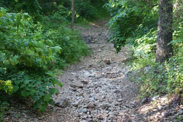
Schneider Hollow
This is a very steep hill with loose rocks and no large ledges. Near the top, there is an off-camber turn, and the upper section of the trail remains off-camber. The trail can be very slippery after rain, with washed-out sections reaching 1 to 2 feet deep in places.
Learn more about Schneider Hollow
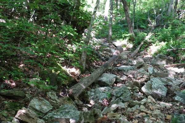
Will Power Hill
This trail starts with a sizable rock garden where 15 inches of clearance on 35-inch Rockzillas still resulted in frame contact. After the rock garden, the climb becomes steep quickly with loose rocks, sand, and gravel. A 74-inch-wide SXS can make it through, though some sections are tight. Any ledg...
Learn more about Will Power Hill
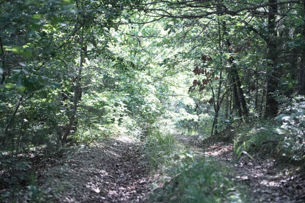
East Ridge Loop
This trail features a steep climb with loose rocks and small rock ledges, along with tight, off-camber turns and deep ruts. The trail is heavily overgrown in several areas, making the route difficult to follow at times. A 74-inch-wide machine can make it through, but some sections are very tight and...
Learn more about East Ridge Loop
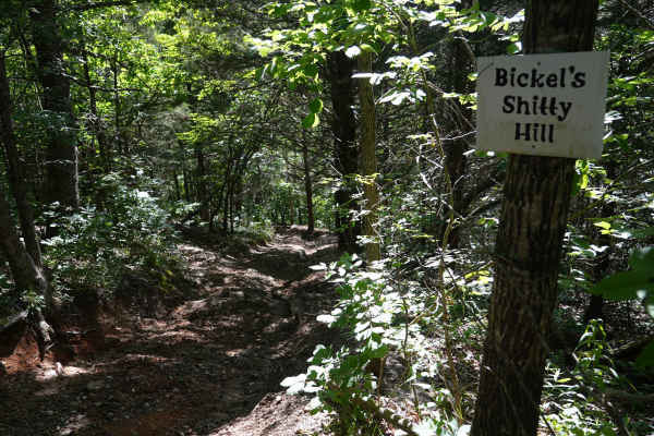
Bickel's Shitty Hill
This is a very steep dirt and mud hill with tight, off-camber turns, deep ruts, and a 15-inch rock ledge. Several lines are available, allowing drivers to choose which obstacles to tackle or avoid. A SXS on 35-inch Rockzillas with 15 inches of clearance required multiple attempts in some areas after...
Learn more about Bickel's Shitty Hill
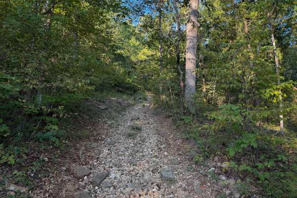
129
Chadwick Trail 129 is mostly a gradual climb from north to south, gaining about 260 feet in elevation over .8 miles. It’s a very narrow trail traversing up a hillside, with lots of chunky loose rock and slabs of rock. There are roots sticking out and tree gaps that would likely be quite narrow for a...
Learn more about 129
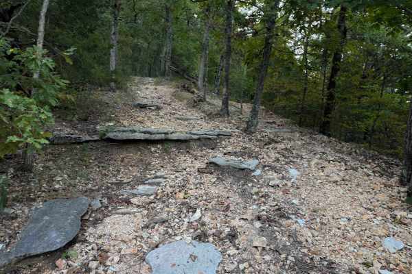
126
Chadwick Trail 126 is a 3-mile-long route through the Chadwick Motorized Trail System through a forest of hickory and oak. Going clockwise, it starts off Trail 101, just west of the KC Pavilion Trailhead. The route is mostly gradual, but it has several rock features that make it more of an intermedi...
Learn more about 126
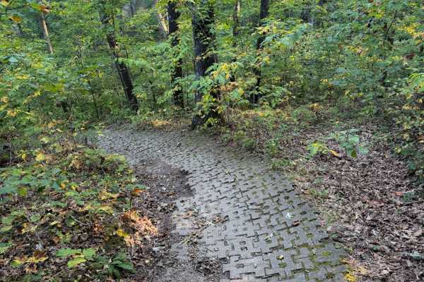
132a
Chadwick Trail 132a is a 1.1-mile-long ATV trail that connects Trail 130 to the intersection with Trails 131 and 132. It mostly weaves through a tight forest on a narrow dirt path with minor loose rock and roots. There are cinder blocks reinforcing the path at times to prevent erosion, and the trail...
Learn more about 132a
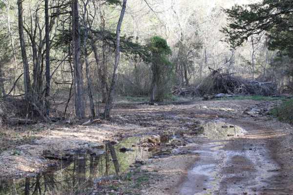
Lookout Road
Lookout Road is a scenic, moderately challenging 3.5-mile unpaved route through the Mark Twain National Forest's Chadwick Motorcycle and ATV Recreation Area. Starting near Cobb Ridge Campground, the dirt and gravel road winds along forested ridges and hollows in southwest Missouri, with elevations r...
Learn more about Lookout Road
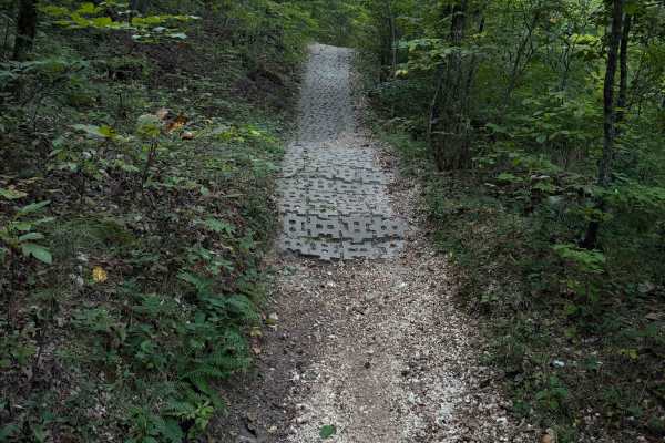
130
Chadwick Trail 130 makes a 1.2-mile loop off of Lookout Road in the Chadwick Motorized Trail System. Going clockwise, it starts off as a narrow ATV trail weaving through a tight forest above a ravine. It enters the ravine, riding on packed-down small loose rocks. This will likely be very tight for A...
Learn more about 130
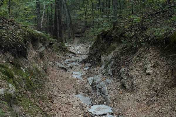
140
Chadwick Trail 140 starts at the KC Pavilion Trailhead. Riding clockwise, it starts as a narrow trail, more like a single track, going through a ravine covered in a layer of small, loose shale-like rocks all packed down into the ravine. It’s like riding in a V-bottom trough between mossy and rooty h...
Learn more about 140
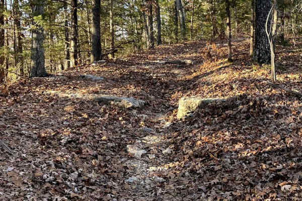
Blue Ridge Road
Blue Ridge Road is a spur offering additional access to Mark Twain National Forest. This route eventually dissolves into no discernible trail and should be considered an out-and-back. The route is characterized by heavy foliage and some chunky rocks scattered throughout, including a rock step sectio...
Learn more about Blue Ridge Road
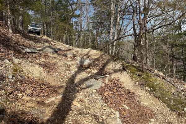
Devreaux Ridge Road Cave
This is a short trail that branches off the Devreaux Ridge Road trail. It starts pretty smooth, but soon approaches a few drops (approximately 10 inches). It will then lead to a small cave that sits on a hill. Make sure you stop to check it out. After that, you will go through some tight turns, and ...
Learn more about Devreaux Ridge Road Cave
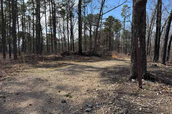
Prieskon Hollow - FSR 143
Prieskon Hollow is an out and back trail that runs along the hillside offering scenic views. Pay close attention as according to 2024 MVUMs the road does stop but there are tire marks that continue past where it legally stops. Just before this point, there is a turnaround point where you could easil...
Learn more about Prieskon Hollow - FSR 143
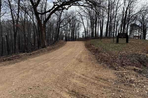
County Road 943
County Road 943 connects Glade Top North - FS 141 to County Road 924. This is a fairly maintained county road so there are no washouts or other potential obstacles to overcome. As you traverse along County Road 943 you will have great scenic views of the surrounding hills and other landscapes.
Learn more about County Road 943
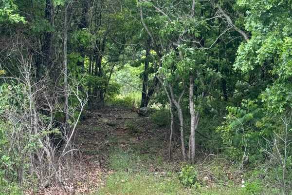
Hudson's Hideaway
This is a rock-notch in between pass-throughs to test articulation/vehicle pivoting skills. Recommended high clearance/larger tires.
Learn more about Hudson's Hideaway
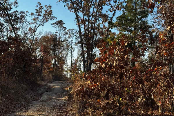
Loggers Trail / Heavens Stairs Connection
As the trail name states this is just a quick and convenient access trail to help access from the loggers trail to Heavens Stairs easily. Please remember to do your part in helping the park and keeping the trails clean for the enjoyment of others. Be mindful of traffic in this area.
Learn more about Loggers Trail / Heavens Stairs Connection
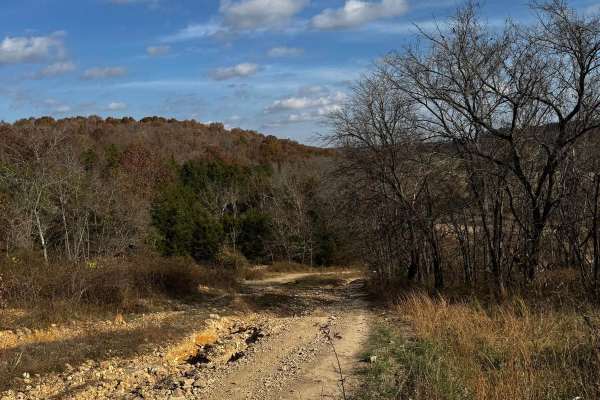
Heavens Stairs Middle Section
This trail is the easiest of the options for going up Heavens Stairs. Although featuring optional obstacles this section allows you to make it up to the top with minimal issues. The trail is still very steep and loose but not really as rugged as the surrounding sections. Make sure to be mindful of o...
Learn more about Heavens Stairs Middle Section
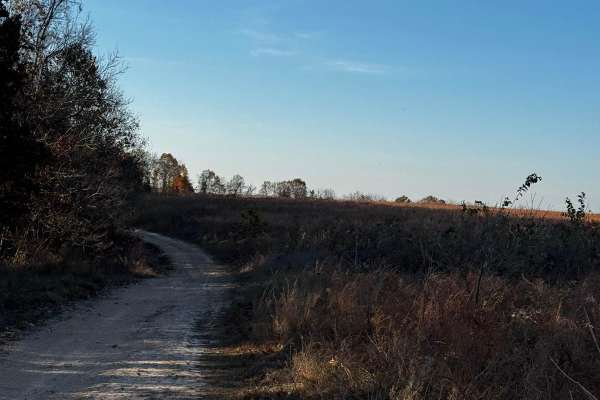
OnX Crossing
This fun beautiful trail was named after our dear friends @ OnX featuring some of the best spaces for camping with your buddies and enjoying some absolutely beautiful scenery located in the north section of the park. It's not the most difficult by any means but it sure is very enjoyable.
Learn more about OnX Crossing
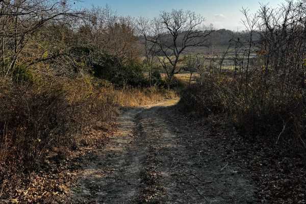
Heavens Stairs R2
This is 1 of the 5 optional challenges on the heavens stairs. This particular climb features some of the gnarliest washouts, climbs, and rocks you can get your paws on. This is absolutely not recommended for vehicles that are on less than 37-inch tires. This is a truly buggy territory, please be min...
Learn more about Heavens Stairs R2
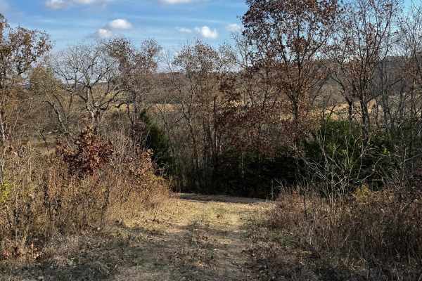
Stairway Climb 2
This particular section of the stairway is absolutely bananas. We highly suggest you are aware of what you're getting into before putting tires down. The trail has monster washouts, ruts, and rocks that will absolutely show you who's boss. Be mindful of others on the trail, and please help keep the ...
Learn more about Stairway Climb 2
ATV trails near Diggins, Missouri
Explore ATV-friendly trails near you. These trails are accessible for vehicles up to 50 inches wide, perfect for ATVs and smaller off-road machines.
Schneider Hollow
This is a very steep hill with loose rocks and no large ledges. Near the top, there is an off-camber turn, and the upper section of the trail remains off-camber. The trail can be very slippery after rain, with washed-out sections reaching 1 to 2 feet deep in places.
Learn more about Schneider Hollow
Will Power Hill
This trail starts with a sizable rock garden where 15 inches of clearance on 35-inch Rockzillas still resulted in frame contact. After the rock garden, the climb becomes steep quickly with loose rocks, sand, and gravel. A 74-inch-wide SXS can make it through, though some sections are tight. Any ledg...
Learn more about Will Power Hill
East Ridge Loop
This trail features a steep climb with loose rocks and small rock ledges, along with tight, off-camber turns and deep ruts. The trail is heavily overgrown in several areas, making the route difficult to follow at times. A 74-inch-wide machine can make it through, but some sections are very tight and...
Learn more about East Ridge Loop
Bickel's Shitty Hill
This is a very steep dirt and mud hill with tight, off-camber turns, deep ruts, and a 15-inch rock ledge. Several lines are available, allowing drivers to choose which obstacles to tackle or avoid. A SXS on 35-inch Rockzillas with 15 inches of clearance required multiple attempts in some areas after...
Learn more about Bickel's Shitty Hill
UTV/side-by-side trails near Diggins, Missouri
Find UTV and side-by-side trails near you. These trails accommodate vehicles up to 60 inches wide, ideal for UTVs, side-by-sides, and wider off-road rigs.
Schneider Hollow
This is a very steep hill with loose rocks and no large ledges. Near the top, there is an off-camber turn, and the upper section of the trail remains off-camber. The trail can be very slippery after rain, with washed-out sections reaching 1 to 2 feet deep in places.
Learn more about Schneider Hollow
Will Power Hill
This trail starts with a sizable rock garden where 15 inches of clearance on 35-inch Rockzillas still resulted in frame contact. After the rock garden, the climb becomes steep quickly with loose rocks, sand, and gravel. A 74-inch-wide SXS can make it through, though some sections are tight. Any ledg...
Learn more about Will Power Hill
East Ridge Loop
This trail features a steep climb with loose rocks and small rock ledges, along with tight, off-camber turns and deep ruts. The trail is heavily overgrown in several areas, making the route difficult to follow at times. A 74-inch-wide machine can make it through, but some sections are very tight and...
Learn more about East Ridge Loop
Bickel's Shitty Hill
This is a very steep dirt and mud hill with tight, off-camber turns, deep ruts, and a 15-inch rock ledge. Several lines are available, allowing drivers to choose which obstacles to tackle or avoid. A SXS on 35-inch Rockzillas with 15 inches of clearance required multiple attempts in some areas after...
Learn more about Bickel's Shitty Hill
The onX Offroad Difference
onX Offroad combines trail photos, descriptions, difficulty ratings, width restrictions, seasonality, and more in a user-friendly interface. Available on all devices, with offline access and full compatibility with CarPlay and Android Auto. Discover what you're missing today!
Open Trail Map