
Dirt Bike Trails
Near Cortez, Colorado
Explore All Dirt Bike Trails Near Cortez, Colorado
Dirt Bike Trails Near Cortez, Colorado
Discover the best dirt bike trails near you. Browse trail maps, check difficulty ratings, and find your next adventure — whether you're looking for a quick ride or an all-day expedition.
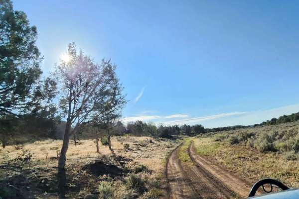
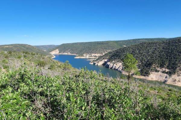
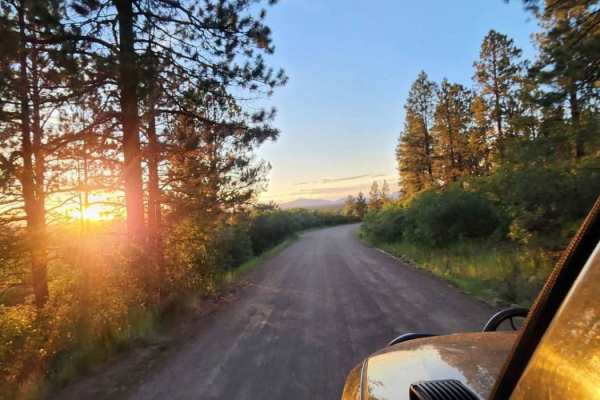
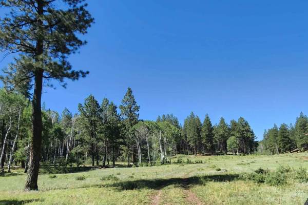
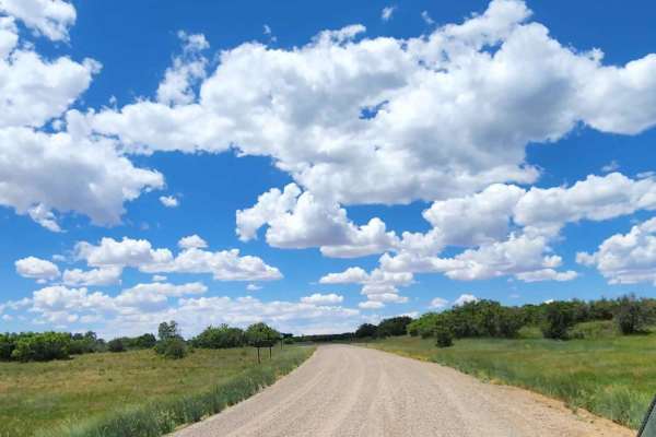
Beaver Rim Road
Beaver Rim Road is an inviting 5.7-mile off-road route near McPhee Reservoir, ideal for beginners and scenic drivers seeking a rewarding destination with a stunning overlook at the trail's end. Navigating through the picturesque landscape of southwestern Colorado, the trail begins near the Boggy Dra...
Learn more about Beaver Rim Road
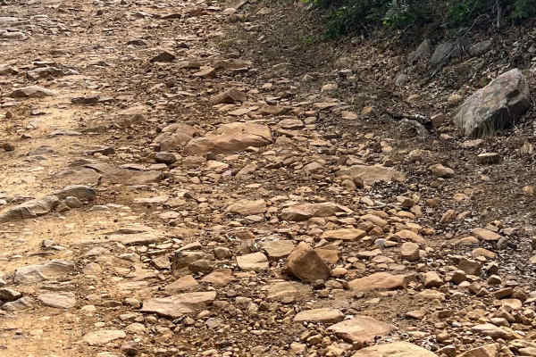
Beaver Rim F Road
This road can be very dusty when dry and muddy when wet. Beautiful view at the end with a small camp spot for one or two people. Dirt or rocky road, typically unmaintained after rain or snow. You may encounter shallow water crossings and obstacles under 12" on the trail, including small ledges. Road...
Learn more about Beaver Rim F Road
Upper House Creek Road
This trail is very muddy in spots and has small water puddles. It offers lots of camping with hiking and biking trails. Dirt or rocky road, typically unmaintained after rain or snow. You may encounter shallow water crossings and obstacles under 12" on the trail, including small ledges. Roads are typ...
Learn more about Upper House Creek Road
Dry Canyon A Road
There are some low trees on this road, so it is not recommended for tall vehicles. Along this route is a big open meadow and some camping areas. Can be muddy when wet. There are some small rocky areas. You may encounter shallow water crossings and obstacles under 12" on the trail, including small le...
Learn more about Dry Canyon A Road
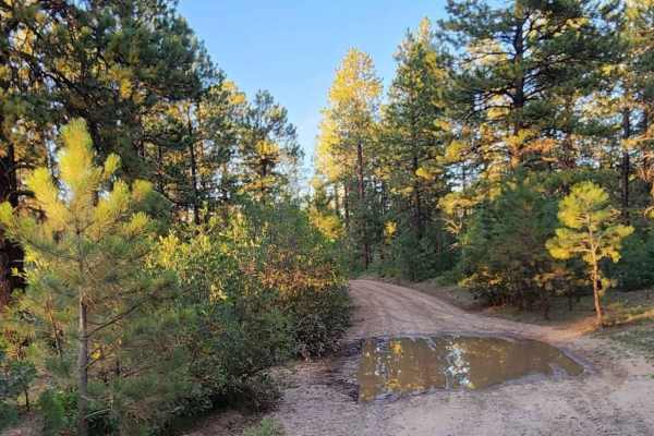
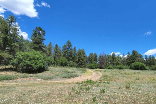
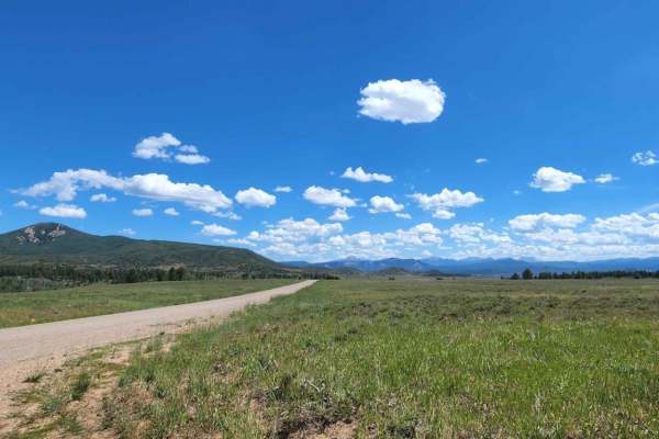
Boggy Draw Road
Boggy Draw Road is a scenic, beginner-friendly route near Dolores, Colorado, ideal for offroaders seeking easy access to the region’s premier non-motorized trail systems and dispersed camping. Stretching approximately 3.8 miles through the lush ponderosa pines of the San Juan National Forest, this u...
Learn more about Boggy Draw Road
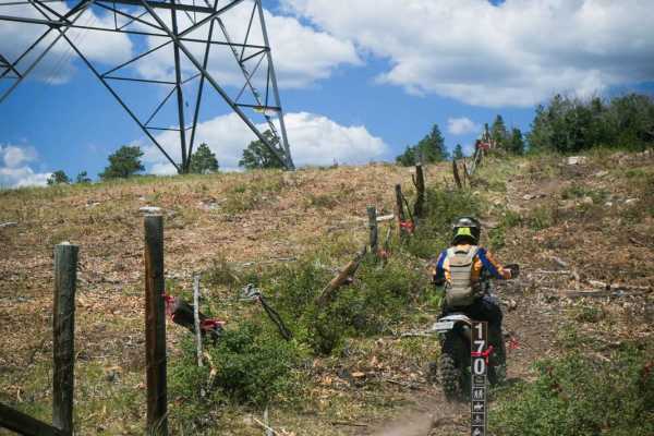
Coyote Park South
Coyote Park South starts as a dry and rocky trail that climbs up from the trailhead along a fence line. The initial hill climb has some embedded boulders, but then it gets into a more lush aspen tree forest and continues through some nice open meadows. This trail is pretty hot and dry with lots of s...
Learn more about Coyote Park South
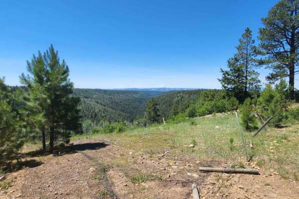
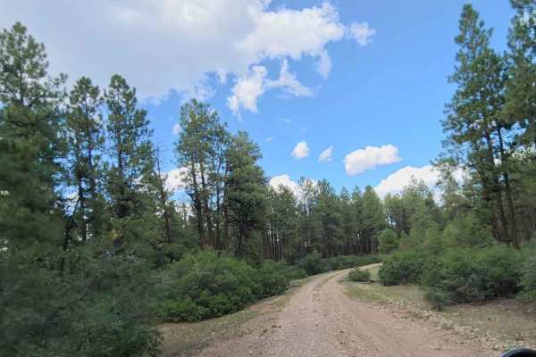
CR 44 Echo Basin Loop
This gorgeous route starts at a staging area and immediately enters the San Juan National Forest. It climbs through scrub oak and ponderosa terrain before reaching large aspen glades on both sides of the road. The ride leads towards the majestic Helmet Peak and prominent Hesperus Mountain, at 13,237...
Learn more about CR 44 Echo Basin Loop
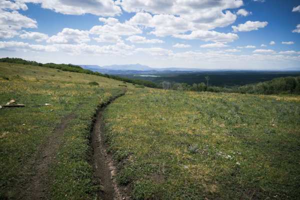
Spring Cr Pt Road
Can be muddy when wet. The road offers a decent view at the end overlooking a valley. There is a gate, so please close it behind you! If you like cows, you'll have plenty of cow friends to make, be aware there are also bulls. Dirt or rocky road with gentle grades. Safe for most 4WD and high-clearanc...
Learn more about Spring Cr Pt Road
Red Arrow Aspen Passage
This is an easy, breathtaking, beautiful ride into the La Plata Mountains in the San Juan National Forest. There is a staging area at the start of the ride. At 2.3 miles, this trail travels back and forth on Horse Creek. This part of the route is easy to miss but is well worth it as the aspen trees ...
Learn more about Red Arrow Aspen Passage
Ramparts Loop
The Ramparts Loop snakes through a mix of dry open hillsides, and lush aspen tree forests. This trail is in a bit lower elevation than some of the other trails in the Mancos riding area, so it is hotter and drier. Starting on the southern portion of the loop, the trail steadily climbs up 1,000 feet ...
Learn more about Ramparts Loop
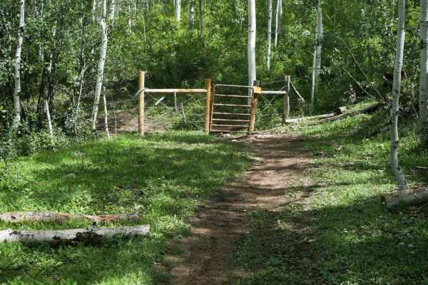
Rim Trail
The Rim trail is a short single track that connects to the south end of Chicken Creek at an intersection with a non-motorized trail. It is a mile long, and mostly straight, flat, smooth, and easy, as it meanders through the forest. There aren't many rocks or curves. It goes through a fence on the no...
Learn more about Rim Trail

Plateau Road
Short quick access road to get to others. There are big open pastures with lots of cows, so watch out for cow pies! Dirt or rocky road with gentle grades. Safe for most 4WD and high-clearance 2WD vehicles. Roads are typically two vehicles wide. Can be muddy when wet.
Learn more about Plateau Road
Cabin Rim Road
Quick short road with beautiful scenery and big tall trees. The road can be muddy when wet, and dusty when dry. Typically two vehicles wide and provides access to other roads. An easy road for any vehicle, safe for most 4WD and high-clearance 2WD vehicles. You might see cows. Dirt or rocky road with...
Learn more about Cabin Rim Road
Beaver Point Road
There are big open pastures with lots of cows, so watch out for cow pies! Dirt or rocky road with gentle grades. Safe for most 4WD and high-clearance 2WD vehicles. Roads are typically two vehicles wide. Can be muddy when wet. There are multiple areas to camp with amazing views.
Learn more about Beaver Point Road
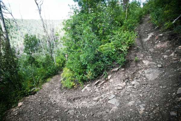
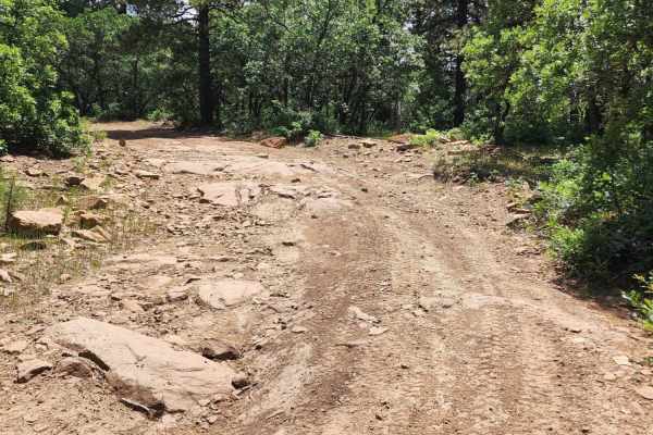
Box Canyon
Box Canyon is a fun and longer single track in the San Juan National Forest by Mancos, Colorado, that has a variety of terrain and some challenging switchbacks. From the trailhead off of Forest Service Road 561, the trail starts with a series of really steep and tight switchbacks down to a walking t...
Learn more about Box Canyon
Ferris Road
There is burned area at end of the road, so be mindful of debris, and muddy spots. There are some camp spots and access to other roads. Pretty open pastures.Dirt or rocky road with gentle grades. Safe for most 4WD and high-clearance 2WD vehicles. Roads are typically two vehicles wide.
Learn more about Ferris Road
Coyote Park North
Coyote Park North is a short trail that connects Coyote Park South to Box Canyon. It's only a mile long, but that mile is entirely made up of switchbacks that drop down a hillside into a gulch with a creek. The top few switchbacks are tight and with loose dirt. The bottom ones are wider and more rid...
Learn more about Coyote Park North
Ormiston Point Road
This road offers some camping, good access to many other roads, and lots of views. There is cell service at spots, but it can be very spotty with the weather. Can be muddy when wet. Dirt or rocky road with gentle grades. Safe for most 4WD and high-clearance 2WD vehicles. Roads are typically two vehi...
Learn more about Ormiston Point Road
Trimble Road
This is a short quick access road to get to others. There are some pretty views and big open pastures. There are lots and lots of cows, so watch out for cow pies! Dirt or rocky road, typically unmaintained after rain or snow. Can be muddy when wet. You may encounter shallow water crossings and obsta...
Learn more about Trimble Road
Chicken Creek Road
Rocky road in some spots, nothing to difficult though, easily done with a high clearance rig, muddy when wet. Dirt or rocky road, typically unmaintained after rain or snow. You may encounter shallow water crossings and obstacles under 12" on the trail, including small ledges. Roads are typically one...
Learn more about Chicken Creek Road
ATV trails near Cortez, Colorado
Explore ATV-friendly trails near you. These trails are accessible for vehicles up to 50 inches wide, perfect for ATVs and smaller off-road machines.
Beaver Rim Road
Beaver Rim Road is an inviting 5.7-mile off-road route near McPhee Reservoir, ideal for beginners and scenic drivers seeking a rewarding destination with a stunning overlook at the trail's end. Navigating through the picturesque landscape of southwestern Colorado, the trail begins near the Boggy Dra...
Learn more about Beaver Rim Road
Beaver Rim F Road
This road can be very dusty when dry and muddy when wet. Beautiful view at the end with a small camp spot for one or two people. Dirt or rocky road, typically unmaintained after rain or snow. You may encounter shallow water crossings and obstacles under 12" on the trail, including small ledges. Road...
Learn more about Beaver Rim F Road
Upper House Creek Road
This trail is very muddy in spots and has small water puddles. It offers lots of camping with hiking and biking trails. Dirt or rocky road, typically unmaintained after rain or snow. You may encounter shallow water crossings and obstacles under 12" on the trail, including small ledges. Roads are typ...
Learn more about Upper House Creek Road
Dry Canyon A Road
There are some low trees on this road, so it is not recommended for tall vehicles. Along this route is a big open meadow and some camping areas. Can be muddy when wet. There are some small rocky areas. You may encounter shallow water crossings and obstacles under 12" on the trail, including small le...
Learn more about Dry Canyon A Road
UTV/side-by-side trails near Cortez, Colorado
Find UTV and side-by-side trails near you. These trails accommodate vehicles up to 60 inches wide, ideal for UTVs, side-by-sides, and wider off-road rigs.
Beaver Rim Road
Beaver Rim Road is an inviting 5.7-mile off-road route near McPhee Reservoir, ideal for beginners and scenic drivers seeking a rewarding destination with a stunning overlook at the trail's end. Navigating through the picturesque landscape of southwestern Colorado, the trail begins near the Boggy Dra...
Learn more about Beaver Rim Road
Beaver Rim F Road
This road can be very dusty when dry and muddy when wet. Beautiful view at the end with a small camp spot for one or two people. Dirt or rocky road, typically unmaintained after rain or snow. You may encounter shallow water crossings and obstacles under 12" on the trail, including small ledges. Road...
Learn more about Beaver Rim F Road
Upper House Creek Road
This trail is very muddy in spots and has small water puddles. It offers lots of camping with hiking and biking trails. Dirt or rocky road, typically unmaintained after rain or snow. You may encounter shallow water crossings and obstacles under 12" on the trail, including small ledges. Roads are typ...
Learn more about Upper House Creek Road
Dry Canyon A Road
There are some low trees on this road, so it is not recommended for tall vehicles. Along this route is a big open meadow and some camping areas. Can be muddy when wet. There are some small rocky areas. You may encounter shallow water crossings and obstacles under 12" on the trail, including small le...
Learn more about Dry Canyon A Road
The onX Offroad Difference
onX Offroad combines trail photos, descriptions, difficulty ratings, width restrictions, seasonality, and more in a user-friendly interface. Available on all devices, with offline access and full compatibility with CarPlay and Android Auto. Discover what you're missing today!
Open Trail Map