
Dirt Bike Trails
Near Cook, Minnesota
Explore All Dirt Bike Trails Near Cook, Minnesota
Dirt Bike Trails Near Cook, Minnesota
Discover the best dirt bike trails near you. Browse trail maps, check difficulty ratings, and find your next adventure — whether you're looking for a quick ride or an all-day expedition.
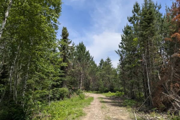
FS 248
The first part of the trail splits between private property and national forest land and is smooth and well-maintained. The second portion of the trail is a rough and rugged route designed for off-road vehicles, including ATVs, side-by-sides, and 4WD trucks or Jeeps. While it starts off relatively s...
Learn more about FS 248
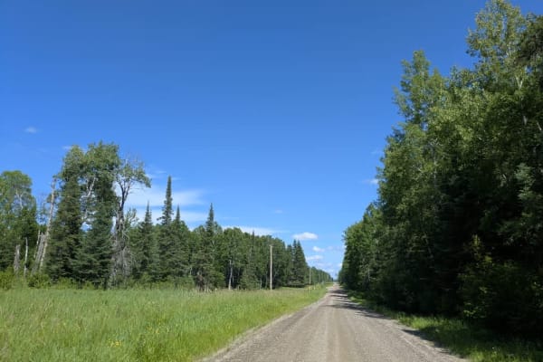
Goodell Road
Goodell Road begins as a straight, smooth trail with a well-maintained surface of gravel and sand. It winds through fields and forests, passing a few homesteads. The trail starts off paved Highway 25. For the first stretch, it offers easy driving conditions, but after crossing Road 73, the character...
Learn more about Goodell Road
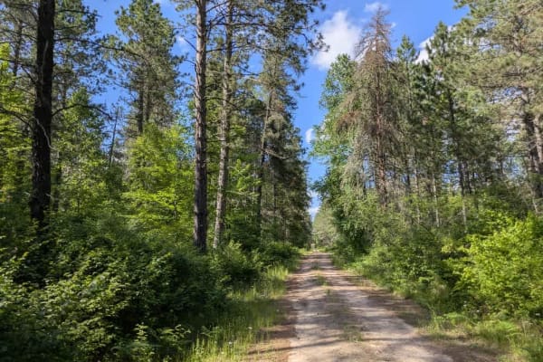
Dark River South
This trail provides access to a section of the Dark River South Trail and intersects with the Taconite ATV and side-by-side trail. From the outset, the route is narrow and increasingly overgrown as it winds its way into the forest, despite the presence of two residences along its length. The trail s...
Learn more about Dark River South
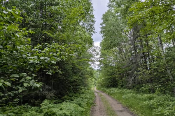
Old Angora Road
Approaching the trail from Hulum Road, the route quickly reveals its more challenging character. It is narrow, twisting, and features rocky, off-camber sections, with occasional steep climbs and muddy patches that can become slick after rain. Vegetation grows tightly along the sides, and drivers of ...
Learn more about Old Angora Road
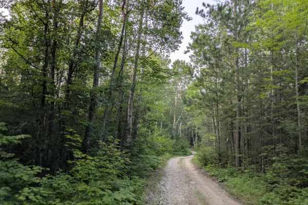
Shuster Road
This long trail requires a permit for access and is rated a three due to its rugged, technical nature. The route is rocky and uneven, with steep climbs and descents that make for a slow but rewarding drive. It is especially popular with ATV and side-by-side riders looking for a more adventurous outi...
Learn more about Shuster Road
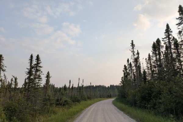
Elbow Lake
This trail offers a variety of features and sees frequent use throughout the year. It consists of flat, two-vehicle-wide gravel and remains mostly level along its length, with only a few gentle curves. Due to the high volume of traffic, the surface is heavily corrugated in most areas, which may affe...
Learn more about Elbow Lake
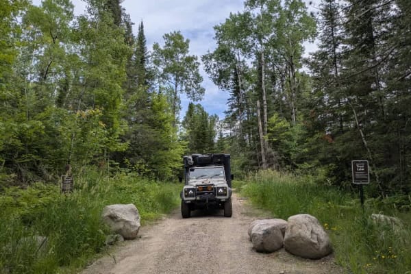
Deep Water Lake
This trail leads to Deep Water Lake, a trout lake where fishing is only permitted during the designated season. Access appears to be intentionally restricted during the off-season, with large boulders placed to block the trail entrance, but cleared in June. The route begins as an unmaintained gravel...
Learn more about Deep Water Lake
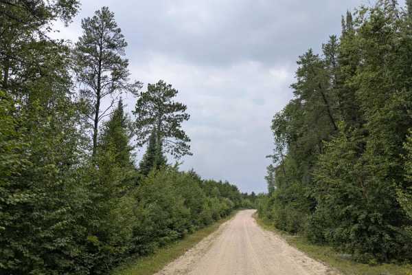
FS 610
This trail presents a challenging route for overlanders, especially during the warmer months. It begins as a wide, well-maintained gravel road that is smooth and easily navigable, offering a relatively relaxed start. The main gravel road curves left toward a lake with a beach that locals consider on...
Learn more about FS 610
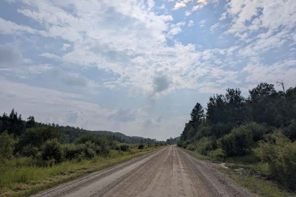
County Road 180
This trail is a long, smooth, and well-maintained gravel route. It is wide enough for two vehicles and travels through forested terrain with a series of gradual ascents and descents. Early on, the trail passes a logging operation, and numerous residences line parts of the route, so drivers should be...
Learn more about County Road 180
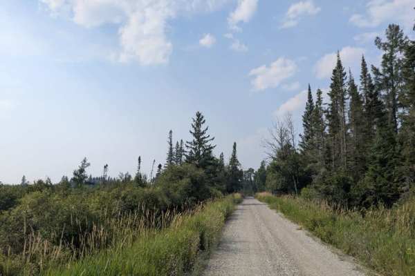
Murray Road
This off-road trail, designated for ATV, SXS, and highway-legal vehicles, begins just off Highway 1 and follows a wide, well-maintained gravel route through dense forest. The initial section of the trail is broad and smooth, winding gently until it intersects a private road marked clearly with a sto...
Learn more about Murray Road

Echo Trail
Echo Trail, a former logging trail that runs through Superior National Forest, is one of northern Minnesota's most scenic and accessible ORV trails. Technically, the whole trail spans over 70 miles with a mix of road surfaces including pavement, however, this report is primarily concerned with the e...
Learn more about Echo Trail
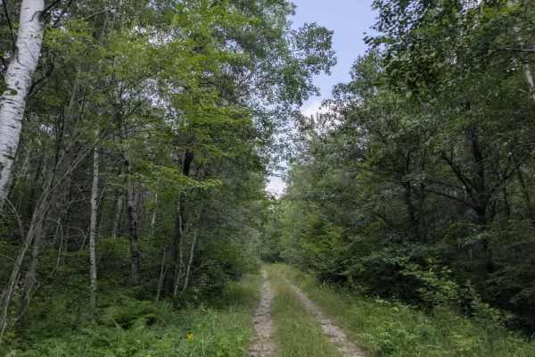
Joko
This trail branches off the Echo Trail and offers a rugged, enjoyable drive through dense forest. From the beginning, it is narrow, overgrown, and marked by rocks and bumps, making vehicle pinstriping nearly unavoidable. The route includes a series of gradual ascents and descents as it winds its way...
Learn more about Joko
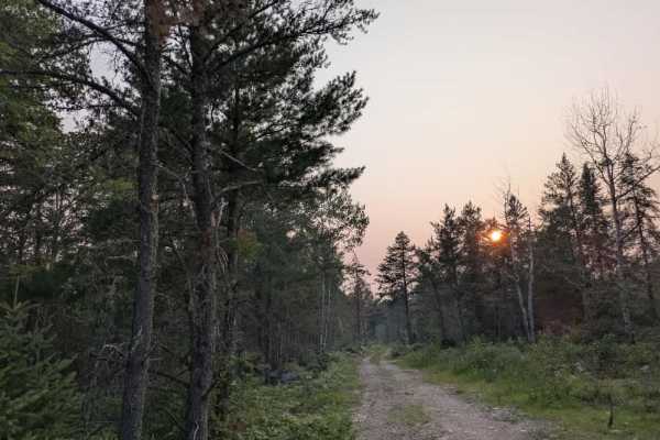
Maude Lake
This trail is an unmaintained, narrow gravel two-track that winds through forested terrain and features a mix of ascents and descents, some of which are steep and lined with large rocks. The route appears to serve industrial activity, and sections of the forest alongside the trail have been cleared ...
Learn more about Maude Lake
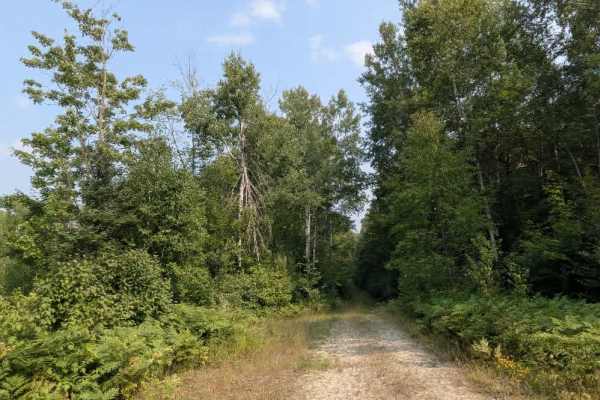
FS 487AB
This trail is accessed via Forest Service Road 487A and consists of a mix of gravel and rock. It begins as an overgrown two-track that winds through dense forest, with moderate ascents and descents along its route. Some sections can be quite bumpy, muddy, and wet, especially after rainfall. The trai...
Learn more about FS 487AB
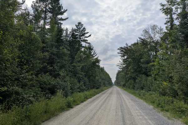
FS 203
This trail follows a wide, well-maintained gravel road that winds through a forested area with a mix of ascents and descents. It provides a relatively smooth and accessible route, though users should be aware of occasional local traffic. Several side trails branch off from the main route, including ...
Learn more about FS 203
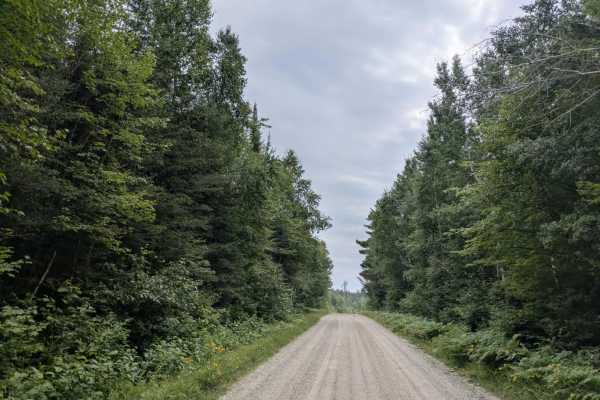
Elephant Lake
This trail is a well-maintained gravel road that is wide enough for two vehicles to pass and winds through a scenic section of forest. It features several steep ascents and descents and offers views of creeks and wetlands along the way. A number of trails branch off from the main route, including se...
Learn more about Elephant Lake
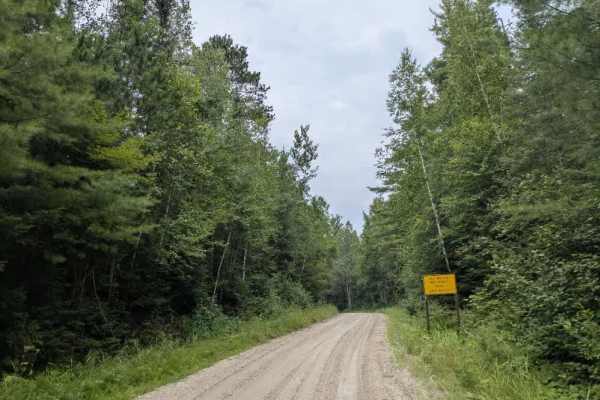
FS 493
This trail is primarily a single-lane, well-maintained gravel route that winds through a scenic forested landscape with rolling terrain, including gentle ups and downs. Along the way, it passes several creeks and wetlands before reaching a sign indicating that public use is permitted only during dry...
Learn more about FS 493
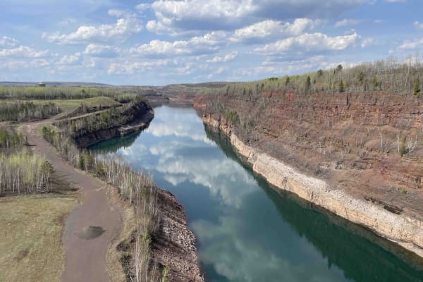
Core Trail
This is a dirt trail with tons of rocks. Most of the trail is open to all uses, but the stretch from Eveleth and Virginia to the main trail is only open to ATVs and OHM. It has a great overlook. Great way to get from Virginia to the OHV park. If on an ATV or OHM, the bridge over the query has some a...
Learn more about Core Trail
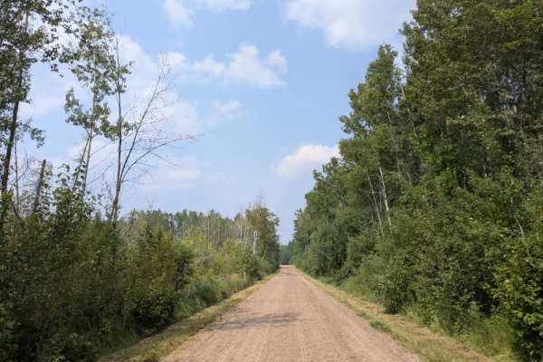
Gold Mine Road
This trail begins as a wide, well-maintained route that passes several older residential properties. The presence of homes and driveways along this initial stretch means that users should drive cautiously and respect local traffic. After the first group of residences, the trail narrows into a two-tr...
Learn more about Gold Mine Road
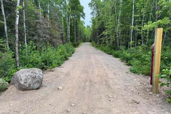
North Roll
This trail is located within the newly developed expansion area of the park and offers a smooth, easy ride suitable for all vehicle types. The surface is primarily gravel, providing solid traction and a straightforward path with no technical challenges or obstacles. It's ideal for beginners, stock v...
Learn more about North Roll
ATV trails near Cook, Minnesota
Explore ATV-friendly trails near you. These trails are accessible for vehicles up to 50 inches wide, perfect for ATVs and smaller off-road machines.
FS 248
The first part of the trail splits between private property and national forest land and is smooth and well-maintained. The second portion of the trail is a rough and rugged route designed for off-road vehicles, including ATVs, side-by-sides, and 4WD trucks or Jeeps. While it starts off relatively s...
Learn more about FS 248
Goodell Road
Goodell Road begins as a straight, smooth trail with a well-maintained surface of gravel and sand. It winds through fields and forests, passing a few homesteads. The trail starts off paved Highway 25. For the first stretch, it offers easy driving conditions, but after crossing Road 73, the character...
Learn more about Goodell Road
Dark River South
This trail provides access to a section of the Dark River South Trail and intersects with the Taconite ATV and side-by-side trail. From the outset, the route is narrow and increasingly overgrown as it winds its way into the forest, despite the presence of two residences along its length. The trail s...
Learn more about Dark River South
Old Angora Road
Approaching the trail from Hulum Road, the route quickly reveals its more challenging character. It is narrow, twisting, and features rocky, off-camber sections, with occasional steep climbs and muddy patches that can become slick after rain. Vegetation grows tightly along the sides, and drivers of ...
Learn more about Old Angora Road
UTV/side-by-side trails near Cook, Minnesota
Find UTV and side-by-side trails near you. These trails accommodate vehicles up to 60 inches wide, ideal for UTVs, side-by-sides, and wider off-road rigs.
FS 248
The first part of the trail splits between private property and national forest land and is smooth and well-maintained. The second portion of the trail is a rough and rugged route designed for off-road vehicles, including ATVs, side-by-sides, and 4WD trucks or Jeeps. While it starts off relatively s...
Learn more about FS 248
Goodell Road
Goodell Road begins as a straight, smooth trail with a well-maintained surface of gravel and sand. It winds through fields and forests, passing a few homesteads. The trail starts off paved Highway 25. For the first stretch, it offers easy driving conditions, but after crossing Road 73, the character...
Learn more about Goodell Road
Dark River South
This trail provides access to a section of the Dark River South Trail and intersects with the Taconite ATV and side-by-side trail. From the outset, the route is narrow and increasingly overgrown as it winds its way into the forest, despite the presence of two residences along its length. The trail s...
Learn more about Dark River South
Old Angora Road
Approaching the trail from Hulum Road, the route quickly reveals its more challenging character. It is narrow, twisting, and features rocky, off-camber sections, with occasional steep climbs and muddy patches that can become slick after rain. Vegetation grows tightly along the sides, and drivers of ...
Learn more about Old Angora Road
The onX Offroad Difference
onX Offroad combines trail photos, descriptions, difficulty ratings, width restrictions, seasonality, and more in a user-friendly interface. Available on all devices, with offline access and full compatibility with CarPlay and Android Auto. Discover what you're missing today!
Open Trail Map