
Dirt Bike Trails
Near Cliffdell, Washington
Explore All Dirt Bike Trails Near Cliffdell, Washington
Dirt Bike Trails Near Cliffdell, Washington
Discover the best dirt bike trails near you. Browse trail maps, check difficulty ratings, and find your next adventure — whether you're looking for a quick ride or an all-day expedition.
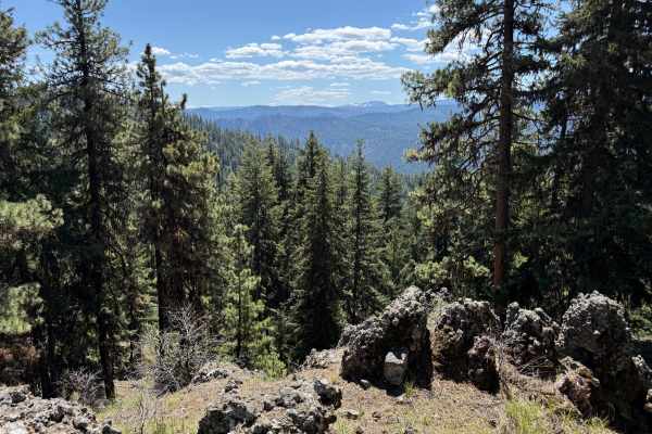
Pine Tar
This is a single-width 4x4 trail with a few spots to pass, pin-stripe potential, shelf roads, and a couple of ledges that could pose a challenge to AWD vehicles. This is a point-to-point trail with fun terrain that climbs a hill and traverses a ridge ending at an old logging landing at the end that ...
Learn more about Pine Tar
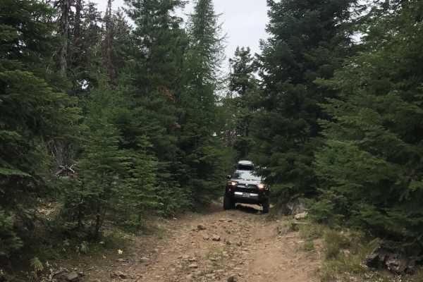
Swamp Devil Connection
This is a short 3.6-mile connector trail between Devil Creek and Swamp Creek watersheds. This trail is relatively easy in dry conditions and can be traversed with a two-wheel drive vehicle with decent ground clearance. There is one steep ascent/descent (direction-dependent) which is slightly off-cam...
Learn more about Swamp Devil Connection

Rock Creek Road
This 9-mile point-to-point road takes you from Highway 410 up to Bald Mountain Road. The first mile passes through private property, be respectful and drive slowly and stay on the road. As you climb in altitude the views become amazing as you can see Mount Rainer in the distance. This road is mainta...
Learn more about Rock Creek Road
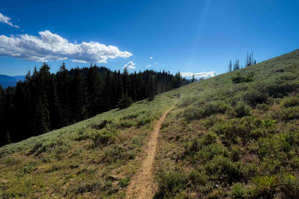
Gold Creek - FS 966
The Gold Creek trail is a short segment of single track from Gold Creek Road, a rocky 4x4 trail, down to the Gold Creek Trailhead at the end of FS 1703. It’s a narrow side-hilling trail for the majority of the route. It traverses the hillside with several short climbs up and down. The side-hilling s...
Learn more about Gold Creek - FS 966
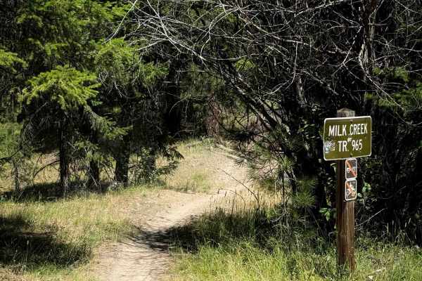
Milk Creek - FS 965
Milk Creek (FS 965) is a moderately challenging 3.4-mile single-track trail within the Manastash OHV Trail system. Climbing steadily from west to east through the Okanogan-Wenatchee National Forest, the route gains approximately 1,750 feet. The journey starts on the forest floor and winds through ro...
Learn more about Milk Creek - FS 965
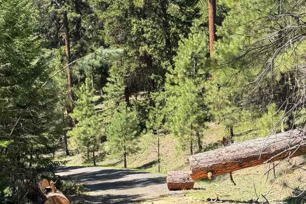
Pine Creek Road
This road is a nice drive with lots of beautiful meadows and camping spots along the way. The map shows it connecting at Highway 410; however, it does not. There is a permanent barrier placed to reroute logging operations away from Boulder Cave State Park. Do not go this way expecting a shortcut to ...
Learn more about Pine Creek Road
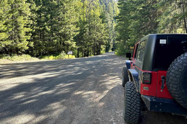
Milk Creek Road
This 8.1-mile point-to-point trail travels along Milk Creek, passes by Milk Pond (picnic area), and ends at Milk Lake. Enjoy the winding road as it climbs up Manastash Ridge toward Bald Mountain. This trail turns into a 4WD trail past Milk Lake. Passable by stock 4WD and high clearance 2WD vehicles.
Learn more about Milk Creek Road
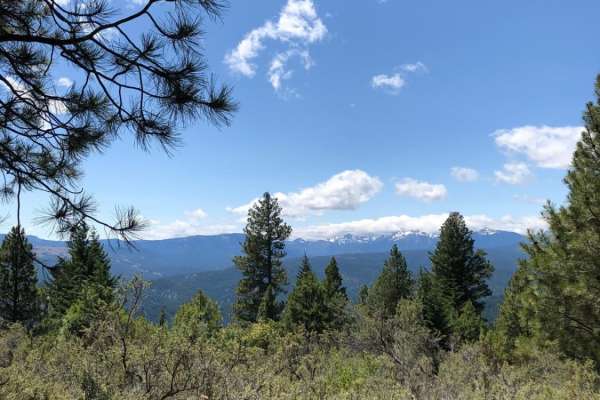
Lower Mud Lake Road
Lower Mud Lake Road is primarily a dirt and gravel road with limited obstacles. There are some rutted sections, and some descents contain loose rocks, but it's very easy going for the most part. Be aware of dust kick-up in some areas when dry, as this can limit field of vision and make the terrain a...
Learn more about Lower Mud Lake Road
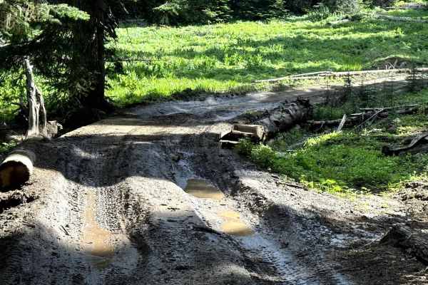
Milk Creek 4WD Trail
This 3.1-mile point-to-point trail connects Milk Creek Road to the Funny Rocks and Moon Rocks OHV areas. This portion of Milk Creek Road is considered 4WD, there are several sections of this trail that have washed out from snow runoff and heavy rainfall. This trail also passes Five Fingers Hill. It ...
Learn more about Milk Creek 4WD Trail
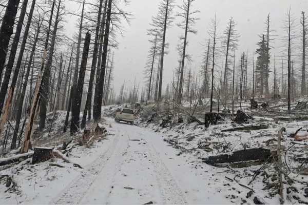
Little Bald
This trail encompasses shelf roads, loose rock, off-camber sections, and smooth trails. Depending on the season, there will be snow and, more dangerously, slick trails to a fire lookout tower. This route covers a classic off-road journey in the Naches Ranger District of the Okanogan-Wenatchee Nation...
Learn more about Little Bald
Milk Creek
This delightful trail is nestled in the Okanogan-Wenatchee National Forest and takes you through a beautiful, mature old-growth Ponderosa Pine. You'll find shady spots that offer a refreshing escape from the bright sun in eastern Washington. The best part of this adventure is a charming little alpin...
Learn more about Milk Creek
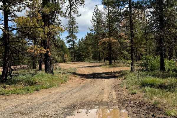
FS 1714-675
This is a dirt-based forest road that is narrow and one lane wide. In some areas, the trail is two-track, and for most of the trail, it is bumpy and rocky. There are mud holes and ruts that are a foot or more in some areas, and this is a free-range area for cattle, which are frequently on the trail....
Learn more about FS 1714-675
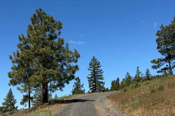
Benton - FS 1701-517
This is a gravel-based forest road that is mostly hard-packed and smooth and transitions to dirt near the end. Once you hit the dirt sections, there are a couple of mud holes/puddles and a section where you will encounter ruts up to a foot deep in the mud. As you gradually climb this trail, you are ...
Learn more about Benton - FS 1701-517
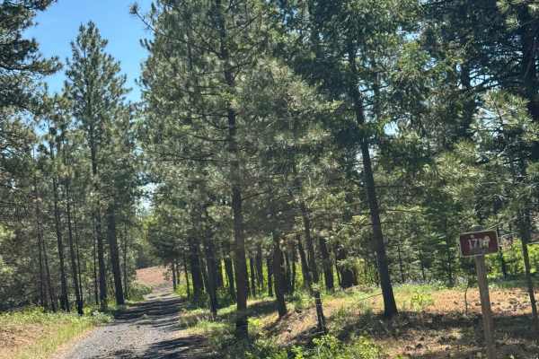
Rocky Point - FS 1714
This is a narrow, one-lane, dirt-based forest road. The trail has some two-track sections and climbs over 1,000 feet in elevation. The climb is gradual, other than the very last portion, which is a long, steep climb at a 21% pitch. The trail is extremely bumpy with rock garden sections, and you will...
Learn more about Rocky Point - FS 1714
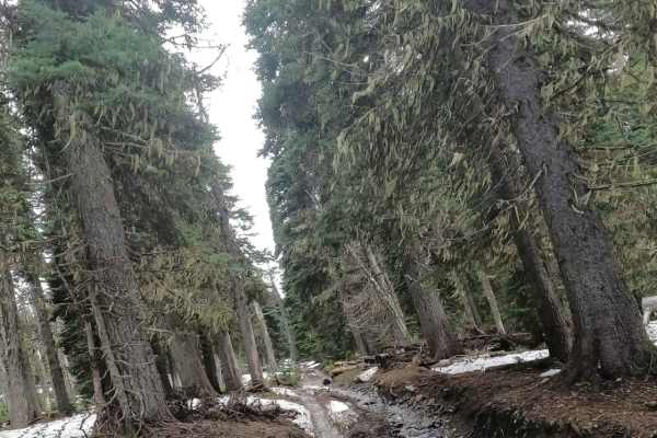
4W CJRs Hideout - NF1701-530
This is a tight and twisty 4WD trail connecting Summit Trail to Bald Mountain. Once the trail approaches Bald Mountain, it opens up to a fast rock road. It is primarily designed for short-wheel-based vehicles and UTVs. The segment north of Moon Rocks is on a North-facing slope and in tight trees and...
Learn more about 4W CJRs Hideout - NF1701-530
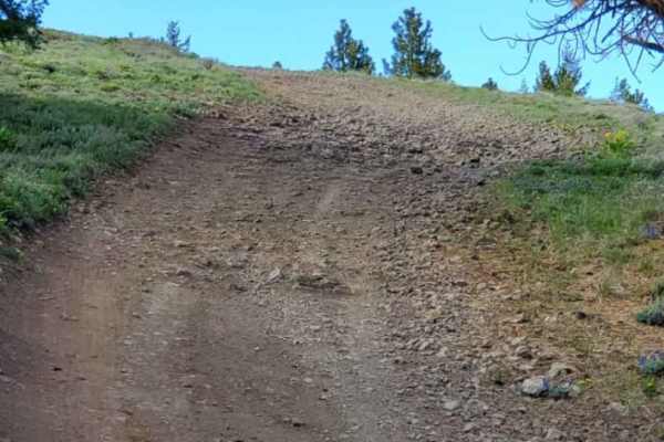
Cleman Mountain
The Cleman Mountain trail is a relatively easy trail with great views. This trail is mainly a one vehicle wide road with lots of wide places to pass. The trail does not have many obstacles but is very rough with some loose rock and a few rutted sections. Along the way you will go through some meadow...
Learn more about Cleman Mountain
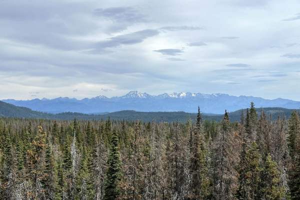
Tripod Flats Trail
This 5.1-mile point-to-point trail connects the Manastash Divide Area Trailhead and campground to the Milk Creek Area, Funny Rocks and Moon Rocks OHV areas. This trail winds through the Wenatchee National Forest. Tree roots, rocks, and mud holes are found throughout this trail. Several narrow passes...
Learn more about Tripod Flats Trail
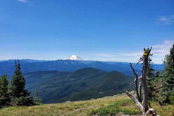
4W330 Tipover
Tipover is located in the Okanogan-Wenatchee National Forest. The trail ascends 2.5 miles to an elevation of just over 5,900 feet. Most of the trail is covered in lava rock and loose dirt, with towering rock walls rising above. Just when you think you'll escape the rocky path, you enter the Silver F...
Learn more about 4W330 Tipover

Indian Flat - FS 955
Indian Flat Trail descends from the West Quartz Creek Loop singletrack to the Indian Flats Trailhead on the Washington 410 highway. The descent from north to south is quite steep, as the trail drops almost 950 feet over 1.7 miles. The majority of the trail is side-hilling on a narrow single track on...
Learn more about Indian Flat - FS 955
Quartz Creek Road
This 6.3-mile point-to-point road gives access to many 4WD trails and the Green Diamond Trail system. The views of the Wenatchee National Forest are stunning along this trail. There are several dispersed camping locations along this road. This is a maintained forest service road that is passable by ...
Learn more about Quartz Creek Road
ATV trails near Cliffdell, Washington
Explore ATV-friendly trails near you. These trails are accessible for vehicles up to 50 inches wide, perfect for ATVs and smaller off-road machines.
Pine Tar
This is a single-width 4x4 trail with a few spots to pass, pin-stripe potential, shelf roads, and a couple of ledges that could pose a challenge to AWD vehicles. This is a point-to-point trail with fun terrain that climbs a hill and traverses a ridge ending at an old logging landing at the end that ...
Learn more about Pine Tar
Swamp Devil Connection
This is a short 3.6-mile connector trail between Devil Creek and Swamp Creek watersheds. This trail is relatively easy in dry conditions and can be traversed with a two-wheel drive vehicle with decent ground clearance. There is one steep ascent/descent (direction-dependent) which is slightly off-cam...
Learn more about Swamp Devil Connection
Rock Creek Road
This 9-mile point-to-point road takes you from Highway 410 up to Bald Mountain Road. The first mile passes through private property, be respectful and drive slowly and stay on the road. As you climb in altitude the views become amazing as you can see Mount Rainer in the distance. This road is mainta...
Learn more about Rock Creek Road
Pine Creek Road
This road is a nice drive with lots of beautiful meadows and camping spots along the way. The map shows it connecting at Highway 410; however, it does not. There is a permanent barrier placed to reroute logging operations away from Boulder Cave State Park. Do not go this way expecting a shortcut to ...
Learn more about Pine Creek Road
UTV/side-by-side trails near Cliffdell, Washington
Find UTV and side-by-side trails near you. These trails accommodate vehicles up to 60 inches wide, ideal for UTVs, side-by-sides, and wider off-road rigs.
Pine Tar
This is a single-width 4x4 trail with a few spots to pass, pin-stripe potential, shelf roads, and a couple of ledges that could pose a challenge to AWD vehicles. This is a point-to-point trail with fun terrain that climbs a hill and traverses a ridge ending at an old logging landing at the end that ...
Learn more about Pine Tar
Swamp Devil Connection
This is a short 3.6-mile connector trail between Devil Creek and Swamp Creek watersheds. This trail is relatively easy in dry conditions and can be traversed with a two-wheel drive vehicle with decent ground clearance. There is one steep ascent/descent (direction-dependent) which is slightly off-cam...
Learn more about Swamp Devil Connection
Rock Creek Road
This 9-mile point-to-point road takes you from Highway 410 up to Bald Mountain Road. The first mile passes through private property, be respectful and drive slowly and stay on the road. As you climb in altitude the views become amazing as you can see Mount Rainer in the distance. This road is mainta...
Learn more about Rock Creek Road
Pine Creek Road
This road is a nice drive with lots of beautiful meadows and camping spots along the way. The map shows it connecting at Highway 410; however, it does not. There is a permanent barrier placed to reroute logging operations away from Boulder Cave State Park. Do not go this way expecting a shortcut to ...
Learn more about Pine Creek Road
The onX Offroad Difference
onX Offroad combines trail photos, descriptions, difficulty ratings, width restrictions, seasonality, and more in a user-friendly interface. Available on all devices, with offline access and full compatibility with CarPlay and Android Auto. Discover what you're missing today!
Open Trail Map