
Dirt Bike Trails
Near Claremont, California
Explore All Dirt Bike Trails Near Claremont, California
Dirt Bike Trails Near Claremont, California
Discover the best dirt bike trails near you. Browse trail maps, check difficulty ratings, and find your next adventure — whether you're looking for a quick ride or an all-day expedition.
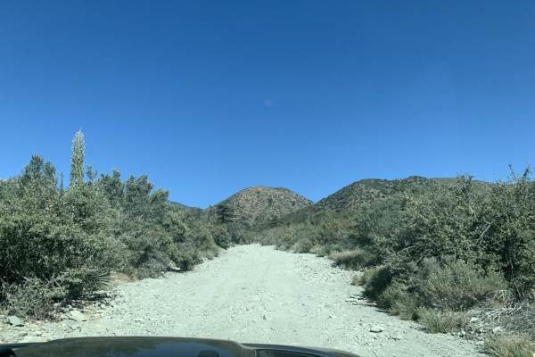
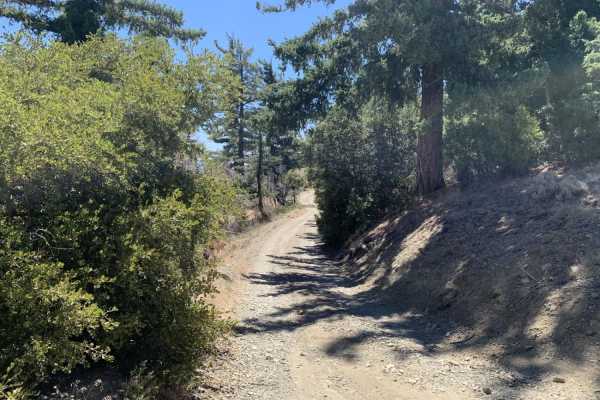
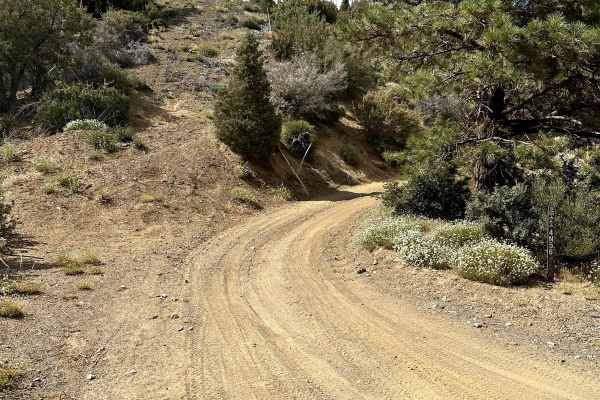
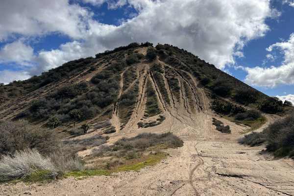
Slade Canyon
This is a a fun, quick trail that leads you up into the mountains from the creek bed below. After heavy snowfall, ice could make for very dangerous conditions. If snow is present 4WD is a necessity. Street legal vehicles only.
Learn more about Slade Canyon
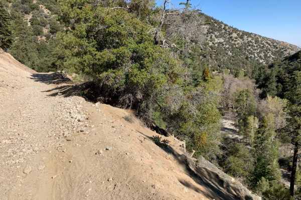
3N06A Cold Water Canyon
A very fun trail, nestled in the canyons off Lytle Creek Road. The trail starts easy, then becomes moderate-difficult as you ascend deeper into the mountains. There are spectacular views throughout the trail, and as you reach the end of the trail, you are welcomed to a large area of dispersed campin...
Learn more about 3N06A Cold Water Canyon

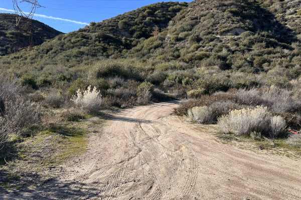
Old Cc Spur - 2N57
This is a 1.4-mile, well-maintained, easy gravel spur road that connects Lytle Creek Road and Lower Lytle Creek Divide - 3N31. This spur road is a convenient way to access Lower Lytle Creek Divide - 3N31, which is an 8.5-mile fun, scenic ridgeline trail above Lytle Creek.
Learn more about Old Cc Spur - 2N57
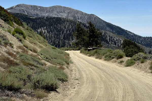
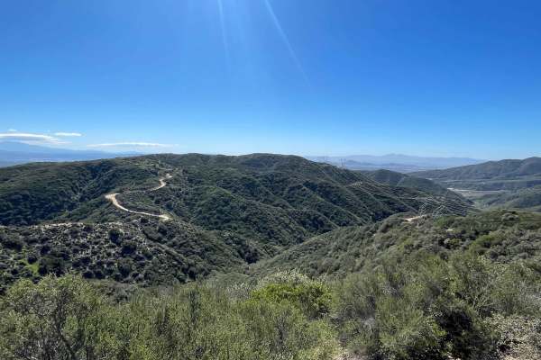
Blue Ridge Truck Trail
This trail is a pretty drive along Blue Ridge in the eastern San Gabriel Mountains. The trail overlooks Mount Baden-Powell, Vincent Gulch, Pine Mountain/Pine Mountain Ridge, the Mountain High ski resort, Wright Mountain, and of course, the towering Mount San Antonio. The trail begins along CA Highwa...
Learn more about Blue Ridge Truck Trail
Sharpless Ranch
This is a simple trail that leads from Lone Pine Canyon Road to Upper Lytle Creek Divide. It is an easy trail that is just a fun little uphill or downhill trail depending on direction that has some rocks and tight turns. The brush can get very overgrown on the trail and can cause some pinstriping on...
Learn more about Sharpless Ranch
Gobblers Knob Spur A
This is a beautiful trail that leads you to the highest point within the little set of trails in this area. It also connects at the top with the Pacific Crest Trail (PCT). Be careful when you reach the top because it is possible for you to find hikers on the PCT at most times of the year. The road i...
Learn more about Gobblers Knob Spur A
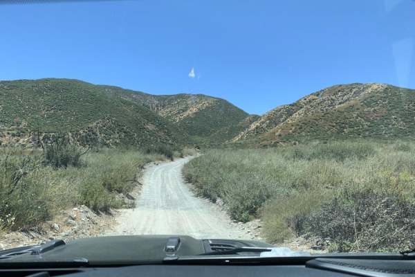
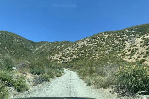
Sheep Canyon
Sheep Canyon is an ideal route for beginner offroaders and drivers of stock SUVs seeking a scenic, low-stress connection between Lytle Creek and Swarthout Canyon. This easy, dirt track winds through the rugged chaparral of the eastern San Gabriel Mountains, offering scenic vistas of the surrounding ...
Learn more about Sheep Canyon

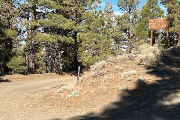
3N26
Trail head starts on Angeles Crest Highway at the Vincent Gap Turnout. It is a very short trail that leads to a locked gate at Jackson Flat Camping Area. The scenery during this trail consists of mature trees providing plenty of shade throughout the trail, views of the Antelope Valley from above, an...
Learn more about 3N26
Lower Lytle Creek Divide - 3N31
The easiest way to start this trail is off the 15 Freeway and Glen Helen Parkway Road to Lower Lytle Creek Divide - 3N31. There are a couple of residences on the right-hand side of the road just before the trail begins, so please be mindful of this when airing down/airing up. The trail begins shortl...
Learn more about Lower Lytle Creek Divide - 3N31

Cleghorn Technical Access Road
This trail is full of technical surprises that keep you on your toes. It’s not very well maintained, so some 4x4s will struggle, and dual sport or dirt bikes are definitely the safer bet. You’ll hit 2 or 3 steep uphill climbs that demand careful throttle control, and the downhill sections are washed...
Learn more about Cleghorn Technical Access Road
Old 3N49 Access Road
The Old 3N49 Trail is seriously epic for anyone looking for a challenge. The scenery along the way is stunning, with sweeping views and a lot of terrain variety to keep things interesting. It hasn’t been maintained in a few years, so don’t expect a smooth ride. Sections are washed out, strewn with r...
Learn more about Old 3N49 Access Road
3N267 Fenner Saddle (4N12)
The trail starts at the third quarter into marked trail 3N26. There is shade for more than half of the trail from mature tree and a hillside for the majority of the trail. During certain times of year, there are shallow creek crossings and obstacles such as fallen trees and boulders from the hillsid...
Learn more about 3N267 Fenner Saddle (4N12)
Mescal Canyon Road
This trail can be approached from South to North or North to South. North to South will be more challenging because it is going up hill. Mainly dirt and small rocks make up the trail. The main road is wide enough for a vehicle to move aside and let others pass if needed. It is a two way trail, so wa...
Learn more about Mescal Canyon Road
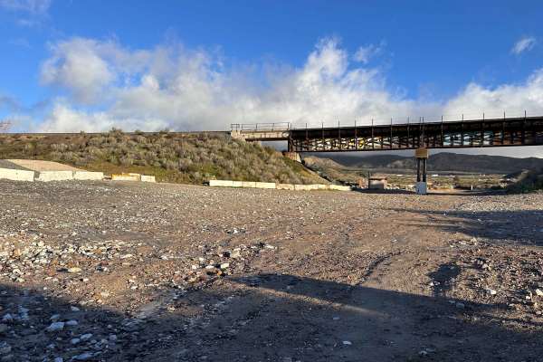
Cleghorn Tracks
Cleghorn Tracks takes you through some really interesting geological terrain with plenty to check out along the way. One highlight is spotting the old train tracks tucked into the landscape—they make for a fun little photo op. The trail is mostly easy riding, with a few water crossings that add a bi...
Learn more about Cleghorn Tracks
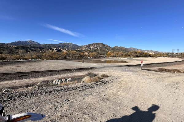
Baldy Mesa Staging Corridor
This popular entry point provides off-road enthusiasts with quick access to some of the closest OHV areas in San Bernardino. Located right off the 15 freeway, the trail begins with a bumpy access road that leads to a spacious staging area. Approximately one mile in, you’ll find public restrooms, mak...
Learn more about Baldy Mesa Staging Corridor
Pinyon Ridge Truck Trail
This is a mellow trail along Pinyon Ridge, which is just west of Vincent Gap and Blue Ridge. The trail itself is mellow and surrounded by - you guessed it - single-leaf/needle Pinyon pine trees, which are the namesake of the ridge and native to only the Western United States. There are no less than ...
Learn more about Pinyon Ridge Truck Trail
Cleghorn Ridge Entry
One of Southern California’s gateways to some solid off-road trails and adventure roads. Parking is limited, so don’t expect a big welcoming lot. The area has a bit of a sketchy reputation, so keep your head on a swivel. The ride up is short but delivers some killer views overlooking Interstate 15. ...
Learn more about Cleghorn Ridge Entry
Cleghorn CA-15 Overlook
This trail offers a solid mix of easy riding and great scenery. The main road stays mostly clear and well-maintained, making it friendly for 4x4s and dual sport or dirt bikes. Surface conditions are usually firm and predictable in dry weather. There are a couple of cool water crossings that add some...
Learn more about Cleghorn CA-15 Overlook
Upper Cleghorn Ridge
Great trail to overlook the California Interstate 15. Pretty rad views. What starts out manageable quickly turns rough, with deep ruts, heavy erosion, and uneven surfaces that get chewed up after storms. Loose rock, sand, and washed-out sections are common and can make parts of the route very diffic...
Learn more about Upper Cleghorn Ridge
The Widow Maker
The legend of "The Widow Maker" precedes itself among local riders, standing as a rite of passage for those with enough grit to attempt the ascent. This iconic hill climb offers an adrenaline-pumping vertical challenge that rewards successful climbers with some of the most spectacular, high-altitude...
Learn more about The Widow Maker
ATV trails near Claremont, California
Explore ATV-friendly trails near you. These trails are accessible for vehicles up to 50 inches wide, perfect for ATVs and smaller off-road machines.
Old Cc Spur - 2N57
This is a 1.4-mile, well-maintained, easy gravel spur road that connects Lytle Creek Road and Lower Lytle Creek Divide - 3N31. This spur road is a convenient way to access Lower Lytle Creek Divide - 3N31, which is an 8.5-mile fun, scenic ridgeline trail above Lytle Creek.
Learn more about Old Cc Spur - 2N57
Blue Ridge Truck Trail
This trail is a pretty drive along Blue Ridge in the eastern San Gabriel Mountains. The trail overlooks Mount Baden-Powell, Vincent Gulch, Pine Mountain/Pine Mountain Ridge, the Mountain High ski resort, Wright Mountain, and of course, the towering Mount San Antonio. The trail begins along CA Highwa...
Learn more about Blue Ridge Truck Trail
3N26
Trail head starts on Angeles Crest Highway at the Vincent Gap Turnout. It is a very short trail that leads to a locked gate at Jackson Flat Camping Area. The scenery during this trail consists of mature trees providing plenty of shade throughout the trail, views of the Antelope Valley from above, an...
Learn more about 3N26
Lower Lytle Creek Divide - 3N31
The easiest way to start this trail is off the 15 Freeway and Glen Helen Parkway Road to Lower Lytle Creek Divide - 3N31. There are a couple of residences on the right-hand side of the road just before the trail begins, so please be mindful of this when airing down/airing up. The trail begins shortl...
Learn more about Lower Lytle Creek Divide - 3N31
UTV/side-by-side trails near Claremont, California
Find UTV and side-by-side trails near you. These trails accommodate vehicles up to 60 inches wide, ideal for UTVs, side-by-sides, and wider off-road rigs.
Old Cc Spur - 2N57
This is a 1.4-mile, well-maintained, easy gravel spur road that connects Lytle Creek Road and Lower Lytle Creek Divide - 3N31. This spur road is a convenient way to access Lower Lytle Creek Divide - 3N31, which is an 8.5-mile fun, scenic ridgeline trail above Lytle Creek.
Learn more about Old Cc Spur - 2N57
Blue Ridge Truck Trail
This trail is a pretty drive along Blue Ridge in the eastern San Gabriel Mountains. The trail overlooks Mount Baden-Powell, Vincent Gulch, Pine Mountain/Pine Mountain Ridge, the Mountain High ski resort, Wright Mountain, and of course, the towering Mount San Antonio. The trail begins along CA Highwa...
Learn more about Blue Ridge Truck Trail
3N26
Trail head starts on Angeles Crest Highway at the Vincent Gap Turnout. It is a very short trail that leads to a locked gate at Jackson Flat Camping Area. The scenery during this trail consists of mature trees providing plenty of shade throughout the trail, views of the Antelope Valley from above, an...
Learn more about 3N26
Lower Lytle Creek Divide - 3N31
The easiest way to start this trail is off the 15 Freeway and Glen Helen Parkway Road to Lower Lytle Creek Divide - 3N31. There are a couple of residences on the right-hand side of the road just before the trail begins, so please be mindful of this when airing down/airing up. The trail begins shortl...
Learn more about Lower Lytle Creek Divide - 3N31
The onX Offroad Difference
onX Offroad combines trail photos, descriptions, difficulty ratings, width restrictions, seasonality, and more in a user-friendly interface. Available on all devices, with offline access and full compatibility with CarPlay and Android Auto. Discover what you're missing today!
Open Trail Map