
Dirt Bike Trails
Near Central City, South Dakota
Explore All Dirt Bike Trails Near Central City, South Dakota
Dirt Bike Trails Near Central City, South Dakota
Discover the best dirt bike trails near you. Browse trail maps, check difficulty ratings, and find your next adventure — whether you're looking for a quick ride or an all-day expedition.
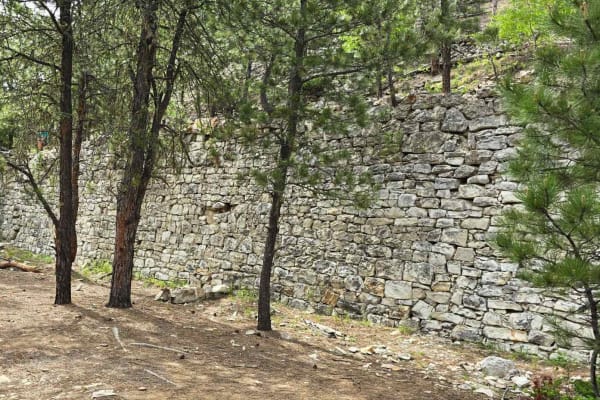
China Wall Trail
Another fantastic historical site in the Black Hills National Forest is the China Wall. The waypoint on the track shows exactly where the hike begins, and it's only about 600 yards to the wall. It's well worth the hike. The trail begins at Highway 385 on the south, and it runs up through Galena and ...
Learn more about China Wall Trail
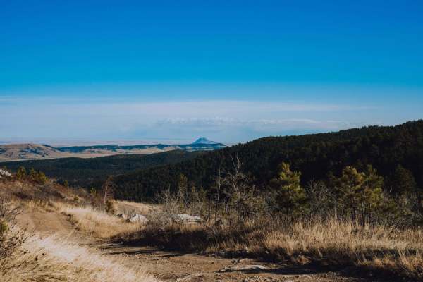
Spearfish Mountain
Spearfish Mountain is one of the three peaks that make up the mountains surrounding Spearfish. It is the only one accessible by off road vehicles. A short drive down Christensen Drive will lead you to the trail head. From here there is one main shot up to the top with a few different spurs off the m...
Learn more about Spearfish Mountain
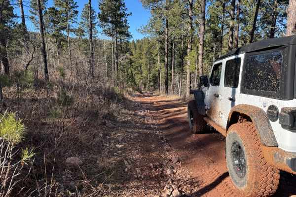
FS 567.1
This trail is a 1.6-mile connecting route between Lost Gulch (FS 172.1) and the China Wall Trail. It consists of packed gravel, loose rocks, mild climbs and descents, as well as smaller ruts and mud puddles. It meets up with Lost Gulch at (44.36499, -103.61948) and connects to the China Wall Trail a...
Learn more about FS 567.1
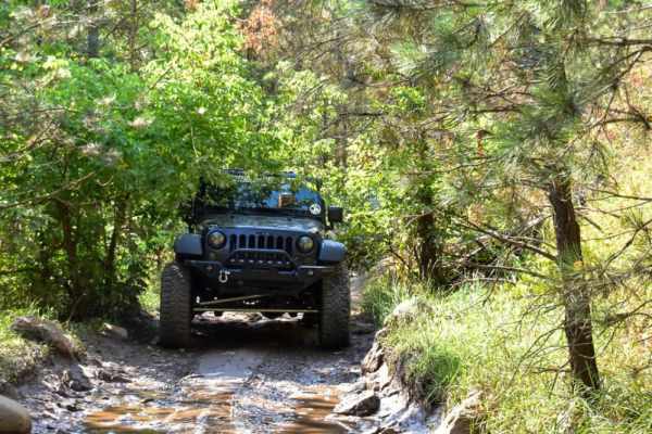
Camp 5
This is a fun trail that offers access to several other trails in the area, such as Calamity Canyon and Kong, and it parallels Hal Johns for much of the trail. There are several spots that require careful tire placement. The trail is narrow with tight trees in many spots along the trail, so expect p...
Learn more about Camp 5
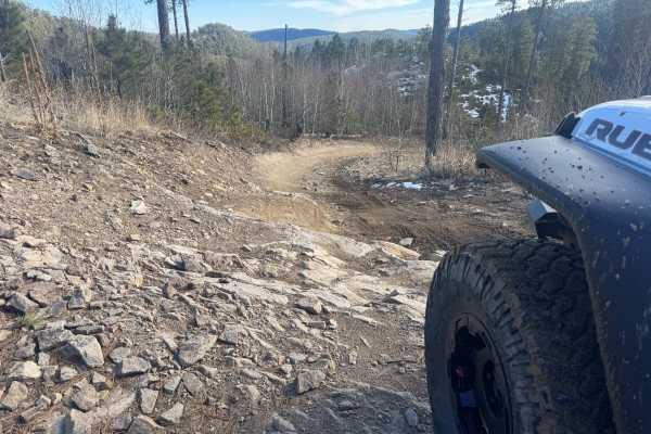
Lost Gulch - FS 172.1
Lost Gulch (FS 172.1) is a minimally maintained forest service road that takes you between the Camp 5 area and Galena. This trail runs north and south. This trail is a combination of hard-packed dirt, loose rocks, larger stationary rocks, and loose gravel. There are large ruts and mud puddles throug...
Learn more about Lost Gulch - FS 172.1
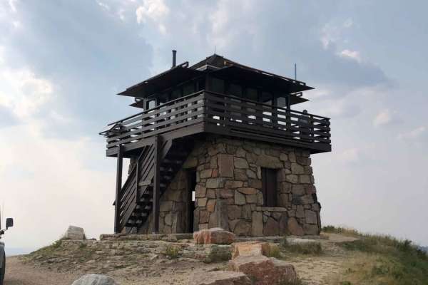
Cement Ridge Fire Lookout
Leaving Spearfish Canyon from Savoy, you'll find yourself on Roughlock Falls Road, a well-maintained gravel road that leads you up to Cement Ridge Fire Lookout, which boasts expansive views of the Black Hills Forest and surrounding area. If you decide to take the trail down to Grand Canyon Road, bew...
Learn more about Cement Ridge Fire Lookout
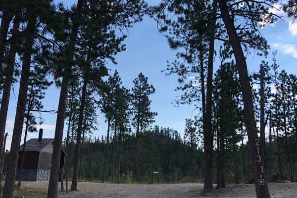
Custer Peak Fire Lookout
The trail up to Custer Peak Fire Lookout offers riders views of the Black Hills National Forest that are second to none. The lookout was first built in 1911 and replaced in 1935 with the Cupola Building. Finally, in 1941, the Civilian Conservation Corps rebuilt the lookout with local materials to wh...
Learn more about Custer Peak Fire Lookout
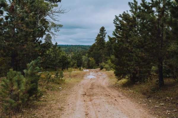
Game Farm
Game farm is a local favorite in the Spearfish Area. The area is a game preserve for the South Dakota Fish and Game Department. It can be accessed from Higgins Gultch Road, or from Tinton in the Big Hill Parking lot. Big Hill offers a staging area with room for trailers. Game Farm offers scenic view...
Learn more about Game Farm
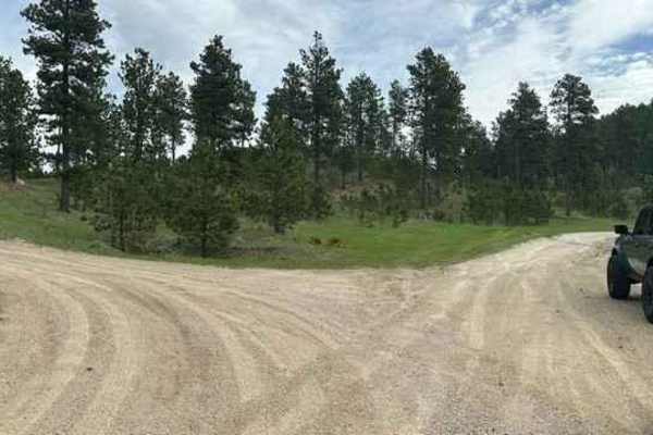
Veterans Peak Trail
This short 0.7-mile trail is an offshoot of Bulldog Trail, quick, and easily accessible from Vanocker Canyon. Upon leaving the highway, you will be presented with two choices. The left trail is Veterans Peak. This is a narrow trail that has a few pull-off locations for oncoming traffic but you'll wa...
Learn more about Veterans Peak Trail
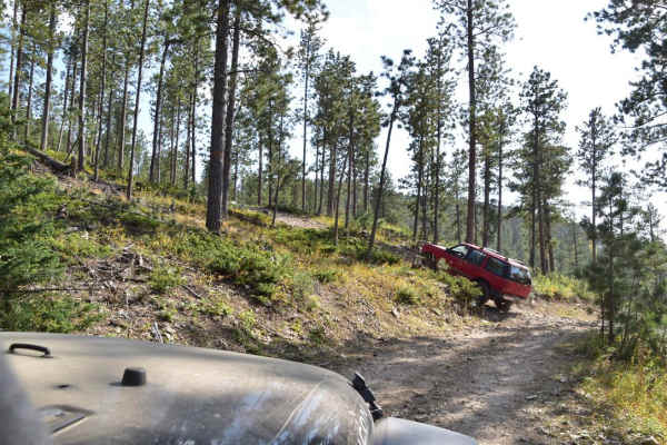
Moses Hill
Moses Hill is a scenic point-to-point trail in the Black Hills of South Dakota. It is named for a very steep portion that gets you to the top of the mountain, which is tree covered, but a short walk brings you to an overlook that allows you to see out of the trees to the surrounding valley. This ste...
Learn more about Moses Hill
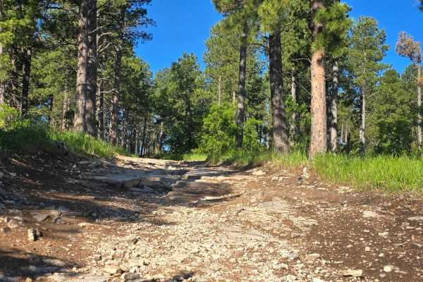
Black Hills Forest Access from Sturgis
Ride from downtown Sturgis, and within just 2 miles, you're on dirt. This is a fun hilly rocky trail that takes you into the Black Hills National Forest without having to travel busy Highway 14A. From this trail, which goes over Red Hill, you can access the Camp 5/Calamity Jane trails area or go to ...
Learn more about Black Hills Forest Access from Sturgis
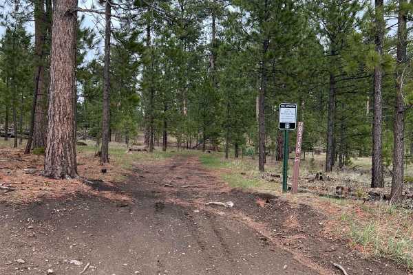
Benchmark Trail
This dirt bike trail has many different surfaces and sections. Part of the trail will almost appear as a full-size truck trail while other sections have narrow pass-throughs between large rocks. There are some rocky inclines and declines but the rocks are not too large. Some areas of this trail see...
Learn more about Benchmark Trail
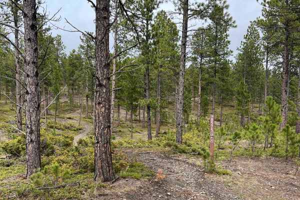
Boxelder Ridge Cut Through Final Leg
This dirt bike only trail in a moderate combination of roots, small water puddles, and rocks. There are some sharper rock sections but overall the trail is tame with no clear large obstacles. There are bushes and stumps to dodge but no narrow sections along this route. You will see almost only ever...
Learn more about Boxelder Ridge Cut Through Final Leg
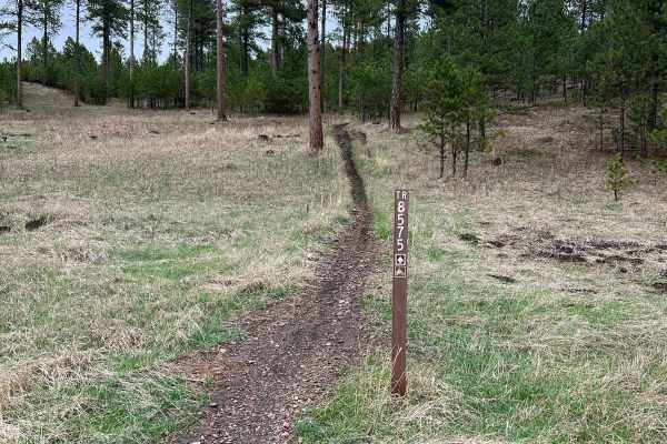
Crystal Mount Single Track
This dirt bike route was a rather smooth and flowy trail. I did not notice many rocks or roots and the bulk of the trail was not overly narrow. One thing that may trip people up is the path itself is quite narrow so if you find yourself catching your tire on the none-dirt portion of the trail, it co...
Learn more about Crystal Mount Single Track
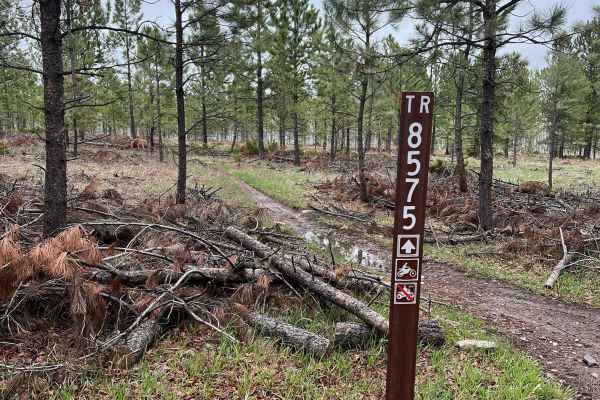
Boxelder Ridge Wooded Hills Cut Through
This dirt bike only trail takes you from many of the trails west of Highway 385 back toward the other trail system east. The trail has some intermittent rocks and roots but is quite wide with very few narrow areas. Overall a smooth trail with great wooded nature to enjoy but rather than needing to w...
Learn more about Boxelder Ridge Wooded Hills Cut Through
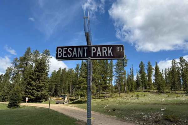
Besant Park Road - FS 206
FS 206 into Besant Park is one of those low-key gems -- narrow in spots, winding through thick timber, and then suddenly opening up into wide meadows that feel like they've been hidden for decades. This route stays mellow overall but has a few tight one-lane sections that add just enough spice. The ...
Learn more about Besant Park Road - FS 206
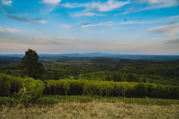
Boundary Gulch
Boundary Gulch trail is a Black Hills favorite for off-road enthusiasts of all kinds. The trail leads you to the Cement Ridge Fire lookout. Along the way, you will find ponds, scenic outlooks and the remnants of Tinton Town, an old mining town that turned into a sawmill for the area. There is privat...
Learn more about Boundary Gulch
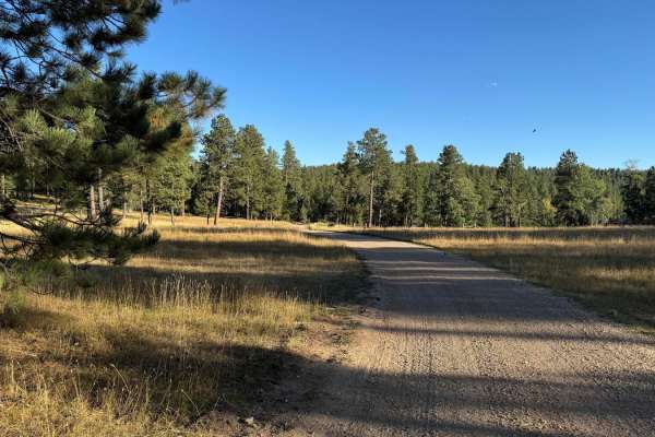
Boles Canyon
Boles Canyon is an easy route from South Rapid to Highway 85, which you can connect to Tinton Road. There is a 400-foot elevation change during this 4.9-mile route. It's a single-lane road that is navigable with any vehicle. The area is used for cattle grazing, so be on the lookout for them.
Learn more about Boles Canyon
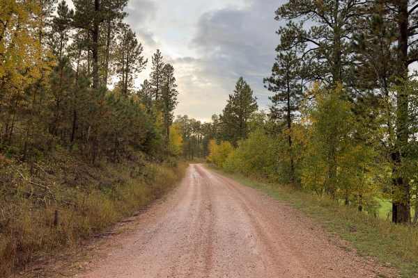
Kelly Spur Road (FS 136) Loop
This is a short detour/loop off Vanocker Canyon Road to the west and is about 2.5 miles between the beginning/end of Vanocker Canyon Road. The southern portion runs east/west along Little Elk Creek and is a maintained road wide enough for two vehicles. Cattle can be seen grazing in the eastern area ...
Learn more about Kelly Spur Road (FS 136) Loop
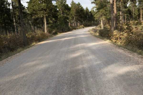
Tinton Road
This is a great way to access trails in the area. It is a wide gravel road with several unloading areas. The traffic can get heavy at times. Beware of dust and wash boards.
Learn more about Tinton Road
ATV trails near Central City, South Dakota
Explore ATV-friendly trails near you. These trails are accessible for vehicles up to 50 inches wide, perfect for ATVs and smaller off-road machines.
China Wall Trail
Another fantastic historical site in the Black Hills National Forest is the China Wall. The waypoint on the track shows exactly where the hike begins, and it's only about 600 yards to the wall. It's well worth the hike. The trail begins at Highway 385 on the south, and it runs up through Galena and ...
Learn more about China Wall Trail
Spearfish Mountain
Spearfish Mountain is one of the three peaks that make up the mountains surrounding Spearfish. It is the only one accessible by off road vehicles. A short drive down Christensen Drive will lead you to the trail head. From here there is one main shot up to the top with a few different spurs off the m...
Learn more about Spearfish Mountain
FS 567.1
This trail is a 1.6-mile connecting route between Lost Gulch (FS 172.1) and the China Wall Trail. It consists of packed gravel, loose rocks, mild climbs and descents, as well as smaller ruts and mud puddles. It meets up with Lost Gulch at (44.36499, -103.61948) and connects to the China Wall Trail a...
Learn more about FS 567.1
Camp 5
This is a fun trail that offers access to several other trails in the area, such as Calamity Canyon and Kong, and it parallels Hal Johns for much of the trail. There are several spots that require careful tire placement. The trail is narrow with tight trees in many spots along the trail, so expect p...
Learn more about Camp 5
UTV/side-by-side trails near Central City, South Dakota
Find UTV and side-by-side trails near you. These trails accommodate vehicles up to 60 inches wide, ideal for UTVs, side-by-sides, and wider off-road rigs.
China Wall Trail
Another fantastic historical site in the Black Hills National Forest is the China Wall. The waypoint on the track shows exactly where the hike begins, and it's only about 600 yards to the wall. It's well worth the hike. The trail begins at Highway 385 on the south, and it runs up through Galena and ...
Learn more about China Wall Trail
Spearfish Mountain
Spearfish Mountain is one of the three peaks that make up the mountains surrounding Spearfish. It is the only one accessible by off road vehicles. A short drive down Christensen Drive will lead you to the trail head. From here there is one main shot up to the top with a few different spurs off the m...
Learn more about Spearfish Mountain
FS 567.1
This trail is a 1.6-mile connecting route between Lost Gulch (FS 172.1) and the China Wall Trail. It consists of packed gravel, loose rocks, mild climbs and descents, as well as smaller ruts and mud puddles. It meets up with Lost Gulch at (44.36499, -103.61948) and connects to the China Wall Trail a...
Learn more about FS 567.1
Camp 5
This is a fun trail that offers access to several other trails in the area, such as Calamity Canyon and Kong, and it parallels Hal Johns for much of the trail. There are several spots that require careful tire placement. The trail is narrow with tight trees in many spots along the trail, so expect p...
Learn more about Camp 5
The onX Offroad Difference
onX Offroad combines trail photos, descriptions, difficulty ratings, width restrictions, seasonality, and more in a user-friendly interface. Available on all devices, with offline access and full compatibility with CarPlay and Android Auto. Discover what you're missing today!
Open Trail Map