
Dirt Bike Trails
Near Cedaredge, Colorado
Explore All Dirt Bike Trails Near Cedaredge, Colorado
Dirt Bike Trails Near Cedaredge, Colorado
Discover the best dirt bike trails near you. Browse trail maps, check difficulty ratings, and find your next adventure — whether you're looking for a quick ride or an all-day expedition.
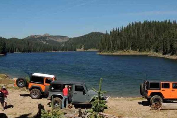
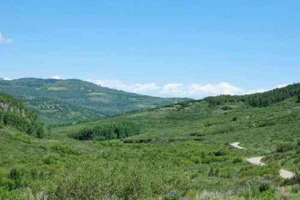
Leon Lake
Leon Lake Jeep trail goes between Cedaredge and Vega Reservoir. A scenic trip, although a bit rocky and bumpy through the center portion. Leon Lake is a beautiful lake at a little over 10,000' elevation. We did this tail in August without any mud problems, but I would not suggest it if the ground i...
Learn more about Leon Lake
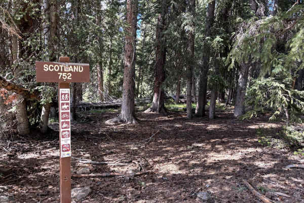
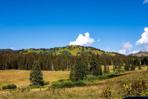
Scotland
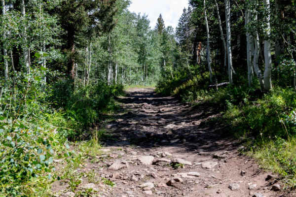
This is a scenic and fun trail on the Mesa with thick trees and meadows of wildflowers. The trail climbs East to West. Obstacles are 12 inches or less. The East side is generally looser with tight turns between trees. The West side opens up and is faster while still featuring loose rocks, though mos...
Learn more about Scotland
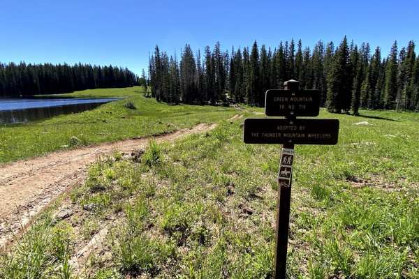
West Green Mountain Trail (#719)
This trail is generally accessed from the West Green Mountain Trailhead off of Surface Creek Road. The trail climbs approximately 1400 feet to the Northwest. The trail is rutted and washed out in spots initially but improves as the climb gets steeper. There are 2-3 stream crossings that are 6-12 inc...
Learn more about West Green Mountain Trail (#719)
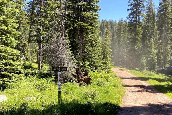
Hay Park (#729)
Hay Park is a fun 50-inch trail that connects Eureka and Hay Park Road. It offers nice views of several lakes. The trail does not change much in elevation and lacks many technical sections but is pretty heavily rutted in spots. The trail passes through many tall and sometimes thick pines rather than...
Learn more about Hay Park (#729)
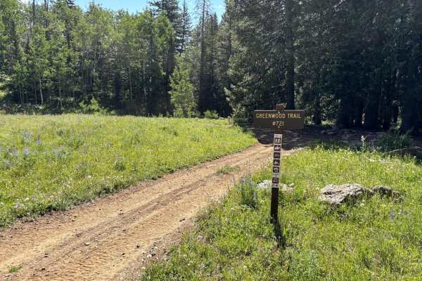
Greenwood Trail
The Greenwood Trail is a fun trail that begins near the Battlement Lakes. The trail is generally easy going as it alternates between woods and meadows. This trail lacks any significant features, but has four fairly rocky and moderately steep grades. There are a few shallow stream crossings. Obstacle...
Learn more about Greenwood Trail

Point Camp Trail
Point Camp Trail is one of only a couple of single-track trails in the Grand Mesa National Forest near Grand Mesa, Colorado. This trail is 3.2 miles and mostly flat with only a couple hundred feet of elevation gain if riding north to south. It goes fast through a lot of meadows, where you'll likely ...
Learn more about Point Camp Trail

Gunnison Gorge South River Road
Just outside of Delta Colorado, inside Gunnison Gorge National Conservation Area you'll find a beat up gravel road that leads you down to the Gunnison river. Most SUV's and trucks will not have an issue navigating the narrow steep road down to the river floor. Once down on the river, you'll have a v...
Learn more about Gunnison Gorge South River Road
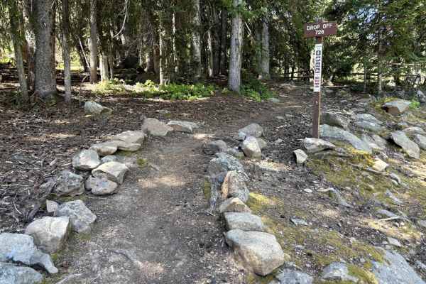
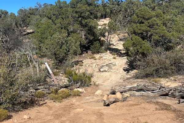
Drop-Off
One of the very few single-track trails on the Grand Mesa. Drop-Off is the tale of two trails. The trail does not see a ton of use and is typically accessed via the Flowing Park Trailhead. When ridden from the Flowing Park Trailhead (North to South), the trail will be a descent. It starts very easil...
Learn more about Drop-Off

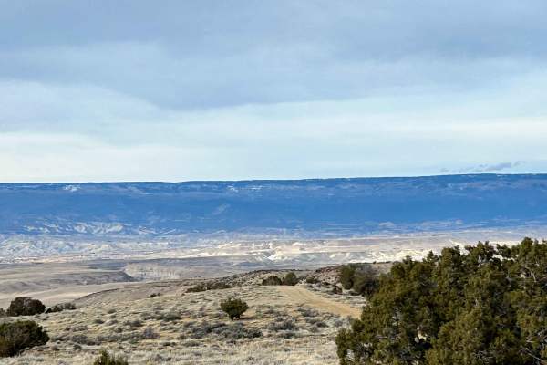
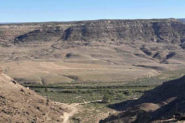
Smith Mountain Jeep Road Overlook
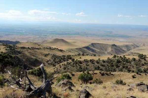
Just outside of Delta, Colorado, inside Gunnison Gorge National Conservation Area, you'll find an unmaintained jeep trail that leads you out onto a peninsula with spectacular views of the Gunnison Gorge. The trail overall is relatively easy to navigate with the occasional steep grade, loose rocks, a...
Learn more about Smith Mountain Jeep Road Overlook
Leroux Creek Road - FS 128
Easy Forest service road that winds up at the lower elevations through gamble oaks then as you climb up in elevation into aspen groves and as you reach the top of the Grand Mesa you will be in Pine/Aspens/meadows with several small lakes that can be fished. There are also many dispersed camping spot...
Learn more about Leroux Creek Road - FS 128
Sunnyside Cutoff
This well-established cutoff provides an alternative option from the Sidewinder Trail to the Smith Mountain Trail. Terrain is easy, but it offers different views to create more of a loop experience in this area. This trail and this area are very accessible, even during the winter months, and make fo...
Learn more about Sunnyside Cutoff
Ellington Creek Road/ FR 128
Ellington Creek Road is also known by the locals as Cunningham Road. The road is rocky and narrow and would have to be tight in places in the trees for full-size trucks, and after wet weather, there are places with muddy holes to get through. The road travels up through forested areas of pines and a...
Learn more about Ellington Creek Road/ FR 128
Alkali Basin
Alkali Basin Loop is a combination of the Alkali Basin Trail on the west and the Pipeline West Trail on the east. This allows for a through Jeep trail rather than an in-and-out. The namesake Alkali Basin is a nondescript basin shown in the photo. This trail crosses the opening, which probably is w...
Learn more about Alkali Basin
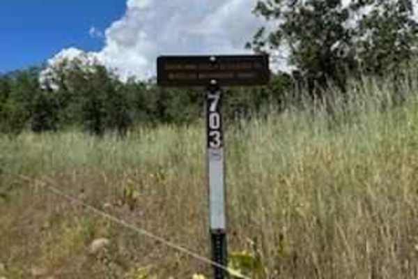
Holly Terror Road - FS 703
This road travels down through the pine forest, it is rocky and at times muddy, it is also very narrow in spots that a full-size vehicle might have a hard time squeezing through. With narrower vehicle mirrors had to be folded in to get through. About halfway down the trail you will have to cross thr...
Learn more about Holly Terror Road - FS 703
Red Rocks- Night Horse Trail
The 7-mile Red Rocks- Night Horse trail is technical in parts but also a very flowy trail that follows the Western Ridge above the Gunnison Gorge topping out at 7,088 feet with spectacular views of the Gunnison River and up into the Black Canyon of the Gunnison National Park. The views along this tr...
Learn more about Red Rocks- Night Horse Trail
Overland Reservoir
This is a scenic graded road over Grand Mesa between Paonia and Collbran, easy enough to be done in a passenger car. Overland Reservoir is owned by Overland Ditch and Reservoir Company, founded in 1903 as a mutual ditch company to serve agricultural farmers primarily in the Redlands Mesa area of Del...
Learn more about Overland Reservoir
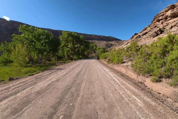
Escalante Canyon Road
Escalante Canyon is a beautifully scenic, highly accessible 6.7-mile route that begins immediately off the paved highway, welcoming off-road explorers with a massive, hard-packed dirt staging area easily capable of accommodating up to 60 vehicles and large trailers. This exceptionally smooth, recent...
Learn more about Escalante Canyon Road
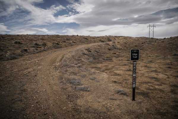
Edge Trail
The Edge Trail is an adobe ridgeline trail in the Peach Valley Recreation Area that goes through an adobe clay badlands landscape. Starting from the northern trailhead, it starts wide but narrows up on the first adobe ridge lines. While on the ridge, you can see straight down to the steep grey fins ...
Learn more about Edge Trail
76 Road
76 Road is a highly accessible and scenic 1.2-mile dirt trail that begins near a sprawling staging area close to the main entrance. Immediately along the start of the route, visitors will find a convenient campground. The early sections of this path are characterized by smooth, effortless travel con...
Learn more about 76 Road
Denca Road
Denca Road is a highly scenic, moderately challenging 6.7-mile backcountry transit that begins directly off the main E 23 route. Welcoming a wide variety of outdoor enthusiasts—including passenger cars, trucks, side-by-sides, and horseback riders—the trail kicks off at a convenient, medium-sized dir...
Learn more about Denca Road
ATV trails near Cedaredge, Colorado
Explore ATV-friendly trails near you. These trails are accessible for vehicles up to 50 inches wide, perfect for ATVs and smaller off-road machines.
Leon Lake
Leon Lake Jeep trail goes between Cedaredge and Vega Reservoir. A scenic trip, although a bit rocky and bumpy through the center portion. Leon Lake is a beautiful lake at a little over 10,000' elevation. We did this tail in August without any mud problems, but I would not suggest it if the ground i...
Learn more about Leon Lake
Scotland
This is a scenic and fun trail on the Mesa with thick trees and meadows of wildflowers. The trail climbs East to West. Obstacles are 12 inches or less. The East side is generally looser with tight turns between trees. The West side opens up and is faster while still featuring loose rocks, though mos...
Learn more about Scotland
West Green Mountain Trail (#719)
This trail is generally accessed from the West Green Mountain Trailhead off of Surface Creek Road. The trail climbs approximately 1400 feet to the Northwest. The trail is rutted and washed out in spots initially but improves as the climb gets steeper. There are 2-3 stream crossings that are 6-12 inc...
Learn more about West Green Mountain Trail (#719)
Hay Park (#729)
Hay Park is a fun 50-inch trail that connects Eureka and Hay Park Road. It offers nice views of several lakes. The trail does not change much in elevation and lacks many technical sections but is pretty heavily rutted in spots. The trail passes through many tall and sometimes thick pines rather than...
Learn more about Hay Park (#729)
UTV/side-by-side trails near Cedaredge, Colorado
Find UTV and side-by-side trails near you. These trails accommodate vehicles up to 60 inches wide, ideal for UTVs, side-by-sides, and wider off-road rigs.
Leon Lake
Leon Lake Jeep trail goes between Cedaredge and Vega Reservoir. A scenic trip, although a bit rocky and bumpy through the center portion. Leon Lake is a beautiful lake at a little over 10,000' elevation. We did this tail in August without any mud problems, but I would not suggest it if the ground i...
Learn more about Leon Lake
Gunnison Gorge South River Road
Just outside of Delta Colorado, inside Gunnison Gorge National Conservation Area you'll find a beat up gravel road that leads you down to the Gunnison river. Most SUV's and trucks will not have an issue navigating the narrow steep road down to the river floor. Once down on the river, you'll have a v...
Learn more about Gunnison Gorge South River Road
Smith Mountain Jeep Road Overlook
Just outside of Delta, Colorado, inside Gunnison Gorge National Conservation Area, you'll find an unmaintained jeep trail that leads you out onto a peninsula with spectacular views of the Gunnison Gorge. The trail overall is relatively easy to navigate with the occasional steep grade, loose rocks, a...
Learn more about Smith Mountain Jeep Road Overlook
Leroux Creek Road - FS 128
Easy Forest service road that winds up at the lower elevations through gamble oaks then as you climb up in elevation into aspen groves and as you reach the top of the Grand Mesa you will be in Pine/Aspens/meadows with several small lakes that can be fished. There are also many dispersed camping spot...
Learn more about Leroux Creek Road - FS 128
The onX Offroad Difference
onX Offroad combines trail photos, descriptions, difficulty ratings, width restrictions, seasonality, and more in a user-friendly interface. Available on all devices, with offline access and full compatibility with CarPlay and Android Auto. Discover what you're missing today!
Open Trail Map