
Dirt Bike Trails
Near Lazear, Colorado
Explore All Dirt Bike Trails Near Lazear, Colorado
Dirt Bike Trails Near Lazear, Colorado
Discover the best dirt bike trails near you. Browse trail maps, check difficulty ratings, and find your next adventure — whether you're looking for a quick ride or an all-day expedition.
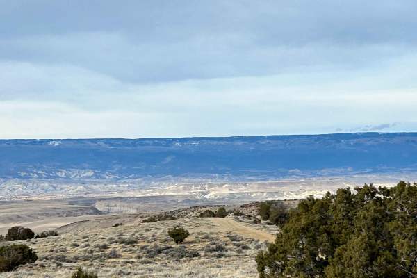
Sunnyside Cutoff
This well-established cutoff provides an alternative option from the Sidewinder Trail to the Smith Mountain Trail. Terrain is easy, but it offers different views to create more of a loop experience in this area. This trail and this area are very accessible, even during the winter months, and make fo...
Learn more about Sunnyside Cutoff

Smith Mountain Jeep Road Overlook
Smith Mountain Jeep Road Overlook is an ideal route for scenic explorers and moderate offroaders seeking panoramic views of the rugged Gunnison River canyon. Located just outside Delta, Colorado, within the Gunnison Gorge National Conservation Area, this unmaintained 4.3-mile trail leads travelers o...
Learn more about Smith Mountain Jeep Road Overlook

Gunnison Gorge South River Road
Just outside of Delta Colorado, inside Gunnison Gorge National Conservation Area you'll find a beat up gravel road that leads you down to the Gunnison river. Most SUV's and trucks will not have an issue navigating the narrow steep road down to the river floor. Once down on the river, you'll have a v...
Learn more about Gunnison Gorge South River Road
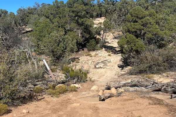
Red Rocks- Night Horse Trail
The 7-mile Red Rocks- Night Horse trail is technical in parts but also a very flowy trail that follows the Western Ridge above the Gunnison Gorge topping out at 7,088 feet with spectacular views of the Gunnison River and up into the Black Canyon of the Gunnison National Park. The views along this tr...
Learn more about Red Rocks- Night Horse Trail
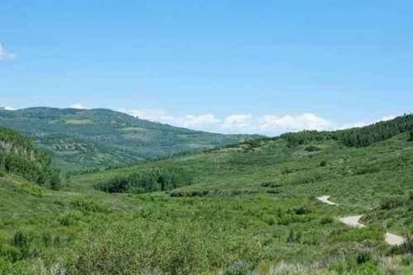
Overland Reservoir
This is a scenic graded road over Grand Mesa between Paonia and Collbran, easy enough to be done in a passenger car. Overland Reservoir is owned by Overland Ditch and Reservoir Company, founded in 1903 as a mutual ditch company to serve agricultural farmers primarily in the Redlands Mesa area of Del...
Learn more about Overland Reservoir
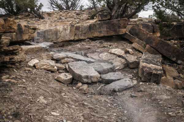
Spikes
Spikes is a short trail in Peach Valley that goes between the top and bottom of a mesa. It's a consistent grade the entire way, dropping 900 feet elevation from the top of the mesa to the bottom (or a constant climb if going the opposite direction). The top half is relatively easy, with some loose r...
Learn more about Spikes
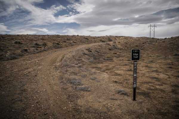
Edge Trail
The Edge Trail is an adobe ridgeline trail in the Peach Valley Recreation Area that goes through an adobe clay badlands landscape. Starting from the northern trailhead, it starts wide but narrows up on the first adobe ridge lines. While on the ridge, you can see straight down to the steep grey fins ...
Learn more about Edge Trail
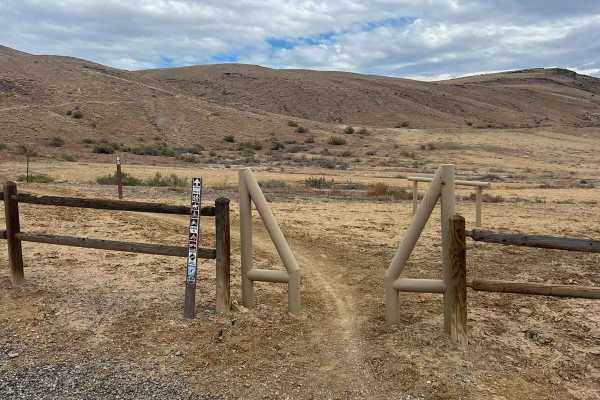
Sidewinder Trail
The Sidewinder Trail is a challenging 20-mile technical single-track route located on the western edge of the Gunnison Gorge National Conservation Area. This twisting trail winds through high-desert terrain, showcasing dry washes and rocky slopes adorned with resilient pinon pine and juniper trees. ...
Learn more about Sidewinder Trail
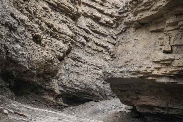
Eagle Valley
Eagle Valley is a highlight of visiting the Peach Valley riding area and shouldn't be missed if up for a rocky challenge. The trail is short, only 1 mile, but one of the more difficult trails in the trail system. It starts in a wash from the staging area on Chukar Road, and then quickly enters into ...
Learn more about Eagle Valley
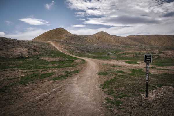
Candy Cane Loop
Candy Cane Loop is an adobe ridge line loop for 50" vehicles in Peach Valley, but has some spots that may be quite narrow for an ATV. Going clockwise, it starts as a winding and whooped out two tracks that meanders on the tops of the adobe clay hills. It has several off camber banked corners in the ...
Learn more about Candy Cane Loop
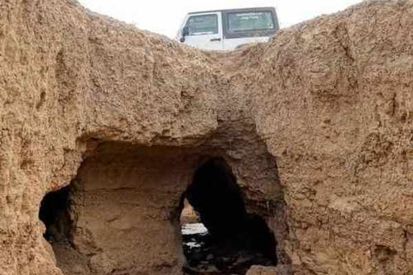
Elephant Skin Road
Elephant Skin Road is an easy Jeep trail between Montrose and Olathe. There are a few shallow gullies across the road, but can be done with any vehicle with a bit of clearance. There is a very strange occurrence in the middle of the trail. There is an area where gullies are joined by underground n...
Learn more about Elephant Skin Road
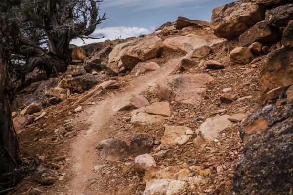
Sunset Rocks
Sunset Rocks is a tight twisty single track through rocky desert terrain on the side of a mesa with pinyon pine and red rock. The trail starts at the intersection of Eagle Valley and Sidewinder and ends at an entrance to Moonlight Mesa in the adobe hills. It curves tightly through the pinyon trees, ...
Learn more about Sunset Rocks
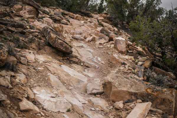
Black Ridge
Black Ridge is one of the more technical trails in Peach Valley but has incredible views from on top the mesa once you make it through all the rock ledges. Starting at the southern trailhead, it starts with a big dip across a ravine and a loose rocky climb up the mesa, and the obstacles start right ...
Learn more about Black Ridge
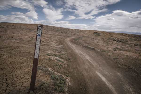
Snake ATV Trail
The Snake ATV trail is a fun ATV trail accessed from the Peach Valley Staging Area that winds at the bottom of the flat valley between the adobe hills. It mostly covers the flat ground and winds back and forth between two hills. There are two narrower sections, and it crosses the Highway One ATV tra...
Learn more about Snake ATV Trail
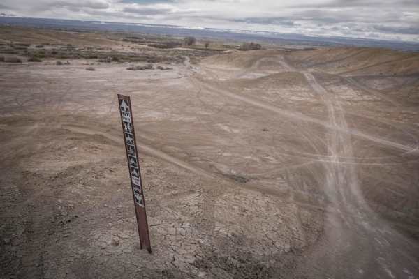
Highway One (Part One)
Highway One is an ATV trail that is the main thoroughfare between the Peach Valley staging area and the Elephant Skin staging area. From the north trailhead, it drops down from Peach Valley staging area and becomes a wide major dirt trail on adobe clay soil. It is as wide as a highway in parts and v...
Learn more about Highway One (Part One)
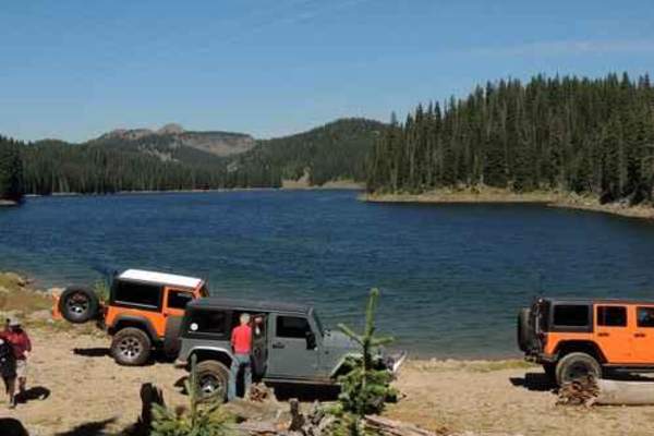
Leon Lake
Leon Lake is an exceptional point-to-point journey for moderately experienced offroaders seeking stunning high-alpine lake views and scenic aspen groves in Western Colorado. Extending approximately 30 miles from Highway 65 on the south near Cedaredge to Road 330 on the north near Vega Reservoir, thi...
Learn more about Leon Lake
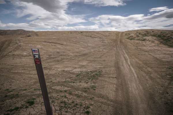
Peach Valley Loop
Peach Valley Loop is one of several ATV trails in the Peach Valley Recreation Area. It is an easy and wide two track making a loop on the adobe clay badlands that make up much of this trail system. It starts at the Peach Valley staging area and climbs up the adobe hills to the ridge lines on top. Th...
Learn more about Peach Valley Loop
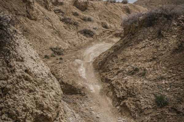
Mystery Ditch
Mystery Ditch is a fun twisty ditch trail with very tight curves and banked corners. The trail rides through the bottom of a dirt arroyo with dirt walls several feet high. The trail is overall easy with no obstacles and barely any rocks. You can get going fast in the ditch if you can keep up with th...
Learn more about Mystery Ditch
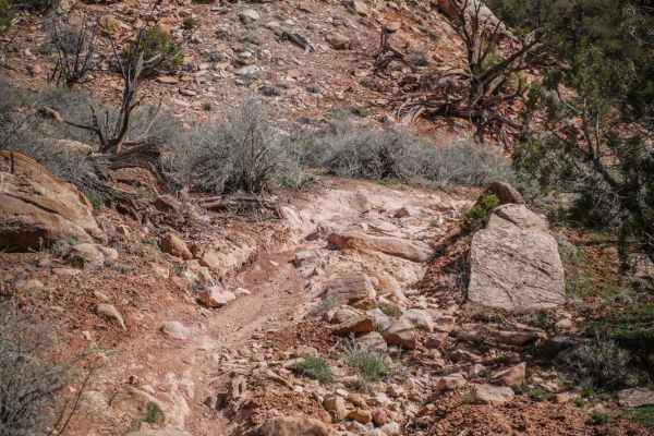
Red Rocks
Red Rocks Trail is a fun single track in the Flat Top Peach Valley Recreation Area. Access it by following Elephant Skin Road all the way to the back of the valley where the adobe hills end and the pine tree-covered mesas start. You have to access this trail through the northern half of Donkey Trail...
Learn more about Red Rocks
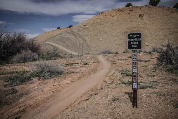
Moonlight Mesa
Moonlight Mesa is one of the longer single tracks in the adobe badlands of the Peach Valley Recreation Area. The SE trailhead on Elephant Skin Road is in the back of the adobe badlands where the hills are made up of more dirt and rocks in addition to the adobe clay. The trail drops back down into th...
Learn more about Moonlight Mesa
ATV trails near Lazear, Colorado
Explore ATV-friendly trails near you. These trails are accessible for vehicles up to 50 inches wide, perfect for ATVs and smaller off-road machines.
Sunnyside Cutoff
This well-established cutoff provides an alternative option from the Sidewinder Trail to the Smith Mountain Trail. Terrain is easy, but it offers different views to create more of a loop experience in this area. This trail and this area are very accessible, even during the winter months, and make fo...
Learn more about Sunnyside Cutoff
Smith Mountain Jeep Road Overlook
Smith Mountain Jeep Road Overlook is an ideal route for scenic explorers and moderate offroaders seeking panoramic views of the rugged Gunnison River canyon. Located just outside Delta, Colorado, within the Gunnison Gorge National Conservation Area, this unmaintained 4.3-mile trail leads travelers o...
Learn more about Smith Mountain Jeep Road Overlook
Gunnison Gorge South River Road
Just outside of Delta Colorado, inside Gunnison Gorge National Conservation Area you'll find a beat up gravel road that leads you down to the Gunnison river. Most SUV's and trucks will not have an issue navigating the narrow steep road down to the river floor. Once down on the river, you'll have a v...
Learn more about Gunnison Gorge South River Road
Overland Reservoir
This is a scenic graded road over Grand Mesa between Paonia and Collbran, easy enough to be done in a passenger car. Overland Reservoir is owned by Overland Ditch and Reservoir Company, founded in 1903 as a mutual ditch company to serve agricultural farmers primarily in the Redlands Mesa area of Del...
Learn more about Overland Reservoir
UTV/side-by-side trails near Lazear, Colorado
Find UTV and side-by-side trails near you. These trails accommodate vehicles up to 60 inches wide, ideal for UTVs, side-by-sides, and wider off-road rigs.
Sunnyside Cutoff
This well-established cutoff provides an alternative option from the Sidewinder Trail to the Smith Mountain Trail. Terrain is easy, but it offers different views to create more of a loop experience in this area. This trail and this area are very accessible, even during the winter months, and make fo...
Learn more about Sunnyside Cutoff
Smith Mountain Jeep Road Overlook
Smith Mountain Jeep Road Overlook is an ideal route for scenic explorers and moderate offroaders seeking panoramic views of the rugged Gunnison River canyon. Located just outside Delta, Colorado, within the Gunnison Gorge National Conservation Area, this unmaintained 4.3-mile trail leads travelers o...
Learn more about Smith Mountain Jeep Road Overlook
Gunnison Gorge South River Road
Just outside of Delta Colorado, inside Gunnison Gorge National Conservation Area you'll find a beat up gravel road that leads you down to the Gunnison river. Most SUV's and trucks will not have an issue navigating the narrow steep road down to the river floor. Once down on the river, you'll have a v...
Learn more about Gunnison Gorge South River Road
Overland Reservoir
This is a scenic graded road over Grand Mesa between Paonia and Collbran, easy enough to be done in a passenger car. Overland Reservoir is owned by Overland Ditch and Reservoir Company, founded in 1903 as a mutual ditch company to serve agricultural farmers primarily in the Redlands Mesa area of Del...
Learn more about Overland Reservoir
The onX Offroad Difference
onX Offroad combines trail photos, descriptions, difficulty ratings, width restrictions, seasonality, and more in a user-friendly interface. Available on all devices, with offline access and full compatibility with CarPlay and Android Auto. Discover what you're missing today!
Open Trail Map