
Dirt Bike Trails
Near Blairsville, Georgia
Explore All Dirt Bike Trails Near Blairsville, Georgia
Dirt Bike Trails Near Blairsville, Georgia
Discover the best dirt bike trails near you. Browse trail maps, check difficulty ratings, and find your next adventure — whether you're looking for a quick ride or an all-day expedition.
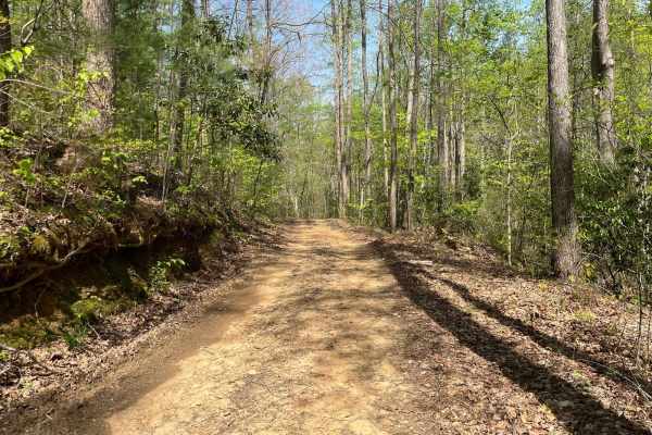
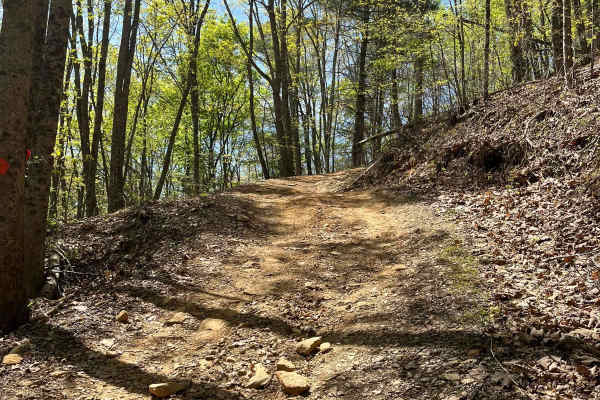
Nicholson Gap
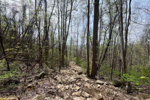
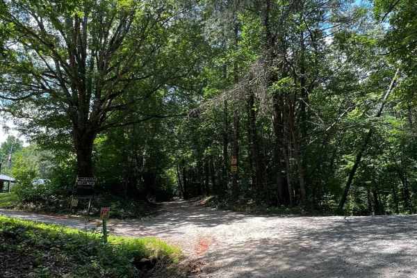
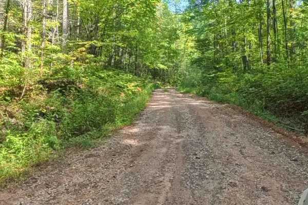
Nicholson Gap begins as the main trail out of the Satterfield Parking lot, it is a moderately steep but otherwise easy access trail to the rest of Beasley Knob OHV. The trail is mostly clay with a small section of rock and is maintained to be an exit from the park during wet conditions.
Learn more about Nicholson Gap
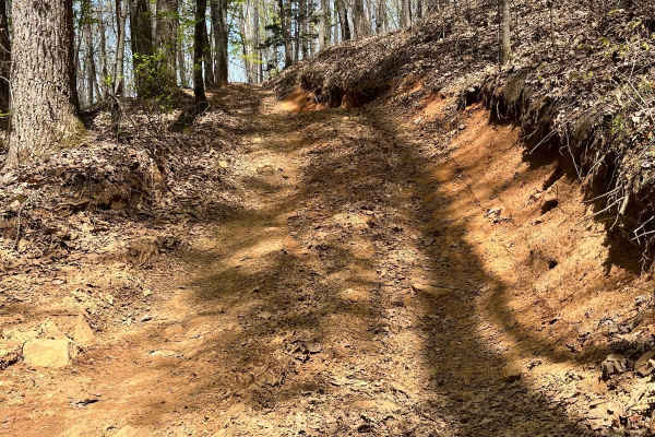
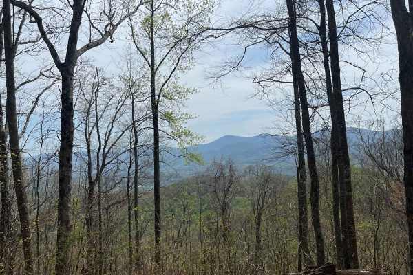
Beasley Knob
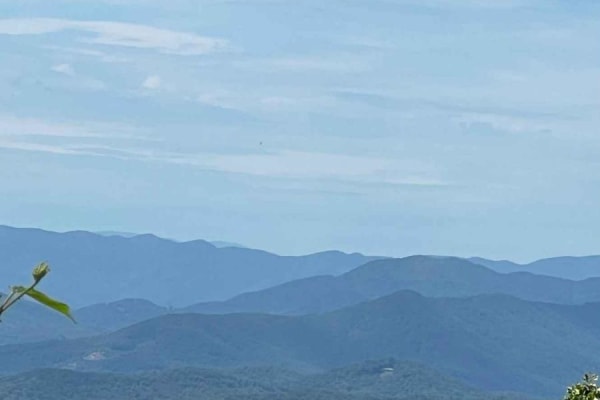
Beasley Knob Trail is a steep and challenging trail in the Beasley Knob OHV area. The dirt-clay mix as well as off-camber sections and ruts keep the trail interesting as you climb Beasley Knob Mountain, the overlook at the top halfway through the trail provides a great view of Brasstown Bald, the ta...
Learn more about Beasley Knob
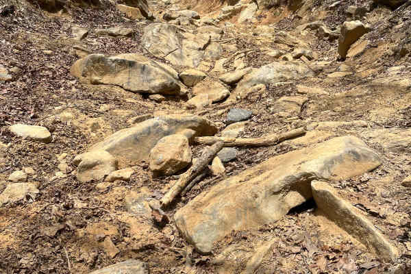
Rattlesnake
Rattlesnake is a steep, difficult trail inside the Beasley Knob OHV area, the lower section of the trail is very rocky with boulders and ledges that require careful attention, and the upper part is a long, steep dirt hill climb. The trail is short but difficult. All of the trails inside Beasley Knob...
Learn more about Rattlesnake
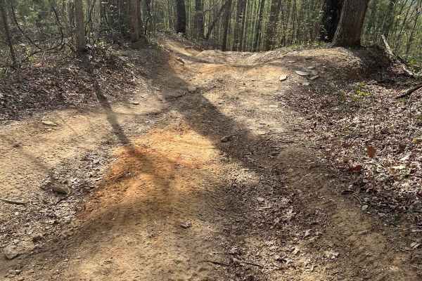
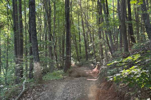
Barnhart-Sutz Trail
This trail is an easy trail inside Beasley Knob OHV that serves as a connector between the Satterfield and Blue Rock parking area, the trail is steep with a small but not very difficult ledge. All of the trails inside Beasley Knob OHV are closed seasonally from December 31st to late March or early A...
Learn more about Barnhart-Sutz Trail
Thunderstruck Mountain
The Thunderstruck Mountain trail is a moderately challenging in the Beasley Knob OHV area. The trail rides along the top of Thunderstruck Mountain, and includes the Jones Knob and Blue Rock overlooks making it easily the most scenic trail in the OHV area. You will find steep, challenging terrain as ...
Learn more about Thunderstruck Mountain
Hospital Cove
Hospital Cove trail is a main access trail inside of Beasley Knob OHV area. The trail is mostly gravel with some dirt and provides a route to a pair of the more challenging trails in the park. It is maintained at a level to be passable during wet conditions. All of the trails inside Beasley Knob OHV...
Learn more about Hospital Cove
Beasley Knob 93a
This can be considered the main access route into the Beasley Knob OHV area in the Chattahoochee National Forest. It is mostly a wide gravel roadway. Some of the trails in the Beasley area are quite rough, so this is a great way to avoid them and still be able to access some of the easier trails. Th...
Learn more about Beasley Knob 93a
Beasley Knob Bitter Creek Loop - FS 93
Beasley Knob Bitter Creek Loop (FR93) is a 2.9-mile loop route that travels through heavily forested terrain on a surface consisting of rock, dirt, and red clay. The trail is a single lane with few places to pass and is lightly maintained, creating a more rugged driving experience than many nearby f...
Learn more about Beasley Knob Bitter Creek Loop - FS 93
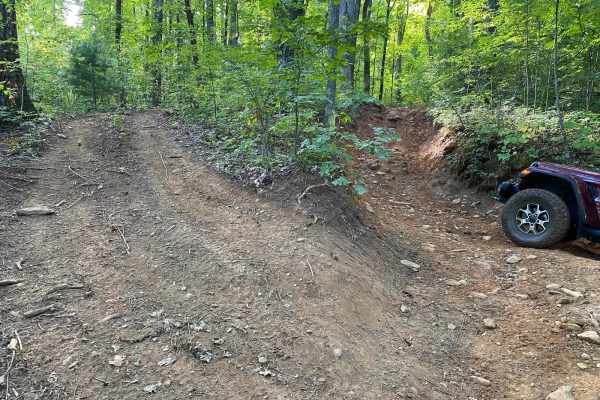
Devil's Backbone - 93B
The Devil's Backbone trail is the most difficult trail in the Beasley Knob OHV area. It is extremely steep and has multiple extremely challenging rock gardens, hill climbs, and ledges to navigate with steep drops to one side for roughly one-third of the trail while you wind your way up the mountain....
Learn more about Devil's Backbone - 93B
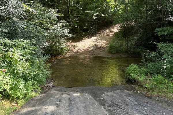
Gillespie Branch - FS 287
This trail is a fun out-and-back ride that starts with a little water crossing. It's primarily one dirt lane surrounded by dense vegetation far enough from your rig to keep away pin stripes. Plenty of room to pass other vehicles. Not too far in are some ruts less than 18 inches, which stock off-road...
Learn more about Gillespie Branch - FS 287
Bowers Cove - FS 298
This out-and-back, one-lane forest trail is easygoing and welcoming, with plenty of space to pass other vehicles and minimal risk of pinstripes. The route is mostly flat, made up of smooth dirt with occasional patches of gravel, and gently winds its way to a closed gate at the end. Two-thirds of the...
Learn more about Bowers Cove - FS 298
Ivy Log Gap (FS 100)
Are you looking for some beautiful GA views, even in the summer? Ivy Log Gap, FS 100, runs along a ridge offering scenic views year-round, with incredibly stunning overlooks in the fall. This smooth gravel road requires no airing down and is generally easy to navigate, with only a few rocky sections...
Learn more about Ivy Log Gap (FS 100)
Fortenberry - FS 395
This forest road is less maintained and perfect for those looking to collect pinstripes, branches, and more if you have roof racks. Right at the beginning is a small campsite before two major humps you'll have to pass over to get to the trail. To get over the humps to access the trail, you will need...
Learn more about Fortenberry - FS 395
Gumlog Gap FS 95
This scenic gravel road offers an easy drive, with a few bumpy sections, small potholes, an easy middle-rutted section, and potentially muddy areas after rain. Running along the ridge of the mountain provides occasional views on both sides, making it especially beautiful during the fall and winter m...
Learn more about Gumlog Gap FS 95
West Wolf Creek - FS 107
This is a fantastic trail that’s genuinely fun to drive, offering a relaxed yet engaging experience from start to finish. When the leaves are down, the views open up beautifully, making this a particularly scenic ride during the cooler months. The trail features 10 campsites, nearly all situated rig...
Learn more about West Wolf Creek - FS 107
Davenport Mountain OHV Trails
Davenport OHV is a 1-way Trail that creates a loop. It's 6.2 miles in length. The parking lot is in the middle of the OHV trail system. There is a 2-way short trail that leads into the loop trail, and then the trail is marked directionally from there. It crosses the road in 2 places. This trail syst...
Learn more about Davenport Mountain OHV Trails
Chester Knob Lower Trail
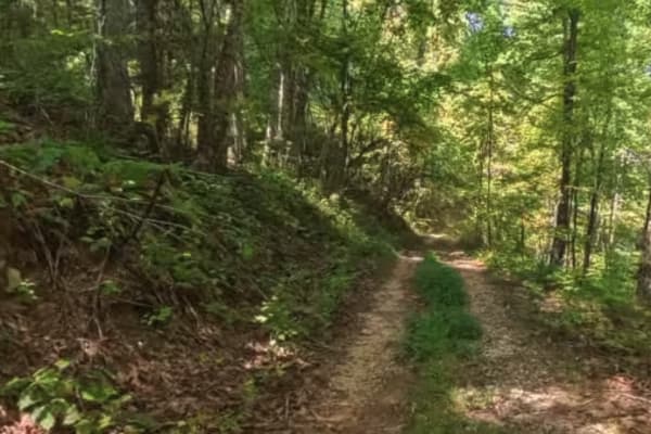
Chester Knob Lower is a short, wooded trail in the Chattahoochee National Forest that gradually descends toward the Nottely River. The 1-mile route is made up of packed dirt and forest floor, making it a smooth and scenic connector for smaller off-road vehicles. The trail winds through dense mountai...
Learn more about Chester Knob Lower Trail
Chester Knob Upper Trail
Chester Knob Upper Trail is a narrow 2.4-mile dirt and gravel path winding through mountainous forest in the Chattahoochee National Forest. While not heavily technical, riders should be cautious of steep drop-offs on the right side when ascending. A few scattered rocks add a minor challenge along th...
Learn more about Chester Knob Upper Trail
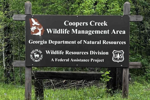
Cooper Creek FS Road 33
If you are searching for an easy trail with campsites and fishing spots available along the way, this one is for you. Well-known among the Georgia offroading crowd and a favorite with locals, this trail is accessible to anyone, including stock vehicles and 2WD. This road connects to Cavendar Gap Roa...
Learn more about Cooper Creek FS Road 33
Flatlands FS Road 637
Looking for some camping, and maybe a visit to a historic cemetery from the 1800s? Then this is your trail. Not long, as it is closed part-way through, it does offer a great intro to the offroading experience at the beginning, and after the cemetery provides a little more of an enclosed challenge. T...
Learn more about Flatlands FS Road 637
ATV trails near Blairsville, Georgia
Explore ATV-friendly trails near you. These trails are accessible for vehicles up to 50 inches wide, perfect for ATVs and smaller off-road machines.
Nicholson Gap
Nicholson Gap begins as the main trail out of the Satterfield Parking lot, it is a moderately steep but otherwise easy access trail to the rest of Beasley Knob OHV. The trail is mostly clay with a small section of rock and is maintained to be an exit from the park during wet conditions.
Learn more about Nicholson Gap
Beasley Knob
Beasley Knob Trail is a steep and challenging trail in the Beasley Knob OHV area. The dirt-clay mix as well as off-camber sections and ruts keep the trail interesting as you climb Beasley Knob Mountain, the overlook at the top halfway through the trail provides a great view of Brasstown Bald, the ta...
Learn more about Beasley Knob
Rattlesnake
Rattlesnake is a steep, difficult trail inside the Beasley Knob OHV area, the lower section of the trail is very rocky with boulders and ledges that require careful attention, and the upper part is a long, steep dirt hill climb. The trail is short but difficult. All of the trails inside Beasley Knob...
Learn more about Rattlesnake
Barnhart-Sutz Trail
This trail is an easy trail inside Beasley Knob OHV that serves as a connector between the Satterfield and Blue Rock parking area, the trail is steep with a small but not very difficult ledge. All of the trails inside Beasley Knob OHV are closed seasonally from December 31st to late March or early A...
Learn more about Barnhart-Sutz Trail
UTV/side-by-side trails near Blairsville, Georgia
Find UTV and side-by-side trails near you. These trails accommodate vehicles up to 60 inches wide, ideal for UTVs, side-by-sides, and wider off-road rigs.
Nicholson Gap
Nicholson Gap begins as the main trail out of the Satterfield Parking lot, it is a moderately steep but otherwise easy access trail to the rest of Beasley Knob OHV. The trail is mostly clay with a small section of rock and is maintained to be an exit from the park during wet conditions.
Learn more about Nicholson Gap
Beasley Knob
Beasley Knob Trail is a steep and challenging trail in the Beasley Knob OHV area. The dirt-clay mix as well as off-camber sections and ruts keep the trail interesting as you climb Beasley Knob Mountain, the overlook at the top halfway through the trail provides a great view of Brasstown Bald, the ta...
Learn more about Beasley Knob
Rattlesnake
Rattlesnake is a steep, difficult trail inside the Beasley Knob OHV area, the lower section of the trail is very rocky with boulders and ledges that require careful attention, and the upper part is a long, steep dirt hill climb. The trail is short but difficult. All of the trails inside Beasley Knob...
Learn more about Rattlesnake
Barnhart-Sutz Trail
This trail is an easy trail inside Beasley Knob OHV that serves as a connector between the Satterfield and Blue Rock parking area, the trail is steep with a small but not very difficult ledge. All of the trails inside Beasley Knob OHV are closed seasonally from December 31st to late March or early A...
Learn more about Barnhart-Sutz Trail
The onX Offroad Difference
onX Offroad combines trail photos, descriptions, difficulty ratings, width restrictions, seasonality, and more in a user-friendly interface. Available on all devices, with offline access and full compatibility with CarPlay and Android Auto. Discover what you're missing today!
Open Trail Map