
Dirt Bike Trails
Near Arcadia, California
Explore All Dirt Bike Trails Near Arcadia, California
Dirt Bike Trails Near Arcadia, California
Discover the best dirt bike trails near you. Browse trail maps, check difficulty ratings, and find your next adventure — whether you're looking for a quick ride or an all-day expedition.
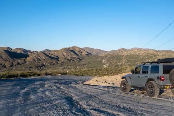
BP & L Road - FS 4N33
This hard-packed dirt road offers a smooth(ish) drive over lots of loose gravel and small rocks that are easily traversed by any stock vehicle, with plenty of turnouts along the Angeles National Forest-designated portions of the road, including many under and around large electrical towers, where yo...
Learn more about BP & L Road - FS 4N33

3N26
Trail head starts on Angeles Crest Highway at the Vincent Gap Turnout. It is a very short trail that leads to a locked gate at Jackson Flat Camping Area. The scenery during this trail consists of mature trees providing plenty of shade throughout the trail, views of the Antelope Valley from above, an...
Learn more about 3N26
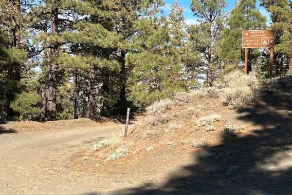
3N267 Fenner Saddle (4N12)
The trail starts at the third quarter into marked trail 3N26. There is shade for more than half of the trail from mature tree and a hillside for the majority of the trail. During certain times of year, there are shallow creek crossings and obstacles such as fallen trees and boulders from the hillsid...
Learn more about 3N267 Fenner Saddle (4N12)
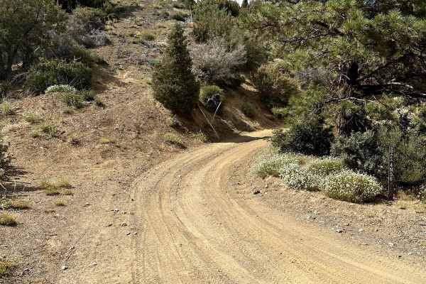
Pinyon Ridge Truck Trail
This is a mellow trail along Pinyon Ridge, which is just west of Vincent Gap and Blue Ridge. The trail itself is mellow and surrounded by - you guessed it - single-leaf/needle Pinyon pine trees, which are the namesake of the ridge and native to only the Western United States. There are no less than ...
Learn more about Pinyon Ridge Truck Trail
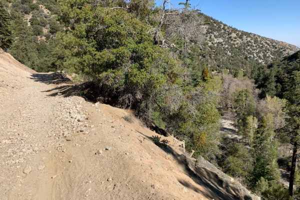
Mescal Canyon Road
Mescal Canyon Road is an ideal trail for beginner offroaders and scenic explorers looking for an accessible dirt route that transitions beautifully between the high desert and the pine-covered slopes near Wrightwood. Spanning approximately 3.1 miles through the San Gabriel Mountains, this point-to-p...
Learn more about Mescal Canyon Road
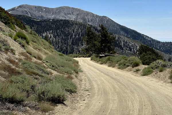
Blue Ridge Truck Trail
This trail is a pretty drive along Blue Ridge in the eastern San Gabriel Mountains. The trail overlooks Mount Baden-Powell, Vincent Gulch, Pine Mountain/Pine Mountain Ridge, the Mountain High ski resort, Wright Mountain, and of course, the towering Mount San Antonio. The trail begins along CA Highwa...
Learn more about Blue Ridge Truck Trail
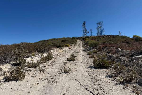
Magic Mountain Summit Trail
Magic Mountain Summit Trail is a 9.2-mile route traversing the scenic Magic Mountain Wilderness within the Angeles National Forest. Beginning near Magic Mountain Peak, the trail descends 2,610 feet to an access road at the base, which is gated and may or may not be open depending on conditions. This...
Learn more about Magic Mountain Summit Trail
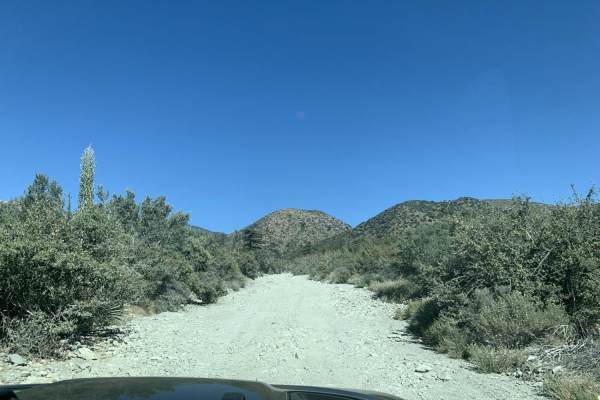
Slade Canyon
Slade Canyon is a short, scenic climb perfect for beginner offroaders looking to escape into the San Bernardino National Forest and enjoy panoramic mountain views above the Lytle Creek area. Stretching approximately 2.8 miles, this route begins near the creek bed at an elevation of 5,228 feet and cl...
Learn more about Slade Canyon
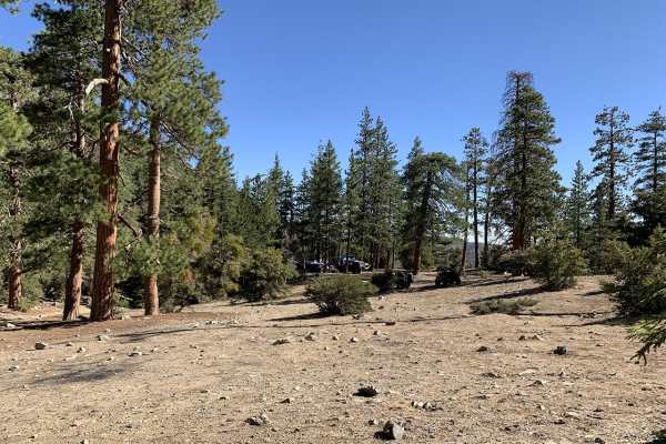
3N06A Cold Water Canyon
3N06A Cold Water Canyon is an engaging 2.6-mile off-road adventure nestled in the San Bernardino National Forest near Lytle Creek, perfect for intermediate drivers seeking a scenic and moderately challenging climb. Starting off Lytle Creek Road at an elevation of 4,960 feet, this trail quickly trans...
Learn more about 3N06A Cold Water Canyon
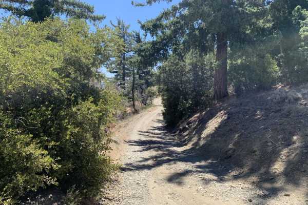
Gobblers Knob Spur A
This is a beautiful trail that leads you to the highest point within the little set of trails in this area. It also connects at the top with the Pacific Crest Trail (PCT). Be careful when you reach the top because it is possible for you to find hikers on the PCT at most times of the year. The road i...
Learn more about Gobblers Knob Spur A
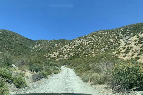
Sharpless Ranch
Sharpless Ranch is an easy 2.3-mile point-to-point trail ideal for beginner offroaders and high-clearance vehicles looking to climb from Lone Pine Canyon Road up to the Upper Lytle Creek Divide. This short, single-vehicle-wide route offers a quick but engaging ascent through the San Bernardino Natio...
Learn more about Sharpless Ranch
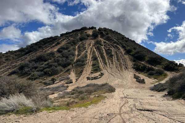
The Widow Maker
The legend of "The Widow Maker" precedes itself among local riders, standing as a rite of passage for those with enough grit to attempt the ascent. This iconic hill climb offers an adrenaline-pumping vertical challenge that rewards successful climbers with some of the most spectacular, high-altitude...
Learn more about The Widow Maker
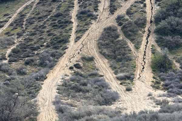
Chickens
This route serves as one of the primary bypass options for the more intimidating main line of the legendary Widow Maker hill climb. It is a fantastic alternative for riders who want to experience the thrill of the ascent without the "all-or-nothing" commitment of the most vertical face. Whether you ...
Learn more about Chickens

Old Cc Spur - 2N57
This is a 1.4-mile, well-maintained, easy gravel spur road that connects Lytle Creek Road and Lower Lytle Creek Divide - 3N31. This spur road is a convenient way to access Lower Lytle Creek Divide - 3N31, which is an 8.5-mile fun, scenic ridgeline trail above Lytle Creek.
Learn more about Old Cc Spur - 2N57
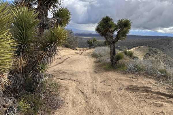
Tom's Kitchen
This technical offshoot trail is a local favorite for those who enjoy gaining elevation through a series of challenging, sandy whoop sections. As you climb, the terrain opens up to reveal some of the most scenic views in the region, making it an ideal spot to kill the engine and enjoy a cold drink. ...
Learn more about Tom's Kitchen
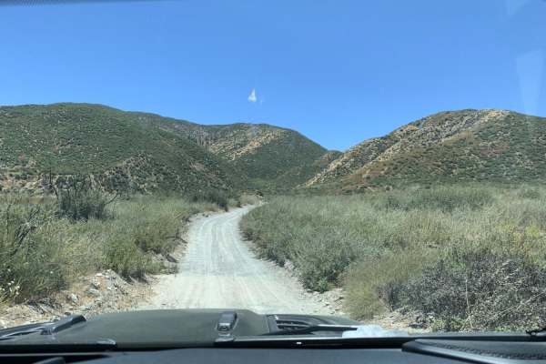
Sheep Canyon
Sheep Canyon is an ideal route for beginner offroaders and drivers of stock SUVs seeking a scenic, low-stress connection between Lytle Creek and Swarthout Canyon. This easy, dirt track winds through the rugged chaparral of the eastern San Gabriel Mountains, offering scenic vistas of the surrounding ...
Learn more about Sheep Canyon
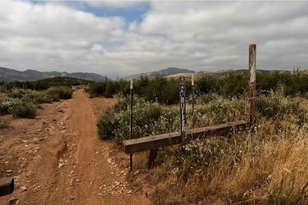
Buffer OHV Trail
Buffer OHV Trail is an easy, enjoyable route located near Staging Area #3 in the Rowher Flats OHV Area. The trail forms a loop around the open riding area just south of the staging area, making it a convenient and accessible option. This two-way trail is designated for dirt bikes and ATVs only and f...
Learn more about Buffer OHV Trail
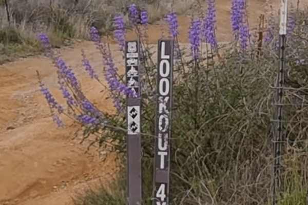
Lookout Trail - FS 3414W34
Lookout Trail (3414W34) is widely considered the most difficult trail in the Rowher OHV area, offering a short but challenging climb to one of the best vantage points in the Sierra Pelona range. Branching off the main Rowher trail network, this route quickly transitions from decomposed granite into ...
Learn more about Lookout Trail - FS 3414W34
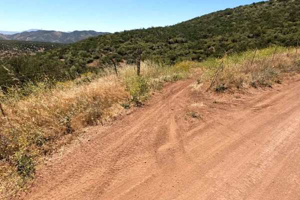
Spring OHV Trail
Spring OHV Trail is a fun connector between Staging Area #1 and Staging Area #3. This is a two-way dirt bike and ATV trail with some really fun twists and turns. Nice and flowing, this trail would be great for a seasoned beginner to level up their riding. There are a couple of sections that are tigh...
Learn more about Spring OHV Trail
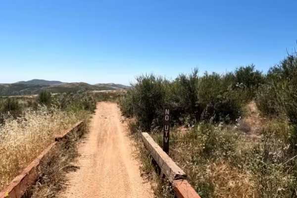
Arc OHV Trail
A fun and easy trail close to the staging areas. This is a two-way dirt bike and ATV trail. One end is just to the south of Staging Area #1. The other end is at FS 5N14, close to both Stage and Flat OHV trails. Mostly flat with nice winding turns, this is a great trail for beginners as both ends mee...
Learn more about Arc OHV Trail
ATV trails near Arcadia, California
Explore ATV-friendly trails near you. These trails are accessible for vehicles up to 50 inches wide, perfect for ATVs and smaller off-road machines.
BP & L Road - FS 4N33
This hard-packed dirt road offers a smooth(ish) drive over lots of loose gravel and small rocks that are easily traversed by any stock vehicle, with plenty of turnouts along the Angeles National Forest-designated portions of the road, including many under and around large electrical towers, where yo...
Learn more about BP & L Road - FS 4N33
3N26
Trail head starts on Angeles Crest Highway at the Vincent Gap Turnout. It is a very short trail that leads to a locked gate at Jackson Flat Camping Area. The scenery during this trail consists of mature trees providing plenty of shade throughout the trail, views of the Antelope Valley from above, an...
Learn more about 3N26
3N267 Fenner Saddle (4N12)
The trail starts at the third quarter into marked trail 3N26. There is shade for more than half of the trail from mature tree and a hillside for the majority of the trail. During certain times of year, there are shallow creek crossings and obstacles such as fallen trees and boulders from the hillsid...
Learn more about 3N267 Fenner Saddle (4N12)
Pinyon Ridge Truck Trail
This is a mellow trail along Pinyon Ridge, which is just west of Vincent Gap and Blue Ridge. The trail itself is mellow and surrounded by - you guessed it - single-leaf/needle Pinyon pine trees, which are the namesake of the ridge and native to only the Western United States. There are no less than ...
Learn more about Pinyon Ridge Truck Trail
UTV/side-by-side trails near Arcadia, California
Find UTV and side-by-side trails near you. These trails accommodate vehicles up to 60 inches wide, ideal for UTVs, side-by-sides, and wider off-road rigs.
BP & L Road - FS 4N33
This hard-packed dirt road offers a smooth(ish) drive over lots of loose gravel and small rocks that are easily traversed by any stock vehicle, with plenty of turnouts along the Angeles National Forest-designated portions of the road, including many under and around large electrical towers, where yo...
Learn more about BP & L Road - FS 4N33
3N26
Trail head starts on Angeles Crest Highway at the Vincent Gap Turnout. It is a very short trail that leads to a locked gate at Jackson Flat Camping Area. The scenery during this trail consists of mature trees providing plenty of shade throughout the trail, views of the Antelope Valley from above, an...
Learn more about 3N26
3N267 Fenner Saddle (4N12)
The trail starts at the third quarter into marked trail 3N26. There is shade for more than half of the trail from mature tree and a hillside for the majority of the trail. During certain times of year, there are shallow creek crossings and obstacles such as fallen trees and boulders from the hillsid...
Learn more about 3N267 Fenner Saddle (4N12)
Pinyon Ridge Truck Trail
This is a mellow trail along Pinyon Ridge, which is just west of Vincent Gap and Blue Ridge. The trail itself is mellow and surrounded by - you guessed it - single-leaf/needle Pinyon pine trees, which are the namesake of the ridge and native to only the Western United States. There are no less than ...
Learn more about Pinyon Ridge Truck Trail
The onX Offroad Difference
onX Offroad combines trail photos, descriptions, difficulty ratings, width restrictions, seasonality, and more in a user-friendly interface. Available on all devices, with offline access and full compatibility with CarPlay and Android Auto. Discover what you're missing today!
Open Trail Map