
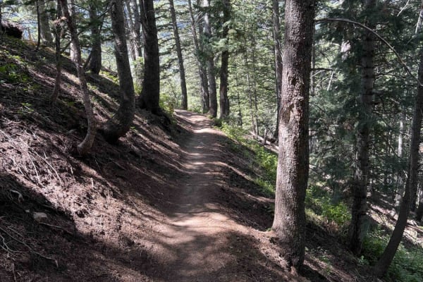
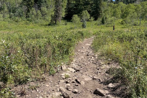
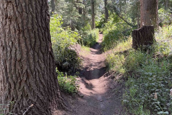
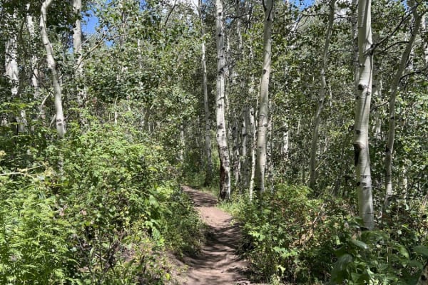
Dirt Bike Trails
Near American Fork, Utah
Explore All Dirt Bike Trails Near American Fork, Utah
Dirt Bike Trails Near American Fork, Utah
Discover the best dirt bike trails near you. Browse trail maps, check difficulty ratings, and find your next adventure — whether you're looking for a quick ride or an all-day expedition.
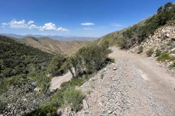
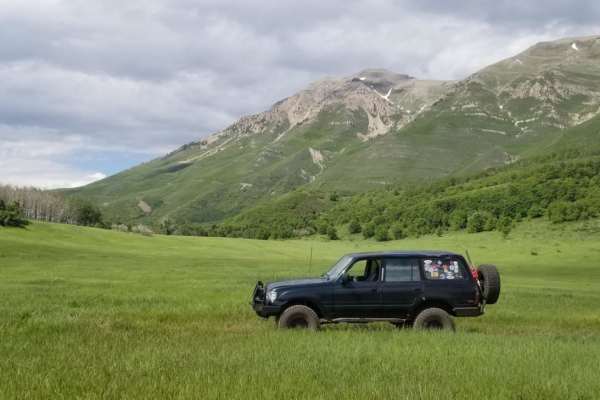
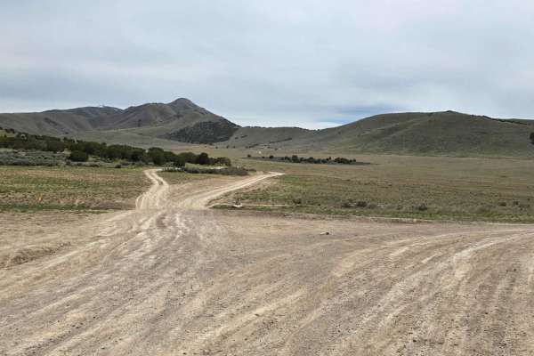
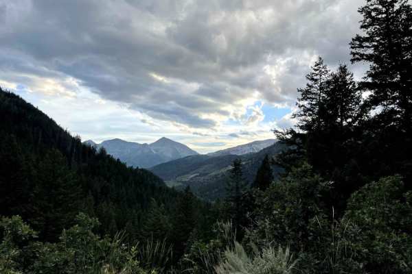
Israel Canyon Lake Mountains Pass
This road is also known as North Lake Mountain Comm Road. This route will take you over the Lake Mountains, from Saratoga Springs (north) to Eagle Mountain (south). Please note that this is a seasonal trail and is closed during winter months. You can contact Utah County Public Works at (801)-851-860...
Learn more about Israel Canyon Lake Mountains Pass
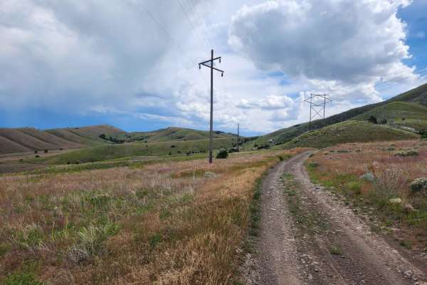
Powerline Road
This trail is a fun, easy cruise that follows the powerlines south-west of Saratoga Springs UT up and over some of the Lake Mountain foothills. The trail has some great views of the Utah lake and takes you into some neat areas that are worth exploring further on your own! This is a great trail for a...
Learn more about Powerline Road
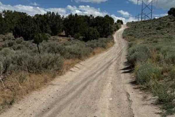
Lake Mountain East
This trail is the gateway to tons of adventure. There are tons of spots off this trail to do some shooting, hiking, mountain biking, relax next to a fire pit, or soak in the beautiful view of Utah Lake with the picturesque mountains in the background. The trail itself is pretty mellow, but is consta...
Learn more about Lake Mountain East
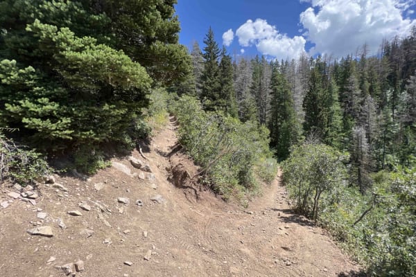
Bear Canyon Spur (2178)
Bear Canyon Spur is a short trail that runs between Timpooneke-Chris' Flat and Bear Canyon trails. The trail is narrow and drops downhill as you ride towards Bear Canyon. There are a few smaller, golf ball- or baseball-sized rock sections and several tight turns. There's also one road crossing at Ti...
Learn more about Bear Canyon Spur (2178)
Timpooneke Road
This is a high-altitude Uinta-Wasatch-Cache National Forest road starting at the back of the Timpooneke Campground and wrapping around the face of the Timpanogos Wilderness Area. It is approximately 19 miles round trip and a there-and-back road. The route is rocky, but the rough road pays off with a...
Learn more about Timpooneke Road
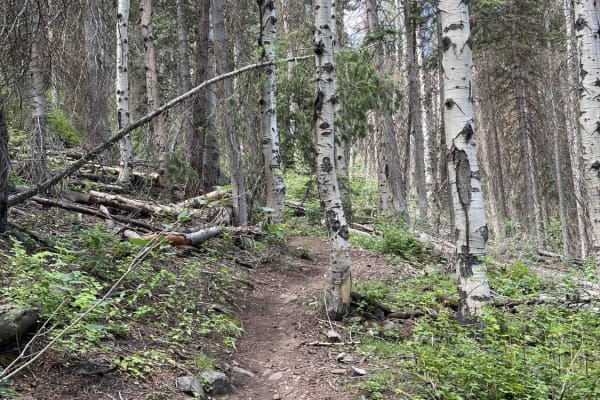
Timpooneke to Chris' Flat (2151)
This single-track trail connects the Timpanooke parking lot to Timpooneke Forest Road. From the parking lot riding west, the trail climbs to the next intersection with Bear Canyon Spur and features several big rock sections. These rocks are basketball-sized or larger, embedded in the ground, and cre...
Learn more about Timpooneke to Chris' Flat (2151)
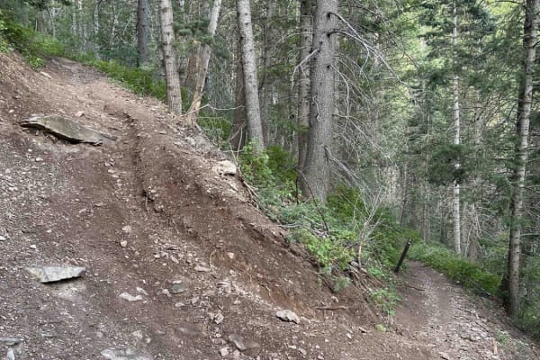
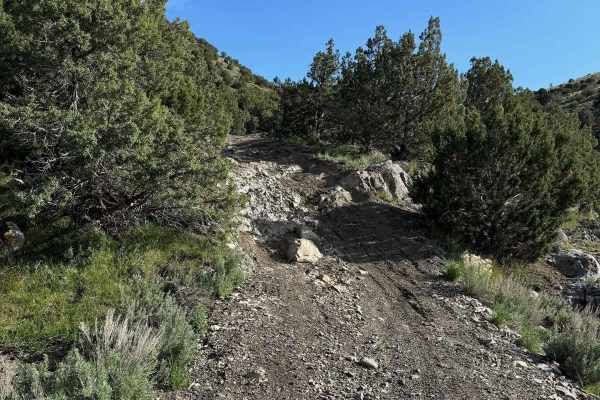
Bear Canyon (2179)
This single-track route connects the Pine Hollow parking lot to the Timpooneke-Chris' Flat trail. Riding south away from the parking lot, the trail starts with a tight downhill section that puts you across the road from the Mutual Dell campground. From here, the trail is primarily uphill with multip...
Learn more about Bear Canyon (2179)
Ridge Connector (2216)
Ridge Connector is a short single-track trail that runs from Willow Hollow to Ridge Trail. Riding west to east, the trail starts in a field with high grass and transitions to woods after a few hundred feet. From here, the trail is a steady ~400-foot climb up to the Ridge Trail. There are several tig...
Learn more about Ridge Connector (2216)
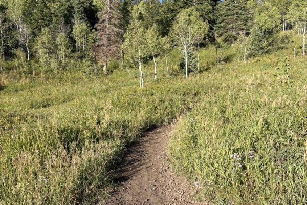
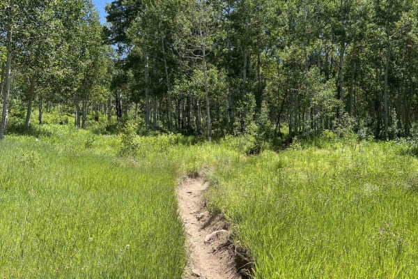
Salamander Flat (2150)
Salamander Flat is a single-track that runs south from Pine Hollow and ends at the Timpanooke parking lot. Riding away from Pine Hollow, it's a gradual descent to the parking lot. This trail is very smooth, without many obstacles, but can be narrow in sections. One of these is a traverse across a wo...
Learn more about Salamander Flat (2150)
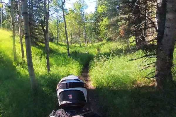
Willow Hollow (2159)
Willow Hollow begins at the Alpine Loop Summit parking lot and descends to Salamander Flat Trail. This single-track trail is extremely tight and twisty near the parking lot. There are some roots and cut trees to watch out for at foot peg-level. There isn't much flow to this top section-it feels more...
Learn more about Willow Hollow (2159)
South Fork Little Deer Creek (2252)
This track connects Ridge Trail to Lame Horse near the Alpine Loop Summit Parking Lot. Starting from Ridge, this wooded trail has great flow when traveling downhill. There are a few root sections mixed in, but you don't notice them traveling downhill away from Ridge trail. There are 2 road crossings...
Learn more about South Fork Little Deer Creek (2252)
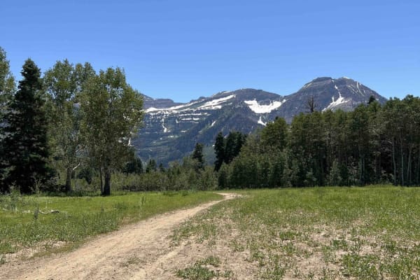
Lame Horse (2055)
Lame Horse runs from the Alpine Loop Summit parking lot to the base of Mount Timpanogos hiking trails. It's a dead end with views of the mountain, but nowhere to go but back towards the parking lot. The single-track trail cuts through an aspen forest and is generally flat without any major obstacles...
Learn more about Lame Horse (2055)
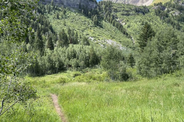
Hidden Hollow Loop
This is a fun family loop behind Hidden Hollow Elementary in Eagle Mountain. This is a multi-use area, so there are a lot of mountain bikers. This loop takes you to two lookouts. The first one overlooks Utah Lake and the Saratoga Springs Temple, the second overlook is at the Prayer Flags, and this o...
Learn more about Hidden Hollow Loop
Lake Mountain Trail
This trail runs along Lake Mountain with a view looking down onto Eagle Mountain. It starts in Reformation Canyon. The trail is pretty mellow for the first 5.5 miles and consists mainly of hard-packed trails. 2 miles in is a gate that is to remain closed as you pass through. As this trail comes into...
Learn more about Lake Mountain Trail
Mud Springs (2173)
The Mud Springs single-track trail starts at Mill Canyon, intersects Tibble Fork, and terminates at Ridge Trail. Between Mill Canyon and Ridge Trail, it's mostly uphill and climbs ~1,300 feet. The Mill Canyon end has a few root and rock sections with large basketball-sized boulders embedded in the g...
Learn more about Mud Springs (2173)
Pine Hollow (2047)
This single-track trail connects the Pine Hollow Parking Lot to the Ridge Trail. From the parking lot, it's a steady climb ~1,200 feet to the Ridge Trail. The beginning is very narrow, with brush on either side of the trail. There's high exposure here as you traverse a hillside and gain elevation fr...
Learn more about Pine Hollow (2047)
American Fork Snake Creek
This trail is a low risk, high pay out trail with lots of jaw dropping views. The trail could honestly be done in a 2WD sedan if you don't explore any of the side trails. There are lots of picnicking and dispersed camping sites along the way. The trail runs from Tibble Fork reservoir in American ...
Learn more about American Fork Snake Creek
Tibble Fork (2041)
From Mill Canyon, this trail runs west and then southeast, climbing about 1,400 feet where it intersects with Ridge Trail. The lower portion running west takes you on a ledge trail through the woods above Tibble Fork Reservoir. From here, it continues climbing, intersects Mud Springs, and finally re...
Learn more about Tibble Fork (2041)
Holman (2039)
From the Tibble Fork parking area, this single-track trail is a more difficult entrance into the American Fork system. It's not ridden as often as the others in the canyon. From the American Fork Snake Creek Road, this trail climbs ~2,500 feet where it intersects with Ridge (2157) and East Ridge (20...
Learn more about Holman (2039)
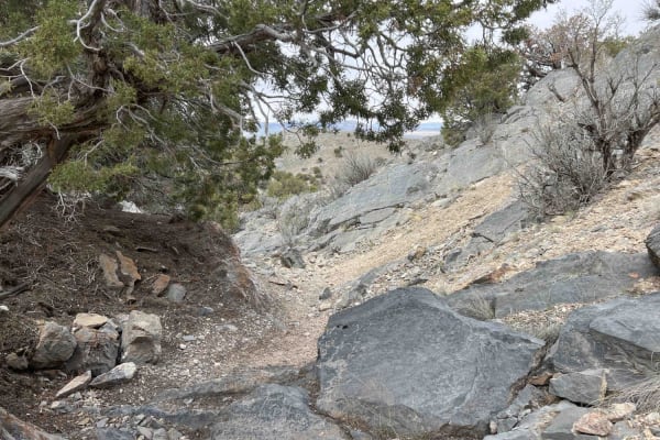
Rib Cage Canyon
This is a more difficult trail off the Back/Front 9 which leads into a narrow canyon. Early on the canyon is blocked by rocks and a cliff. The only way around is to take a steep bypass trail up the side of the canyon, which hairpins over a rock ledge, and then drops back into the canyon with a loose...
Learn more about Rib Cage Canyon
ATV trails near American Fork, Utah
Explore ATV-friendly trails near you. These trails are accessible for vehicles up to 50 inches wide, perfect for ATVs and smaller off-road machines.
Israel Canyon Lake Mountains Pass
This road is also known as North Lake Mountain Comm Road. This route will take you over the Lake Mountains, from Saratoga Springs (north) to Eagle Mountain (south). Please note that this is a seasonal trail and is closed during winter months. You can contact Utah County Public Works at (801)-851-860...
Learn more about Israel Canyon Lake Mountains Pass
Powerline Road
This trail is a fun, easy cruise that follows the powerlines south-west of Saratoga Springs UT up and over some of the Lake Mountain foothills. The trail has some great views of the Utah lake and takes you into some neat areas that are worth exploring further on your own! This is a great trail for a...
Learn more about Powerline Road
Lake Mountain East
This trail is the gateway to tons of adventure. There are tons of spots off this trail to do some shooting, hiking, mountain biking, relax next to a fire pit, or soak in the beautiful view of Utah Lake with the picturesque mountains in the background. The trail itself is pretty mellow, but is consta...
Learn more about Lake Mountain East
Timpooneke Road
This is a high-altitude Uinta-Wasatch-Cache National Forest road starting at the back of the Timpooneke Campground and wrapping around the face of the Timpanogos Wilderness Area. It is approximately 19 miles round trip and a there-and-back road. The route is rocky, but the rough road pays off with a...
Learn more about Timpooneke Road
UTV/side-by-side trails near American Fork, Utah
Find UTV and side-by-side trails near you. These trails accommodate vehicles up to 60 inches wide, ideal for UTVs, side-by-sides, and wider off-road rigs.
Israel Canyon Lake Mountains Pass
This road is also known as North Lake Mountain Comm Road. This route will take you over the Lake Mountains, from Saratoga Springs (north) to Eagle Mountain (south). Please note that this is a seasonal trail and is closed during winter months. You can contact Utah County Public Works at (801)-851-860...
Learn more about Israel Canyon Lake Mountains Pass
Powerline Road
This trail is a fun, easy cruise that follows the powerlines south-west of Saratoga Springs UT up and over some of the Lake Mountain foothills. The trail has some great views of the Utah lake and takes you into some neat areas that are worth exploring further on your own! This is a great trail for a...
Learn more about Powerline Road
Lake Mountain East
This trail is the gateway to tons of adventure. There are tons of spots off this trail to do some shooting, hiking, mountain biking, relax next to a fire pit, or soak in the beautiful view of Utah Lake with the picturesque mountains in the background. The trail itself is pretty mellow, but is consta...
Learn more about Lake Mountain East
Timpooneke Road
This is a high-altitude Uinta-Wasatch-Cache National Forest road starting at the back of the Timpooneke Campground and wrapping around the face of the Timpanogos Wilderness Area. It is approximately 19 miles round trip and a there-and-back road. The route is rocky, but the rough road pays off with a...
Learn more about Timpooneke Road
The onX Offroad Difference
onX Offroad combines trail photos, descriptions, difficulty ratings, width restrictions, seasonality, and more in a user-friendly interface. Available on all devices, with offline access and full compatibility with CarPlay and Android Auto. Discover what you're missing today!
Open Trail Map