
Dirt Bike Trails
Near Amargosa Valley, Nevada
Explore All Dirt Bike Trails Near Amargosa Valley, Nevada
Dirt Bike Trails Near Amargosa Valley, Nevada
Discover the best dirt bike trails near you. Browse trail maps, check difficulty ratings, and find your next adventure — whether you're looking for a quick ride or an all-day expedition.
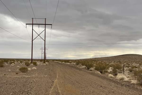
Dunes Poll Line Road
A pretty straight, pretty flat rip from the Amargosa Dunes over to the access trail to get to Blackmarble Mountain and other trails in the area. There are a few spots where it gets rutted out and silty, and a few sections of choosing your own adventure that meets up to the same track. The trail is g...
Learn more about Dunes Poll Line Road
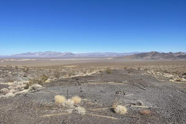
Landing Strip of Washouts
If you love long straightaways with tons of washouts, then this is the trail for you. Any chance of picking up speed on this trail is taken by very frequent washouts as you cross the desert. The reward at the end is you come to a cool old abandoned mine and amazing views of the valley below. It's wo...
Learn more about Landing Strip of Washouts
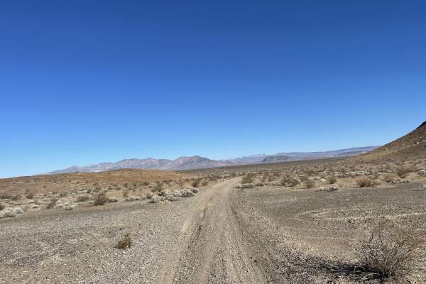
Indian Pass Vista Point
An easily traveled two-track trail crosses through frequent washouts and some loose sandy washes. Small rocky and loose sections towards the end. Some off-camber sections and steep climbs. Views from Indian Pass point are stunning. Looks down over Death Valley. The trail does pass through Death Vall...
Learn more about Indian Pass Vista Point
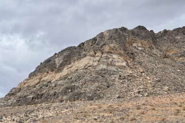
Black Marble Mountain Single Track
The western leg of Marble the Mountain Loop. The trail is mostly singletrack. There are a few spots to camp with a view of the valley and the mountains. The trail consists of lots of deep rutted-out transitions, big washouts, and narrow sections. Would not advise for a novice rider. 2 bars LTE servi...
Learn more about Black Marble Mountain Single Track
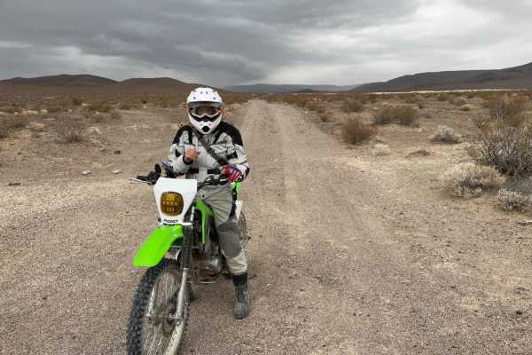
Black Marble Mountains Sandy Revenge
The mostly sandy two-track trail goes from sand to sharp rocks to hard pack and back to sandy wash. This is the long way around Marble Mountain. There are wide-open planes and views of a big dune as you come to the southern end of the trail. The washes are coarse sand and very rutted. Could be impas...
Learn more about Black Marble Mountains Sandy Revenge
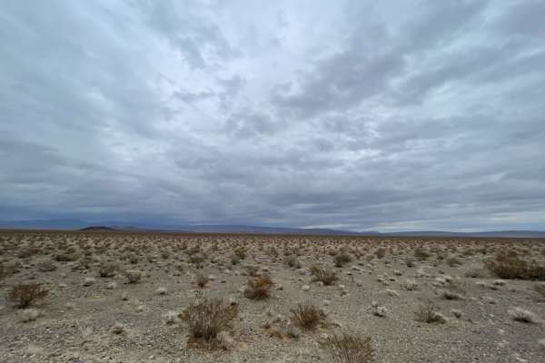
Black Marble Mountain Truck Route
The first half of the trail is relatively easy;most high clearance 4x4 will have no issues. There are a few dispersed camping spots and a few old mining areas to explore with a vast elevated view of the canyon below. The trail narrows to a single track on the mountain's south side. No cell service o...
Learn more about Black Marble Mountain Truck Route
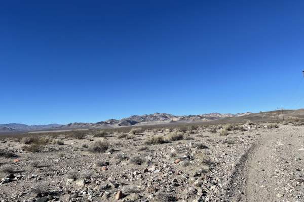
Pole Line Road
This trail is the main Pole line heading south out of town from Beatty and its more local dirt trails. This road takes you along the power lines and down toward two interesting abandoned mining complex trails. At one point, the trail is very tricky as it passes asphalt. You will want to follow their...
Learn more about Pole Line Road
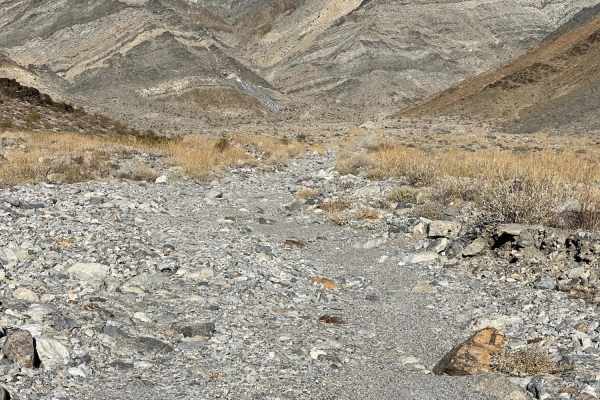
Carrara Canyon Road
This brutal rocky, sandy slog up the hill ends at an old mining complex with interesting large mined cubes and a few old building foundations. One can see where the road was supposed to be, and the further up you get, bigger rocks and the looser sand. This trail could be impassable or flooded in rai...
Learn more about Carrara Canyon Road
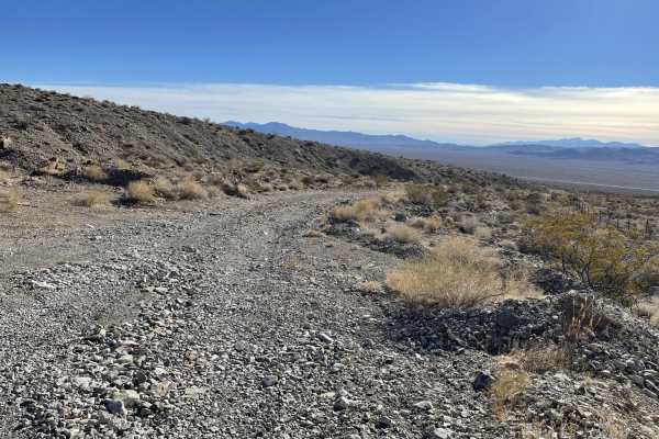
Golden Ace Mine
This is a short trail to the Gold Ace Mine Complex Ruins. The lower mine is easily accessed by car or SUV. The upper section of the complex is more technical and very rocky, and loose near the end. Once in the "parking" area, you can easily see what other trails you wish to explore in the area or ju...
Learn more about Golden Ace Mine
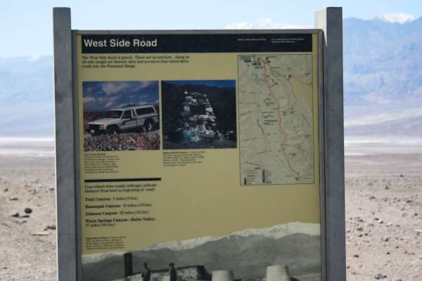
West Side Road - DVNP
Easy route around the west side of the dry lake bed in Death Valley. This route offers a different, and remote, perspective of the Devil's Golf Course and Badwater Basin. The route starts about 11 miles north of Badwater Basin and continues for 40 miles ending near Ashford Mill Ruins. Eagle Borax ...
Learn more about West Side Road - DVNP
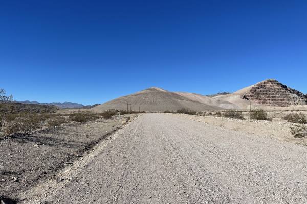
Old Railroad Grade Road
The western section of the road is well-graded and more than two cars wide. Once you transition onto the two-track near the airport, the trail gets rocky, with a few washout transitions. One specifically is a little larger than the others. The main trail passes near the airport and right past the Ne...
Learn more about Old Railroad Grade Road
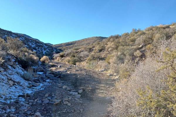
Noides Road
Noides Road drives through the Humboldt-Toiyabe National Forest and Bureau of Land Management Government Lands. It is a semi-easy road with sections that take a 4x4 vehicle and good line placement to navigate loose rocky washouts. You will find a large camp area at the lower open desert area right u...
Learn more about Noides Road
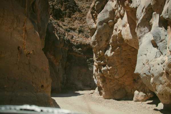
Titus Canyon
Titus Canyon is a scenic one way dirt road from East to West, doable in any stock SUV. In just 26 easy miles you will drive through mountains, a ghost town, along petroglyphs and through the Narrows before being dumped into Death Valley itself. While not a challenging trail, it is one of the most be...
Learn more about Titus Canyon
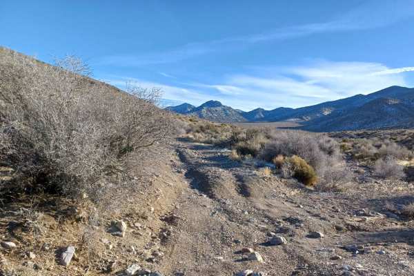
552 Mining Entry Road
552 Mining Entry Road drives through the Humboldt-Toiyabe National Forest and Bureau of Land Management Government Lands, it is a easy gravel road with sections of loose rock, and spots that have been washed out a 4x4 vechile is recommended. This area can have possible floods, there is a camp spot a...
Learn more about 552 Mining Entry Road
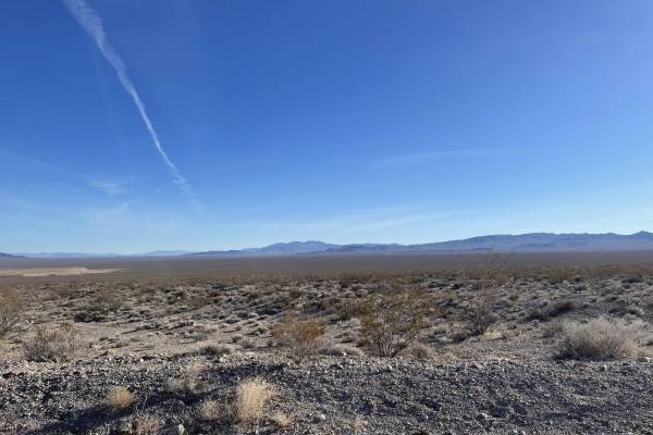
Gold Bar Road
This trail starts out easy with a graded two-lane washboard dirt road by the private Big Red Art Barn. Look, but please don't touch. It also appears people camp in the parking lot by the many fire rings scattered about. Technically it's BLM land, so It could be allowed. Always e sure to check with t...
Learn more about Gold Bar Road
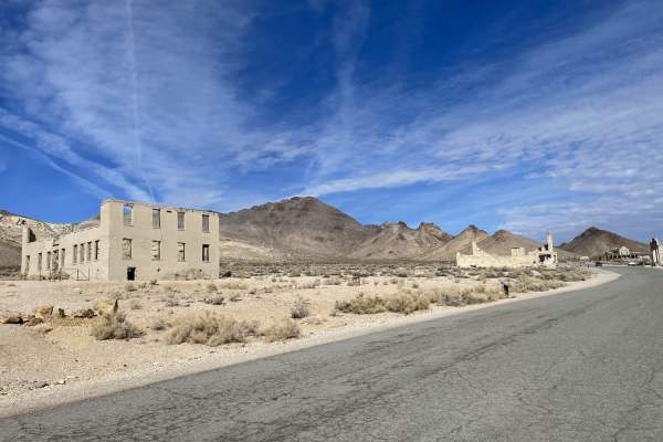
Rainbow Mountain Road
A mostly east trail that begins or ends at the Rhyolite ghost town on the western end of the trail. The ghost town is somewhat preserved with many structures still standing and lots to explore, including many informational Kiosks to spend your time learning about the town. There are also pit toilets...
Learn more about Rainbow Mountain Road
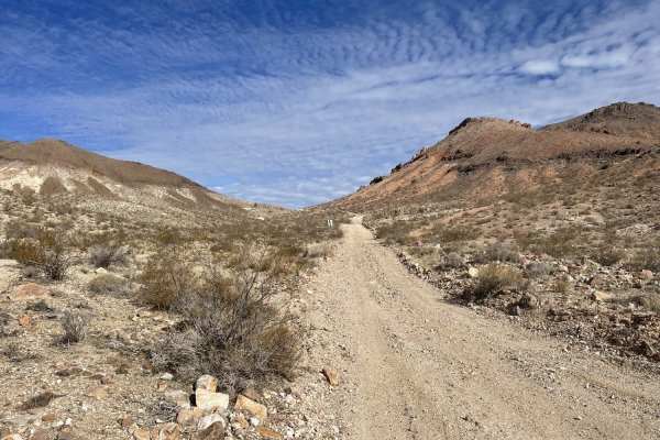
Crystal Springs Road
This is a mostly easy trail with sharp rocks and differing vistas around every turn. It passes by the crystal spring that seems to bubble up a little further from the fenced-off section where it is marked. The Western end of the trail has another spring that is fed into a trough and pours over into ...
Learn more about Crystal Springs Road
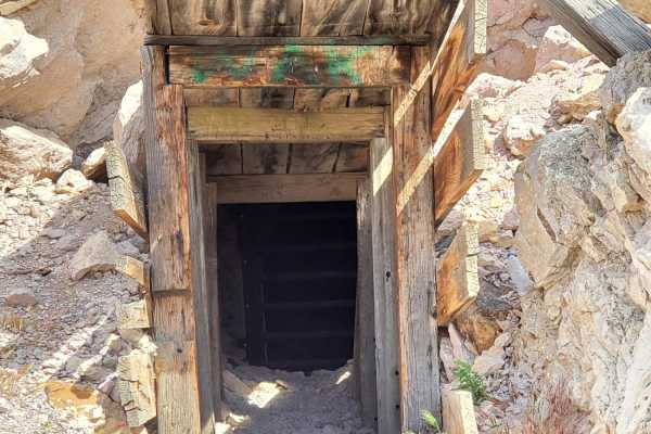
Rhyolite Ghost Town Loop
This is a fairly easy trail with the exception of Secret Pass, which can be bypassed easily with other trails nearby. Secret Pass has short, steep grades that are rocky and tight in various sections. Pinstripes, tire sidewall damage and water crossings up to a foot during the wet months are likely. ...
Learn more about Rhyolite Ghost Town Loop
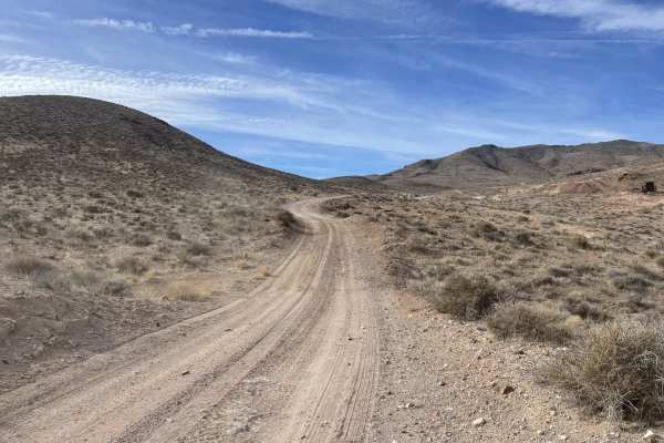
Pioneer Road
A mostly easy trail, except for the last 100 yards that complete the trail to the mine. There is plenty of room for oncoming traffic, and the trail is well graded. 2 bars LTE at the bottom and no service up by the mines. Use caution near the mines. There is plenty of dispersed camping around the tra...
Learn more about Pioneer Road
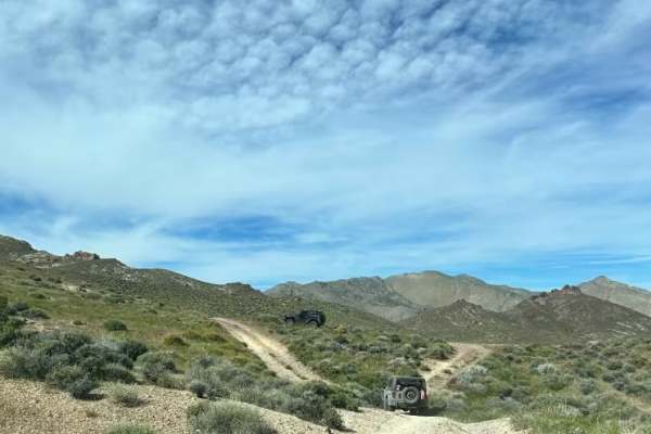
Gold Valley Road - Willow Spring Spur
If you’re looking for a relaxed off-road outing with big views, this trail is a great choice. It’s an easy, scenic route that feels more like a desert cruise than a technical drive—ideal for a low-stress day or for bringing along newer drivers.
The route is about 13 miles and takes roughly 2 hours ...
Learn more about Gold Valley Road - Willow Spring Spur
ATV trails near Amargosa Valley, Nevada
Explore ATV-friendly trails near you. These trails are accessible for vehicles up to 50 inches wide, perfect for ATVs and smaller off-road machines.
Dunes Poll Line Road
A pretty straight, pretty flat rip from the Amargosa Dunes over to the access trail to get to Blackmarble Mountain and other trails in the area. There are a few spots where it gets rutted out and silty, and a few sections of choosing your own adventure that meets up to the same track. The trail is g...
Learn more about Dunes Poll Line Road
Landing Strip of Washouts
If you love long straightaways with tons of washouts, then this is the trail for you. Any chance of picking up speed on this trail is taken by very frequent washouts as you cross the desert. The reward at the end is you come to a cool old abandoned mine and amazing views of the valley below. It's wo...
Learn more about Landing Strip of Washouts
Indian Pass Vista Point
An easily traveled two-track trail crosses through frequent washouts and some loose sandy washes. Small rocky and loose sections towards the end. Some off-camber sections and steep climbs. Views from Indian Pass point are stunning. Looks down over Death Valley. The trail does pass through Death Vall...
Learn more about Indian Pass Vista Point
Black Marble Mountain Single Track
The western leg of Marble the Mountain Loop. The trail is mostly singletrack. There are a few spots to camp with a view of the valley and the mountains. The trail consists of lots of deep rutted-out transitions, big washouts, and narrow sections. Would not advise for a novice rider. 2 bars LTE servi...
Learn more about Black Marble Mountain Single Track
UTV/side-by-side trails near Amargosa Valley, Nevada
Find UTV and side-by-side trails near you. These trails accommodate vehicles up to 60 inches wide, ideal for UTVs, side-by-sides, and wider off-road rigs.
Dunes Poll Line Road
A pretty straight, pretty flat rip from the Amargosa Dunes over to the access trail to get to Blackmarble Mountain and other trails in the area. There are a few spots where it gets rutted out and silty, and a few sections of choosing your own adventure that meets up to the same track. The trail is g...
Learn more about Dunes Poll Line Road
Landing Strip of Washouts
If you love long straightaways with tons of washouts, then this is the trail for you. Any chance of picking up speed on this trail is taken by very frequent washouts as you cross the desert. The reward at the end is you come to a cool old abandoned mine and amazing views of the valley below. It's wo...
Learn more about Landing Strip of Washouts
Indian Pass Vista Point
An easily traveled two-track trail crosses through frequent washouts and some loose sandy washes. Small rocky and loose sections towards the end. Some off-camber sections and steep climbs. Views from Indian Pass point are stunning. Looks down over Death Valley. The trail does pass through Death Vall...
Learn more about Indian Pass Vista Point
Black Marble Mountain Single Track
The western leg of Marble the Mountain Loop. The trail is mostly singletrack. There are a few spots to camp with a view of the valley and the mountains. The trail consists of lots of deep rutted-out transitions, big washouts, and narrow sections. Would not advise for a novice rider. 2 bars LTE servi...
Learn more about Black Marble Mountain Single Track
The onX Offroad Difference
onX Offroad combines trail photos, descriptions, difficulty ratings, width restrictions, seasonality, and more in a user-friendly interface. Available on all devices, with offline access and full compatibility with CarPlay and Android Auto. Discover what you're missing today!
Open Trail Map