
Dirt Bike Trails
Near Amador Pines, California
Explore All Dirt Bike Trails Near Amador Pines, California
Dirt Bike Trails Near Amador Pines, California
Discover the best dirt bike trails near you. Browse trail maps, check difficulty ratings, and find your next adventure — whether you're looking for a quick ride or an all-day expedition.
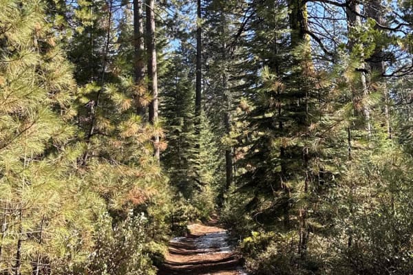
Gold Note 4WD
Gold Note 4WD (FS 8N91) is a moderately challenging Gold Note trail system segment. The trail is single-vehicle width and features areas of overgrown brush, adding to the difficulty. Riders will encounter deep ruts and tight sections, with some spots where fallen trees have been cleared just enough ...
Learn more about Gold Note 4WD

Five Corners
Five Corners (FS 8N54) is an easy trail that connects multiple trail systems in the area. Located at an elevation of approximately 4,100 feet, it offers several dispersed camping spots along its route, making it a convenient option for outdoor enthusiasts. During summer, riders should anticipate dus...
Learn more about Five Corners
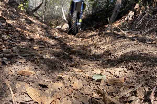
Ditch Digger
This is an area of BLM land on the North Fork of the Mokelumne River off Highway 26, just outside of Red Corral, California. Parts of the trail are un-maintained dirt roads, sections of which are rocky and washed out. The other part of the trail is in the abandoned flume or up on the levee alongside...
Learn more about Ditch Digger

Gold Note
Gold Note (FS 8N55) is an easy trail in the Eldorado National Forest, sitting at approximately 4,400 feet. It acts as a critical connector, linking various trails within the Gold Note trail system and providing access to large dispersed camping sites and OHV staging areas. A restroom facility is ava...
Learn more about Gold Note
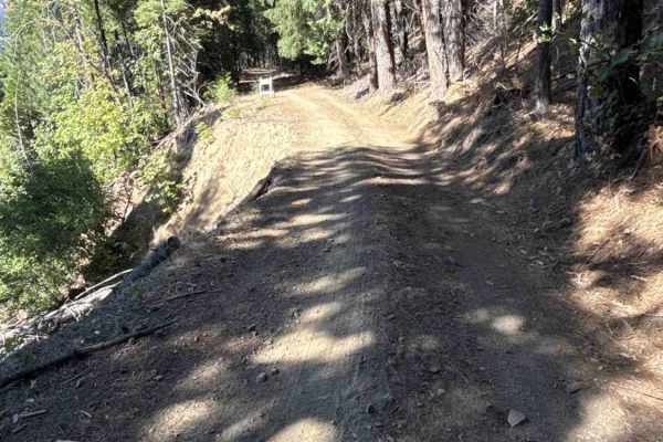
FS 7N08
Nestled deep within the lush, densely timbered pine canopy of the Stanislaus National Forest, FS 7N08 functions as an incredibly scenic and highly useful backcountry connector. Branching directly off of forest route 7N28 and ultimately linking to 8N50, this lengthy pathway provides vital throughput ...
Learn more about FS 7N08
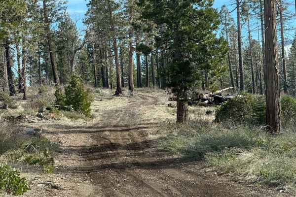
FS N967
This trail starts out as a pretty easy dirt road and makes for a nice cruise through the forest. It only gets more challenging toward the end when you reach the final climb. That section has some bigger rocks, a few ledges, and some tighter, winding spots where you’ll need to pick your line a bit mo...
Learn more about FS N967
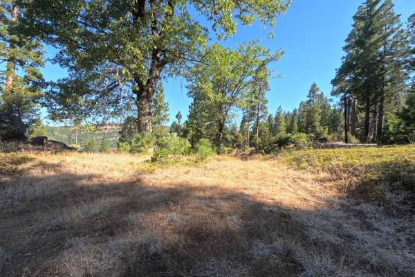
FS 8N16B
Branching directly off the paved surface of Forest Road 8N16, FS 8N16B serves as a short, secluded out-and-back mountain spur. The pathway slowly climbs along a scenic ridgeline through a somewhat open, sun-dappled pine forest managed by the National Forest System. The driving surface consists of a ...
Learn more about FS 8N16B
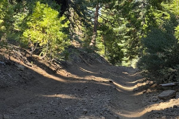
Horse Peddler - FS 9N25
Access via Horse Canyon (FS 8N27). This trail offers a fun out-and-back run or can be ridden continuously via the bypass. Note that the historically marked trail is permanently blocked by a berm and rocks, but a well-traveled bypass detour leads around the closure. Horse Peddler features moderate te...
Learn more about Horse Peddler - FS 9N25
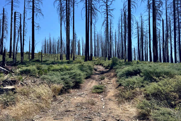
Baltic Ridge - FS 10N46M
This trail starts out as dirt and is narrow, with overgrown vegetation on the sides of the trail and an occasional tree to maneuver around on the side. The trail turns into more of a gravel and rock combo towards the middle of the trail. There are a good number of ruts and washes along the trail, in...
Learn more about Baltic Ridge - FS 10N46M
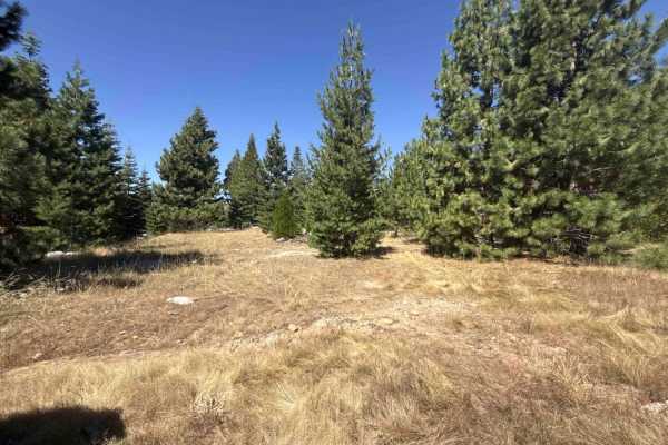
Doe Road - FS 8N02
Branching directly off the main paved route, Doe Road - FS 8N02 serves as a secluded and highly scenic out-and-back mountain spur tucked away in the National Forest. This winding pathway travels through a dynamic high-alpine environment, transitioning beautifully between dense, shaded timber stands ...
Learn more about Doe Road - FS 8N02
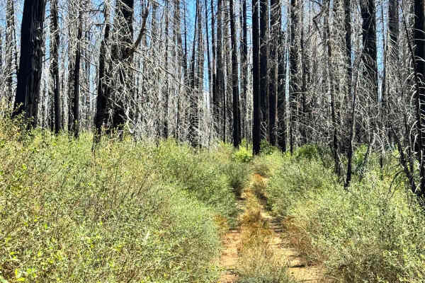
Vandenberg - FS 10N65
This is a trail that has become overgrown with so much vegetation that you can't get down most of it anymore. There are some narrow sections along the trail as well. The trail starts off with pavement as you enter it from the main road and quickly turns to dirt. The trail travels through a previousl...
Learn more about Vandenberg - FS 10N65
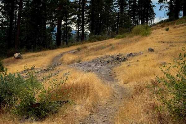
15EV55
The east end of this trail starts at the intersection with 15EV56 and 15EV106, and goes across a sun-exposed and grassy hilltop with some flat layers of embedded rock in the trail, covered in small loose rock and some minor roots. It descends off the hilltop into the trees, on a narrow path lined wi...
Learn more about 15EV55
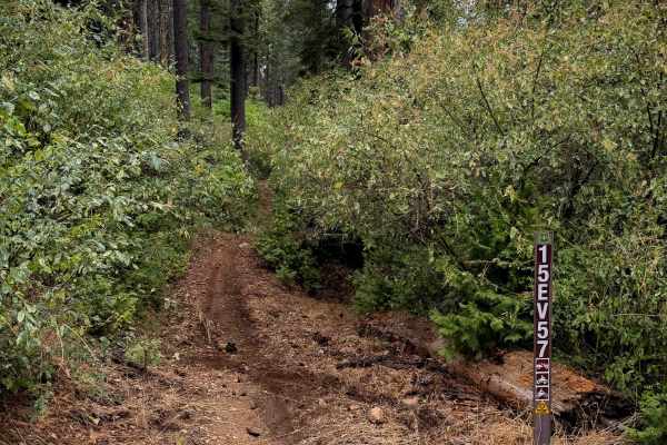
15EV57
This is a 1.2-mile-long easy ATV loop in the northern area of the Interface Trail System. It’s quite narrow for an ATV trail, with a lot of segments between the bushes that feel more like a dirt bike trail. It’s fast and flowy with some big whoops, meandering through flat grassy meadows, and gradual...
Learn more about 15EV57
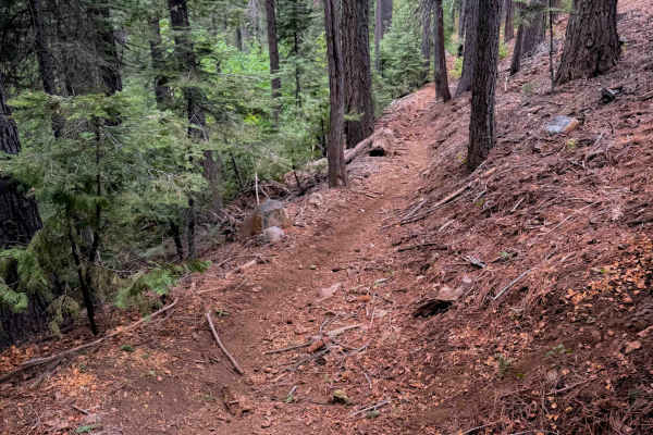
15EV56
This ATV trail starts out on the west end between the bushes, creating a tighter feeling path for ATVs, although still wide for dirt bikes. It winds down through the tall pine trees, cutting across the side of the hill, on a narrower path with big whoops. It goes underneath a canopy of bigleaf maple...
Learn more about 15EV56
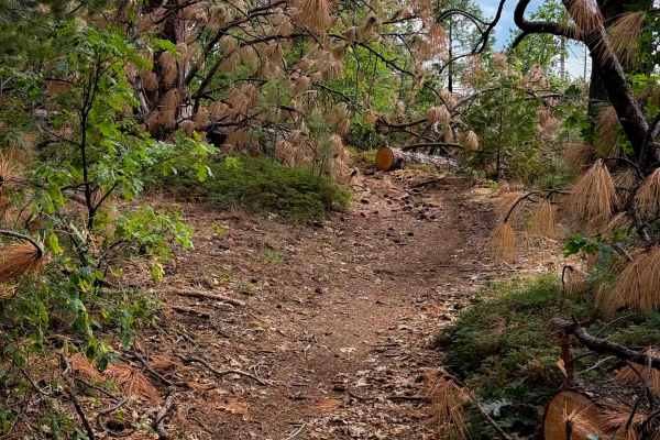
15EV58
This short dirt bike trail weaves between a tight corridor of oaks and shrubs, with towering pine trees. It meanders along the hillside through the tight bushes, often overgrown and whacking you in the face and blocking visibility. Several downed logs have been cut, keeping the trail clear, but ther...
Learn more about 15EV58
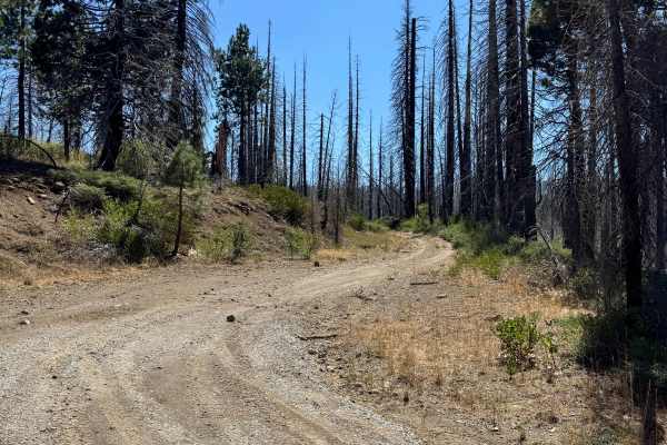
Smiths - FS 10N87
This is a short, 2.3-mile trail that will connect you from the main road to an inner trail system. The trail gets pretty rocky and narrow in some areas. There are some larger washes and ruts along the trail as well in a couple of spots, but they should be able to be driven around and maneuvered thro...
Learn more about Smiths - FS 10N87

15EV105
This is a wide and easy ATV trail that cuts through the middle of the Interface OHV trail system, acting as an easy access route to access several other trails. It has minor loose rock and shallow ruts, but mostly is smooth dirt. It’s lined with bear clover, and goes through a sparse forest of tower...
Learn more about 15EV105

Dennis - FS 10N46
This trail is a long trail that connects you to other trails, and there are many areas off this trail and spurs off this trail where you can camp. There are washes and drainage ruts along this trail, and some sections that get rocky. There are some camp spots with great views of surrounding hills, a...
Learn more about Dennis - FS 10N46
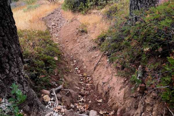
15EV72
This is one of the more difficult dirt bike trails in the Interface Trail System. The entrance from the north end is rutted, with overgrown grass, a few rocks, and embedded root bands across the trail creating small drop-offs. It starts descending down a rutted slope, with lots of loose rock filling...
Learn more about 15EV72
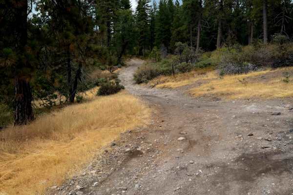
15EV73
This is a wide and easy ATV trail that starts out on the south end lined with small manzanita shrubs and under towering pine trees. It has small loose rocks and shallow ruts, gradually ascending up a hillside, but is mostly a smooth dirt path. It gets a bit narrow in a couple spots between the shrub...
Learn more about 15EV73
ATV trails near Amador Pines, California
Explore ATV-friendly trails near you. These trails are accessible for vehicles up to 50 inches wide, perfect for ATVs and smaller off-road machines.
Gold Note 4WD
Gold Note 4WD (FS 8N91) is a moderately challenging Gold Note trail system segment. The trail is single-vehicle width and features areas of overgrown brush, adding to the difficulty. Riders will encounter deep ruts and tight sections, with some spots where fallen trees have been cleared just enough ...
Learn more about Gold Note 4WD
Five Corners
Five Corners (FS 8N54) is an easy trail that connects multiple trail systems in the area. Located at an elevation of approximately 4,100 feet, it offers several dispersed camping spots along its route, making it a convenient option for outdoor enthusiasts. During summer, riders should anticipate dus...
Learn more about Five Corners
Gold Note
Gold Note (FS 8N55) is an easy trail in the Eldorado National Forest, sitting at approximately 4,400 feet. It acts as a critical connector, linking various trails within the Gold Note trail system and providing access to large dispersed camping sites and OHV staging areas. A restroom facility is ava...
Learn more about Gold Note
FS 7N08
Nestled deep within the lush, densely timbered pine canopy of the Stanislaus National Forest, FS 7N08 functions as an incredibly scenic and highly useful backcountry connector. Branching directly off of forest route 7N28 and ultimately linking to 8N50, this lengthy pathway provides vital throughput ...
Learn more about FS 7N08
UTV/side-by-side trails near Amador Pines, California
Find UTV and side-by-side trails near you. These trails accommodate vehicles up to 60 inches wide, ideal for UTVs, side-by-sides, and wider off-road rigs.
Gold Note 4WD
Gold Note 4WD (FS 8N91) is a moderately challenging Gold Note trail system segment. The trail is single-vehicle width and features areas of overgrown brush, adding to the difficulty. Riders will encounter deep ruts and tight sections, with some spots where fallen trees have been cleared just enough ...
Learn more about Gold Note 4WD
Five Corners
Five Corners (FS 8N54) is an easy trail that connects multiple trail systems in the area. Located at an elevation of approximately 4,100 feet, it offers several dispersed camping spots along its route, making it a convenient option for outdoor enthusiasts. During summer, riders should anticipate dus...
Learn more about Five Corners
Gold Note
Gold Note (FS 8N55) is an easy trail in the Eldorado National Forest, sitting at approximately 4,400 feet. It acts as a critical connector, linking various trails within the Gold Note trail system and providing access to large dispersed camping sites and OHV staging areas. A restroom facility is ava...
Learn more about Gold Note
FS 7N08
Nestled deep within the lush, densely timbered pine canopy of the Stanislaus National Forest, FS 7N08 functions as an incredibly scenic and highly useful backcountry connector. Branching directly off of forest route 7N28 and ultimately linking to 8N50, this lengthy pathway provides vital throughput ...
Learn more about FS 7N08
The onX Offroad Difference
onX Offroad combines trail photos, descriptions, difficulty ratings, width restrictions, seasonality, and more in a user-friendly interface. Available on all devices, with offline access and full compatibility with CarPlay and Android Auto. Discover what you're missing today!
Open Trail Map