
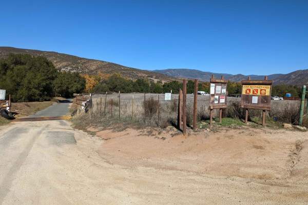
Dirt Bike Trails
Near Aguanga, California
Explore All Dirt Bike Trails Near Aguanga, California
Dirt Bike Trails Near Aguanga, California
Discover the best dirt bike trails near you. Browse trail maps, check difficulty ratings, and find your next adventure — whether you're looking for a quick ride or an all-day expedition.
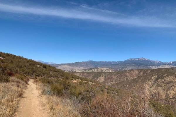
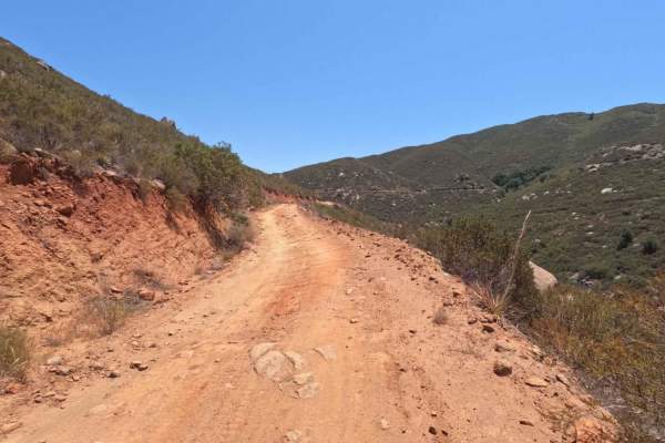
8S05 - North Palomar Mountain Road
8S05 is a well-maintained service road, but you can expect large rocks, ruts, and very steep drop-offs throughout. The weather could have a significant impact on the road. Muddy conditions are likely; one should ensure their vehicle is properly equipped and use caution. This drive is great for a loc...
Learn more about 8S05 - North Palomar Mountain Road
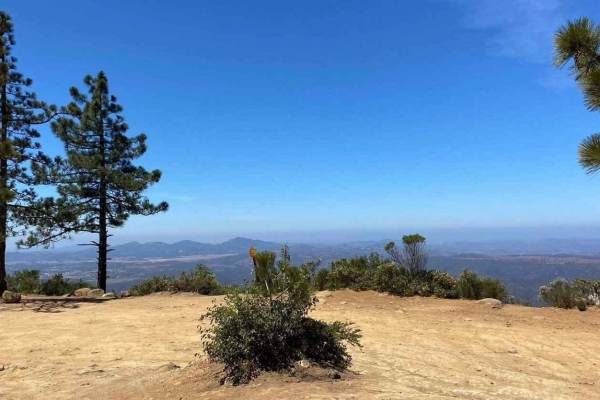
Nate Harrison Grade
Nate Harrison Grade is a dirt backroad into Palomar Mountain State Park. This trail leads from typical Southern California scrubland scenery up to lush forests and mountain views. You'll encounter loose rocky areas and several deep ruts throughout the route. The trail is primarily non-technical, wit...
Learn more about Nate Harrison Grade
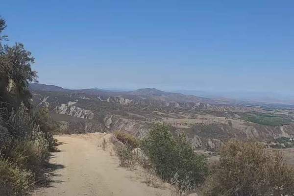
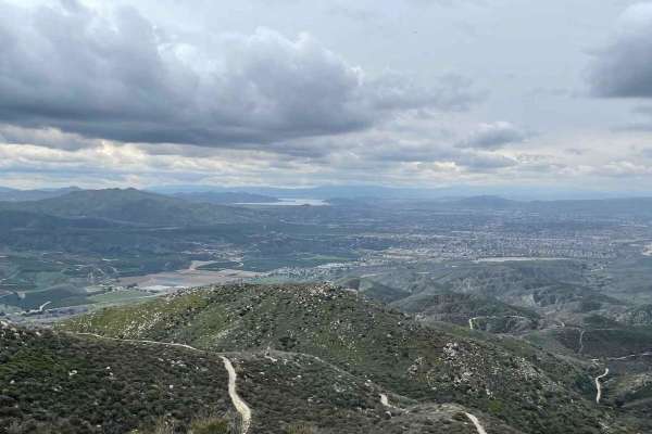
Red Mountain OHV Trail
Beautiful views of the valley below and mountains above. There are lots of switchbacks and about 600 feet of elevation gain in just a few miles of driving. The second half of the trail was closed after Hurricane Hillary, but it does connect to Juan Diego Flats to get you back out to civilization. Th...
Learn more about Red Mountain OHV Trail
Juan Diego Flat
This is the descending trail from Red Mountain Trail to Reed Vally Road. The beginning of the trail has some washed-out sections and tight switchbacks and becomes smoother as you descend the mountain. Sweeping vistas, mountain meadows, woods, and mountain views are visible throughout the length of t...
Learn more about Juan Diego Flat
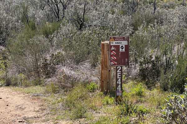
Allesandro Trail - 2E44
This technical trail is a blast from top to bottom, but it doesn't leave much room for error. You’ll be dodging overgrown brush in tight sections that make the flow feel intense. It’s a top-tier challenge that’s probably best ridden downhill unless you’re looking for a brutal climb. Super enjoyable ...
Learn more about Allesandro Trail - 2E44
Rouse Ridge via Cottonwood
Rouse Ridge via Cottonwood is a trail that scales Rouse Ridge/Thomas Mountain using Cottonwood (6S18) and Thomas Mountain Rd (6S13). This trail offers stunning views in all directions as you ascend and descend the mountain. While it is possible to complete this trail in either direction, the souther...
Learn more about Rouse Ridge via Cottonwood
Thomas Mountain West Approach
This trail connects the Rouse Ridge via Cottonwood trail to the Thomas Mountain Campground via the western end of Thomas Mountain Road. During dry months, the trail is an easily passable dirt road, requiring only moderate clearance to pass over occasional ruts and drainage control berms running acro...
Learn more about Thomas Mountain West Approach
Rouse Hill
Rouse Hill is a ridgeline trail with tremendous west and east views. This trail is predominately hard-packed dirt with a loose top layer. It can be a bit sandy in some sections but that will typically only be an issue for 2-wheel vehicles. The trail is only single vehicle wide in some places and som...
Learn more about Rouse Hill
Hixon - Bautista Trail (2E43)
The Hixon - Bautista Trail is an ATV/Dirt Bike Trail in San Bernardino National Forest. This trail includes a significant amount of elevation gain from Bautista Canyon to Red Mountain. The fantastic views stretch from Mount San Jacinto all the way to Santiago Peak, but be aware that this is not an e...
Learn more about Hixon - Bautista Trail (2E43)
5S06 Idyllwild Control
5S06 Idyllwild Control is a 6-mile point-to-point trail rated 3 of 10 located within the San Bernardino National Forest, San Jacinto Ranger District. 5S06 climbs from Highway 74 nearly 3,000 feet, ending at the intersection with Apple Drive in Idyllwild. The road is open to highway-legal vehicles on...
Learn more about 5S06 Idyllwild Control
11S03 Lusardi Truck Trail
11S03 Lusardi Truck Trail is an 11.6-mile out-and-back trail rated 3 of 10 located within the Cleveland National Forest, Trabuco Ranger District. Lusardi Truck Trail ascends the Carney Canyon between the Black Butte (west) and Black Mountain (east) to the National Forest boundary at 5.8 miles. The t...
Learn more about 11S03 Lusardi Truck Trail
Bee Canyon
Bee Canyon Truck Trail is a solid choice for beginner to intermediate off-roaders looking for a moderate challenge close to Hemet, California. Winding through the San Bernardino National Forest, this trail combines scenic canyon views with varied terrain, making it one of the more accessible dirt tr...
Learn more about Bee Canyon
Santa Ysabel Truck Trail
Santa Ysabel Truck Trail is a narrow, shelf-road trail running through a section of the Cleveland National Forest in Ramona. The trail follows along Santa Ysabel Creek and offers beautiful views over the mountains, and leads to several hiking and recreation areas. The terrain along the route is rutt...
Learn more about Santa Ysabel Truck Trail
11S04 Black Mountain
11S04 Black Mountain is a 10.8-mile out-and-back located in the Cleveland National Forest, Palomar Ranger District. This is a limited-use trail restricted to street-legal vehicles. The trail is rated 3 of 10 but has the potential to be worse during and right after seasonal weather and is subject to ...
Learn more about 11S04 Black Mountain
East Indian Canyon 4S10
This is a level 2-rated full-width road back to Highway 243. This is the fastest and safest way back up to Highway 243. The route through Bee Canyon is currently closed. 2 areas had a boulder roll off the hill into the road. Even an H1 Hummer can make it around both of them, so they won't stop you s...
Learn more about East Indian Canyon 4S10
San Jacinto Ridge Trail (FS 5S09)
San Jacinto Ridge is a two-way trail running East to West between the Banning-Idyllwild Panoramic Highway (SR 243) and Bee Canyon Road (FS 5S07) in the San Bernardino National Forest. Comprised of mostly hard-pack dirt, the trail weaves through chaparral and pine trees and crosses over the North for...
Learn more about San Jacinto Ridge Trail (FS 5S09)
Orosco Ridge Truck Trail 12S02
This trail winds its way through the Cleveland Forest from Pamo Road to the Guejito Truck Trail. The trail is not very well maintained. It is very rutted. The trail takes you up and over some good hills in Pamo Valley. Parts of the trail are very scenic and beautiful.
Learn more about Orosco Ridge Truck Trail 12S02
Indian Mountain Trail
Indian Mountain is a two-way trail between the Banning-Idyllwild Panoramic Highway (SR 243) and the San Jacinto Ridge Trail (FS 5S09) in the San Bernardino National Forest. Comprised of mostly hard-pack dirt, the trail weaves through chaparral and pine trees to the summit of Indian Mountain at 5,790...
Learn more about Indian Mountain Trail
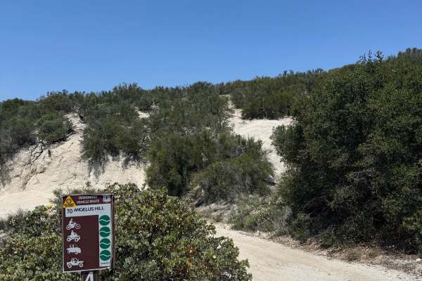
4S19 Angelus Hill
Angelus Hill is an alternative route branching off 4S06 Indian Canyon, featuring mellow terrain and scenic ridgeline riding. The trail follows a hardpack dirt road with light rutting that is shallow and unlikely to trap a tire. Riders can expect gradual hill climbs and sweeping views stretching acro...
Learn more about 4S19 Angelus Hill
Black Mountain Road
This is an easy trail that most stock vehicles could tackle. There are some really beautiful views, and the high point is the lookout, which gives a breathtaking view of the sunset. There are 5 or 6 yellow post camping sites on the way up.
Learn more about Black Mountain Road
ATV trails near Aguanga, California
Explore ATV-friendly trails near you. These trails are accessible for vehicles up to 50 inches wide, perfect for ATVs and smaller off-road machines.
Red Mountain OHV Trail
Beautiful views of the valley below and mountains above. There are lots of switchbacks and about 600 feet of elevation gain in just a few miles of driving. The second half of the trail was closed after Hurricane Hillary, but it does connect to Juan Diego Flats to get you back out to civilization. Th...
Learn more about Red Mountain OHV Trail
Juan Diego Flat
This is the descending trail from Red Mountain Trail to Reed Vally Road. The beginning of the trail has some washed-out sections and tight switchbacks and becomes smoother as you descend the mountain. Sweeping vistas, mountain meadows, woods, and mountain views are visible throughout the length of t...
Learn more about Juan Diego Flat
Rouse Ridge via Cottonwood
Rouse Ridge via Cottonwood is a trail that scales Rouse Ridge/Thomas Mountain using Cottonwood (6S18) and Thomas Mountain Rd (6S13). This trail offers stunning views in all directions as you ascend and descend the mountain. While it is possible to complete this trail in either direction, the souther...
Learn more about Rouse Ridge via Cottonwood
Thomas Mountain West Approach
This trail connects the Rouse Ridge via Cottonwood trail to the Thomas Mountain Campground via the western end of Thomas Mountain Road. During dry months, the trail is an easily passable dirt road, requiring only moderate clearance to pass over occasional ruts and drainage control berms running acro...
Learn more about Thomas Mountain West Approach
UTV/side-by-side trails near Aguanga, California
Find UTV and side-by-side trails near you. These trails accommodate vehicles up to 60 inches wide, ideal for UTVs, side-by-sides, and wider off-road rigs.
Red Mountain OHV Trail
Beautiful views of the valley below and mountains above. There are lots of switchbacks and about 600 feet of elevation gain in just a few miles of driving. The second half of the trail was closed after Hurricane Hillary, but it does connect to Juan Diego Flats to get you back out to civilization. Th...
Learn more about Red Mountain OHV Trail
Juan Diego Flat
This is the descending trail from Red Mountain Trail to Reed Vally Road. The beginning of the trail has some washed-out sections and tight switchbacks and becomes smoother as you descend the mountain. Sweeping vistas, mountain meadows, woods, and mountain views are visible throughout the length of t...
Learn more about Juan Diego Flat
Rouse Ridge via Cottonwood
Rouse Ridge via Cottonwood is a trail that scales Rouse Ridge/Thomas Mountain using Cottonwood (6S18) and Thomas Mountain Rd (6S13). This trail offers stunning views in all directions as you ascend and descend the mountain. While it is possible to complete this trail in either direction, the souther...
Learn more about Rouse Ridge via Cottonwood
Thomas Mountain West Approach
This trail connects the Rouse Ridge via Cottonwood trail to the Thomas Mountain Campground via the western end of Thomas Mountain Road. During dry months, the trail is an easily passable dirt road, requiring only moderate clearance to pass over occasional ruts and drainage control berms running acro...
Learn more about Thomas Mountain West Approach
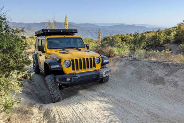
The onX Offroad Difference
onX Offroad combines trail photos, descriptions, difficulty ratings, width restrictions, seasonality, and more in a user-friendly interface. Available on all devices, with offline access and full compatibility with CarPlay and Android Auto. Discover what you're missing today!
Open Trail Map