Craig Andersen
Dec 21, 2025
Open
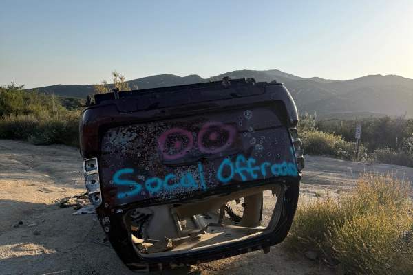
Dusty
Kyle SR
Nov 06, 2025
Open
DustyRough/Deteriorated
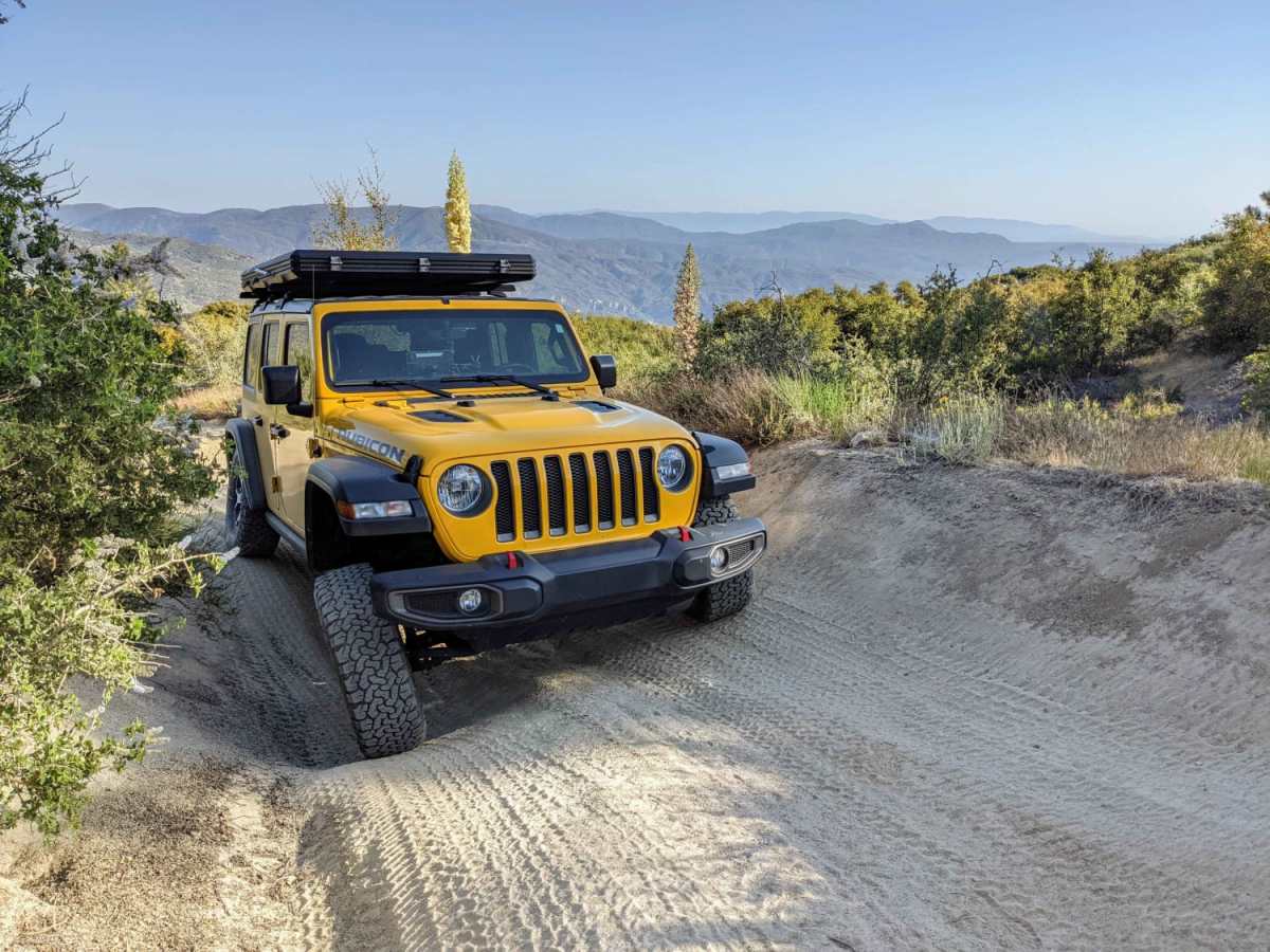
Climbed up south to north from San Jacinto trail. Mid travel Tacoma open diffs. Fun trail, not for the faint of heart or inexperienced. Trail will push your rig to its limits, constantly, in the first 2 miles. We did the optional route which has a massive rock on driver side edge, took a couple extra turns near the top to avoid I high centering.
Shawn Powers
Sep 09, 2025
2017 Jeep Wrangler
Open
David Shah
Aug 20, 2025
Open
NormalDustyRough/Deteriorated
Nick
Jul 19, 2025
2015 Polaris RZR XP 4 1000
Open
NormalDustyRough/Deteriorated
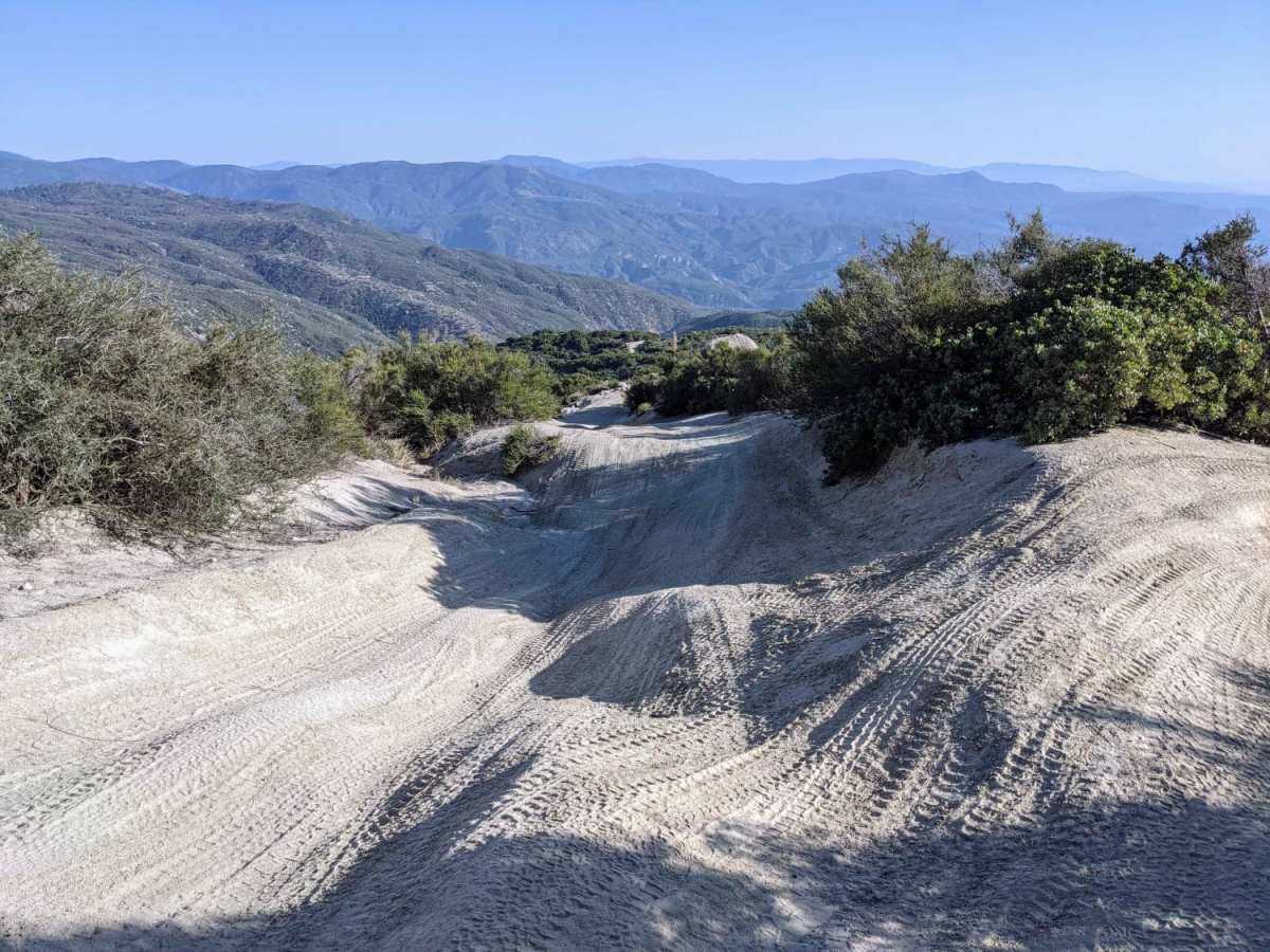
What a fun ride! I only went up about half way this time due to time constraints. The first mile from the south heading north is the most difficult part I encountered. The views up there are amazing. I highly recommend this ride.
David Wilford
Jan 26, 2025
2023 Jeep Gladiator
Open
Snow/Ice
Probably a sold six on a non snowy day
John Stone
Jan 08, 2025
Open
DustyRough/Deteriorated
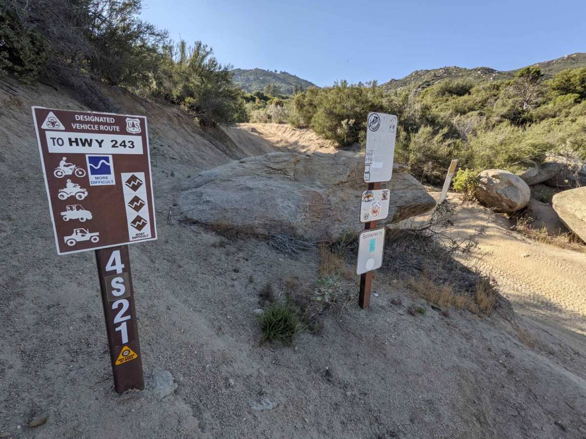
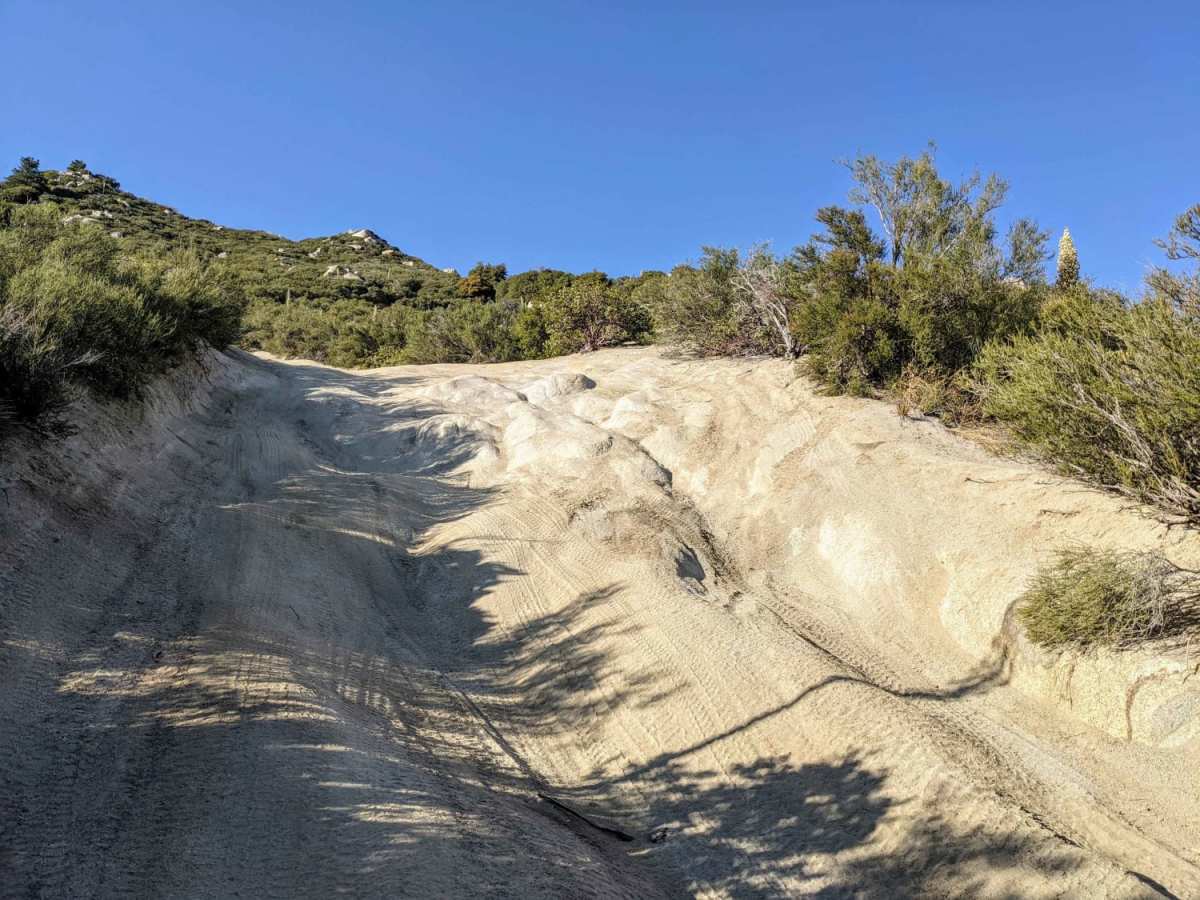
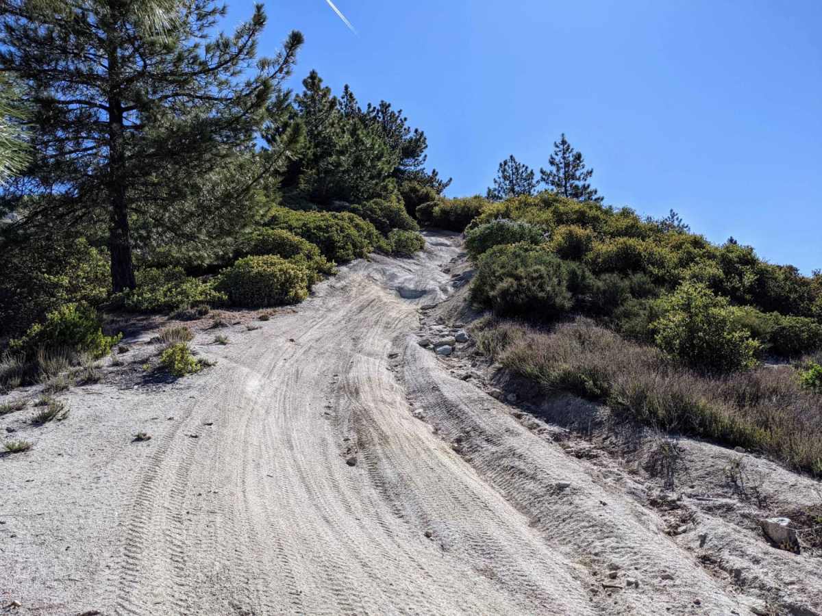
I started by coming up from Bee Canyon to the San Jacinto trail (5S09) to take this trail. The first half is the fun part. This section will def test your suspension and articulation. I did use the rear lockers for most of the bottom section and used both front and rear lockers to go up a steep section on the left where the trail splits just to keep the wheels from spinning. But for the trail being as dusty as it was, the rocks have really good traction. You can see the size of the rocks in the pic compared to my 37" tire. I'm in a full size 2500 Ram Power Wagon so the second half of the was pretty tight which resulted in some pin stripping. Other than that the second half was easy enough to do in 2WD. Overall it's a fun trail, I did this alone without a spotter but wouldn't recommend it, but I do highly recommend doing this trail.
J Hoofty
Dec 29, 2024
2024 Chevrolet Colorado
Open
DustyRough/Deteriorated
This trail is no joke. We started at the north end. No real difficulty until we started heading down the south face. There are several very challenging and technical obsticals. Off camber sections which gave us a 25° tilt and ruts easily 4' deep. Definitely not for the faint of heart. The rock sliders were utilized more than once to protect from body damage. Heavy pinstriping from overgrown thorny bushes. We made it down with some careful driving.
Norman Kephart
Dec 29, 2024
Open
DustyRough/Deteriorated
First two miles of the trail is difficult. 21 tacoma trd off-road. 33” bfg all terrains. Fun trail for sure
Sabina & Dan DuCasse
Dec 18, 2024
2022 Ford Bronco
Open
DustyRough/Deteriorated
Don’t mistake this Indian OHV Trail for the East Indian Canyon Trail! We did this trail in our stock Bronco Big Bend and we had a blast. This trail is no joke! We had to take it slow and choose our routes carefully with spotting through the many obstacles. Besides the spur marks on the side of the Bronco we came out fine, but had several exciting moments! Definitely could not turn around once we started, the hills are very steep and sandy.
Kyle SR
Dec 07, 2024
Open
NormalDusty
We attempted going up Indian mountain in 2021 Tacoma 4x4 with mid travel kit. Good luck to anyone trying to make it up this, by far the most advanced trail I've seen in SoCal. We made about 3/4 mile of the way up (south to north) and made 2/3 gatekeepers. The third was extremely off camber, stressful on the front axel. The ruts were about 4ft tall and very technical. Not sure who is getting up this with all the recent erosion...BFG KO3's around 32inch wasn't nearly enough. Would recommend MT or some sort of sand tire because it was loose.
Matthew Segal
Nov 30, 2024
2023 Mercedes G-Class
Open
Normal
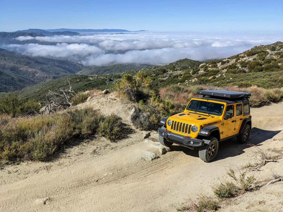
Very exciting trail. Didn’t air down tires but used 2/3 lockers. Would have been relatively easy with my wild peaks and airing down. Only issue was there were lots of thorny plants that were overgrown leading to lots of pin stripping. Will come back after getting car covered in a protective wrap.
Miguel Contreras
Nov 03, 2024
2024 Chevrolet Traverse
Open
I have a 2024 z71 traverse, went on this trail by accident trying to find the San Jac trail because Google maps told me it would be quicker from the Beaumont side rather than idllywild side. we made it in one piece but definitely would not recommend this trail unless you have a lifted 4x4 with good tires. our AWD saved us multiple times and thank God Chevy actually put some decent tires on this car if not we wouldn't have made it 🤣
Matthew saacks
Oct 26, 2024
2005 Toyota 4Runner
Open
Definitely a relatively difficult trail, very loose dirt and I can see in the winter with water or snow on the ground this being exceptionally difficult, obstacle after obstacle, however none of the terrain is particularly aggressive and I was able to make it up with my Michelin defenders, traction was an issue but with good line choice 4wd and some good articulation you’ll make it
Jeremy Nolan
Sep 28, 2024
2022 Jeep Wrangler
Open
Ran this trail uphill from its intersection with San Jacinto Ridge Truck Trail. The first mile was definitely the most technical, with several steep, rocky, and deeply rutted climbs that were fun with a manual transmission. A stock Wrangler with decent off-road tires and sway bars disconnected shouldn't have an issue if you choose the right line. Limited slip or lockers aren't necessary but may help with traction if you take a harder line. Road gets pretty off-camber at points so take it slow and you'll have a blast.