11S04 Black Mountain

Total Miles 5.5
Technical Rating
3 Easy
Best Time Spring, Summer, Fall, Winter
Trail Type Full-Width Road
Accessible By
Open Trail Map

Trail Overview

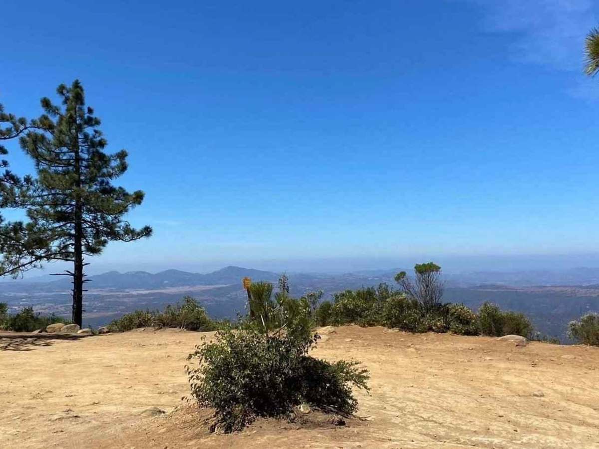
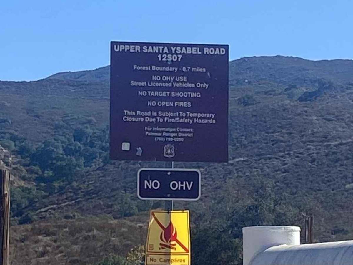
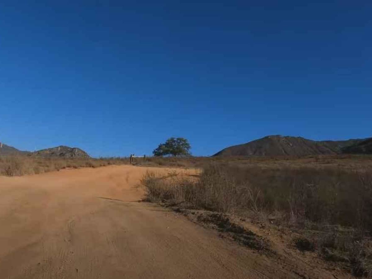
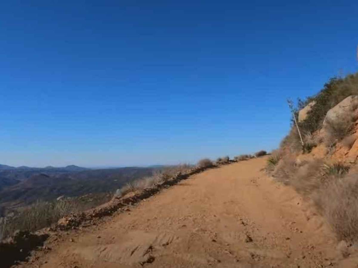
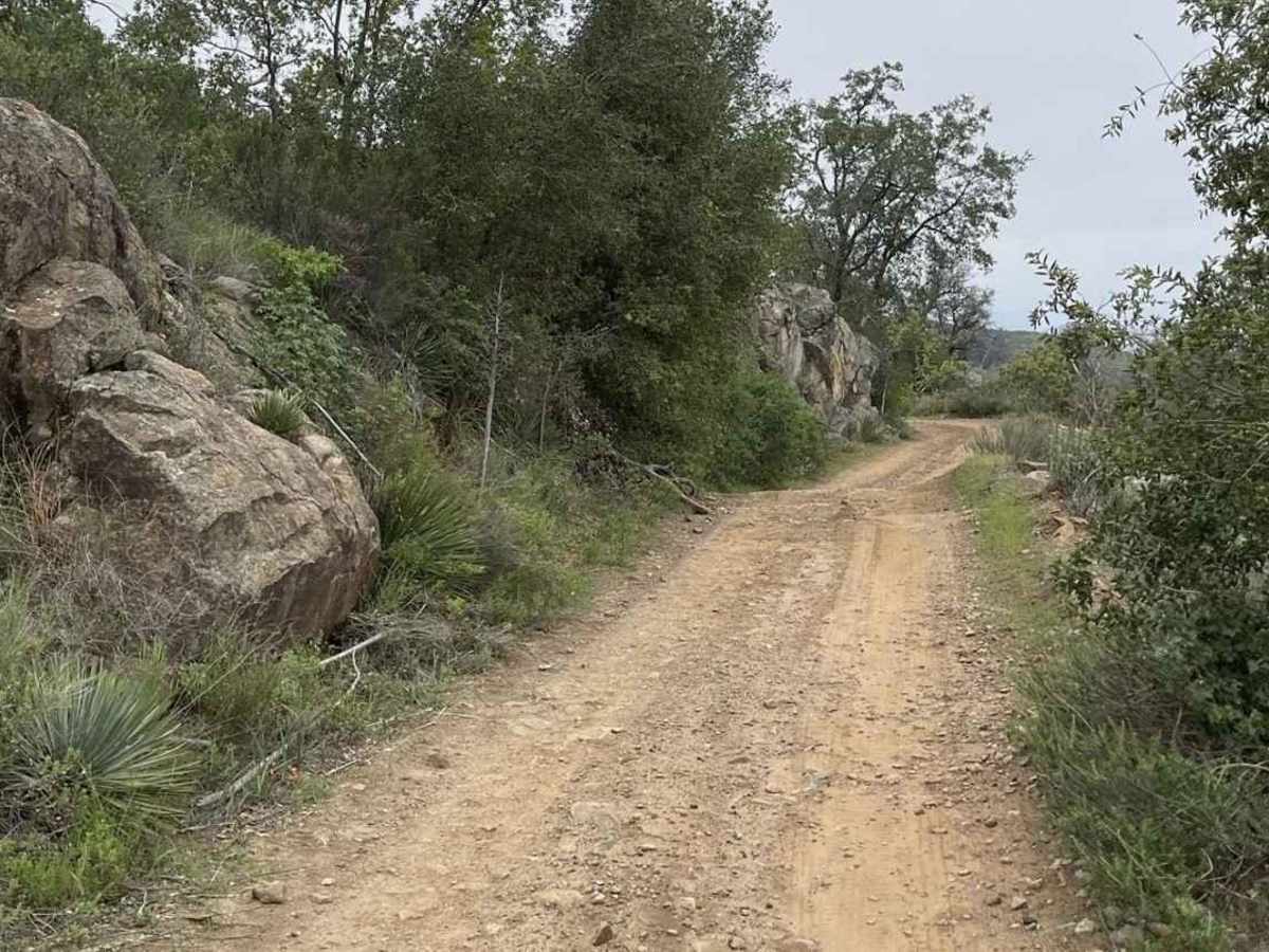
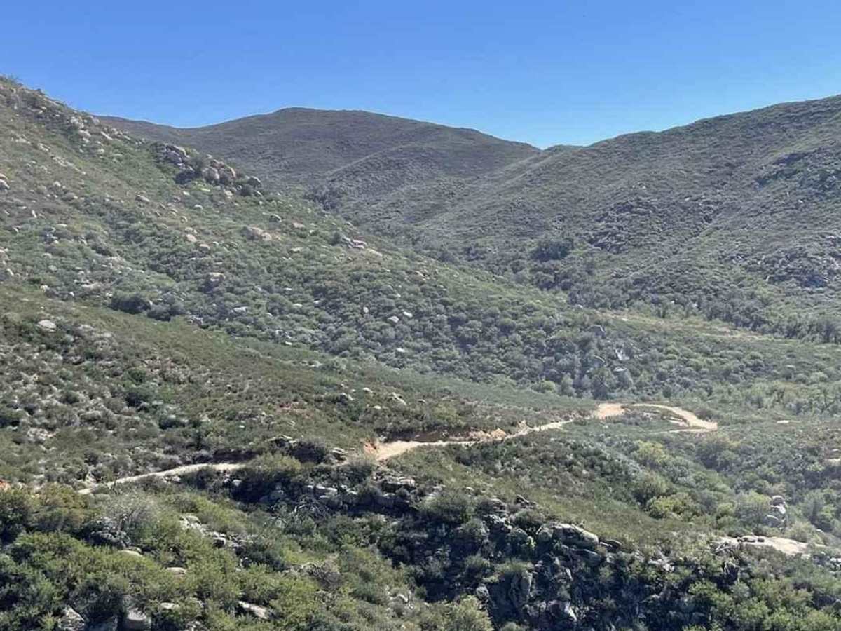
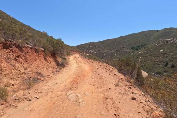
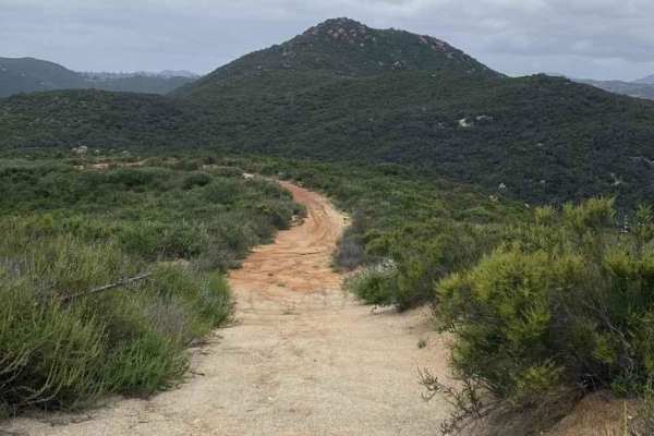
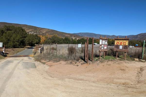
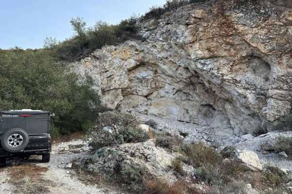
11S04 Black Mountain is a 10.8-mile out-and-back located in the Cleveland National Forest, Palomar Ranger District. This is a limited-use trail restricted to street-legal vehicles. The trail is rated 3 of 10 but has the potential to be worse during and right after seasonal weather and is subject to closure by the NFS to prevent trail damage. The trail is located within a National Forest, so an Adventure Pass is required to park for any extended time. Black Mountain is the most prominent mountain in the area and provides panoramic views of the surrounding area. This is a truck trail which means it was built to get fire equipment into the mountainous area in the event of fire. Starting from the intersection with 12S07, the trail passes near the Organ Valley Research Natural Area. This 500+-acre study area was set aside to learn more about Engelmann oaks, which are abundant here but relatively rare elsewhere. Black Mountain is so named because of the black or dark gabbro rocks that are found here. As the trail ascends, it will narrow with a single-lane shelf road at times with a steep drop on one side or the other. At a little over 4.5 miles, the trail will come into a wide parking area with a fence at the end. This is the boundary of the National Forest. That last three-quarters of a mile to the top may be gated by the NFS. It is open most of the summer but tends to be closed in the spring and fall due to seasonal weather. Cell phone service is intermittent. The nearest services are located in Ramona.

Photos of 11S04 Black Mountain

Difficulty

The trail consists of loose rocks, dirt, and sand with some slick rock surfaces. Mud holes are possible, but there are no steps higher than 12 inches. 4WD may be required, and aggressive tires are a plus.

History

For trail and road closures, see here: https://www.fs.usda.gov/detail/cleveland/recreation/ohv/?cid=stelprdb5340229

Technical Rating

3

Status Reports

Add Status Report
Tim M
Apr 03, 2026
Open
Nice & challenging trail up for me on a mid-size adv bike. Made it all the way to the pine trees. Lots of ruts, some sand periodically, ledges/shelves, embedded rocks & a ton of loose rocks ranging from ping pong size to baby heads. Good stuff!
Bryan Allbaugh
Mar 28, 2026
Open
This is a much easier truck trail rather than bike trail. There are lots of loose golf ball to grapefruit size rocks in some sections and the last 1/2 mile is pretty steep and rocky. On a dirt bike i would give this trail a 4-5 and on an adventure bike i would give this trail a 6-7. The views are worth it at the top and it's a great trail to link with the Santa Ysabel truck trail for a good out and back route from Black Canyon Road.
Joe T
Mar 14, 2026
Open
Fine in my stock TRD OR. Compared to other level 3, I found this rough and deteriorated, but with clearance ok. Beautiful at the top.
Pete Amancio
Mar 14, 2026
Open
Bryan Allbaugh
Mar 01, 2026
Open
Didn’t go all the way up, but it’s open and rocky.
burly
Jan 22, 2026
Open
Myron MacNeil
Jan 18, 2026
Open
Seems like the rains back in December may have washed it out in places. Especially the top half of the trail
lee Evans
Jan 18, 2026
Open
Michael Garcia
Dec 30, 2025
Open
Trail was closed, probably due to possible rain.
Nil Doron
Dec 21, 2025
Open
Nice easy trail, awesome views, good weather. Will do again.
Brian Koke
Dec 19, 2025
Open
Pretty rocky near the top. I didn’t see the burnt truck.
Jared Harkins
Nov 25, 2025
Open
Pamo Valley Trails reopened this afternoon.
outdoorz
Nov 22, 2025
Open
gate was closed. dirt bikes were still going in. didn't see a date but road up the mountain looked dry.
Jahzeel Franklin
Oct 13, 2025
Open
moved the burned truck off the trail into a good spot no longer in the way
Pippa Mercedes R
Oct 12, 2025
Open
First time taking my Crosstrek on a trail like this. Had an experienced friend help me navigate some of the sketchier sections. He has a lot of experience in Jeeps and Tacomas. His opinion was this trail feels more like a 4. But reading the rating descriptions, I don’t think there were any obstacles larger than 12”. So a 3 rating it is. The trail starts off easy with dusty and smooth ups and downs. Once you get to the Black Mtn road part, things start things start to change. Way more rocks protruding up and waiting to catch the undercarriage. If you have a Wrangler, Bronco, or anything that is trail rated you’ll have no problem. My Crosstrek did well enough but I definitely couldn’t just blast through some of the more technical stuff. If you’re just getting into off-roading it’s a great place to learn. If you’re experienced you’ll breeze through. Lastly, there were decent options for making room for others to pass as needed, which was nice.

11S04 Black Mountain Trail can be accessed by the following ride types:

  • Single Track
  • High Clearance
  • Full Width

11S04 Black Mountain Map

The onX Offroad Difference

onX Offroad combines trail photos, descriptions, difficulty ratings, width restrictions, seasonality, and more in a user-friendly interface. Available on all devices, with offline access and full compatibility with CarPlay and Android Auto. Discover what you're missing today!

Open Trail Map