Beginner Off-Road Trails
Near Sangerville, Maine
Explore All Beginner Trails Near Sangerville, Maine
Beginner Off-Road Trails Near Sangerville, Maine
Discover the best beginner-friendly off-road trails near you. These easier, lower-rated trails are a great place to start — browse trail maps, check difficulty ratings, and find your next adventure.

Newport to Onawa
This is a great trail with a fantastic train trestle at the end. The trail is mostly two-track, with a few standard ATV trails. Trails are well marked and maintained, and the views from the trestle are amazing. Other interesting things along the way include waterfalls, beaver dams and lakes. Stop in...
Learn more about Newport to Onawa
Moose Head Lake
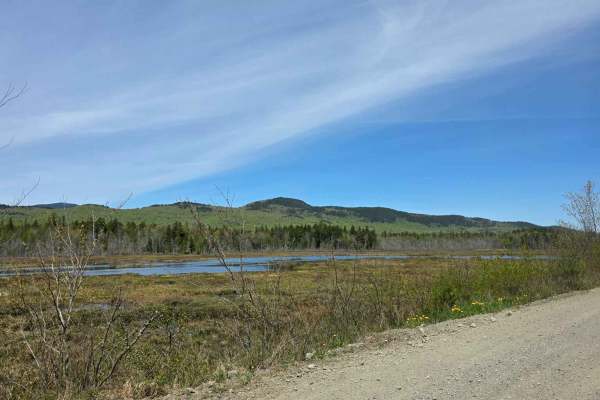
Moosehead Lake trail a smooth and relaxing ride with great scenery, picnic areas. Places to stop and fish or spot some of Maine's awesome wildlife. Can be very dusty on dry days but putting that aside, the roughly 6 and a half hours of pure backwoods, marshes and the great people you can meet while ...
Learn more about Moose Head Lake
Corinna Loop Trail
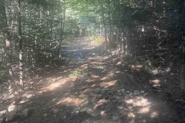
This route starts on the Newport - Dover multi use trail. The trail contains a lot of riding on the edge of farmers fields, and access roads to get back to the multi- use trail. The trail does had a spot with some deep mud but does have a bypass around the mud pit. The trail uses a lot of farmer fie...
Learn more about Corinna Loop Trail
Burrill Woods Road
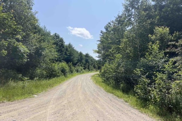
Originally part of the Plumb Creek Land Trust, this is a semi-active logging road where there has been logging recently. There are lots of side trails and roads to explore. This road is not actively maintained in the winter unless logging is taking place. Parts of the road are open to ATVs, SxSs, an...
Learn more about Burrill Woods Road
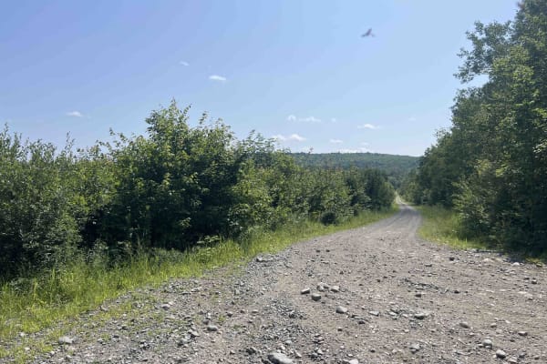
Overlook Trail
On this gravel road, you will travel up the back side of Goodwin Hill. You will pass many side trails that double as ATV and snowmobile trails in the corresponding seasons. There are some beautiful overlooks of Great Moose Pond. Leaf peeper views are excellent in the fall. Just watch out for hunters...
Learn more about Overlook Trail
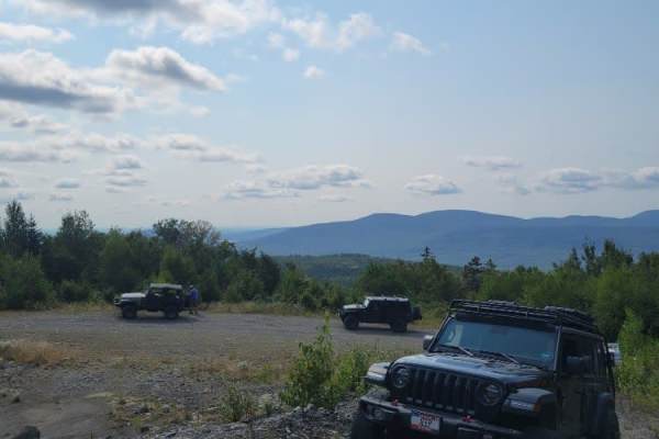
Greenwood Pond Trail
This trail to Greenwood Pond starts at the Katahdin Iron Works Historic Site which is also the Ki-Jo Mary check-in point for the Northern Maine Woods. The trail is all dirt roads typically wide enough for 2 vehicles to pass, but roughly 2/3rds of the way the trail becomes a bit narrower and in some ...
Learn more about Greenwood Pond Trail
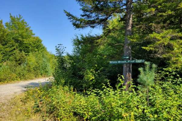
Big White Brook - Campsites
Big White Brook - Campsites is a scenic 3.7-mile out-and-back trail in Maine that is perfect for campers and recreational offroaders looking for a peaceful riverside retreat. Starting near the historic Katahdin Iron Works, this easy dirt route has a technical rating of 2, meaning it is accessible to...
Learn more about Big White Brook - Campsites

Scott Road
Scott Road is a gravel road with many side trails to explore. This road is seasonally open and a semi-active logging road. Parts of the road are open to ATVs and SxS and are part of the local trail system, though motorcycles are prohibited. The road has some dried ruts in part of it. Watch out for ...
Learn more about Scott Road
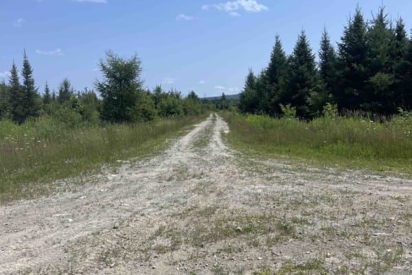
Scott Road Spur
This trail is an in-and-out old dirt logging road that has some scenic areas. Use caution as this area is used by local hunters. While accessible by SxS and ATV, its primary use would be a full-size rig or a Jeep. There are wildlife viewing opportunities plentiful on this road.
Learn more about Scott Road Spur
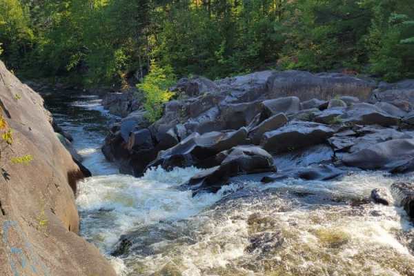
Gauntlet Falls West Trail
This Gauntlet Falls West Trail is a branch starting at the Katahdin Iron Works Historic site which is also the Ki-Jo Mary check-in point for the Northern Maine Woods. The trail is all dirt roads typically wide enough for 2 vehicles to pass. The trail has a variety of spurs to be explored with time. ...
Learn more about Gauntlet Falls West Trail
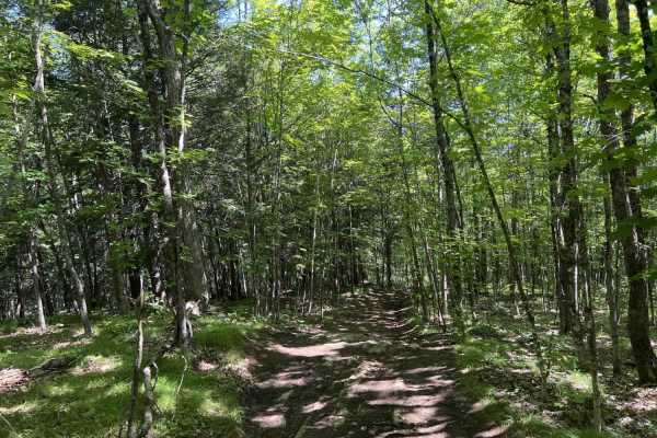
Chase Fire Tower
Chase Fire Tower is an ideal, short trail for beginner to intermediate offroaders seeking a scenic climb with a historical reward at the summit. Spanning just under a half-mile, this route ascends the backside of Chase Hill to a maximum elevation of 764 feet, gaining about 108 feet of cumulative ele...
Learn more about Chase Fire Tower

B52 Memorial Site - Elephant Mountain
Gravel road with mixed use which does change from time to time. Currently logging in a small section that still lets full vehicles through but OHRVs get a reroute. They have done a great job with signs to let you know the use of the road. There is more than one way to get there.
Learn more about B52 Memorial Site - Elephant Mountain
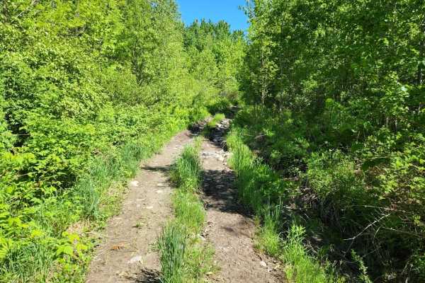
Center Trail
This is a winding trail through mostly woods and fields. This trail is quite smooth with a few small rocks and rocky areas. A few rough exposed roots and a lot of ditches to keep the trail erosion under control. A couple of sharp turns and uneven terrain. No mud but may have mud puddles with a hard ...
Learn more about Center Trail
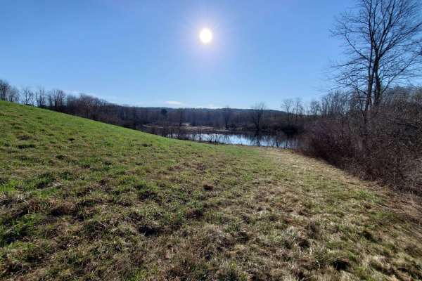
Quarry Road Trail
Designed for intermediate riders, the Quarry Road Trail offers a convenient and scenic escape that seamlessly connects Waterville's commercial hub to the rural trail systems of Fairfield. Starting directly behind the Waterville Home Depot, this 2.4-mile route winds through the scenic Quarry Road Rec...
Learn more about Quarry Road Trail

Sias Hill Road
This is a dirt road from Moosehead Lake providing access to the famous Golden Road. Sias Hill Road provides a great introduction to the North Maine Woods' flagship routes. Dirt roads are well-maintained for such a remote area. Washouts are common, and potholes are plentiful. Tread carefully and be n...
Learn more about Sias Hill Road
The Golden Road
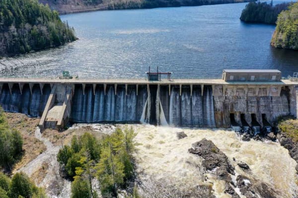
The famous Golden Road from Millinocket to the Canadian Border, with stops at Ripogenus Falls, Ripogenus Gorge, and Ripogenus Dam. This route does enter North Maine Woods which requires paying an entrance fee at the checkpoint about halfway through the route (after the Falls/Gorge/Dam). North Maine ...
Learn more about The Golden Road

Frye Mountain - High Ridge to Getchell
The Frye Mountain - High Ridge to Getchell trail is a West to East crossing through the Frye Mountain State Game Management Area. This trail is just over 8 miles passing by the Carter Cemetery and includes a small 3 mile (out and back) to another private Cemetery, where the trail becomes a turnarou...
Learn more about Frye Mountain - High Ridge to Getchell
Bald Mountain Trail
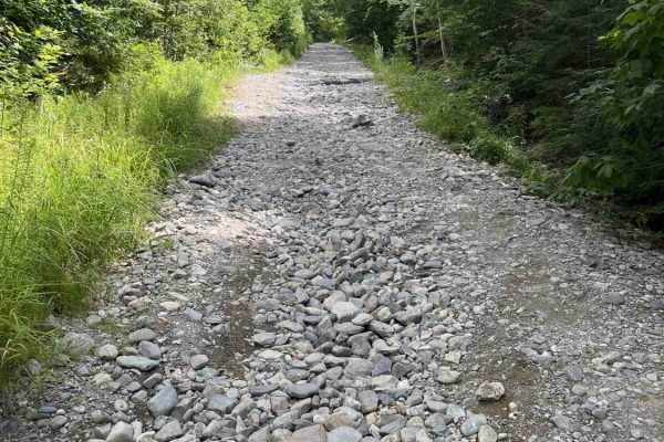
A mostly gravel road with a few washouts. A few snowmobile side trails that are not 4x4 friendly. Towards the top, there are a few ledges with some concrete filler and a granite bluff with some ledge steps to play on. The top is shared with a hiking trail, and the road is hiked as well.
Learn more about Bald Mountain Trail

Wind and Water Trail
The Wind and Water Trail is a 40-mile trail that starts at Route 6 in Lincoln, Maine. At the start of the trail is a collection of windmills, each with its access road. These windmills are amazing to see up close, and some of the windmill sites open up to expansive views. Most of the trail is dirt w...
Learn more about Wind and Water Trail
Bald Mountain
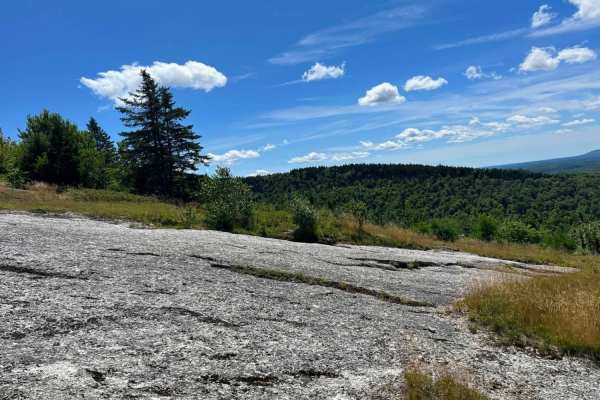
Granite rock face. Very steep up and down with a few off-camber angles with a few in excess of 27 degrees over some ledges. Amazing views on both sides of the trail going up and past the antenna towers overlooking Phillips Lake up to Bangor.
Learn more about Bald Mountain
Beginner ATV trails near Sangerville, Maine
Explore ATV-friendly trails near you. These trails are accessible for vehicles up to 50 inches wide, perfect for ATVs and smaller off-road machines.
Newport to Onawa
This is a great trail with a fantastic train trestle at the end. The trail is mostly two-track, with a few standard ATV trails. Trails are well marked and maintained, and the views from the trestle are amazing. Other interesting things along the way include waterfalls, beaver dams and lakes. Stop in...
Learn more about Newport to Onawa
Moose Head Lake
Moosehead Lake trail a smooth and relaxing ride with great scenery, picnic areas. Places to stop and fish or spot some of Maine's awesome wildlife. Can be very dusty on dry days but putting that aside, the roughly 6 and a half hours of pure backwoods, marshes and the great people you can meet while ...
Learn more about Moose Head Lake
Corinna Loop Trail
This route starts on the Newport - Dover multi use trail. The trail contains a lot of riding on the edge of farmers fields, and access roads to get back to the multi- use trail. The trail does had a spot with some deep mud but does have a bypass around the mud pit. The trail uses a lot of farmer fie...
Learn more about Corinna Loop Trail
Chase Fire Tower
Chase Fire Tower is an ideal, short trail for beginner to intermediate offroaders seeking a scenic climb with a historical reward at the summit. Spanning just under a half-mile, this route ascends the backside of Chase Hill to a maximum elevation of 764 feet, gaining about 108 feet of cumulative ele...
Learn more about Chase Fire Tower
Beginner UTV/side-by-side trails near Sangerville, Maine
Find UTV and side-by-side trails near you. These trails accommodate vehicles up to 60 inches wide, ideal for UTVs, side-by-sides, and wider off-road rigs.
Corinna Loop Trail
This route starts on the Newport - Dover multi use trail. The trail contains a lot of riding on the edge of farmers fields, and access roads to get back to the multi- use trail. The trail does had a spot with some deep mud but does have a bypass around the mud pit. The trail uses a lot of farmer fie...
Learn more about Corinna Loop Trail
Burrill Woods Road
Originally part of the Plumb Creek Land Trust, this is a semi-active logging road where there has been logging recently. There are lots of side trails and roads to explore. This road is not actively maintained in the winter unless logging is taking place. Parts of the road are open to ATVs, SxSs, an...
Learn more about Burrill Woods Road
Scott Road Spur
This trail is an in-and-out old dirt logging road that has some scenic areas. Use caution as this area is used by local hunters. While accessible by SxS and ATV, its primary use would be a full-size rig or a Jeep. There are wildlife viewing opportunities plentiful on this road.
Learn more about Scott Road Spur
Chase Fire Tower
Chase Fire Tower is an ideal, short trail for beginner to intermediate offroaders seeking a scenic climb with a historical reward at the summit. Spanning just under a half-mile, this route ascends the backside of Chase Hill to a maximum elevation of 764 feet, gaining about 108 feet of cumulative ele...
Learn more about Chase Fire Tower
The onX Offroad Difference
onX Offroad combines trail photos, descriptions, difficulty ratings, width restrictions, seasonality, and more in a user-friendly interface. Available on all devices, with offline access and full compatibility with CarPlay and Android Auto. Discover what you're missing today!
Open Trail Map