
Beginner Off-Road Trails
Near Roswell, Georgia
Explore All Beginner Trails Near Roswell, Georgia
Beginner Off-Road Trails Near Roswell, Georgia
Discover the best beginner-friendly off-road trails near you. These easier, lower-rated trails are a great place to start — browse trail maps, check difficulty ratings, and find your next adventure.

Etowah River Access
Trail access is located directly off Conns Creek Road. The entrance is not marked, and it is easy to miss the freshly graveled access point if you are not paying close attention. The trailhead includes a porta-potty before entering and proceeding down the trail. The trail itself is relatively short ...
Learn more about Etowah River Access
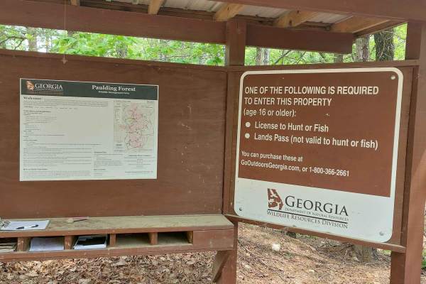
Iron Stab
This trail is on National Forest land. A hunting/fishing license or land pass is required to enter. Expect beautiful wooden views during spring and summer. The trail is half gravel and half dirt; rain will create a few washout ruts and some mud sections. There's a deep water pit with a mud bottom lo...
Learn more about Iron Stab
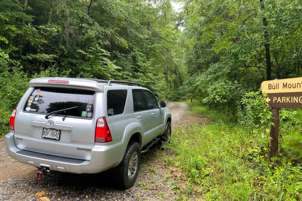
FS 83 (Bull Mountain Rd.)
Bull Mountain Road is in the Chattahoochee-Oconee National Forest. The trail branches off Winding Stair Gap Road, and, like many north Georgia Forest Service routes, the surface is mostly gravel with patches and brief stretches of dirt (red clay). 4WD is recommended, especially during or after rainf...
Learn more about FS 83 (Bull Mountain Rd.)
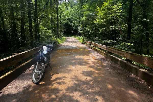
Nimblewill Branch 1
Branching off from Winding Stair Mountain Trail, this beginner-friendly path leads you through the North Georgia mountains on hard-packed dirt and gravel. At the northern end of this branch, you will find an Army Ranger base marking the transition to the next trail. Along the route, there are option...
Learn more about Nimblewill Branch 1
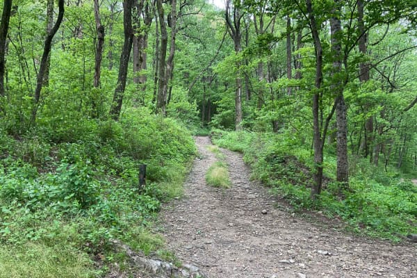
Amicalola Creek - FS 46
FS 46, Amicalola Creek Trail, is approximately 4.5 miles long and a relatively easy trail to navigate. You can enter from Nimblewill Road and exit the trail at an amazing campground associated with the Amicalola Falls State Park. The trail is a good mix of terrain. The portion closer to the State Pa...
Learn more about Amicalola Creek - FS 46
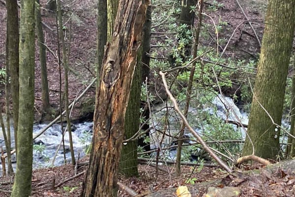
Jones Creek Road - FS 77A
This deceptively fun out-and-back drive branches west from Winding Stair Gap Road in the Chattahoochee-Oconee National Forest. The surface is gravel, rock, and red Georgia clay and runs through dense forest along its namesake Jones Creek. The rushing water can be heard with the windows down. 4WD is ...
Learn more about Jones Creek Road - FS 77A
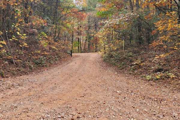
Moss Hill - FSR 28B
Moss Hill, FSR 28B, is a fairly well-maintained seasonally closed road in the Chattahoochee-Oconee National Forest. It is typical of the forest service roads in the immediate area being fairly well groomed and essentially a smooth gravel road. It is an out-and-back FSR, so you will get to see the ro...
Learn more about Moss Hill - FSR 28B
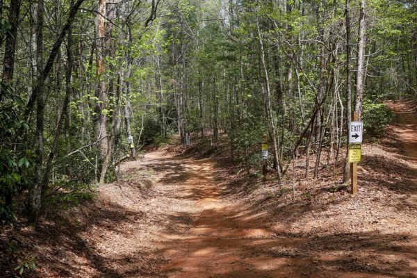
Hightower Loop Connector Trail D
Trail D is a 1.3-mile two-way access route that connects the main ATV Trail 192 to the more challenging trails C and E on the western side of the trail system. Beginning at its southern junction with 192, the trail is wide with gently curving sections--some of which are blind corners, but designed t...
Learn more about Hightower Loop Connector Trail D
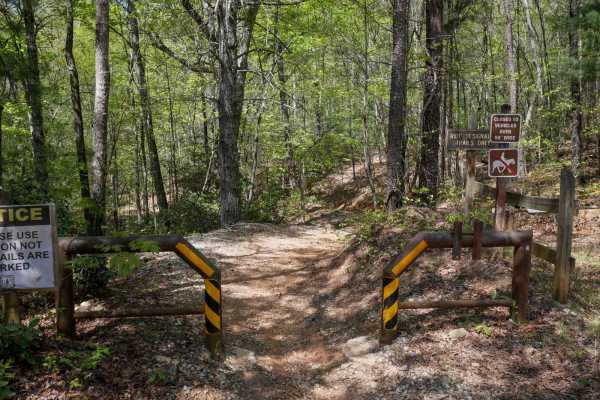
Parking Lot Trail 192
ATV Trail 192 serves as the main two-way corridor providing access from the parking area to the southern entry point of Trail D. It begins at a 50-inch pinch point and is designated for ATV/dirt bike use only--horses are not permitted. The trail is relatively wide to accommodate two-way traffic and ...
Learn more about Parking Lot Trail 192
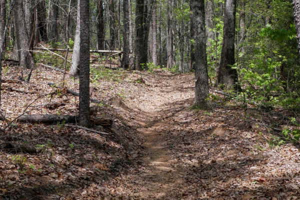
Peggy Creek Connector H
This short, directional connector trail runs north to south and closely mirrors the terrain and features of Trail J. It serves as a mileage-saving shortcut, bypassing a portion of the main J loop. The trail winds gently through the forest with lots of leaf cover, small roots, and easy curves, though...
Learn more about Peggy Creek Connector H
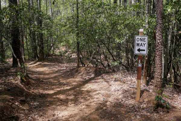
Hightower Loop Trail E
Trail E is a 1.6-mile clockwise ATV loop and one of the longer routes in the area, a great spot to do a couple laps to tack on mileage before your ride is over. Starting at the end of Trail D, it features more pronounced elevation changes, including a mix of steeper climbs and descents, sharper corn...
Learn more about Hightower Loop Trail E
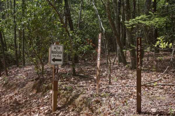
Sally Free Trail J
Trail J is a two-mile, directional ATV loop ridden clockwise, offering an easy and enjoyable ride through forested terrain. The trail features gentle rollers, minor ruts, roots, and rocks, with occasional springtime mud puddles. Riders will encounter a few tighter turns, including one notable switch...
Learn more about Sally Free Trail J
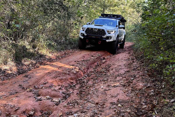
Montgomery Creek - FS 141
This is an almost 6-mile loop that offers lots to do and see, including a water crossing, spots to fish, and Merrill Army Base on the northern end of the trail. Although the trail has been freshly graded, it remains mostly dirt, which can cause some slippery conditions when wet. In most sections, it...
Learn more about Montgomery Creek - FS 141
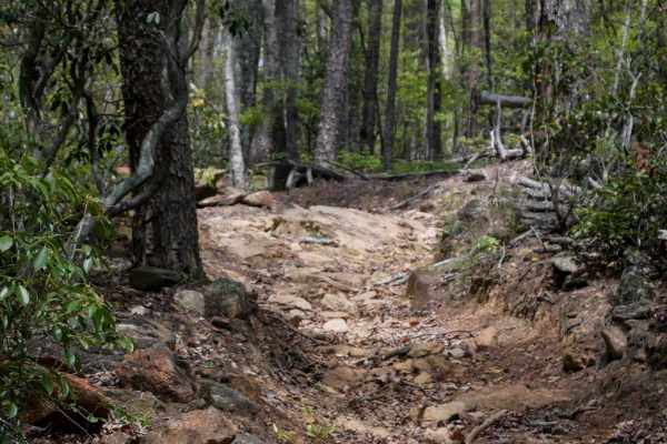
Copperhead Trail B
Trail B is a one-way, southwest-to-northeast ATV trail that provides an easier alternative to the more technical parallel trail Whoop De Dos. It features sharp corners and a shelf-like traverse along the edge of the hillside, with moderate width and a surface often obscured by heavy leaf cover, but ...
Learn more about Copperhead Trail B
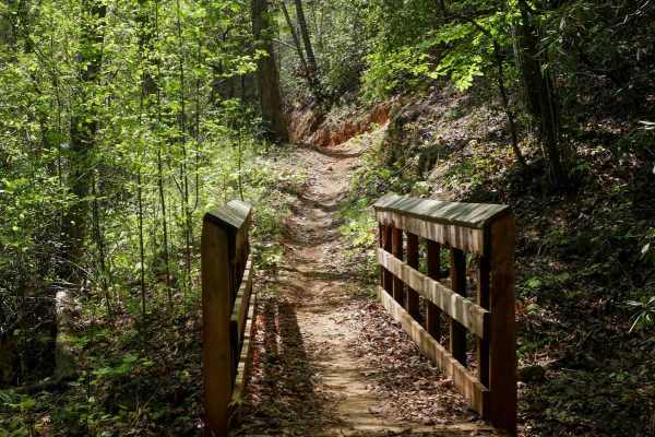
Double Bridges Trail F
This dirt bike-only trail starts at a pinch point off of the main ATV corridor 192, and is one-way directional north-to-south. It flows through mellow forested terrain, following the natural curvature of the mountain, featuring mild exposure and moderate technical elements such as small roots and ro...
Learn more about Double Bridges Trail F
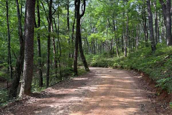
Winding Stair Gap - FS 77
The Winding Stair Gap, also known as FS 77, connects FS 28-1 at the south end with FS 42 at the north end of the trail. That trail takes you to the Winding Stair Trailhead. It is a gravel forestry road with some soft sand spots that can turn into mud holes after heavy rain. The road is not always w...
Learn more about Winding Stair Gap - FS 77
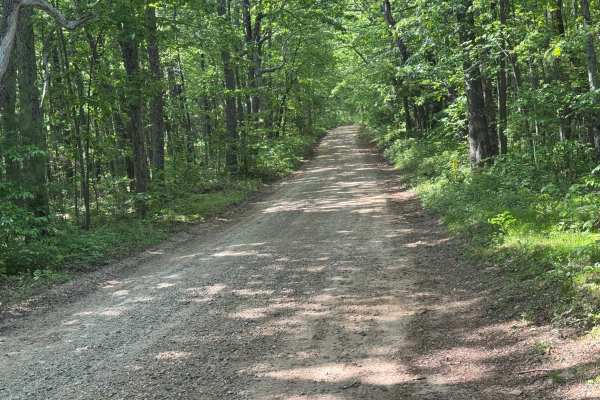
Blue Ridge - FS 42
Blue Ridge - FS 42 is a 3.7-mile point-to-point route that follows a well-maintained packed dirt and gravel surface through heavily forested terrain. The trail features a generous single-lane width and carries an easy difficulty rating, making it a straightforward forest road for highway-legal vehic...
Learn more about Blue Ridge - FS 42
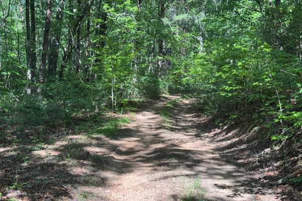
East Cane Creek - FS 243
East Cane Creek - FS 243 is a 2.5-mile out-and-back route that follows a packed dirt and gravel surface through heavily forested terrain. The trail remains a single lane with few places to pass and is described as not maintained, although it carries an easy difficulty rating. A steel barricade marks...
Learn more about East Cane Creek - FS 243
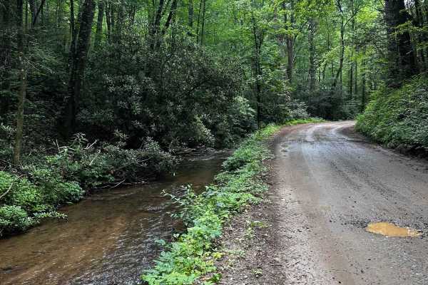
Cooper's Gap
This trail begins at the intersection near the Army Ranger Base, across from Mt. Zion Baptist Church (34.62794, -84.10149). The church parking lot offers some parking opportunities for loading and offloading vehicles. There are a few switchbacks along the trail, and most of the terrain consists of d...
Learn more about Cooper's Gap
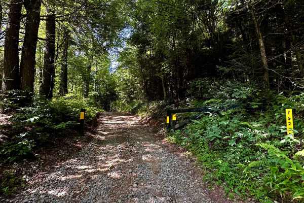
Long Creek Trail
This out-and-back trail consists mostly of hard-packed gravel and dirt. As you veer onto the section at (34.65449, -84.17772), be mindful of seasonal gate closures. This trail features a few deeper ruts and narrower passages, making it difficult to find turn-around points. At the end of the trail, t...
Learn more about Long Creek Trail
Beginner ATV trails near Roswell, Georgia
Explore ATV-friendly trails near you. These trails are accessible for vehicles up to 50 inches wide, perfect for ATVs and smaller off-road machines.
FS 83 (Bull Mountain Rd.)
Bull Mountain Road is in the Chattahoochee-Oconee National Forest. The trail branches off Winding Stair Gap Road, and, like many north Georgia Forest Service routes, the surface is mostly gravel with patches and brief stretches of dirt (red clay). 4WD is recommended, especially during or after rainf...
Learn more about FS 83 (Bull Mountain Rd.)
Nimblewill Branch 1
Branching off from Winding Stair Mountain Trail, this beginner-friendly path leads you through the North Georgia mountains on hard-packed dirt and gravel. At the northern end of this branch, you will find an Army Ranger base marking the transition to the next trail. Along the route, there are option...
Learn more about Nimblewill Branch 1
Jones Creek Road - FS 77A
This deceptively fun out-and-back drive branches west from Winding Stair Gap Road in the Chattahoochee-Oconee National Forest. The surface is gravel, rock, and red Georgia clay and runs through dense forest along its namesake Jones Creek. The rushing water can be heard with the windows down. 4WD is ...
Learn more about Jones Creek Road - FS 77A
Hightower Loop Connector Trail D
Trail D is a 1.3-mile two-way access route that connects the main ATV Trail 192 to the more challenging trails C and E on the western side of the trail system. Beginning at its southern junction with 192, the trail is wide with gently curving sections--some of which are blind corners, but designed t...
Learn more about Hightower Loop Connector Trail D
Beginner UTV/side-by-side trails near Roswell, Georgia
Find UTV and side-by-side trails near you. These trails accommodate vehicles up to 60 inches wide, ideal for UTVs, side-by-sides, and wider off-road rigs.
FS 83 (Bull Mountain Rd.)
Bull Mountain Road is in the Chattahoochee-Oconee National Forest. The trail branches off Winding Stair Gap Road, and, like many north Georgia Forest Service routes, the surface is mostly gravel with patches and brief stretches of dirt (red clay). 4WD is recommended, especially during or after rainf...
Learn more about FS 83 (Bull Mountain Rd.)
Nimblewill Branch 1
Branching off from Winding Stair Mountain Trail, this beginner-friendly path leads you through the North Georgia mountains on hard-packed dirt and gravel. At the northern end of this branch, you will find an Army Ranger base marking the transition to the next trail. Along the route, there are option...
Learn more about Nimblewill Branch 1
Jones Creek Road - FS 77A
This deceptively fun out-and-back drive branches west from Winding Stair Gap Road in the Chattahoochee-Oconee National Forest. The surface is gravel, rock, and red Georgia clay and runs through dense forest along its namesake Jones Creek. The rushing water can be heard with the windows down. 4WD is ...
Learn more about Jones Creek Road - FS 77A
Cooper's Gap
This trail begins at the intersection near the Army Ranger Base, across from Mt. Zion Baptist Church (34.62794, -84.10149). The church parking lot offers some parking opportunities for loading and offloading vehicles. There are a few switchbacks along the trail, and most of the terrain consists of d...
Learn more about Cooper's Gap
The onX Offroad Difference
onX Offroad combines trail photos, descriptions, difficulty ratings, width restrictions, seasonality, and more in a user-friendly interface. Available on all devices, with offline access and full compatibility with CarPlay and Android Auto. Discover what you're missing today!
Open Trail Map