
Beginner Off-Road Trails
Near Mountain, Wisconsin
Explore All Beginner Trails Near Mountain, Wisconsin
Beginner Off-Road Trails Near Mountain, Wisconsin
Discover the best beginner-friendly off-road trails near you. These easier, lower-rated trails are a great place to start — browse trail maps, check difficulty ratings, and find your next adventure.

Mountain Tower Road
Mountain Tower Road is a short access road that is used to access the Mountain Fire Tower Lookout. This road is well maintained, but it is steep, gaining about 100ft of elevation within a relatively short distance. Atop the road, there is a moderately sized parking area located just next to the look...
Learn more about Mountain Tower Road
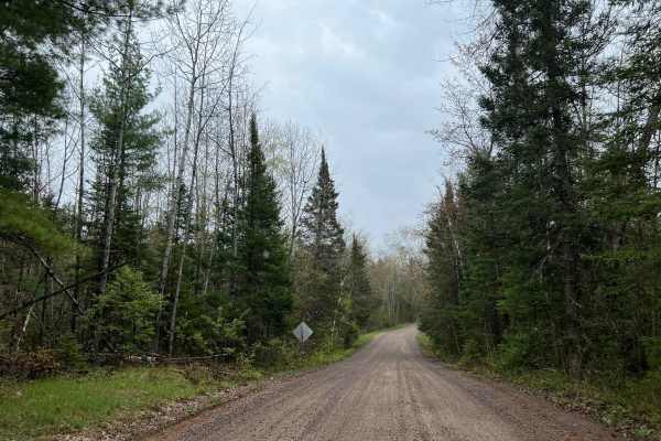
FS 2630
FS 2630 begins at its intersection with County Highway W, and navigates east to its intersection with FS 2107. This is a moderately maintained gravel forest road, which serves as a great, quick access point from the highway to access some of the more remote trails within this region of the Nicolet N...
Learn more about FS 2630
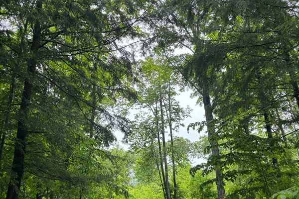
Forest Road 2619
Forest Road 2619 is a dirt trail located in the Lakewood-Laona Ranger District of the Chequamegon-Nicolet National Forest. Unlike many forest routes in the region, Forest Road 2619 has limited tree cover. This provides open views of the surrounding Northwoods landscape--but also means less shade, ma...
Learn more about Forest Road 2619
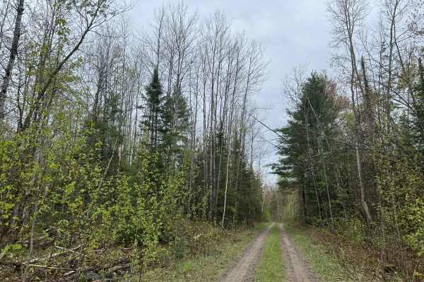
East Sunrise Road - FS 2683
East Sunrise Road - FS 2683 is a there-and-back style trail which can be found at its intersection with FS 2319 at 45.2177, -88.41614. This trail is a moderately narrow two-track trail, with dense forest surrounding most of it. The trail surface is primarily packed dirt and loose sand; there are sma...
Learn more about East Sunrise Road - FS 2683

Sunrise Lake Road - FS 2319
Sunrise Lake Road, FR 2319 navigates from Old 32 Road to its intersection with McCauley Creek Rd, FR 2321. This is a wide, well-maintained forest road that provides access to a large number of trails in this section of the Nicolet National Forest. The trail is wide enough for two vehicles to pass ea...
Learn more about Sunrise Lake Road - FS 2319

McCauley Creek Road - FS 2321
McCauley Creek Road FS 2321 begins at its intersection with Sunrise Lake Road FS 2319, and travels to Tar Damn Road 2104. This trail is one of the higher-traffic, well-maintained forest roads in the area. It allows access to several more remote trails in this section of the Nicolet National Forest. ...
Learn more about McCauley Creek Road - FS 2321
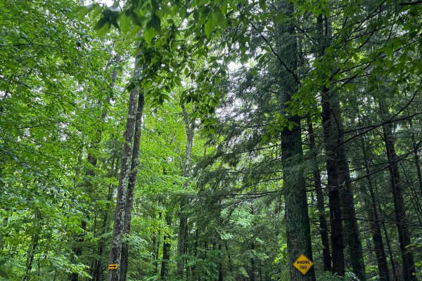
Forest Road 2330M
Forest Road 2330M is a scenic dirt trail winding through a heavily wooded section of the Chequamegon-Nicolet National Forest. The trail surface features small rocks and occasional shallow mud holes, making it a solid option for stock 4x4 vehicles or overland rigs looking for a peaceful, low-stress d...
Learn more about Forest Road 2330M
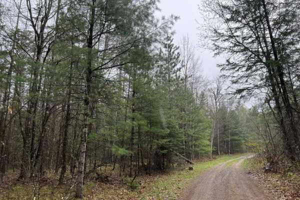
Sawbuck Road - FS 2302
Sawbuck Rd, FR 2302 is a remote and rugged, there-and-back style trail which can be found at its intersection with Old Hwy 64 at 45.15115, -88.39431. This trail navigates through dense forest. As the trail begins, it is wide with little overgrowth surrounding the trail, but as it navigates deeper in...
Learn more about Sawbuck Road - FS 2302
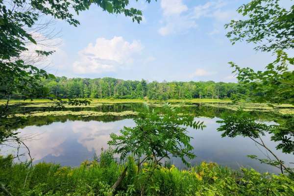
FR 2289
This is a short two-track trail that winds through a scenic mix of conifers and hardwoods. The terrain varies between gravel, mud, and occasional washouts—one of which is deep enough to bottom out if approached carelessly. A few muddy, less-maintained spurs branch off the main fire road, leading to ...
Learn more about FR 2289
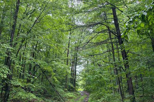
Forest Road 2321J
Forest Road 2321J is a narrow dirt trail located in northeastern Wisconsin, nestled between the towns of Mountain, Lakewood, and Crooked Lake. This trail is primarily composed of dirt with occasional small rocks and scattered mud holes. The trail's narrow width and natural surface make it better sui...
Learn more about Forest Road 2321J
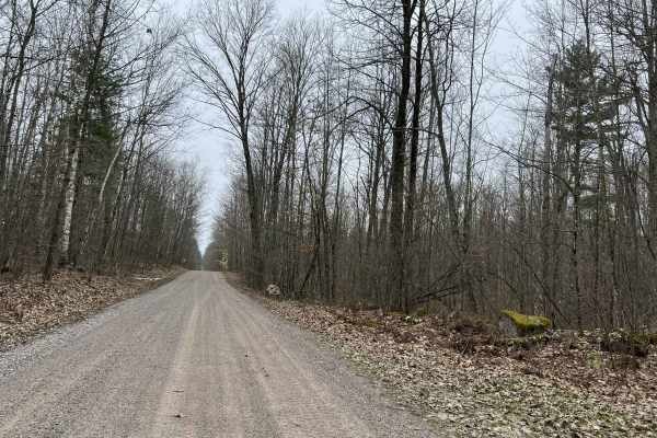
Sullivan Springs Road - FS 2330
Sullivan Springs Road - FS 2330 navigates from its intersection with Tar Damn Road, FS 2104, and navigates to its intersection with Smyth Road. This trail, like several others in the area, is mildly maintained with a gravel base throughout most of its length. The trail varies in width from two vehic...
Learn more about Sullivan Springs Road - FS 2330
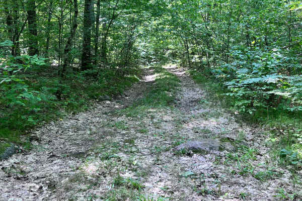
Forest Road 2330B
Forest Road 2330B begins at the intersection of Sullivan Springs Road - FS 2330 and extends west .8 miles, ending at the eastern banks of the North Branch of the Oconto River across from Snow Falls State Natural Area. The terrain of the trail starts out with multiple ruts and small exposed rocks, th...
Learn more about Forest Road 2330B
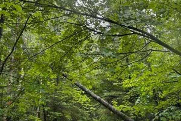
Forest Road 2614
Forest Road 2614 is a narrow, overgrown trail tucked deep in the Chequamegon-Nicolet National Forest, offering a remote experience for off-roaders. With thick brush and minimal maintenance, it's best suited for compact, high-clearance 4x4 vehicles. Expect tight squeezes, pinstriping, and occasional ...
Learn more about Forest Road 2614
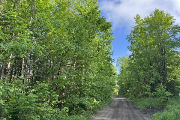
Bonita Road - FS 2112
Bonita Road (FS 2112) begins at its intersection with Weso Creek Road and the paved portion of Forest Service Road 2112, and navigates northwest to its intersection with County Highway W. This is a moderately maintained gravel trail that is wide enough for two vehicles for most of its length. This t...
Learn more about Bonita Road - FS 2112
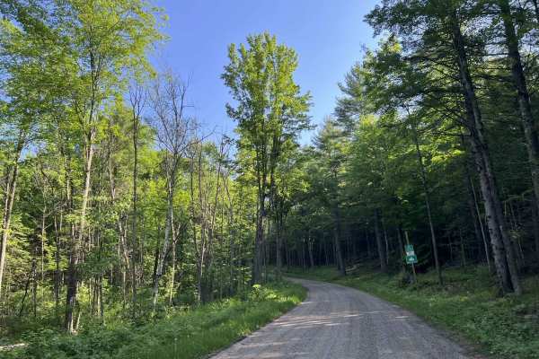
FS 2316
Forest Service Road 2316 begins at its intersection with County Highway W and travels north to its intersection with State Highway 64. This trail is a moderately maintained forest road that has a loose gravel base and is wide enough for two vehicles to comfortably pass each other at speed in most ar...
Learn more about FS 2316
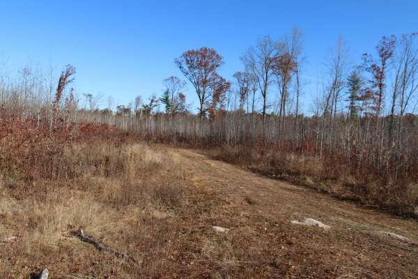
FR 3009
This is a relatively flat two track with a couple small water holes and washouts. The surface is a combination of gravel and dirt/mud. During the Winter this trail overlaps with the snowmobile trail so it would be in your best interest to avoid it altogether during snowmobile season.
Learn more about FR 3009
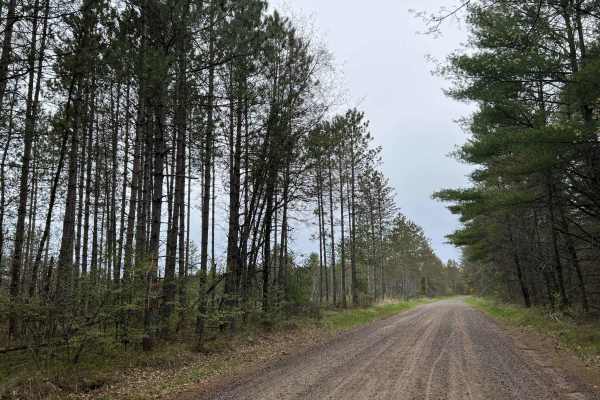
FS 2107
FS 2107 begins at its intersection with Old Highway 64 and navigates north to its intersection with County Highway W. This is a fast paced moderatly maintained forest road that can be used to quickly navigate from the lower portion of the Nicolet National Forest to the upper portion. This trail is w...
Learn more about FS 2107
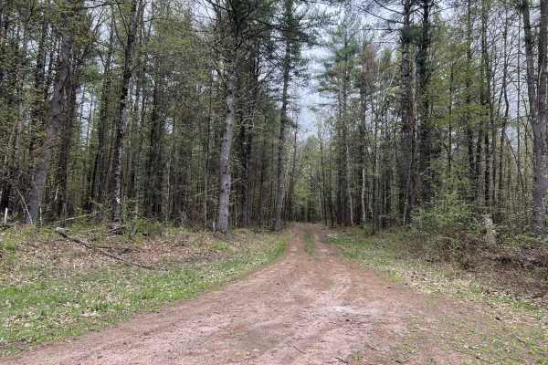
FS 2081
FS 2081 navigates from its intersection with Old Highway 64 FS 2308, and travels to its intersection with Jack Pine Road FS 2301. This trail is a tight two-track trail made up of mostly dirt. There are a few areas along the way that allow for vehicles to pull over and pass. A good portion of this pa...
Learn more about FS 2081

FS 2326B
FS 2326B begins at its intersection with FS 2326 and travels to its intersection with Fr 2330E. This is a rugged 2-track trail that is not regularly maintained. The trail is overgrown in most places, with only a few areas opening up enough to allow for vehicles to pass one another. The trail surface...
Learn more about FS 2326B

FS 2973B, 2301J, 2107LF
FS 2973B, 2301J, 2107LF is a short but fun section of trail that begins at its western intersection with FS 2973, and navigates to its southern intersection with FR 2107L. This trail has a very sandy base, which can become very soft during periods without consistent rain and with frequent travel. Th...
Learn more about FS 2973B, 2301J, 2107LF
Beginner ATV trails near Mountain, Wisconsin
Explore ATV-friendly trails near you. These trails are accessible for vehicles up to 50 inches wide, perfect for ATVs and smaller off-road machines.
FS 2630
FS 2630 begins at its intersection with County Highway W, and navigates east to its intersection with FS 2107. This is a moderately maintained gravel forest road, which serves as a great, quick access point from the highway to access some of the more remote trails within this region of the Nicolet N...
Learn more about FS 2630
Sunrise Lake Road - FS 2319
Sunrise Lake Road, FR 2319 navigates from Old 32 Road to its intersection with McCauley Creek Rd, FR 2321. This is a wide, well-maintained forest road that provides access to a large number of trails in this section of the Nicolet National Forest. The trail is wide enough for two vehicles to pass ea...
Learn more about Sunrise Lake Road - FS 2319
McCauley Creek Road - FS 2321
McCauley Creek Road FS 2321 begins at its intersection with Sunrise Lake Road FS 2319, and travels to Tar Damn Road 2104. This trail is one of the higher-traffic, well-maintained forest roads in the area. It allows access to several more remote trails in this section of the Nicolet National Forest. ...
Learn more about McCauley Creek Road - FS 2321
Sullivan Springs Road - FS 2330
Sullivan Springs Road - FS 2330 navigates from its intersection with Tar Damn Road, FS 2104, and navigates to its intersection with Smyth Road. This trail, like several others in the area, is mildly maintained with a gravel base throughout most of its length. The trail varies in width from two vehic...
Learn more about Sullivan Springs Road - FS 2330
Beginner UTV/side-by-side trails near Mountain, Wisconsin
Find UTV and side-by-side trails near you. These trails accommodate vehicles up to 60 inches wide, ideal for UTVs, side-by-sides, and wider off-road rigs.
FS 2630
FS 2630 begins at its intersection with County Highway W, and navigates east to its intersection with FS 2107. This is a moderately maintained gravel forest road, which serves as a great, quick access point from the highway to access some of the more remote trails within this region of the Nicolet N...
Learn more about FS 2630
Sunrise Lake Road - FS 2319
Sunrise Lake Road, FR 2319 navigates from Old 32 Road to its intersection with McCauley Creek Rd, FR 2321. This is a wide, well-maintained forest road that provides access to a large number of trails in this section of the Nicolet National Forest. The trail is wide enough for two vehicles to pass ea...
Learn more about Sunrise Lake Road - FS 2319
McCauley Creek Road - FS 2321
McCauley Creek Road FS 2321 begins at its intersection with Sunrise Lake Road FS 2319, and travels to Tar Damn Road 2104. This trail is one of the higher-traffic, well-maintained forest roads in the area. It allows access to several more remote trails in this section of the Nicolet National Forest. ...
Learn more about McCauley Creek Road - FS 2321
FR 2289
This is a short two-track trail that winds through a scenic mix of conifers and hardwoods. The terrain varies between gravel, mud, and occasional washouts—one of which is deep enough to bottom out if approached carelessly. A few muddy, less-maintained spurs branch off the main fire road, leading to ...
Learn more about FR 2289
The onX Offroad Difference
onX Offroad combines trail photos, descriptions, difficulty ratings, width restrictions, seasonality, and more in a user-friendly interface. Available on all devices, with offline access and full compatibility with CarPlay and Android Auto. Discover what you're missing today!
Open Trail Map