
Beginner Off-Road Trails
Near Greenland, Arkansas
Explore All Beginner Trails Near Greenland, Arkansas
Beginner Off-Road Trails Near Greenland, Arkansas
Discover the best beginner-friendly off-road trails near you. These easier, lower-rated trails are a great place to start — browse trail maps, check difficulty ratings, and find your next adventure.
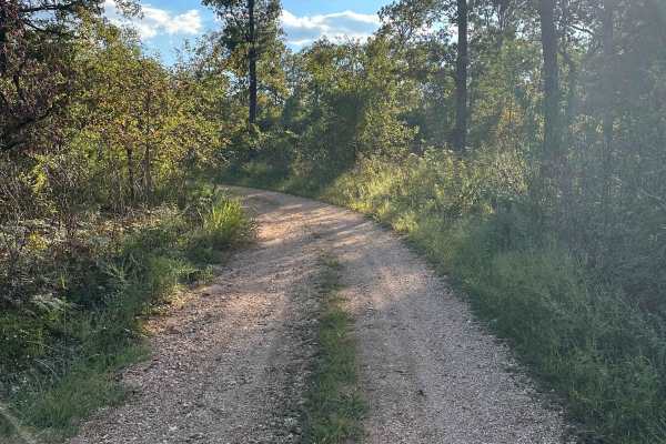
Twin Knobs
The Twin Knobs Trail offers a scenic out-and-back route that showcases the natural beauty of the Ozarks. Starting as a well-maintained gravel road, the trail gradually transitions to a rock and clay-based surface as you travel from west to east. While the trail isn’t particularly technical, it provi...
Learn more about Twin Knobs
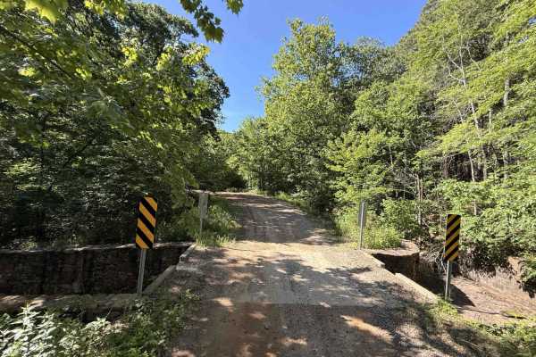
Cove Creek Crossing
Cove Creek Crossing is a scenic forest route that follows the creek through a narrow mountain valley surrounded by towering hardwoods, rock bluffs, and rolling ridgelines. The road is primarily gravel and generally easy to navigate, though scattered embedded rock and occasional rough patches keep it...
Learn more about Cove Creek Crossing
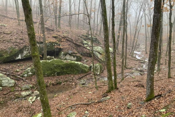
Bradford Easy Loop 1720B/2509
This is a great loop trail off Freedom Road. Along the trail, there are a few more loop and side road options that would make the path longer or more difficult. Due to narrow and tight turns, it is not currently suitable for full-size 4x4 pickups. Your 4x4 Jeep, Bronco, or midsize truck should be fi...
Learn more about Bradford Easy Loop 1720B/2509
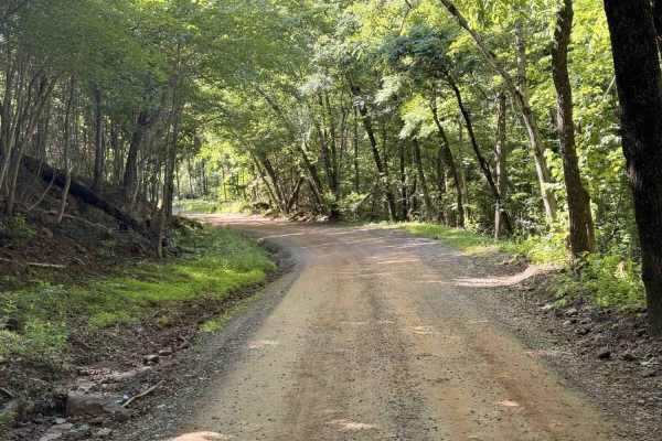
Old Cove City Road
Old Cove City Road is an easy scenic gravel road that winds through dense hardwood forest and rolling mountain terrain within the National Forest. The route is generally wide and well-maintained, making it suitable for most highway-registered vehicles in dry conditions. Long stretches of tree canopy...
Learn more about Old Cove City Road
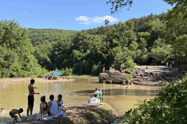
Upper Lee Creek Trail
Lower Lee Creek Trail is a short access road leading to one of the area’s most popular swimming and fishing destinations along Lee Creek. The site features a large gravel bar and beach area for lounging, along with clear water, rock bluffs commonly used for jumping, and rope swings that make it espe...
Learn more about Upper Lee Creek Trail
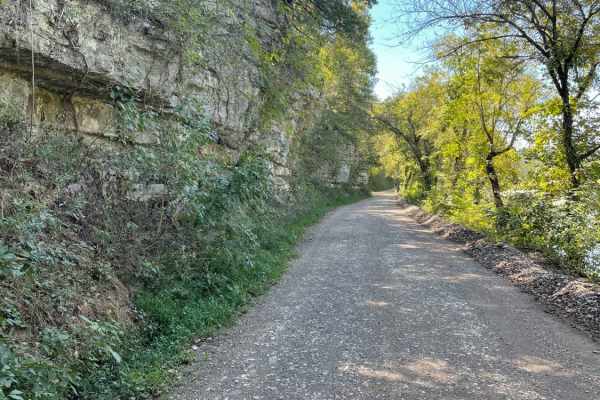
Tsalagi Trail East
The Tsalagi Trail East offers a scenic and leisurely expedition through the historic eastern reaches of the Cherokee Nation, making it perfect for beginners, families, and overland enthusiasts seeking a relaxed day on the trail. Spanning approximately 55 miles of unpaved county roads, this route win...
Learn more about Tsalagi Trail East
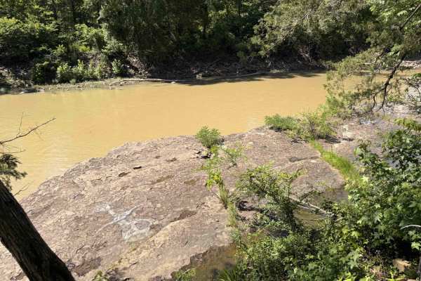
Lower Lee Creek Trail
This trail provides access to the lower portion of Lee Creek for swimming and fishing. The trail goes all the way to the water; however, there is no parking at the water allowed. Rangers patrol this area since it is a common swimming hole, so park at the designated parking area if you plan to stay. ...
Learn more about Lower Lee Creek Trail
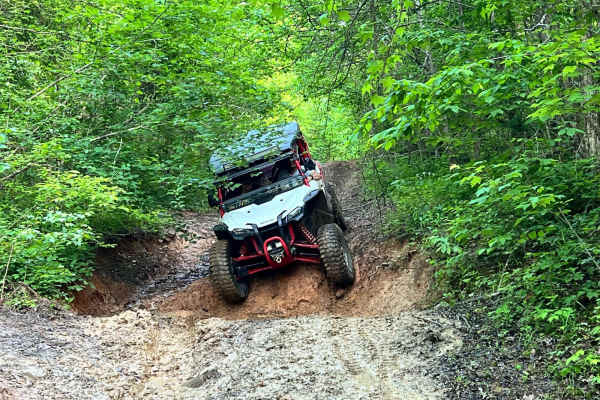
Delaney Creek Trail FS1517
Delaney Creek trail FS1517 is located in the Boston Mountains. The trail is filled with a few off-camber spots with mud and creek crossings. It also has a couple of narrow spots with low-hanging trees that you should be able to get under with ATVs, SxSs, and vehicles that are not lifted too high. Th...
Learn more about Delaney Creek Trail FS1517
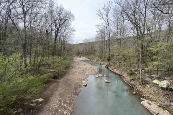
White Rock Mountain West
White Rock Mountain is magnificent. Sitting at an elevation of 2,309 feet the hiking trails with their views and caves to explore are a sight to see. There are three ways to get to White Rock Mountain, however one of which (Road 1003 in certain sections) is closed due to a landslide. This route is t...
Learn more about White Rock Mountain West
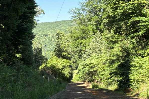
Cove Creek Road
Cove Creek Road is an easy scenic forest road that follows Cove Creek through a narrow mountain valley beneath a dense tree canopy. The route is primarily gravel and generally well maintained, making it suitable for most highway-registered vehicles in normal conditions. The road winds through a mix ...
Learn more about Cove Creek Road
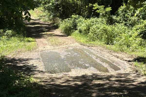
Elmo Creek
Elmo Creek Trail is an out-and-back National Forest route that offers a mix of easy forest driving with a few moderately rough sections scattered throughout. The trail begins as a relatively smooth gravel and dirt road beneath a dense tree canopy before gradually becoming narrower and more uneven de...
Learn more about Elmo Creek
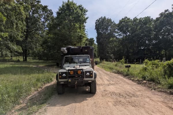
D0854
The track rolls out as loose gravel that is generally well cared for, though scattered potholes and stretches of washboard keep the ride lively. Because farmhouses line much of the route, pickups and delivery vans appear without warning, and a lone basketball hoop at one junction hints that local ki...
Learn more about D0854
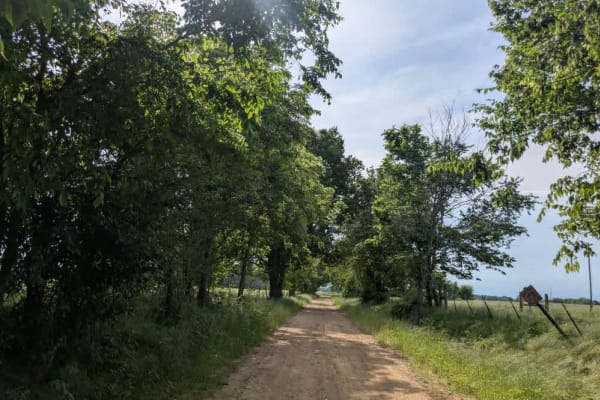
E0834
The road unfolds as loose gravel, usually in decent shape but peppered with washboard ripples and the odd pothole that urges a slower pace. It threads through rolling farmland where pastures stretch to the fence lines, then splashes over a shallow creek that freshens the air. We met a spread of curi...
Learn more about E0834
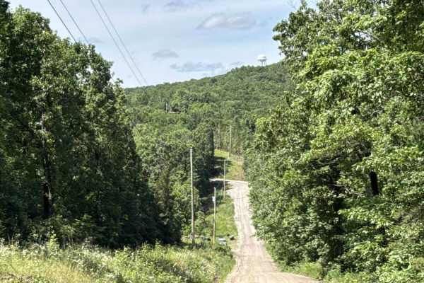
Kimes Tower Road
Kimes Tower Road is an easy gravel forest road that winds through the mountains beneath a dense tree canopy. The route is generally smooth and well-maintained, with only occasional embedded rocks less than 6 inches in height. A series of gentle curves and elevation changes keeps the drive interestin...
Learn more about Kimes Tower Road
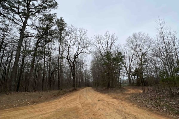
White Rock Mountain East
White Rock Mountain is an amazing place to explore in the Ozarks because it's absolutely magnificent. Sitting at an elevation of 2,309 feet, it provides some of the most breathtaking views in Arkansas. It's also one of the highest elevations in the state. The road to get there is an easy gravel road...
Learn more about White Rock Mountain East
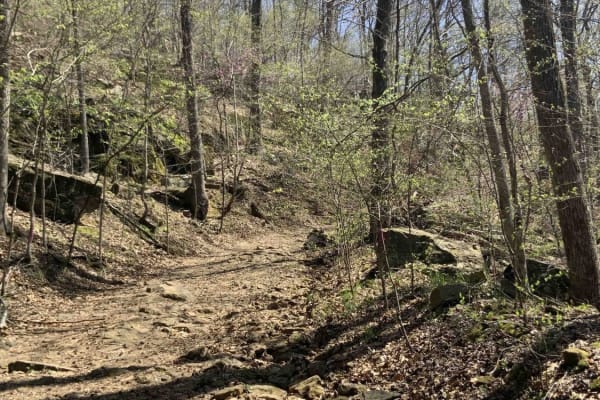
Warloop Road - 1567a
This road starts out as a maintained road and then changes to an unmaintained "right of way" road through private land. It then changes back to a maintained dirt road. There is a sign where the unmaintained section starts that lists the names of the families who own land along the road. It is fairly...
Learn more about Warloop Road - 1567a
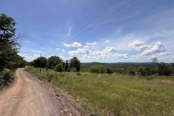
Rackley Mountain Road
Rackley Mountain Road is an easy dirt and gravel mountain road that winds through the forest via a series of gradual switchbacks and elevation changes. Much of the route is covered by a dense tree canopy, giving the trail a shaded and remote feel while also helping keep dust down during dry conditio...
Learn more about Rackley Mountain Road
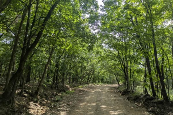
E859
The road drops off the hillside in a lazy set of bends, its gravel surface mostly tidy but interrupted by the odd pothole and strip of washboard that rattles the dash before smoothing out farther down. A hand-painted sign reminds drivers to ease off the gas because kids play nearby, and it is good a...
Learn more about E859
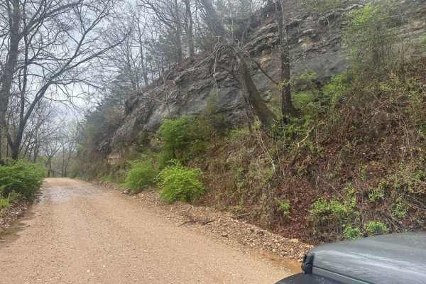
Bluff Run
Bluff Run gets its name from the countless beautiful bluffs, rock faces, and rock formations you will see along the way. This trail is part of the Green Country Oklahoma Adventure Tour (GOAT), which comprises mainly dirt roads with short bits of connecting pavement where necessary. This is an easy r...
Learn more about Bluff Run
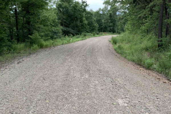
Bliss Ridge / 1505-1
This is a wide, well-maintained, dirt road from the White Rock Mountain Area to Shores Lake. Shores Lake is an 82-acre lake and has hiking, camping, swim areas, restrooms, and a boat ramp. It is a clear lake and has good fishing. ATVs are not allowed in the lake area. There are also a few campsites...
Learn more about Bliss Ridge / 1505-1
Beginner ATV trails near Greenland, Arkansas
Explore ATV-friendly trails near you. These trails are accessible for vehicles up to 50 inches wide, perfect for ATVs and smaller off-road machines.
Cove Creek Crossing
Cove Creek Crossing is a scenic forest route that follows the creek through a narrow mountain valley surrounded by towering hardwoods, rock bluffs, and rolling ridgelines. The road is primarily gravel and generally easy to navigate, though scattered embedded rock and occasional rough patches keep it...
Learn more about Cove Creek Crossing
Bradford Easy Loop 1720B/2509
This is a great loop trail off Freedom Road. Along the trail, there are a few more loop and side road options that would make the path longer or more difficult. Due to narrow and tight turns, it is not currently suitable for full-size 4x4 pickups. Your 4x4 Jeep, Bronco, or midsize truck should be fi...
Learn more about Bradford Easy Loop 1720B/2509
Old Cove City Road
Old Cove City Road is an easy scenic gravel road that winds through dense hardwood forest and rolling mountain terrain within the National Forest. The route is generally wide and well-maintained, making it suitable for most highway-registered vehicles in dry conditions. Long stretches of tree canopy...
Learn more about Old Cove City Road
Tsalagi Trail East
The Tsalagi Trail East offers a scenic and leisurely expedition through the historic eastern reaches of the Cherokee Nation, making it perfect for beginners, families, and overland enthusiasts seeking a relaxed day on the trail. Spanning approximately 55 miles of unpaved county roads, this route win...
Learn more about Tsalagi Trail East
Beginner UTV/side-by-side trails near Greenland, Arkansas
Find UTV and side-by-side trails near you. These trails accommodate vehicles up to 60 inches wide, ideal for UTVs, side-by-sides, and wider off-road rigs.
Cove Creek Crossing
Cove Creek Crossing is a scenic forest route that follows the creek through a narrow mountain valley surrounded by towering hardwoods, rock bluffs, and rolling ridgelines. The road is primarily gravel and generally easy to navigate, though scattered embedded rock and occasional rough patches keep it...
Learn more about Cove Creek Crossing
Bradford Easy Loop 1720B/2509
This is a great loop trail off Freedom Road. Along the trail, there are a few more loop and side road options that would make the path longer or more difficult. Due to narrow and tight turns, it is not currently suitable for full-size 4x4 pickups. Your 4x4 Jeep, Bronco, or midsize truck should be fi...
Learn more about Bradford Easy Loop 1720B/2509
Old Cove City Road
Old Cove City Road is an easy scenic gravel road that winds through dense hardwood forest and rolling mountain terrain within the National Forest. The route is generally wide and well-maintained, making it suitable for most highway-registered vehicles in dry conditions. Long stretches of tree canopy...
Learn more about Old Cove City Road
Tsalagi Trail East
The Tsalagi Trail East offers a scenic and leisurely expedition through the historic eastern reaches of the Cherokee Nation, making it perfect for beginners, families, and overland enthusiasts seeking a relaxed day on the trail. Spanning approximately 55 miles of unpaved county roads, this route win...
Learn more about Tsalagi Trail East
The onX Offroad Difference
onX Offroad combines trail photos, descriptions, difficulty ratings, width restrictions, seasonality, and more in a user-friendly interface. Available on all devices, with offline access and full compatibility with CarPlay and Android Auto. Discover what you're missing today!
Open Trail Map