
Beginner Off-Road Trails
Near Gaffney, South Carolina
Explore All Beginner Trails Near Gaffney, South Carolina
Beginner Off-Road Trails Near Gaffney, South Carolina
Discover the best beginner-friendly off-road trails near you. These easier, lower-rated trails are a great place to start — browse trail maps, check difficulty ratings, and find your next adventure.

South Carolina Adventure Route Segment 4
Segment 4 transits the "midlands" section of South Carolina, with the towns of Gaffney and Camden on each end. This section is mostly forested and contains a mixture of pavement, gravel, and clay roads. The clay can become quite slick and rutted when wet, and the ruts can hold their form when dry, s...
Learn more about South Carolina Adventure Route Segment 4
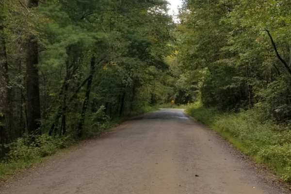
Enoree River Southside Trail System
The Enoree River Southside Trail System is a scenic and highly accessible offroad route ideal for beginners, families, and overlanders looking for a relaxing cruise through South Carolina’s lush forests. Stretching approximately 6.5 miles through the Enoree Ranger District of Sumter National Forest,...
Learn more about Enoree River Southside Trail System
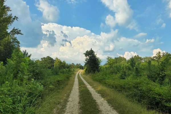
Francis Marion & Sumter National Forests Southern Adventure Route
This route through the Sumter National Forest is approximately 14 miles of easy driving and beautiful scenery. Starting from Indian Circle Road, this route will take you under Interstate 26 and continue traversing through the National Forest; ending at Old Newberry Highway This route provides a nice...
Learn more about Francis Marion & Sumter National Forests Southern Adventure Route
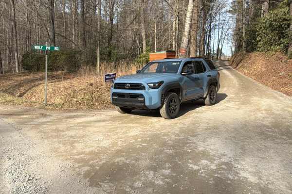
Wolf Pit Road - FS 117
Wolf Pit Road is a maintained gravel road that leads to the scenic Wolf Pit Trailhead, which hikers use to venture up Shortoff Mountain. The right of way passes through multiple private properties, which are located close to the road, and residents urge travelers to pass by slowly and to respect the...
Learn more about Wolf Pit Road - FS 117
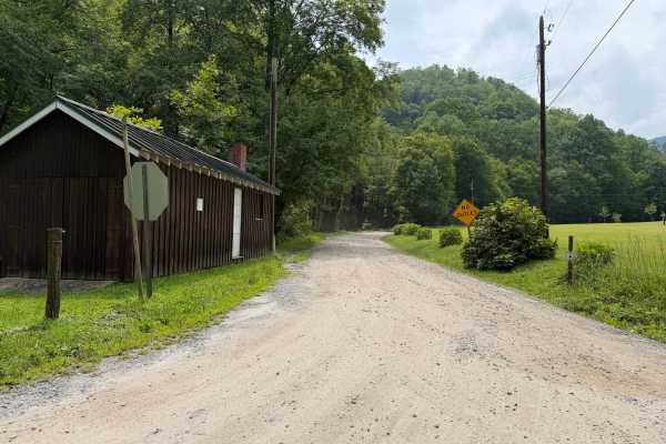
Newberry Creek - FS 482A
Coming up onto Newberry Creek - FS 482A, off of Curtis Creek Road, this trail will lead you to numerous private properties that are posted throughout the trail. A creek runs along side the trail but can only be accessible when coming up towards the end where you can legally fish without trespassing ...
Learn more about Newberry Creek - FS 482A
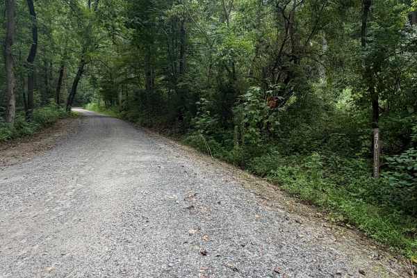
Little Buck Creek - FS 470
Coming up onto Little Buck Creek - FS 470, located above Lake Tahoma off of Highway 80 in Marion. You will casually drive past many homes alongside the lake until you are met with the forestry sign that starts your ascent up the mountain. Many postings and private property signs are spotted up until...
Learn more about Little Buck Creek - FS 470
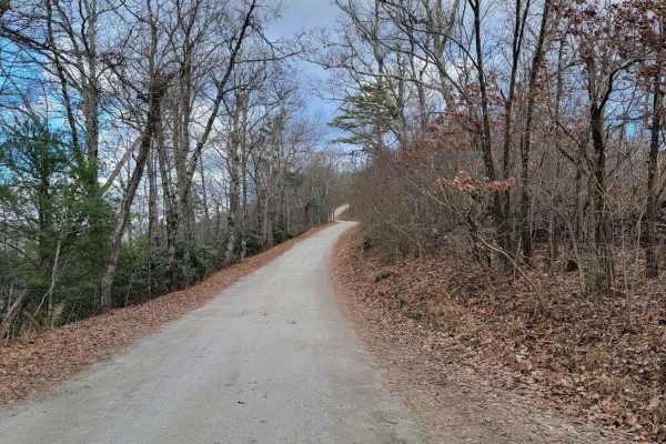
Old NC 105
Old NC 105 is an ideal scenic route for beginner off-roaders, overland campers, and sightseers looking for unparalleled, sweeping views of the Linville Gorge and Table Rock Mountain. Stretching approximately 13.7 miles along the western rim of the gorge, this rugged dirt road climbs from an elevatio...
Learn more about Old NC 105
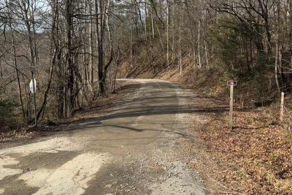
Back Irish Creek - FS 118
Back Irish Creek is a scenic Forest Service Road that travels along private property and leads into the Pisgah National Forest. It is well maintained and spacious pull offs for bypassing vehicles, but recent storm damage is present toward the beginning of the trail where an obstructed tree has been ...
Learn more about Back Irish Creek - FS 118
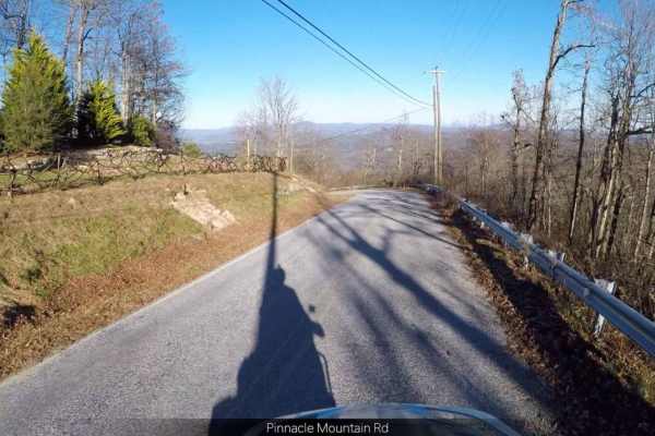
Pinnacle - SCAR Alternate
Pinnacle - SCAR Alternate offers dual-sport riders and four-wheel-drive enthusiasts a scenic detour off the main South Carolina Adventure Route, showcasing stunning ridgetop views along the boundary of DuPont State Recreational Forest. Spanning approximately 20.4 miles, this trail climbs from a mini...
Learn more about Pinnacle - SCAR Alternate
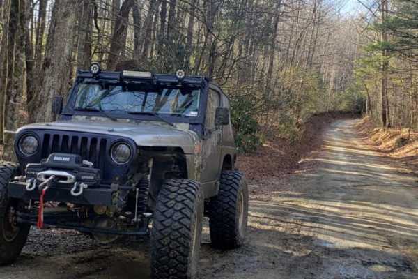
Pinicale Mt Rd
Pinnacle Mountain Road offers an easy and scenic driving experience ideal for beginners, families, and stock high-clearance vehicles looking to explore the beautiful woodlands along the North Carolina and South Carolina border. Running through a mix of public and wildlife conservation lands, this ro...
Learn more about Pinicale Mt Rd
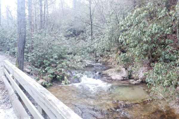
Green River Road
This is a short dirt and gravel trail that can be combined with Pinnacle Mountain Road to make a great loop. It runs along a small stream with great views of the stream and a small waterfall. It runs through a wooded area from a river valley up to a ridge. It's an easy trail with only small rocks an...
Learn more about Green River Road
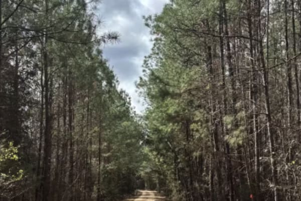
Cricket Tree Road
This scenic forest trail winds through tall pine trees and sandy terrain, offering a quiet off-road drive surrounded by nature. The surface is mostly sandy and graded, with occasional muddy puddles after rain and scattered pinecones along the path. Gentle curves and narrow sections between trees add...
Learn more about Cricket Tree Road

Roses Creek - FS 210
This Forest Service road through Pisgah National Forest offers access to stunning views, Table Rock, and the North Carolina Outward Bound School. The trail begins in a small town, passing through some private property before transitioning into a narrow shelf road with hard-packed gravel. Along the w...
Learn more about Roses Creek - FS 210
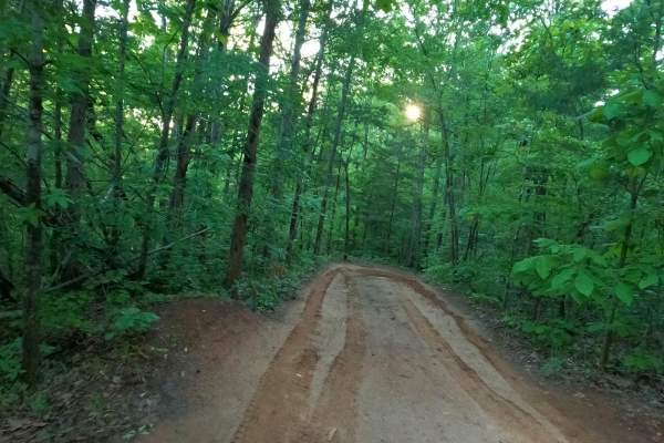
The Ridge
Nice easy bypass when Palmetto Krawler gets too wet, slick, and muddy. Smooth and fairly flat trail that runs along the north property line, so please stay on the trail so we can keep good relations with our neighbors. This trail is lightly used, so is usually in very good condition.
Learn more about The Ridge
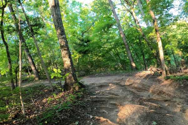
Bamboozled
This is an easier way to get up the hill. Interesting and scenic twisty trail lined with bamboo at the bottom that makes you feel like you're in a foreign country. Bamboozled is a much easier way to get out of the river valley and start back up to the top of the park.
Learn more about Bamboozled
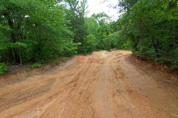
Trail 14
The easiest way to get from the lower River Road area back to the park entrance is. Provides access to Campsite 8 at the bottom, Campsite 10 about halfway up next to the That Dam Trail entrance, and the Shipwreck Trail exit. Also provides access to the Lone Rock trail. Wide, smooth dirt surface trai...
Learn more about Trail 14
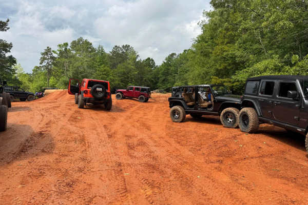
Trail 1
Easy two-way eastern perimeter trail that starts at the Park entrance gate and runs to the southern end of the Park. It provides access to the downhill trails in the center of the park as well as a few easier trails on the eastern side. Watch for oncoming traffic, VERY slick when wet. The East side ...
Learn more about Trail 1
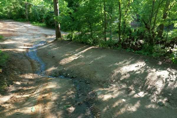
Volunteer Bridge Bypass
Volunteer Bridge Bypass gives riders an alternative to the Volunteer Bridge, which is an obstacle along the main line of River Road. Volunteer Bridge Bypass is an easy dirt trail with no obstacles. If the thought of dropping a wheel between the bridge rails makes you nervous, this is another way aro...
Learn more about Volunteer Bridge Bypass
Dobson Knob - FS 106
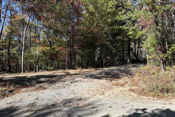
This out-and-back trail is a gravel-over-packed-dirt route beginning at Old North Carolina 105 and following a ridge with scenic views on both sides. Around 4.4 miles in, it narrows to a six-foot-wide path near a large camping area, then continues another 1.5 miles as the Mountains-to-Sea hiking tra...
Learn more about Dobson Knob - FS 106
Toilet Trail
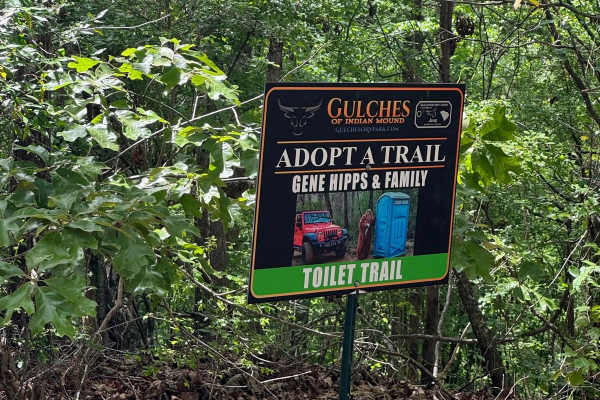
Easy access to the top of the Intentions, Li'l Devil, Hunter's, Twister's Sister, and B&B Hill trails. The trail loops around, returning to its start at Campsite 11. If you're lucky, there might be an outhouse at the top for those moments of need. This trail is sponsored by Gene Hipps and Family.
Learn more about Toilet Trail
Beginner ATV trails near Gaffney, South Carolina
Explore ATV-friendly trails near you. These trails are accessible for vehicles up to 50 inches wide, perfect for ATVs and smaller off-road machines.
Cricket Tree Road
This scenic forest trail winds through tall pine trees and sandy terrain, offering a quiet off-road drive surrounded by nature. The surface is mostly sandy and graded, with occasional muddy puddles after rain and scattered pinecones along the path. Gentle curves and narrow sections between trees add...
Learn more about Cricket Tree Road
The Ridge
Nice easy bypass when Palmetto Krawler gets too wet, slick, and muddy. Smooth and fairly flat trail that runs along the north property line, so please stay on the trail so we can keep good relations with our neighbors. This trail is lightly used, so is usually in very good condition.
Learn more about The Ridge
Bamboozled
This is an easier way to get up the hill. Interesting and scenic twisty trail lined with bamboo at the bottom that makes you feel like you're in a foreign country. Bamboozled is a much easier way to get out of the river valley and start back up to the top of the park.
Learn more about Bamboozled
Trail 14
The easiest way to get from the lower River Road area back to the park entrance is. Provides access to Campsite 8 at the bottom, Campsite 10 about halfway up next to the That Dam Trail entrance, and the Shipwreck Trail exit. Also provides access to the Lone Rock trail. Wide, smooth dirt surface trai...
Learn more about Trail 14
Beginner UTV/side-by-side trails near Gaffney, South Carolina
Find UTV and side-by-side trails near you. These trails accommodate vehicles up to 60 inches wide, ideal for UTVs, side-by-sides, and wider off-road rigs.
Cricket Tree Road
This scenic forest trail winds through tall pine trees and sandy terrain, offering a quiet off-road drive surrounded by nature. The surface is mostly sandy and graded, with occasional muddy puddles after rain and scattered pinecones along the path. Gentle curves and narrow sections between trees add...
Learn more about Cricket Tree Road
The Ridge
Nice easy bypass when Palmetto Krawler gets too wet, slick, and muddy. Smooth and fairly flat trail that runs along the north property line, so please stay on the trail so we can keep good relations with our neighbors. This trail is lightly used, so is usually in very good condition.
Learn more about The Ridge
Bamboozled
This is an easier way to get up the hill. Interesting and scenic twisty trail lined with bamboo at the bottom that makes you feel like you're in a foreign country. Bamboozled is a much easier way to get out of the river valley and start back up to the top of the park.
Learn more about Bamboozled
Trail 14
The easiest way to get from the lower River Road area back to the park entrance is. Provides access to Campsite 8 at the bottom, Campsite 10 about halfway up next to the That Dam Trail entrance, and the Shipwreck Trail exit. Also provides access to the Lone Rock trail. Wide, smooth dirt surface trai...
Learn more about Trail 14
The onX Offroad Difference
onX Offroad combines trail photos, descriptions, difficulty ratings, width restrictions, seasonality, and more in a user-friendly interface. Available on all devices, with offline access and full compatibility with CarPlay and Android Auto. Discover what you're missing today!
Open Trail Map