
Beginner Off-Road Trails
Near Coyville, Kansas
Explore All Beginner Trails Near Coyville, Kansas
Beginner Off-Road Trails Near Coyville, Kansas
Discover the best beginner-friendly off-road trails near you. These easier, lower-rated trails are a great place to start — browse trail maps, check difficulty ratings, and find your next adventure.
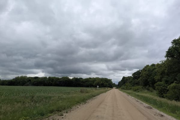
H Road
This gravel backroad stays in decent shape for most of the year, though it ripples with light corrugations and hides the occasional pothole. Late-May rains turn stretches slick and muddy, so four-wheel drive is handy if you want to keep the pace playful. The route threads past a handful of rural hom...
Learn more about H Road
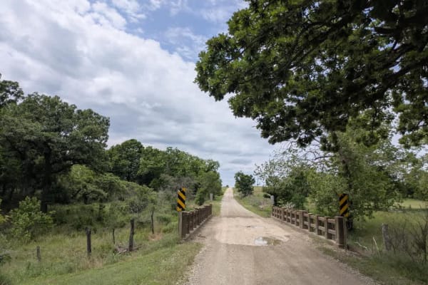
Crisco Road
The route runs over generally well-graded gravel, though frequent corrugations and scattered bumps keep the suspension working. A couple of concrete fords carry the track over shallow rivers, and you will likely meet a steady stream of local traffic moving between pastures. All the while, the landsc...
Learn more about Crisco Road
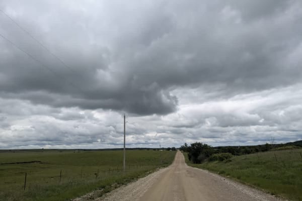
County Road 31
The route runs mostly straight across well-graded gravel, though it bends just enough to keep things interesting and crosses over a broad concrete bridge spanning the creek. Shallow corrugations, scattered potholes, and late-May mud remind you to stay alert, but the drive remains enjoyable rather th...
Learn more about County Road 31
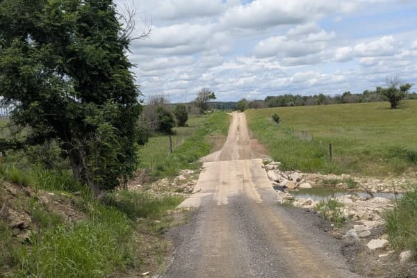
Road 7
The road begins as a narrow, twisting ribbon of rough gravel, its ruts rattling the rig while it drops toward a series of shallow stream crossings where mud can linger long after a storm. Once you leave the water behind, the route straightens and broadens, smoothing out under the wheels thanks to th...
Learn more about Road 7
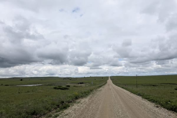
River Road
The road keeps a mostly straight course, bending just enough to break the monotony, but the surface dips and heaves and is uneven in sections that make the vehicle sway, so easing off the throttle is wise. Although the gravel is generally well maintained, you will bump over light corrugations, dodge...
Learn more about River Road
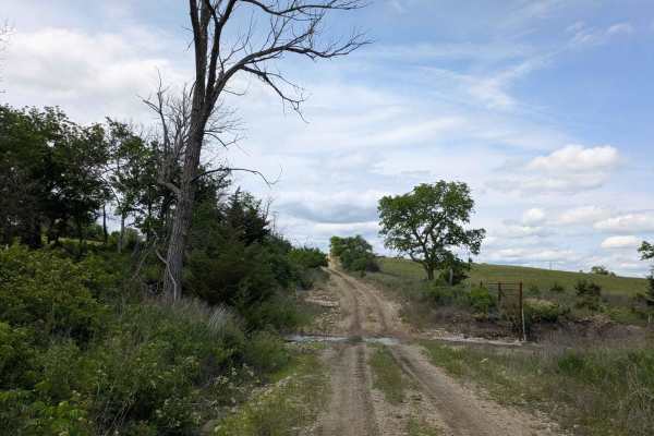
Southeast Wiedemann
The track squeezes into a single lane of muddy, rock-strewn gravel that rises and dips over a handful of short climbs and drops. Tight, twisting corners keep you on your toes, and a few shallow stream crossings add to the fun. This stretch of the larger route feels especially scenic, yet fresh tire ...
Learn more about Southeast Wiedemann
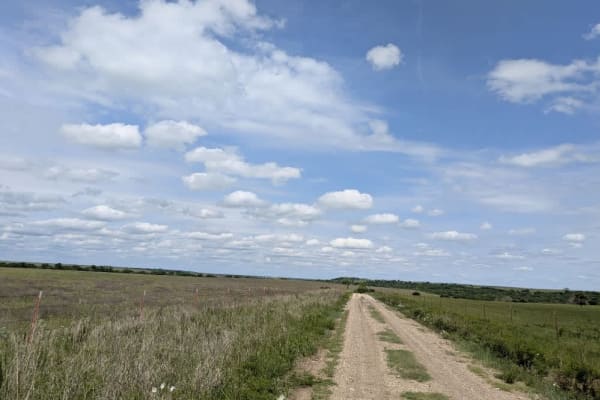
Reece Road
Most of this route snakes through the hills as a single-lane strip of rough, rocky gravel, bouncing over washboard ridges and splashing through a handful of shallow streams. A few miles from the end, it suddenly opens up into a broader, smoother road that local farmers use to reach the town, so the ...
Learn more about Reece Road
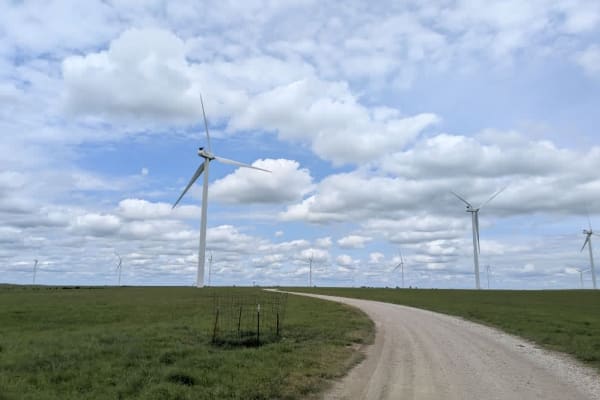
Oil Field Lease Road
The track doubles as an access road for local farmers and crews who service the nearby wind turbines, so it stays in decent shape, though corrugations and the occasional pothole still jolt the suspension. After passing the turbine field office, the road climbs a gentle rise, and from the crest, you ...
Learn more about Oil Field Lease Road
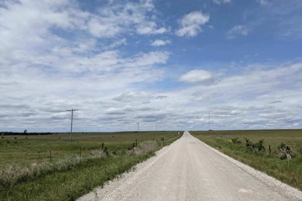
Latham Beaumont Road
The track is largely well-graded, yet gentle climbs and drops add a little variety, and the sharper bends carry washboard ridges that rattle through the chassis. On either side, open fields give way to nodding pump jacks and fenced pastures where cattle graze, creating a patchwork of agriculture and...
Learn more about Latham Beaumont Road

Southeast 70th
The trail squeezes into a single lane and mixes slick mud with loose rock almost from the start. A short stretch of smooth gravel encourages a little extra speed, but the road soon crests and drops into a steep, stone-strewn descent that demands careful braking. This corner of the broader route is s...
Learn more about Southeast 70th
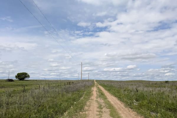
Southeast Summit
The route is a single-lane track, its hard-packed dirt quickly turning to sticky clay whenever it rains. Midway along, a tight creek crossing waits; the banks drop away more sharply than they appear from above, and the water sits a little deeper than most drivers anticipate, though a careful approac...
Learn more about Southeast Summit
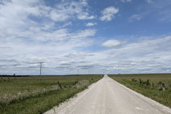
Southeast Ferrell
The road is a broad, well-groomed strip of gravel that rolls almost effortlessly across open grassland. Corrugations and potholes are rare, so the ride stays smooth for long stretches. Expect a steady flow of ranch pickups and turbine service trucks since farmers and wind-power crews rely on this ro...
Learn more about Southeast Ferrell
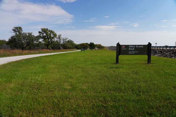
Lake Road
Lake Road is a graded rock road that is a quiet and peaceful drive to the lake at John Redmond Reservoir. This looked like a great spot for fishing or a picnic. There is no camping or fires allowed in this area; however, there is plenty of primitive or RV camping, with 110 hookups just on the other ...
Learn more about Lake Road
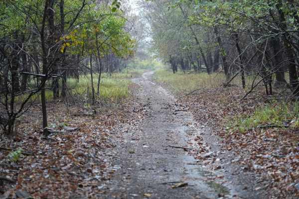
Otter Creek Main Trail
This 2 1/2 mile Trail takes you through the Otter Creek ORV area. The trail is mostly flat, with a few slight elevation changes, and some mud holes that can get deep; however, they are relatively easy to either split or go around entirely. Everything from a small ATV up should have no problem. If th...
Learn more about Otter Creek Main Trail
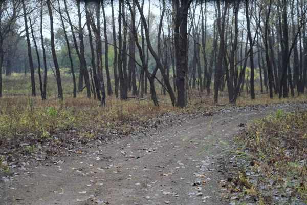
Otter Creek Inner Trail
The Inner trail connects with the main trail throughout the area. This trail is dirt with relatively shallow mud holes, rutted out tracks. This trail gets extremely muddy and slick with the rain. Most of the mud holes are near trees. Take caution with the ones that are not, as you may not have a way...
Learn more about Otter Creek Inner Trail
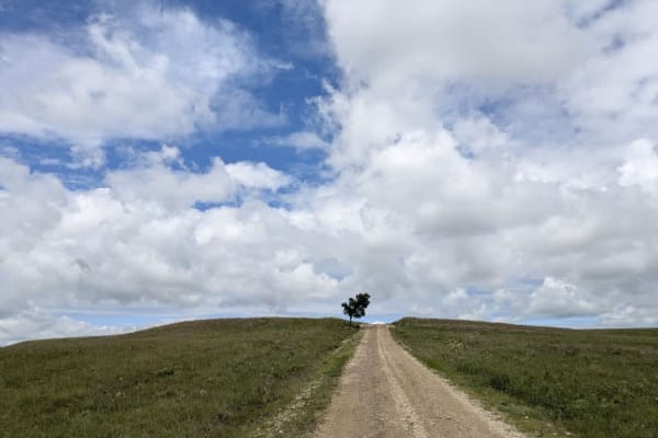
Township Road 50
The path quickly narrows into a muddy ribbon across open range, so you'll pass through several cattle gates and might spot cows lingering on the roadway, drawn by the sound of your engine. Occasional oil derricks punctuate the landscape, hinting at the route's infrequent use by local farmers and fie...
Learn more about Township Road 50
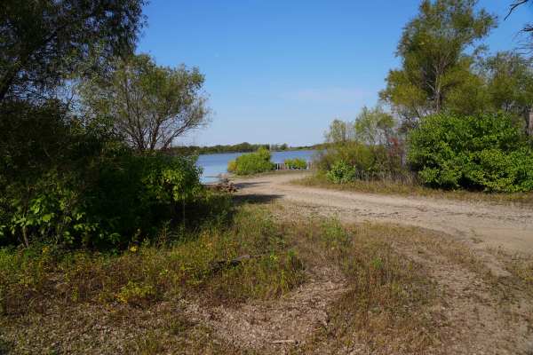
Lake Road West Fork
Lake Rd (west fork) is a graded rock road that forks off to the west for lake access. This was another a great spot for fishing or a picnic. There is a lot of native tallgrass prairie, and is on a flight path for migratory ducks and geese. There is no camping or fires allowed in this area, however t...
Learn more about Lake Road West Fork
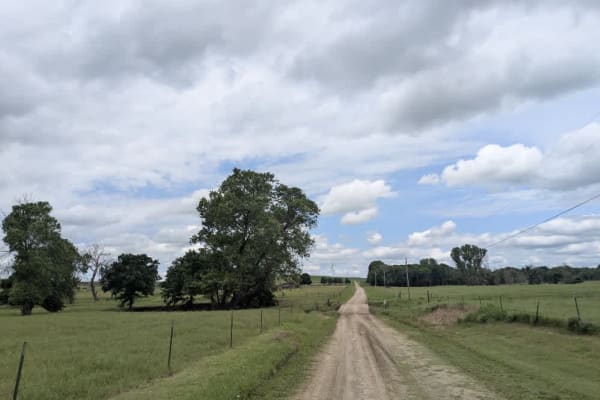
Road 5
This lane is narrower than most main routes, and while the gravel is generally well-groomed, rocky patches and washboard bumps keep the ride lively on its winding stretches. It rolls past a handful of farmhouses, then skips over several small bridges before climbing into a landscape dotted with towe...
Learn more about Road 5
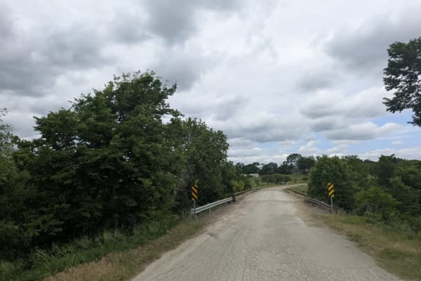
Road 5a
The road rolls out as a fairly well-kept ribbon of gravel, but the steady traffic of ranch trucks has carved in corrugations and pocked it with potholes, so expect a bit of shake and rattle. A fine layer of dust hangs behind each vehicle as the route threads past a mix of weather-beaten homesteads a...
Learn more about Road 5a
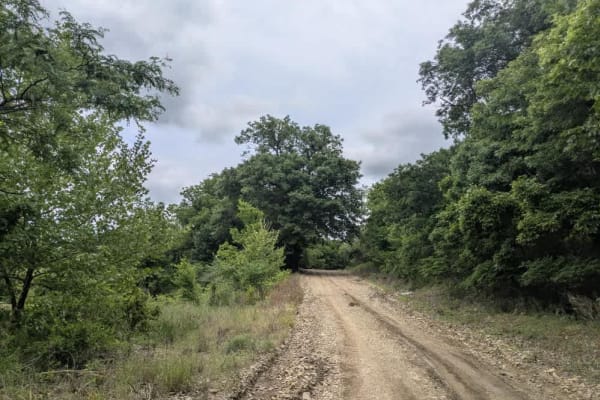
Union Road
The track is a seldom-traveled ribbon of loose gravel;about halfway in, a slick hairpin drops toward the river, where the crossing proves deeper than it looks, and the base is nothing more than soft mud mixed with scattered rocks. On the opposite bank, the road stays muddy while it climbs away from ...
Learn more about Union Road
Beginner ATV trails near Coyville, Kansas
Explore ATV-friendly trails near you. These trails are accessible for vehicles up to 50 inches wide, perfect for ATVs and smaller off-road machines.
Lake Road
Lake Road is a graded rock road that is a quiet and peaceful drive to the lake at John Redmond Reservoir. This looked like a great spot for fishing or a picnic. There is no camping or fires allowed in this area; however, there is plenty of primitive or RV camping, with 110 hookups just on the other ...
Learn more about Lake Road
Otter Creek Main Trail
This 2 1/2 mile Trail takes you through the Otter Creek ORV area. The trail is mostly flat, with a few slight elevation changes, and some mud holes that can get deep; however, they are relatively easy to either split or go around entirely. Everything from a small ATV up should have no problem. If th...
Learn more about Otter Creek Main Trail
Otter Creek Inner Trail
The Inner trail connects with the main trail throughout the area. This trail is dirt with relatively shallow mud holes, rutted out tracks. This trail gets extremely muddy and slick with the rain. Most of the mud holes are near trees. Take caution with the ones that are not, as you may not have a way...
Learn more about Otter Creek Inner Trail
Lake Road West Fork
Lake Rd (west fork) is a graded rock road that forks off to the west for lake access. This was another a great spot for fishing or a picnic. There is a lot of native tallgrass prairie, and is on a flight path for migratory ducks and geese. There is no camping or fires allowed in this area, however t...
Learn more about Lake Road West Fork
Beginner UTV/side-by-side trails near Coyville, Kansas
Find UTV and side-by-side trails near you. These trails accommodate vehicles up to 60 inches wide, ideal for UTVs, side-by-sides, and wider off-road rigs.
Lake Road
Lake Road is a graded rock road that is a quiet and peaceful drive to the lake at John Redmond Reservoir. This looked like a great spot for fishing or a picnic. There is no camping or fires allowed in this area; however, there is plenty of primitive or RV camping, with 110 hookups just on the other ...
Learn more about Lake Road
Otter Creek Main Trail
This 2 1/2 mile Trail takes you through the Otter Creek ORV area. The trail is mostly flat, with a few slight elevation changes, and some mud holes that can get deep; however, they are relatively easy to either split or go around entirely. Everything from a small ATV up should have no problem. If th...
Learn more about Otter Creek Main Trail
Otter Creek Inner Trail
The Inner trail connects with the main trail throughout the area. This trail is dirt with relatively shallow mud holes, rutted out tracks. This trail gets extremely muddy and slick with the rain. Most of the mud holes are near trees. Take caution with the ones that are not, as you may not have a way...
Learn more about Otter Creek Inner Trail
Lake Road West Fork
Lake Rd (west fork) is a graded rock road that forks off to the west for lake access. This was another a great spot for fishing or a picnic. There is a lot of native tallgrass prairie, and is on a flight path for migratory ducks and geese. There is no camping or fires allowed in this area, however t...
Learn more about Lake Road West Fork
The onX Offroad Difference
onX Offroad combines trail photos, descriptions, difficulty ratings, width restrictions, seasonality, and more in a user-friendly interface. Available on all devices, with offline access and full compatibility with CarPlay and Android Auto. Discover what you're missing today!
Open Trail Map