
Beginner Off-Road Trails
Near Constableville, New York
Explore All Beginner Trails Near Constableville, New York
Beginner Off-Road Trails Near Constableville, New York
Discover the best beginner-friendly off-road trails near you. These easier, lower-rated trails are a great place to start — browse trail maps, check difficulty ratings, and find your next adventure.
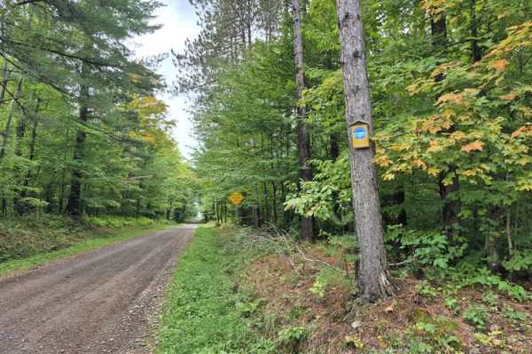
Bower Road
Bower Road is a gravel track traversing the Mohawk Springs State Forest, named for the cold springs that form the headwaters of the historic Mohawk River. The route spans two neighboring forest parcels featuring rolling terrain, historic cellar holes, and a small brook crossing. Please note that thi...
Learn more about Bower Road
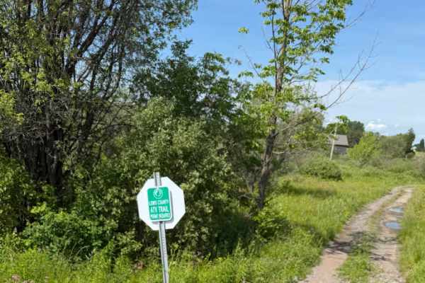
Zimmer Road Spur
This short connector trail provides access to cross New York State Route 26, where riders can use the designated on-road ATV route to connect with other sections of the Lewis County Trail System. The trail primarily serves as a link between riding areas and offers an easy transition to the county’s ...
Learn more about Zimmer Road Spur
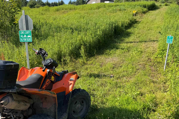
Crofoot Whiskey Trail
The route begins at Crofoot Hill Road, where riders enter a maintained grassy corridor with a gradual incline. The initial climb is smooth overall, though riders may encounter light rutting near the crest. At the posted stop sign, the trail briefly follows Plumber Road before turning left to re-ente...
Learn more about Crofoot Whiskey Trail
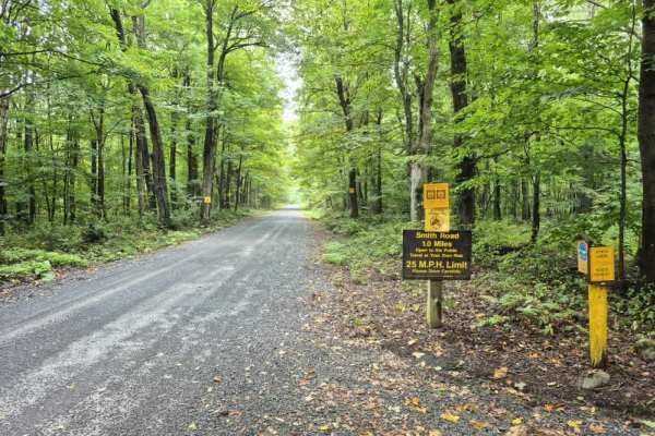
Smith Road PFAR
Smith Road is a well-maintained gravel access route located at the southern end of the 13,793-acre Lesser Wilderness State Forest. The trail winds through a lush hardwood forest, offering excellent opportunities for wildlife viewing throughout the year. Please note that while this is a designated mo...
Learn more about Smith Road PFAR

Byron Corners Orchard
This Lewis County trail winds through historic farmland, including the remnants of an old orchard that hint at the area’s past agricultural use. The route follows a two-track trail with a mix of rutted sections and several mud holes. While the mud varies in depth, none of the holes are bottomless. T...
Learn more about Byron Corners Orchard
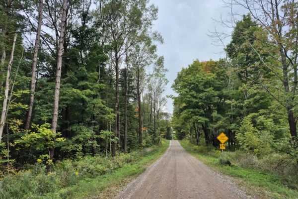
Neff Road
Neff Road is a well-maintained gravel route in southern Lewis County that offers beautiful views of the surrounding forests and fields. Please use caution, as this is a multi-use road that remains open to powersports traffic. Additionally, please be mindful of the various campsites and private prope...
Learn more about Neff Road
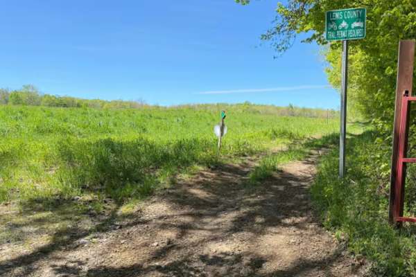
Pollock Run Trail
When traversing along this marked connector trail, riders will travel through a mix of open field edges and wooded terrain featuring a narrow two-track trail surface. The route primarily consists of hard-packed dirt and natural soil with light rutting, uneven sections, scattered loose stone, and occ...
Learn more about Pollock Run Trail
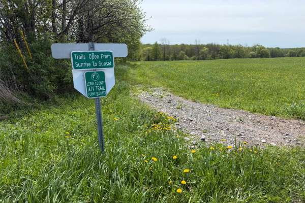
Grower Green Trail West
A scenic and moderately challenging Lewis County ATV trail route traveling through open farm fields, wooded corridors, and remote backcountry terrain. Riders will encounter a mix of hard-packed dirt, loose rock, shallow mud holes, rutted sections, and soft, low-lying areas depending on recent weathe...
Learn more about Grower Green Trail West
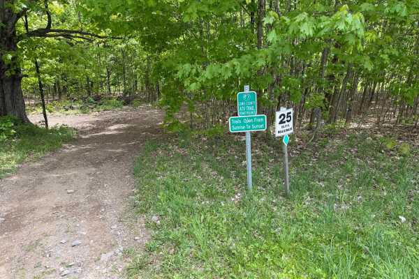
Grower Green Trail East - 1
A moderately easy wooded trail route traveling through classic Lewis County terrain featuring hard-packed dirt, shallow ruts, loose rock, exposed roots, and gradual elevation changes throughout. Riders will travel through dense hardwood forest sections with narrow trail corridors, rolling hills, and...
Learn more about Grower Green Trail East - 1
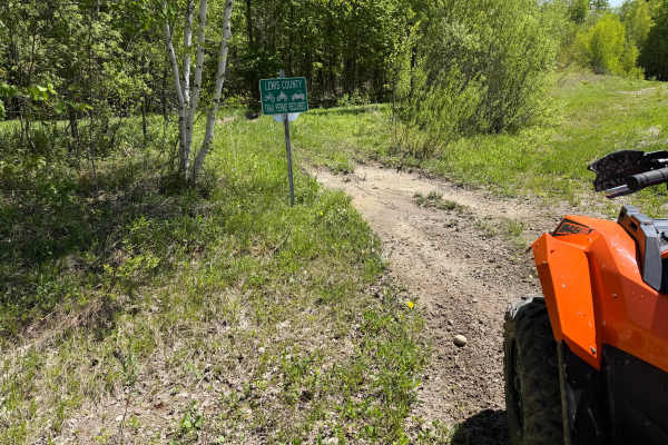
Bauer Wooded Spur Trail
When traveling along this marked connector trail, riders will pass through a mix of wooded terrain and open grass corridor sections featuring a primarily narrow two-track trail surface. Riders can expect mostly hard-packed dirt with shallow ruts, loose soil, scattered roots, and occasional muddy are...
Learn more about Bauer Wooded Spur Trail
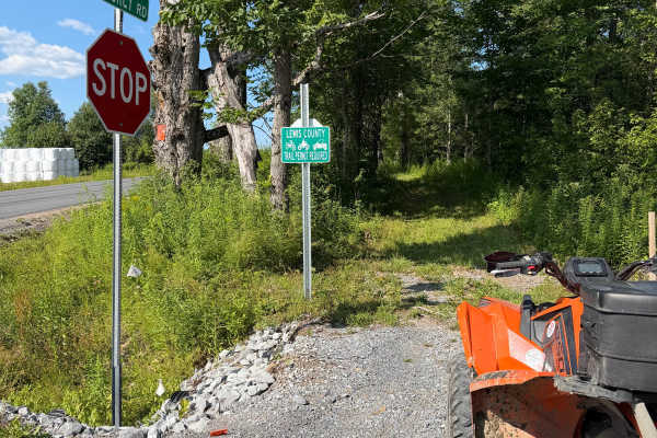
HMW Crofoot Hill–Mackay Trail
This route follows a maintained grassy trail corridor along the edges of an open field with short sections passing through wooded cover. The trail surface is primarily grass and packed soil with light two-track wear and occasional minor rutting. Riders will encounter mostly level terrain with wide ...
Learn more about HMW Crofoot Hill–Mackay Trail
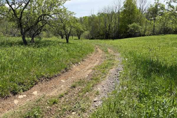
Grower Green Trail East - 2
As you traverse this trail, expect a moderately easy route winding through a mix of wooded terrain and open meadow sections. Riders can expect primarily hard-packed dirt with occasional shallow ruts, loose rock, exposed roots, soft grassy sections, slight off-camber descents, and scattered mud holes...
Learn more about Grower Green Trail East - 2
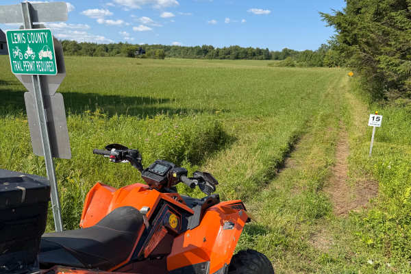
Highmarket Mackay Road Connector
This route is a connector trail within the Lewis County ATV Trail System. Riders can expect a mostly flat, grassy two-track that follows alongside a row of evergreen trees. The trail is well-defined and provides an easy connection between other sections of the trail system. As you approach the end o...
Learn more about Highmarket Mackay Road Connector
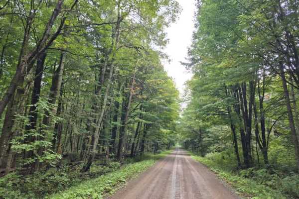
Smith Road
Smith Road is a powersports-legal route that traverses the Lesser Wilderness State Forest toward the Tug Hill region. The trail features a well-maintained surface consisting primarily of dirt and gravel. Riders should maintain moderate speeds, as several corners contain loose stone that can cause tr...
Learn more about Smith Road
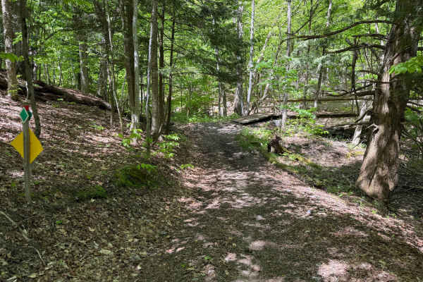
Grower Green Trail East - 3
While traversing through this route, riders will encounter a moderate wooded trail through rolling terrain featuring a mix of hard-packed dirt, loose rock, shallow ruts, and scattered root sections. Several narrow trail corridors wind through the forest with tight turns, small hill climbs and descen...
Learn more about Grower Green Trail East - 3
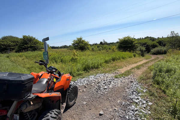
Byron Corners Rd Connector
This short spur connects the main trail to Byrons Corners Road, providing a convenient access point to the Lewis County ATV Trail System. The route follows an open corridor through fields and low brush on a maintained two-track with gentle rolling terrain. A Lewis County ORV permit is required.
Learn more about Byron Corners Rd Connector

Seelman PFAR
Also known as the Dolsee Trail, this route offers a true backcountry driving experience and showcases the full range of terrain found throughout the Tughill region. Expect rocky ledges, deep ruts, mud holes, water crossings, and narrow sections that require careful tire placement and attention to tr...
Learn more about Seelman PFAR

Maple Tap Lane
This short trail starts directly from the Barrows Performance parking lot and serves as an excellent warm-up for a full day of riding. The trail intersects Dolan Road, leading you through a picturesque maple-lined sunken road bordered by historic stone walls on both sides. It’s a beautiful stretch—e...
Learn more about Maple Tap Lane
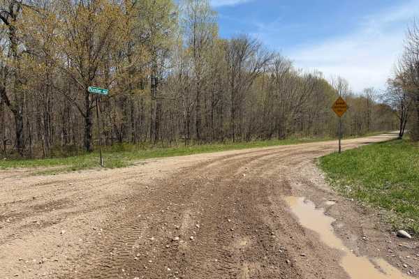
Plumber Road
This route travels through the Lesser Wilderness State Forest, featuring long straightaways, rolling hills, and light curves. The trail primarily consists of maintained gravel and dirt roads with sections of loose rock, shallow mud, and soft shoulders depending on recent weather conditions. Several ...
Learn more about Plumber Road
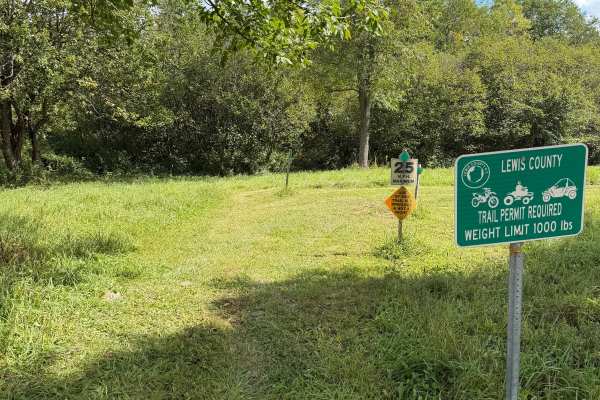
Morgan Run Trail
This route is a grassy two-track trail traveling along Moore Road in Lewis County on private property. Riders can expect a well-marked and maintained trail with plenty of signage throughout the route to help keep riders on the designated trail. Please stay on the marked route, respect the private pr...
Learn more about Morgan Run Trail
Beginner ATV trails near Constableville, New York
Explore ATV-friendly trails near you. These trails are accessible for vehicles up to 50 inches wide, perfect for ATVs and smaller off-road machines.
Bower Road
Bower Road is a gravel track traversing the Mohawk Springs State Forest, named for the cold springs that form the headwaters of the historic Mohawk River. The route spans two neighboring forest parcels featuring rolling terrain, historic cellar holes, and a small brook crossing. Please note that thi...
Learn more about Bower Road
Zimmer Road Spur
This short connector trail provides access to cross New York State Route 26, where riders can use the designated on-road ATV route to connect with other sections of the Lewis County Trail System. The trail primarily serves as a link between riding areas and offers an easy transition to the county’s ...
Learn more about Zimmer Road Spur
Crofoot Whiskey Trail
The route begins at Crofoot Hill Road, where riders enter a maintained grassy corridor with a gradual incline. The initial climb is smooth overall, though riders may encounter light rutting near the crest. At the posted stop sign, the trail briefly follows Plumber Road before turning left to re-ente...
Learn more about Crofoot Whiskey Trail
Byron Corners Orchard
This Lewis County trail winds through historic farmland, including the remnants of an old orchard that hint at the area’s past agricultural use. The route follows a two-track trail with a mix of rutted sections and several mud holes. While the mud varies in depth, none of the holes are bottomless. T...
Learn more about Byron Corners Orchard
Beginner UTV/side-by-side trails near Constableville, New York
Find UTV and side-by-side trails near you. These trails accommodate vehicles up to 60 inches wide, ideal for UTVs, side-by-sides, and wider off-road rigs.
Bower Road
Bower Road is a gravel track traversing the Mohawk Springs State Forest, named for the cold springs that form the headwaters of the historic Mohawk River. The route spans two neighboring forest parcels featuring rolling terrain, historic cellar holes, and a small brook crossing. Please note that thi...
Learn more about Bower Road
Zimmer Road Spur
This short connector trail provides access to cross New York State Route 26, where riders can use the designated on-road ATV route to connect with other sections of the Lewis County Trail System. The trail primarily serves as a link between riding areas and offers an easy transition to the county’s ...
Learn more about Zimmer Road Spur
Crofoot Whiskey Trail
The route begins at Crofoot Hill Road, where riders enter a maintained grassy corridor with a gradual incline. The initial climb is smooth overall, though riders may encounter light rutting near the crest. At the posted stop sign, the trail briefly follows Plumber Road before turning left to re-ente...
Learn more about Crofoot Whiskey Trail
Byron Corners Orchard
This Lewis County trail winds through historic farmland, including the remnants of an old orchard that hint at the area’s past agricultural use. The route follows a two-track trail with a mix of rutted sections and several mud holes. While the mud varies in depth, none of the holes are bottomless. T...
Learn more about Byron Corners Orchard
The onX Offroad Difference
onX Offroad combines trail photos, descriptions, difficulty ratings, width restrictions, seasonality, and more in a user-friendly interface. Available on all devices, with offline access and full compatibility with CarPlay and Android Auto. Discover what you're missing today!
Open Trail Map