
Beginner Off-Road Trails
Near Camp Pendleton South, California
Explore All Beginner Trails Near Camp Pendleton South, California
Beginner Off-Road Trails Near Camp Pendleton South, California
Discover the best beginner-friendly off-road trails near you. These easier, lower-rated trails are a great place to start — browse trail maps, check difficulty ratings, and find your next adventure.
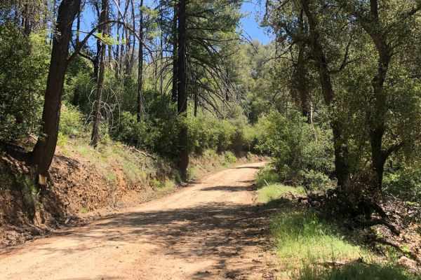
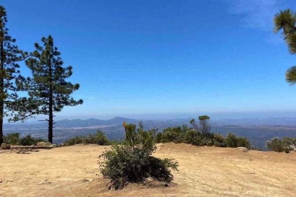
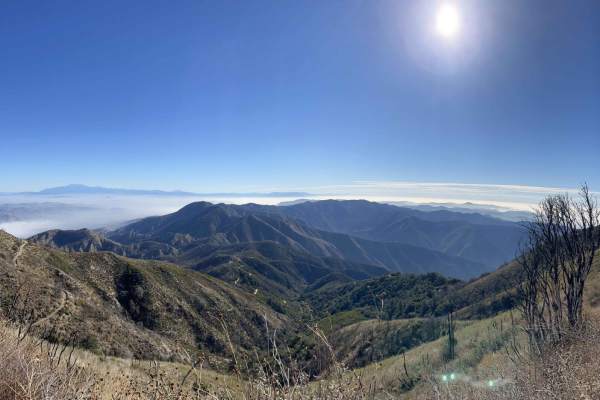
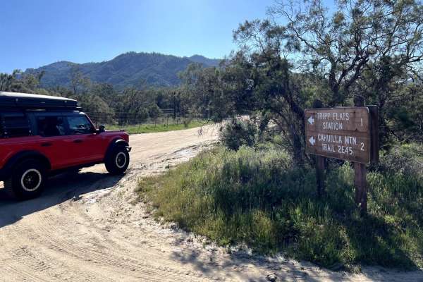
Nate Harrison Grade
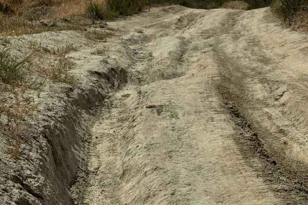
Nate Harrison Grade is a dirt backroad into Palomar Mountain State Park. This trail leads from typical Southern California scrubland scenery up to lush forests and mountain views. You'll encounter loose rocky areas and several deep ruts throughout the route. The trail is primarily non-technical, wit...
Learn more about Nate Harrison Grade
11S03 Lusardi Truck Trail
11S03 Lusardi Truck Trail is an 11.6-mile out-and-back trail rated 3 of 10 located within the Cleveland National Forest, Trabuco Ranger District. Lusardi Truck Trail ascends the Carney Canyon between the Black Butte (west) and Black Mountain (east) to the National Forest boundary at 5.8 miles. The t...
Learn more about 11S03 Lusardi Truck Trail
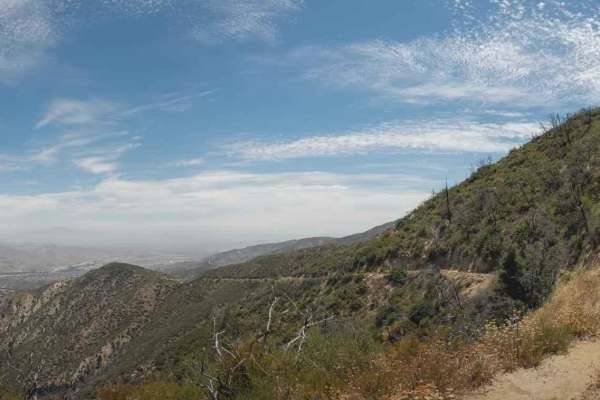
Santa Ysabel Truck Trail
Santa Ysabel Truck Trail is a narrow, shelf-road trail running through a section of the Cleveland National Forest in Ramona. The trail follows along Santa Ysabel Creek and offers beautiful views over the mountains, and leads to several hiking and recreation areas. The terrain along the route is rutt...
Learn more about Santa Ysabel Truck Trail
Orosco Ridge Truck Trail 12S02
This trail winds its way through the Cleveland Forest from Pamo Road to the Guejito Truck Trail. The trail is not very well maintained. It is very rutted. The trail takes you up and over some good hills in Pamo Valley. Parts of the trail are very scenic and beautiful.
Learn more about Orosco Ridge Truck Trail 12S02
11S04 Black Mountain
11S04 Black Mountain is a 10.8-mile out-and-back located in the Cleveland National Forest, Palomar Ranger District. This is a limited-use trail restricted to street-legal vehicles. The trail is rated 3 of 10 but has the potential to be worse during and right after seasonal weather and is subject to ...
Learn more about 11S04 Black Mountain
5S01 Indian Truck Trail
5S01 Indian Truck Trail is a 7-mile point-to-point trail rated 3 of 10 located within the Cleveland National Forest, Trabuco Ranger District. Indian Truck Trail ascends 2,500 feet over the 7-mile drive from the Temescal Canyon to the North Main Divide. This is a limited access trail restricted to st...
Learn more about 5S01 Indian Truck Trail
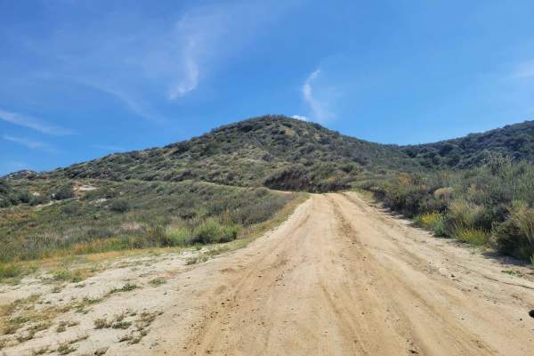
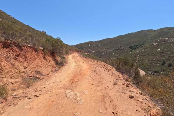
8S05 - North Palomar Mountain Road
8S05 is a well-maintained service road, but you can expect large rocks, ruts, and very steep drop-offs throughout. The weather could have a significant impact on the road. Muddy conditions are likely; one should ensure their vehicle is properly equipped and use caution. This drive is great for a loc...
Learn more about 8S05 - North Palomar Mountain Road
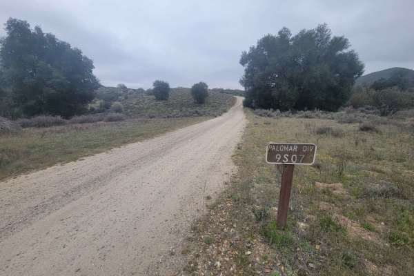
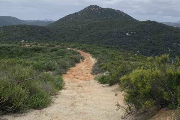
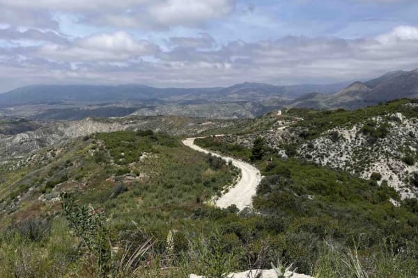
Palomar Divide (9S07)
The Palomar Divide is an easy drive with beautiful views. It is a single lane with pull-offs throughout. The majority of the trail is dirt, however, it has some old paved sections in the lower elevation portion. During the rain or snow seasons, one can expect slick conditions and should proceed with...
Learn more about Palomar Divide (9S07)
North Main Divide Road
Tucked amidst the hustle and bustle of Southern California's heavily-populated coast is a slice of heaven called the Cleveland National Forest. This mountainous region is undeveloped, save for a few great trails connecting world-class views to cozy campgrounds. The North Main Divide Road enters the ...
Learn more about North Main Divide Road
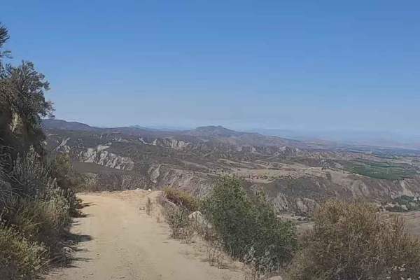
3S04 Main Divide to Santiago Peak
The Main Divide is composed of 3 sections, all of which are easy going trails that can be done with any high clearance 4x4 or a low clearance AWD vehicle with care. This trail offers some of the most amazing views of the Temescal Valley below and Los Angeles beyond. On a clear day you can see all th...
Learn more about 3S04 Main Divide to Santiago Peak
Maple Spring Road
Maple Springs road offers a fun, relatively easy route with scenic views of the Cleveland National Forest. Vehicles should have some ground clearance. At the end of the trail is an elevated patch of asphalt that appears to be a helicopter pad. The trail is shared with dirt bikes, hikers and riders o...
Learn more about Maple Spring Road
FS 4S03
Scenic trail from the 15 Freeway to Santiago Peak. The dirt road is hard-packed and easy to navigate, but does have a few sections with sharp rocks and a few ruts. The road has multiple stop locations for great views towards Riverside. This area is also popular with dirt bikes and hikers.
Learn more about FS 4S03
Red Mountain OHV Trail
Beautiful views of the valley below and mountains above. There are lots of switchbacks and about 600 feet of elevation gain in just a few miles of driving. The second half of the trail was closed after Hurricane Hillary, but it does connect to Juan Diego Flats to get you back out to civilization. Th...
Learn more about Red Mountain OHV Trail
Rouse Ridge via Cottonwood
Rouse Ridge via Cottonwood is a trail that scales Rouse Ridge/Thomas Mountain using Cottonwood (6S18) and Thomas Mountain Rd (6S13). This trail offers stunning views in all directions as you ascend and descend the mountain. While it is possible to complete this trail in either direction, the souther...
Learn more about Rouse Ridge via Cottonwood
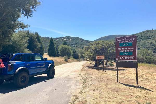
Cedar Creek Loop
This trail cuts through a beautiful stretch of backcountry in eastern San Diego County and passes near hiking trailheads to three different waterfalls. The loop starts and finishes on graded dirt roads and has a more serious middle section that runs high along several canyon walls above several cree...
Learn more about Cedar Creek Loop
Rouse Hill Road
Rouse Hill Road is for street-legal vehicles only; no green stickers or OHV vehicles. Full-size vehicles are at home here, as the trail is a single track with plenty of room. The beginning of this end of the trail winds through the eastern side of Washburn Ranch which is a large grapefruit grower. T...
Learn more about Rouse Hill Road
Bee Canyon
Bee Canyon Truck Trail is a solid choice for beginner to intermediate off-roaders looking for a moderate challenge close to Hemet, California. Winding through the San Bernardino National Forest, this trail combines scenic canyon views with varied terrain, making it one of the more accessible dirt tr...
Learn more about Bee Canyon
Rouse Hill
Rouse Hill is a ridgeline trail with tremendous west and east views. This trail is predominately hard-packed dirt with a loose top layer. It can be a bit sandy in some sections but that will typically only be an issue for 2-wheel vehicles. The trail is only single vehicle wide in some places and som...
Learn more about Rouse Hill
5S06 Idyllwild Control
5S06 Idyllwild Control is a 6-mile point-to-point trail rated 3 of 10 located within the San Bernardino National Forest, San Jacinto Ranger District. 5S06 climbs from Highway 74 nearly 3,000 feet, ending at the intersection with Apple Drive in Idyllwild. The road is open to highway-legal vehicles on...
Learn more about 5S06 Idyllwild Control
Thomas Mountain West Approach
This trail connects the Rouse Ridge via Cottonwood trail to the Thomas Mountain Campground via the western end of Thomas Mountain Road. During dry months, the trail is an easily passable dirt road, requiring only moderate clearance to pass over occasional ruts and drainage control berms running acro...
Learn more about Thomas Mountain West Approach
Beginner ATV trails near Camp Pendleton South, California
Explore ATV-friendly trails near you. These trails are accessible for vehicles up to 50 inches wide, perfect for ATVs and smaller off-road machines.
Orosco Ridge Truck Trail 12S02
This trail winds its way through the Cleveland Forest from Pamo Road to the Guejito Truck Trail. The trail is not very well maintained. It is very rutted. The trail takes you up and over some good hills in Pamo Valley. Parts of the trail are very scenic and beautiful.
Learn more about Orosco Ridge Truck Trail 12S02
Red Mountain OHV Trail
Beautiful views of the valley below and mountains above. There are lots of switchbacks and about 600 feet of elevation gain in just a few miles of driving. The second half of the trail was closed after Hurricane Hillary, but it does connect to Juan Diego Flats to get you back out to civilization. Th...
Learn more about Red Mountain OHV Trail
Rouse Ridge via Cottonwood
Rouse Ridge via Cottonwood is a trail that scales Rouse Ridge/Thomas Mountain using Cottonwood (6S18) and Thomas Mountain Rd (6S13). This trail offers stunning views in all directions as you ascend and descend the mountain. While it is possible to complete this trail in either direction, the souther...
Learn more about Rouse Ridge via Cottonwood
Bee Canyon
Bee Canyon Truck Trail is a solid choice for beginner to intermediate off-roaders looking for a moderate challenge close to Hemet, California. Winding through the San Bernardino National Forest, this trail combines scenic canyon views with varied terrain, making it one of the more accessible dirt tr...
Learn more about Bee Canyon
Beginner UTV/side-by-side trails near Camp Pendleton South, California
Find UTV and side-by-side trails near you. These trails accommodate vehicles up to 60 inches wide, ideal for UTVs, side-by-sides, and wider off-road rigs.
Orosco Ridge Truck Trail 12S02
This trail winds its way through the Cleveland Forest from Pamo Road to the Guejito Truck Trail. The trail is not very well maintained. It is very rutted. The trail takes you up and over some good hills in Pamo Valley. Parts of the trail are very scenic and beautiful.
Learn more about Orosco Ridge Truck Trail 12S02
Red Mountain OHV Trail
Beautiful views of the valley below and mountains above. There are lots of switchbacks and about 600 feet of elevation gain in just a few miles of driving. The second half of the trail was closed after Hurricane Hillary, but it does connect to Juan Diego Flats to get you back out to civilization. Th...
Learn more about Red Mountain OHV Trail
Rouse Ridge via Cottonwood
Rouse Ridge via Cottonwood is a trail that scales Rouse Ridge/Thomas Mountain using Cottonwood (6S18) and Thomas Mountain Rd (6S13). This trail offers stunning views in all directions as you ascend and descend the mountain. While it is possible to complete this trail in either direction, the souther...
Learn more about Rouse Ridge via Cottonwood
Bee Canyon
Bee Canyon Truck Trail is a solid choice for beginner to intermediate off-roaders looking for a moderate challenge close to Hemet, California. Winding through the San Bernardino National Forest, this trail combines scenic canyon views with varied terrain, making it one of the more accessible dirt tr...
Learn more about Bee Canyon
The onX Offroad Difference
onX Offroad combines trail photos, descriptions, difficulty ratings, width restrictions, seasonality, and more in a user-friendly interface. Available on all devices, with offline access and full compatibility with CarPlay and Android Auto. Discover what you're missing today!
Open Trail Map