
Beginner Off-Road Trails
Near Bunker, Missouri
Explore All Beginner Trails Near Bunker, Missouri
Beginner Off-Road Trails Near Bunker, Missouri
Discover the best beginner-friendly off-road trails near you. These easier, lower-rated trails are a great place to start — browse trail maps, check difficulty ratings, and find your next adventure.
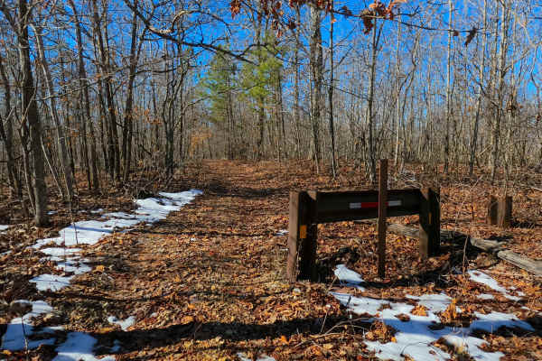
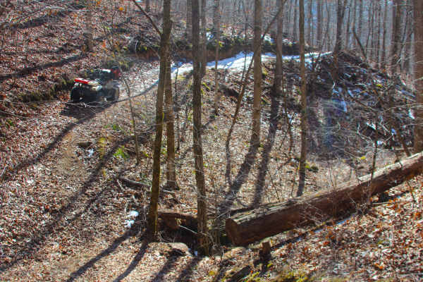
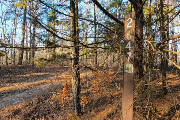
Sutton Bluff ATV 12 - SB 12
Sutton Bluff ATV 12, also known as Bear Tick Hollow with the legal/emergency ID SB 12, is a 50-inch and under restricted trail within the Sutton Bluff OHV trail system, managed by the Mark Twain National Forest Salem Unit. The SB 12 is a part of the smaller "southwest section" of Sutton Bluff OHV. S...
Learn more about Sutton Bluff ATV 12 - SB 12
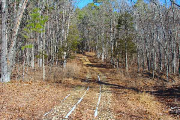
Bear Tick Ridge - FS 2459
Bear Tick Ridge (FS 2459) is a gravel and dirt terrain Forest Service Road within the Salem Unit of Mark Twain National Forest, open to all vehicles complying with Reynolds County and Missouri state laws. From the beginning where the FS 2459 where it spurs off the Reynolds County Road 849 (or FS 223...
Learn more about Bear Tick Ridge - FS 2459
Sutton Bluff ATV 11 - SB 11
Sutton Bluff ATV 11, also known as Little Gulch, with the legal/emergency ID SB 11, is a 50-inch and under restricted trail within the Sutton Bluff OHV trail system, managed by the Mark Twain National Forest Salem Unit. The SB 11 is a part of the smaller "southwest section" of Sutton Bluff OHV. Summ...
Learn more about Sutton Bluff ATV 11 - SB 11
Sutton Bluff ATV 1 - SB 1
Sutton Bluff ATV 1, also known as Long One, with the legal/emergency ID SB 1, is a 50-inch and under restricted trail within the Sutton Bluff OHV trail system, managed by the Mark Twain National Forest Salem Unit. SB 1 is a solo trail in the far northwest portion of the Sutton Bluff OHV. Summary of ...
Learn more about Sutton Bluff ATV 1 - SB 1
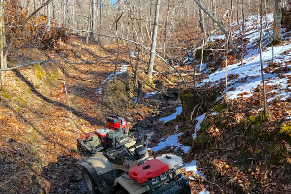
Buzzard Ridge Spur A - FS 2677A
Buzzard Ridge Spur A (FS 2677A) is a gravel and dirt terrain Forest Service Road within the Salem Unit of Mark Twain National Forest, despite the road being legally open up to High Clearance 4x4 sized vehicles, the road is notably very narrow for even SXS (60 inch trail width) sized vehicles, showin...
Learn more about Buzzard Ridge Spur A - FS 2677A
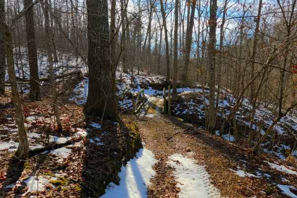
Buzzard Ridge - FS 2677
Buzzard Ridge (FS 2677) is a gravel and dirt terrain Forest Service Road within the Salem Unit of Mark Twain National Forest, open to all vehicles complying with Reynolds County and Missouri state laws. From the beginning where the FS 2677 where it spurs off the Reynolds County Road 849 (or FS 2236)...
Learn more about Buzzard Ridge - FS 2677
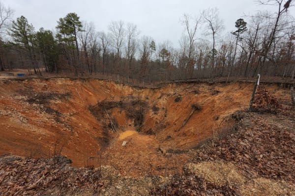
CR 907 Trail of Tears
This is a short gravel road. It is not maintained like it used to be, due to the obstruction now located at the end of the track. While the map shows you can travel through to Highway 32, due to the massive sinkhole, it is a dead end. This short little drive has a must-see sinkhole. Doe Run Minerals...
Learn more about CR 907 Trail of Tears
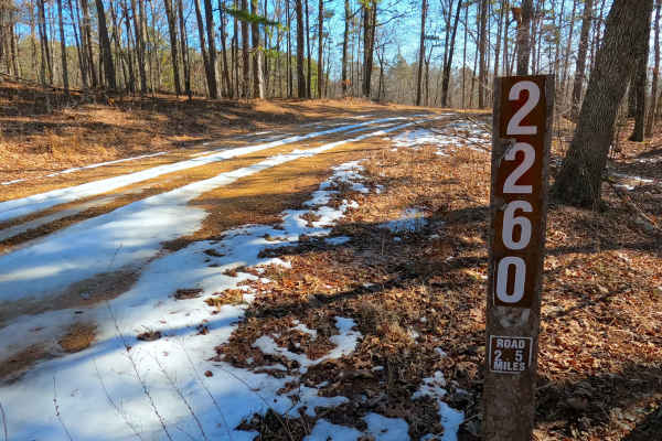
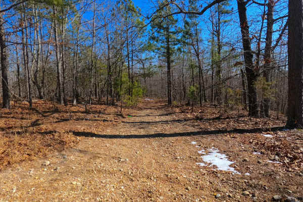
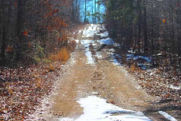
Upper Henderson - FS 2260
Upper Henderson (FS 2260) is a natural leaning gravel and dirt terrain Forest Service Road within the Salem Unit of Mark Twain National Forest, open to all vehicles complying with Reynolds County and Missouri state laws. From the beginning where the FS 2260 spurs off the Karkaghne Scenic Drive (or R...
Learn more about Upper Henderson - FS 2260
Sutton Bluff ATV 10 - SB 10
Sutton Bluff ATV 10, also known as East Buzzard, with the legal/emergency ID SB 10, is a 50-inch and under restricted trail within the Sutton Bluff OHV trail system, managed by the Mark Twain National Forest Salem Unit. The SB 10 is a part of the smaller "southwest section" of Sutton Bluff OHV. Summ...
Learn more about Sutton Bluff ATV 10 - SB 10
Cooks Spring Road
Cooks Spring Road or North Reynolds County Road 848 is a gravel-dirt mixed road and right-of-way, going through the Mark Twain National Forest Salem Unit, in the Sutton Bluff area. From the peak elevation at Karkanghne Scenic Drive ridge, going south, the track aims towards the valley hosting the Co...
Learn more about Cooks Spring Road
Radford Hollow - RCR 848
Radford Hollow or Southwest Reynolds County Road 848 is a gravel-dirt mixed road and right-of-way, going through the Reynolds County and Mark Twain National Forest Salem Unit, in the Sutton Bluff area. From the peak elevation along the ridge that hosts the Reynolds County Road 849 going east and wes...
Learn more about Radford Hollow - RCR 848
Sutton Bluff ATV 3 - SB 3
Sutton Bluff ATV 3, also known as Cooks Heights, with the legal/emergency ID SB 3, is a 50-inch and under restricted trail within the Sutton Bluff OHV trail system, managed by the Mark Twain National Forest Salem Unit. SB 3 is part of the small "center north" section of the Sutton Bluff OHV. Summary...
Learn more about Sutton Bluff ATV 3 - SB 3
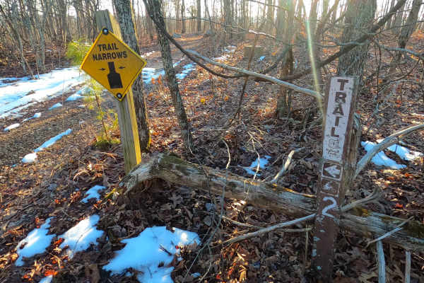
Sutton Bluff ATV 2 - SB 2
Sutton Bluff ATV 2, also known as Old Tower, with the legal/emergency ID SB 2, is a 50-inch and under restricted trail within the Sutton Bluff OHV trail system, managed by the Mark Twain National Forest Salem Unit. SB 2 is part of the small "center north" section of the Sutton Bluff OHV. From the ea...
Learn more about Sutton Bluff ATV 2 - SB 2
Cooks Branch - FS 2646
Cooks Branch (FS 2646) is a gravel and dirt terrain Forest Service Road within the Salem Unit of Mark Twain National Forest, open to all vehicles complying with Reynolds County and Missouri state laws. From the beginning where the FS 2646 spurs off the Karkaghne Scenic Drive (or Reynolds County Road...
Learn more about Cooks Branch - FS 2646
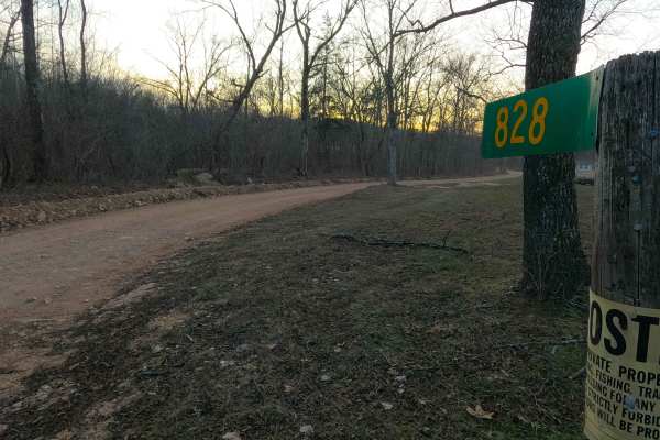
Missouri Branch - RCR 828
Missouri Branch, or Reynolds County Road 828, is a gravel-dirt mixed road and right-of-way, going through the Mark Twain National Forest Salem Unit, in the Sutton Bluff area. The Missouri Branch road showcases a valley to the north of the Karkaghne Scenic Drive ridge. On the north end of the valley,...
Learn more about Missouri Branch - RCR 828
Buick Truck Trail 2231
Buick Truck Trail 2231 is located centrally in the Mark Twain National Forest which encompasses roughly 1.5 million acres in Missouri. It starts out paved until after you reach a rock quarry where it turns to gravel. As you drive through the vast forest of pine and oak you are slowly engulfed into ...
Learn more about Buick Truck Trail 2231
Town Hollow - FS 2647
Town Hollow (FS 2647) is a Forest Service road within the Salem Unit of Mark Twain National Forest, open to all vehicles complying with Reynolds County and Missouri state laws. The surface begins as coarse natural gravel before transitioning into a mixed gravel-dirt terrain.
Starting where FS 2647 s...
Learn more about Town Hollow - FS 2647
Sutton Bluff ATV 13 - SB 13
Sutton Bluff ATV 13, also known as Ramp (legal/emergency ID SB 13), is a 50-inch and under restricted trail within the Sutton Bluff OHV trail system, managed by the Mark Twain National Forest Salem Unit. SB 13 acts as the main entry point of the southwest corner into the large "far east section" of ...
Learn more about Sutton Bluff ATV 13 - SB 13
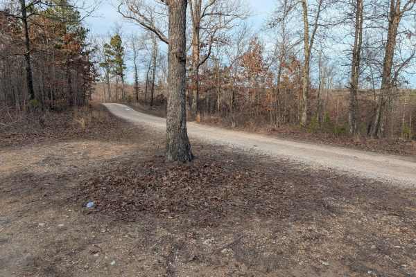
Karakaghne Scenic Drive
This trail is a well-maintained gravel road with minimal washboard and potholes, likely recently graded due to nearby logging. There are no river or stream crossings, though small mud puddles may form along the edges. The route follows a forested ridge with strong northern views, and several gravel ...
Learn more about Karakaghne Scenic Drive
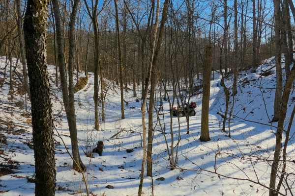
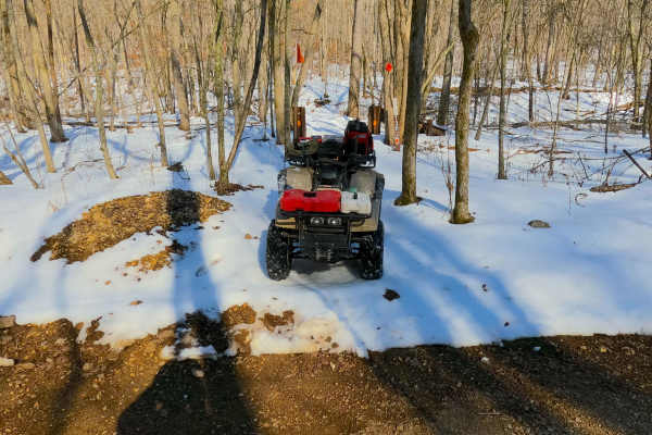
Sutton Bluff ATV 14 South - SB 14
Sutton Bluff ATV 14 (South Section), also known as Stillwell Hollow (legal/emergency ID SB 14), is a 50-inch and under restricted trail within the Sutton Bluff OHV trail system, managed by the Mark Twain National Forest Salem Unit. SB 14 South is a part of the "far east section" of Sutton Bluff OHV....
Learn more about Sutton Bluff ATV 14 South - SB 14
Beginner ATV trails near Bunker, Missouri
Explore ATV-friendly trails near you. These trails are accessible for vehicles up to 50 inches wide, perfect for ATVs and smaller off-road machines.
Sutton Bluff ATV 12 - SB 12
Sutton Bluff ATV 12, also known as Bear Tick Hollow with the legal/emergency ID SB 12, is a 50-inch and under restricted trail within the Sutton Bluff OHV trail system, managed by the Mark Twain National Forest Salem Unit. The SB 12 is a part of the smaller "southwest section" of Sutton Bluff OHV. S...
Learn more about Sutton Bluff ATV 12 - SB 12
Bear Tick Ridge - FS 2459
Bear Tick Ridge (FS 2459) is a gravel and dirt terrain Forest Service Road within the Salem Unit of Mark Twain National Forest, open to all vehicles complying with Reynolds County and Missouri state laws. From the beginning where the FS 2459 where it spurs off the Reynolds County Road 849 (or FS 223...
Learn more about Bear Tick Ridge - FS 2459
Sutton Bluff ATV 11 - SB 11
Sutton Bluff ATV 11, also known as Little Gulch, with the legal/emergency ID SB 11, is a 50-inch and under restricted trail within the Sutton Bluff OHV trail system, managed by the Mark Twain National Forest Salem Unit. The SB 11 is a part of the smaller "southwest section" of Sutton Bluff OHV. Summ...
Learn more about Sutton Bluff ATV 11 - SB 11
Sutton Bluff ATV 1 - SB 1
Sutton Bluff ATV 1, also known as Long One, with the legal/emergency ID SB 1, is a 50-inch and under restricted trail within the Sutton Bluff OHV trail system, managed by the Mark Twain National Forest Salem Unit. SB 1 is a solo trail in the far northwest portion of the Sutton Bluff OHV. Summary of ...
Learn more about Sutton Bluff ATV 1 - SB 1
Beginner UTV/side-by-side trails near Bunker, Missouri
Find UTV and side-by-side trails near you. These trails accommodate vehicles up to 60 inches wide, ideal for UTVs, side-by-sides, and wider off-road rigs.
Bear Tick Ridge - FS 2459
Bear Tick Ridge (FS 2459) is a gravel and dirt terrain Forest Service Road within the Salem Unit of Mark Twain National Forest, open to all vehicles complying with Reynolds County and Missouri state laws. From the beginning where the FS 2459 where it spurs off the Reynolds County Road 849 (or FS 223...
Learn more about Bear Tick Ridge - FS 2459
Buzzard Ridge Spur A - FS 2677A
Buzzard Ridge Spur A (FS 2677A) is a gravel and dirt terrain Forest Service Road within the Salem Unit of Mark Twain National Forest, despite the road being legally open up to High Clearance 4x4 sized vehicles, the road is notably very narrow for even SXS (60 inch trail width) sized vehicles, showin...
Learn more about Buzzard Ridge Spur A - FS 2677A
Buzzard Ridge - FS 2677
Buzzard Ridge (FS 2677) is a gravel and dirt terrain Forest Service Road within the Salem Unit of Mark Twain National Forest, open to all vehicles complying with Reynolds County and Missouri state laws. From the beginning where the FS 2677 where it spurs off the Reynolds County Road 849 (or FS 2236)...
Learn more about Buzzard Ridge - FS 2677
CR 907 Trail of Tears
This is a short gravel road. It is not maintained like it used to be, due to the obstruction now located at the end of the track. While the map shows you can travel through to Highway 32, due to the massive sinkhole, it is a dead end. This short little drive has a must-see sinkhole. Doe Run Minerals...
Learn more about CR 907 Trail of Tears
The onX Offroad Difference
onX Offroad combines trail photos, descriptions, difficulty ratings, width restrictions, seasonality, and more in a user-friendly interface. Available on all devices, with offline access and full compatibility with CarPlay and Android Auto. Discover what you're missing today!
Open Trail Map