
Beginner Off-Road Trails
Near Viburnum, Missouri
Explore All Beginner Trails Near Viburnum, Missouri
Beginner Off-Road Trails Near Viburnum, Missouri
Discover the best beginner-friendly off-road trails near you. These easier, lower-rated trails are a great place to start — browse trail maps, check difficulty ratings, and find your next adventure.
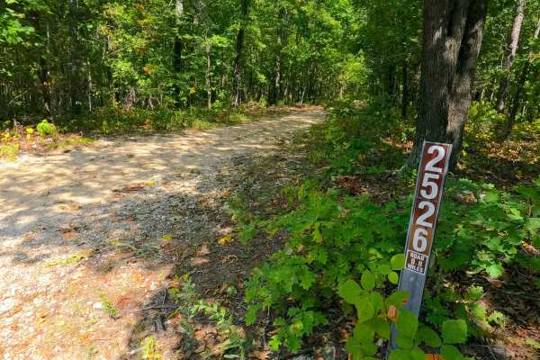
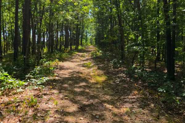
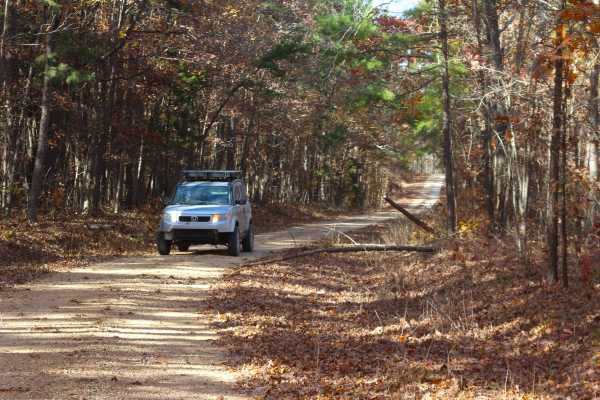
Big Buck - FS 2526
Big Buck FS 2526 is a natural terrain dirt road within the Potosi Unit of Mark Twain National Forest. The road is placed on the upper ridge in between the valleys of the Courtios Creek to the east and Indian Creek to the west. The road slowly tracks downhill, riding the spines of the ridge, traversi...
Learn more about Big Buck - FS 2526
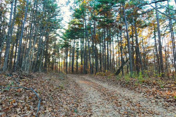
Pleasant Grove Church - FS 2524
Pleasant Grove Church (FS 2524) is a natural terrain dirt road within the Potosi Unit of Mark Twain National Forest. The road is placed on the upper ridge in between the valleys of the Courtios Creek to the east and Indian Creek to the west. The road definitely feels likely to be someone's gem hunti...
Learn more about Pleasant Grove Church - FS 2524
Indian Creek Church - FS 2523
Indian Creek Church (FS 2523) is a natural terrain dirt road within the Potosi Unit of Mark Twain National Forest. The road is placed on the upper ridge spines in between the valleys of the Courtios Creek to the east and Indian Creek to the west. The road drops off the Frank Bay Road right into a do...
Learn more about Indian Creek Church - FS 2523
Frank Bay Road - ICR 1
Frank Bay Road, or Iron County Road 1, is a 6.1-mile-long, majority gravel road (4.5 miles gravel in the center with 0.8 mile of pavement on both ends) through Mark Twain National Forest Potosi Unit and Iron County, Missouri. Frank Bay Road connects the town of Viburnum on the west end to the settle...
Learn more about Frank Bay Road - ICR 1
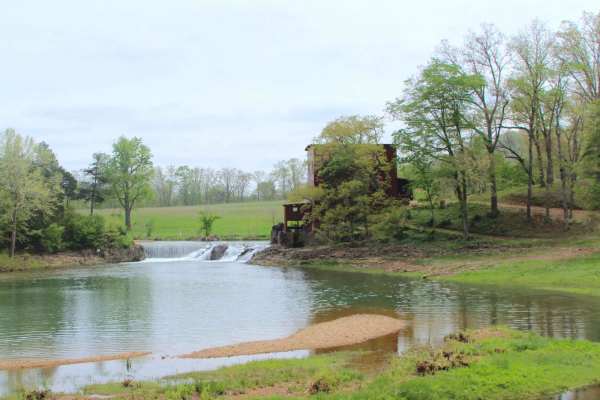
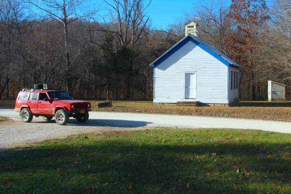
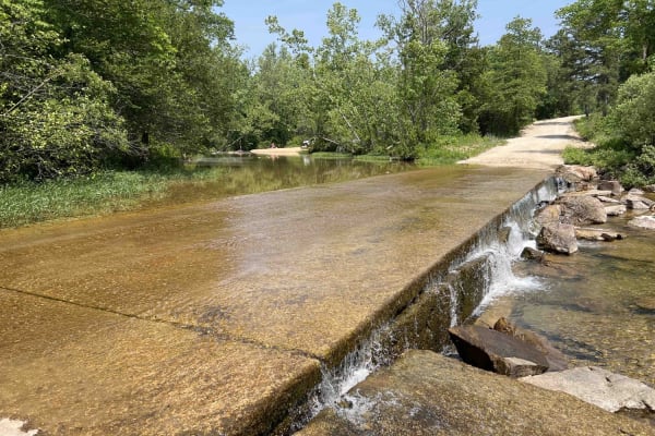
Dillard Mill Road
Dillard Mill Road is a Crawford County gravel road that leads to the Dillard Mill State Historic Site, passing the settlement of Dillard, Missouri, resting along the scenic Huzzah Creek. The road is simple in nature, following a gravel pathway that resonates that this is the way this community has f...
Learn more about Dillard Mill Road
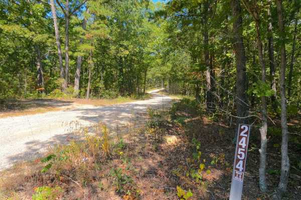
Hickory Grove Church - FS 2454
Hickory Grove Church (FS 2454), or the C L Medley Road, is a semi-maintained gravel road within the Mark Twain National Forest Potosi Unit. The Hickory Grove Church is a generally smooth, scenic road with graceful curves and slight elevation changes along its track. The road is very purposeful; it i...
Learn more about Hickory Grove Church - FS 2454
Crooked Tower Road
Crooked Tower Road, is a maintained gravel road composed of ownership under two agencies, one is the most of northern/east section owned by Crawford County, and the southern section going to the Dent County line is owned by Mark Twain National Forest within the Salem Unit, under the identity Crooke...
Learn more about Crooked Tower Road
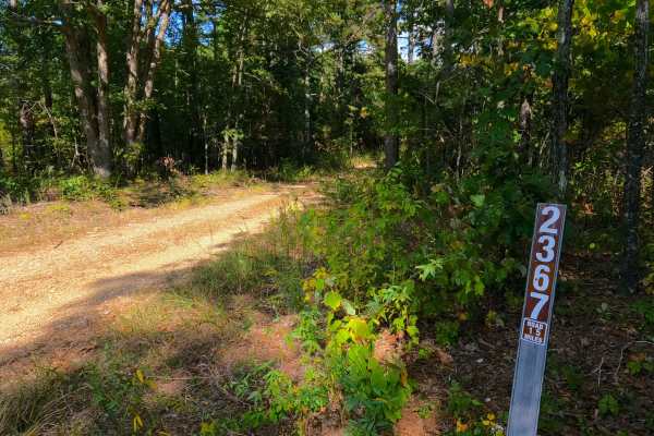
Turner Cemetery - FS 2367
Turner Cemetery (FS 2367) is a dirt-gravel-based forest road within the Mark Twain National Forest Potosi Unit. The road branches off Missouri Route 32 heading south, featuring a circular entry around a large tree. From here, it follows the ridge spines between two valleys, hosting Neals Creek to th...
Learn more about Turner Cemetery - FS 2367
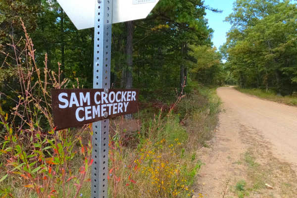
Sam Crocker Cemetery - CR 80
Sam Crocker Cemetery, Upper Goodwater, or the Iron County Road 80, is a gravel county road in western Iron County, Missouri, partially within the Potosi Unit of Mark Twain National Forest. Sam Crocker Cemetery Road is made up of rugged creek gravel, a creek crossing, and red dirt, which Iron County ...
Learn more about Sam Crocker Cemetery - CR 80
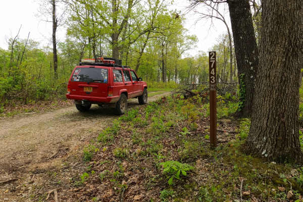
North James - FS 2743
North James (FS 2743) is a low-standard gravel forest service road within the Mark Twain National Forest Potosi Unit. North James features a short annual season of use from November 7th to November 30th, during deer season. The road is 0.9 of a mile long, starting from the hilltop along the Crooked ...
Learn more about North James - FS 2743
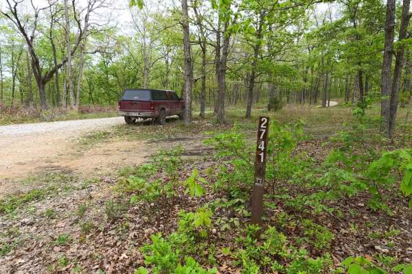
James Branch - FS 2741
James Branch FS 2741 is a gravel forest road, leaning natural-improved in spots, within the Salem Unit of Mark Twain National Forest. James Branch shows its popularity right from where it comes off the Crooked Tower road, having a large dispersed camp at its entry, with the road being the northern p...
Learn more about James Branch - FS 2741
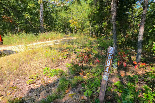
Beasley Hollow - FS 2594
Beasley Hollow (FS 2594) is a Forest Service Road, being mostly semi-maintained gravel leaning towards a natural dirt path at the end, within the Mark Twain National Forest Potosi Unit. Beasley Hollow is named fittingly by the valley that rests to the south of its track as it rides the ridge spines ...
Learn more about Beasley Hollow - FS 2594
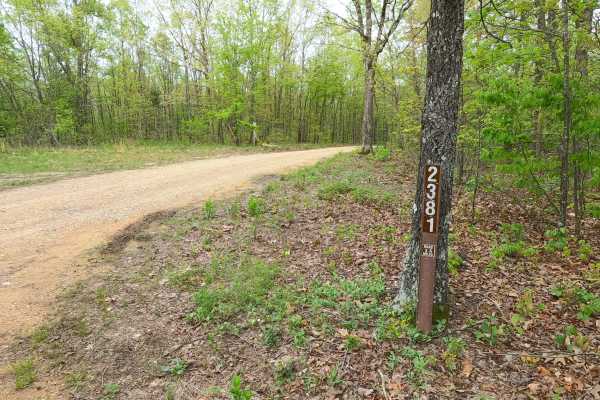
Old Mill - FS 2381
Old Mill FS 2381, is a semi-maintained gravel forest road within the Salem Unit of Mark Twain National Forest. The road features a ridge-top ride on the hill separating James Branch Creek/Chandler Hollow to the North and Indian Creek/Todd Hollow to the South. Along the way, there are small water col...
Learn more about Old Mill - FS 2381
Buick Truck Trail 2231
Buick Truck Trail 2231 is located centrally in the Mark Twain National Forest which encompasses roughly 1.5 million acres in Missouri. It starts out paved until after you reach a rock quarry where it turns to gravel. As you drive through the vast forest of pine and oak you are slowly engulfed into ...
Learn more about Buick Truck Trail 2231
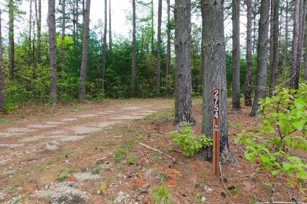
James Ridge - FS 2754
James Ridge FS 2754, is a semi-maintained gravel forest road within the Salem Unit of Mark Twain National Forest. The road features a ridge-top ride on the hill with James Branch Creek to the south and Chandler Hollow/Lost Lake to the east. Along the way, there are small water collection spots, surf...
Learn more about James Ridge - FS 2754
Karakaghne Scenic Drive
This trail is a well-maintained gravel road with minimal washboard and potholes, likely recently graded due to nearby logging. There are no river or stream crossings, though small mud puddles may form along the edges. The route follows a forested ridge with strong northern views, and several gravel ...
Learn more about Karakaghne Scenic Drive
Cub Creek - ICR 15/FS 2391
Cub Creek, Dawes Ridge, or Iron County Road 15 (IDs ICR 15 and FS 2391) is a semi-maintained gravel road consistently throughout its track, being part Iron County right of way, and half solely the Potosi Unit of Mark Twain National Forest. The track features graceful bends and elevation changes on t...
Learn more about Cub Creek - ICR 15/FS 2391
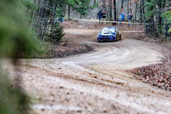
Colen Ridge Road
Colen Ridge Road is a gravel-dirt mixed road going through rural Washington County, specifically a large tract of Potosi Unit land within Mark Twain National Forest. The road features a unique use as an official Rally Stage in the Rally in the 100 Acre Wood (Spring-March) and the Show-Me Rally (Fall...
Learn more about Colen Ridge Road
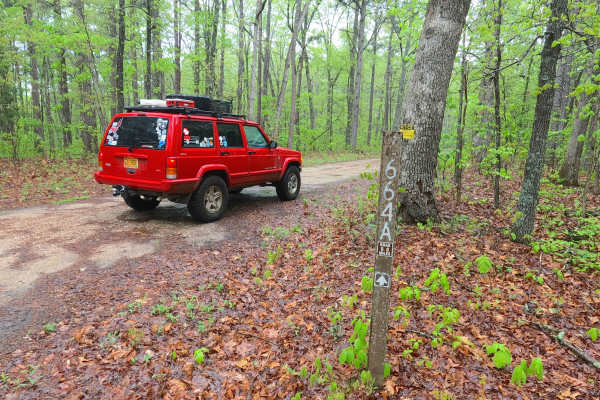
Ironwash Spur A - FS 2664A
Ironwash Spur A FS 2664A is a semi-maintained gravel road within the Potosi Unit of Mark Twain National Forest. The road spurs north from the Ironwash or Crocker Road ICR 9 FS 2664, heading towards the Iron and Washington County line that crosses the ridge top just south of the Herb Road valley. The...
Learn more about Ironwash Spur A - FS 2664A
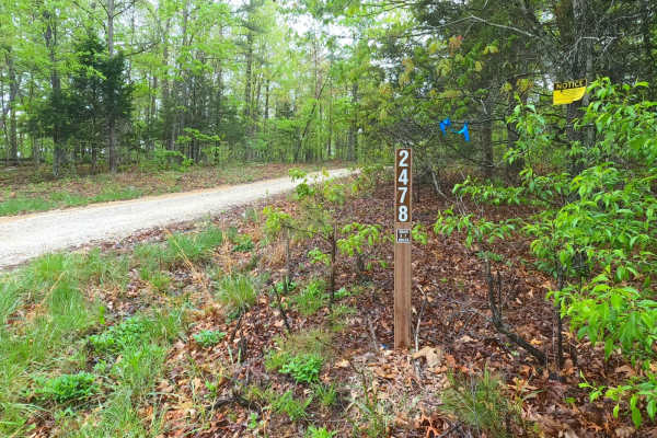
Cistern Ridge - FS 2478
Cistern Ridge FS 2478, is a semi-maintained gravel forest road within the Potosi Unit of Mark Twain National Forest. The road features a ridge-top ride on the hill separating Clayton Creek and its many branch/feeder creeks to the East and the Middle Fork Black River to the West. Along the way, there...
Learn more about Cistern Ridge - FS 2478
Beginner ATV trails near Viburnum, Missouri
Explore ATV-friendly trails near you. These trails are accessible for vehicles up to 50 inches wide, perfect for ATVs and smaller off-road machines.
Big Buck - FS 2526
Big Buck FS 2526 is a natural terrain dirt road within the Potosi Unit of Mark Twain National Forest. The road is placed on the upper ridge in between the valleys of the Courtios Creek to the east and Indian Creek to the west. The road slowly tracks downhill, riding the spines of the ridge, traversi...
Learn more about Big Buck - FS 2526
Pleasant Grove Church - FS 2524
Pleasant Grove Church (FS 2524) is a natural terrain dirt road within the Potosi Unit of Mark Twain National Forest. The road is placed on the upper ridge in between the valleys of the Courtios Creek to the east and Indian Creek to the west. The road definitely feels likely to be someone's gem hunti...
Learn more about Pleasant Grove Church - FS 2524
Indian Creek Church - FS 2523
Indian Creek Church (FS 2523) is a natural terrain dirt road within the Potosi Unit of Mark Twain National Forest. The road is placed on the upper ridge spines in between the valleys of the Courtios Creek to the east and Indian Creek to the west. The road drops off the Frank Bay Road right into a do...
Learn more about Indian Creek Church - FS 2523
Frank Bay Road - ICR 1
Frank Bay Road, or Iron County Road 1, is a 6.1-mile-long, majority gravel road (4.5 miles gravel in the center with 0.8 mile of pavement on both ends) through Mark Twain National Forest Potosi Unit and Iron County, Missouri. Frank Bay Road connects the town of Viburnum on the west end to the settle...
Learn more about Frank Bay Road - ICR 1
Beginner UTV/side-by-side trails near Viburnum, Missouri
Find UTV and side-by-side trails near you. These trails accommodate vehicles up to 60 inches wide, ideal for UTVs, side-by-sides, and wider off-road rigs.
Big Buck - FS 2526
Big Buck FS 2526 is a natural terrain dirt road within the Potosi Unit of Mark Twain National Forest. The road is placed on the upper ridge in between the valleys of the Courtios Creek to the east and Indian Creek to the west. The road slowly tracks downhill, riding the spines of the ridge, traversi...
Learn more about Big Buck - FS 2526
Pleasant Grove Church - FS 2524
Pleasant Grove Church (FS 2524) is a natural terrain dirt road within the Potosi Unit of Mark Twain National Forest. The road is placed on the upper ridge in between the valleys of the Courtios Creek to the east and Indian Creek to the west. The road definitely feels likely to be someone's gem hunti...
Learn more about Pleasant Grove Church - FS 2524
Indian Creek Church - FS 2523
Indian Creek Church (FS 2523) is a natural terrain dirt road within the Potosi Unit of Mark Twain National Forest. The road is placed on the upper ridge spines in between the valleys of the Courtios Creek to the east and Indian Creek to the west. The road drops off the Frank Bay Road right into a do...
Learn more about Indian Creek Church - FS 2523
Frank Bay Road - ICR 1
Frank Bay Road, or Iron County Road 1, is a 6.1-mile-long, majority gravel road (4.5 miles gravel in the center with 0.8 mile of pavement on both ends) through Mark Twain National Forest Potosi Unit and Iron County, Missouri. Frank Bay Road connects the town of Viburnum on the west end to the settle...
Learn more about Frank Bay Road - ICR 1
The onX Offroad Difference
onX Offroad combines trail photos, descriptions, difficulty ratings, width restrictions, seasonality, and more in a user-friendly interface. Available on all devices, with offline access and full compatibility with CarPlay and Android Auto. Discover what you're missing today!
Open Trail Map