
Beginner Off-Road Trails
Near Centerville, Missouri
Explore All Beginner Trails Near Centerville, Missouri
Beginner Off-Road Trails Near Centerville, Missouri
Discover the best beginner-friendly off-road trails near you. These easier, lower-rated trails are a great place to start — browse trail maps, check difficulty ratings, and find your next adventure.

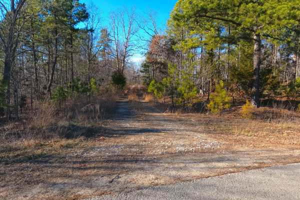
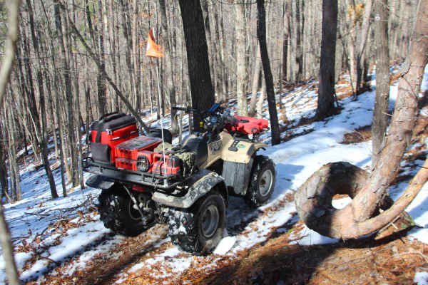
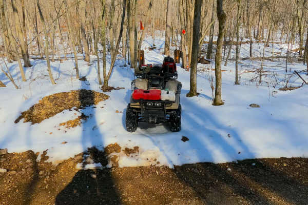
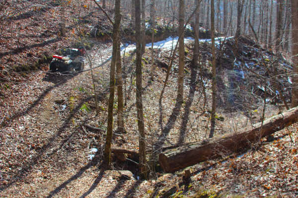
Crooked Tree - FS 2232
Crooked Tree (FS 2232) is a gravel and dirt terrain Forest Service Road within the Salem Unit of Mark Twain National Forest, open to all vehicles complying with Reynolds County and Missouri state laws. From the beginning where the FS 2232 spurs off the Karkaghne Scenic Drive (or Reynolds County Road...
Learn more about Crooked Tree - FS 2232
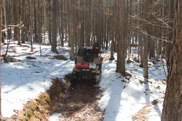
Tall Tree - FS 2243
Tall Tree (FS 2243) is a gravel and dirt terrain Forest Service Road within the Salem Unit of Mark Twain National Forest, open to all vehicles complying with Reynolds County and Missouri state laws. From the beginning where the FS 2243 spurs off the Karkaghne Scenic Drive (or Reynolds County Road 90...
Learn more about Tall Tree - FS 2243
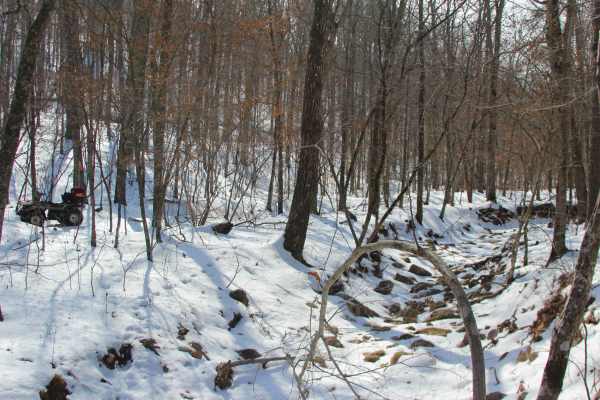
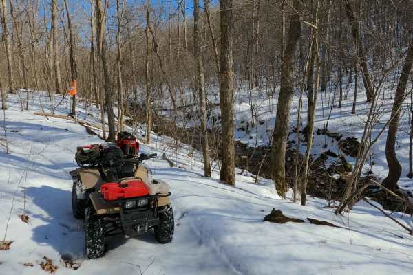
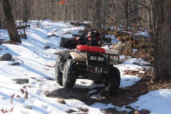
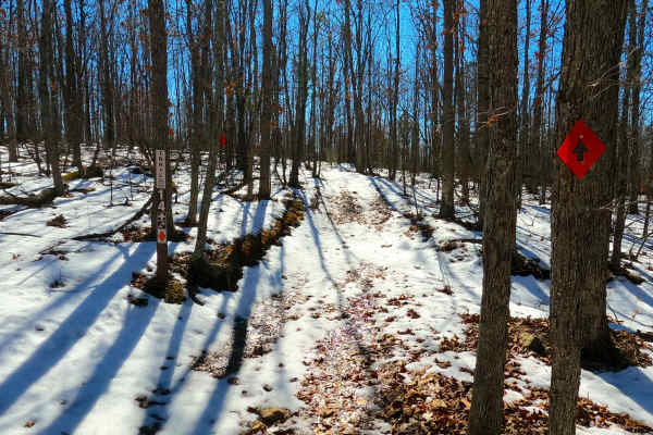
Sutton Bluff ATV 8 East - SB 8
Sutton Bluff ATV 8 (East Section), also known as Low Gap (legal/emergency ID SB 8), is a 50-inch and under restricted trail within the Sutton Bluff OHV trail system managed by the Mark Twain National Forest Salem Unit. SB 8 East is a part of the "far east section" of Sutton Bluff OHV. Oriented as a ...
Learn more about Sutton Bluff ATV 8 East - SB 8
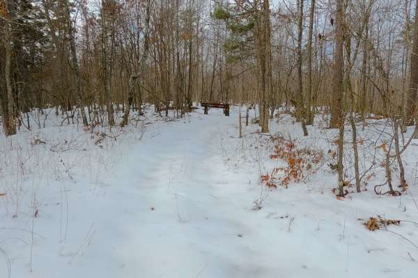
Sutton Bluff ATV 9 - SB 9
Sutton Bluff ATV 9, also known as Ronnie (legal/emergency ID SB 9), is a 50-inch and under restricted trail within the Sutton Bluff OHV trail system managed by the Mark Twain National Forest Salem Unit. SB 9 acts as the main entry point to the southeast corner and the large "far east section" of Sut...
Learn more about Sutton Bluff ATV 9 - SB 9
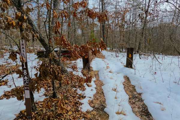
Sutton Bluff ATV 18 - SB 18
Sutton Bluff ATV 18, also known as McLean Heights (legal/emergency ID SB 18), is a 50-inch and under restricted trail within the Sutton Bluff OHV trail system managed by the Mark Twain National Forest Salem Unit. SB 18 is a part of the "far east section" of the Sutton Bluff OHV system. Oriented as a...
Learn more about Sutton Bluff ATV 18 - SB 18
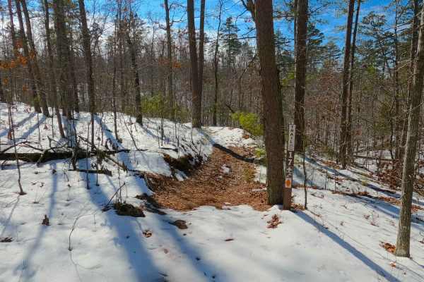
Sutton Bluff ATV 17 - SB 17
Sutton Bluff ATV 17, also known as Bobcat Trap (legal/emergency ID SB 17), is a 50-inch and under restricted trail within the Sutton Bluff OHV trail system managed by the Mark Twain National Forest Salem Unit. SB 17 is a part of the "far east section" of Sutton Bluff OHV. It is a north-to-south-orie...
Learn more about Sutton Bluff ATV 17 - SB 17
Sutton Bluff ATV 7 North - SB 7
Sutton Bluff ATV 7 (North Section), also known as Stillwell Branch (legal/emergency ID SB 7), is a 50-inch and under restricted trail within the Sutton Bluff OHV trail system, managed by the Mark Twain National Forest Salem Unit. SB 7 North is a part of the “far east section” of Sutton Bluff OHV. Or...
Learn more about Sutton Bluff ATV 7 North - SB 7
Sutton Bluff ATV 14 South - SB 14
Sutton Bluff ATV 14 (South Section), also known as Stillwell Hollow (legal/emergency ID SB 14), is a 50-inch and under restricted trail within the Sutton Bluff OHV trail system, managed by the Mark Twain National Forest Salem Unit. SB 14 South is a part of the "far east section" of Sutton Bluff OHV....
Learn more about Sutton Bluff ATV 14 South - SB 14
Sutton Bluff ATV 8 West - SB 8
Sutton Bluff ATV 8 (West Section), also known as McLean Branch (legal/emergency ID SB 8), is a 50-inch and under restricted trail within the Sutton Bluff OHV trail system managed by the Mark Twain National Forest Salem Unit. SB 8 West is a part of the "far east section" of Sutton Bluff OHV. Oriented...
Learn more about Sutton Bluff ATV 8 West - SB 8
Sutton Bluff ATV 15 West - SB 15
Sutton Bluff ATV 15 (West Section), also known as Twisted Pine, with the legal/emergency ID SB 15, is a 50-inch and under restricted trail within the Sutton Bluff OHV trail system, managed by the Mark Twain National Forest Salem Unit. The SB 15 West is apart of the "far east section" of Sutton Bluff...
Learn more about Sutton Bluff ATV 15 West - SB 15
Sutton Bluff ATV 15 East - SB 15
Sutton Bluff ATV 15 (East Section), also known as Bent Tree, with the legal/emergency ID SB 15, is a 50-inch and under restricted trail within the Sutton Bluff OHV trail system, managed by the Mark Twain National Forest Salem Unit. The SB 15 East is apart of the "far east section" of Sutton Bluff OH...
Learn more about Sutton Bluff ATV 15 East - SB 15
Sutton Bluff ATV 16 - SB 16
Sutton Bluff ATV 16, also known as Ridge Bend (legal/emergency ID SB 16), is a 50-inch and under restricted trail within the Sutton Bluff OHV trail system managed by the Mark Twain National Forest Salem Unit. SB 16 is a part of the "far east section" of Sutton Bluff OHV. Oriented as an east-to-west ...
Learn more about Sutton Bluff ATV 16 - SB 16
Sutton Bluff ATV 7 South - SB 7
Sutton Bluff ATV 7 (South Section), also known as Gladden Dale, with the legal/emergency ID SB 7, is a 50-inch and under restricted trail within the Sutton Bluff OHV trail system, managed by the Mark Twain National Forest Salem Unit. The SB 7 South is a part of the "far east section" of Sutton Bluff...
Learn more about Sutton Bluff ATV 7 South - SB 7
Sutton Bluff ATV 13 - SB 13
Sutton Bluff ATV 13, also known as Ramp (legal/emergency ID SB 13), is a 50-inch and under restricted trail within the Sutton Bluff OHV trail system, managed by the Mark Twain National Forest Salem Unit. SB 13 acts as the main entry point of the southwest corner into the large "far east section" of ...
Learn more about Sutton Bluff ATV 13 - SB 13
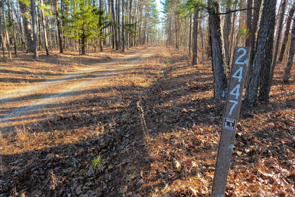
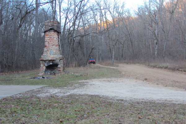
Turkey Trot - FS 2447
Here's a cleaned-up version:
Turkey Trot (FS 2447) is a semi-maintained gravel Forest Service road within the Salem Unit of Mark Twain National Forest, open to all vehicles complying with Reynolds County and Missouri state law. The road spurs south off Karkaghne Scenic Drive (Reynolds County Road 9...
Learn more about Turkey Trot - FS 2447
Sutton Bluff ATV 4 North - SB 4
Sutton Bluff ATV 4 (North Section), also known as Boulder Clearing, with the legal/emergency ID SB 4, is a 50-inch and under restricted trail within the Sutton Bluff OHV trail system, managed by the Mark Twain National Forest Salem Unit. The SB 4 North is a part of the "far east section" of Sutton B...
Learn more about Sutton Bluff ATV 4 North - SB 4
Sutton Bluff ATV 14 North - SB 14
Sutton Bluff ATV 14 (North Section), also known as River Road Gap (legal/emergency ID SB 14), is a 50-inch and under restricted trail within the Sutton Bluff OHV trail system managed by the Mark Twain National Forest Salem Unit. SB 14 North is a part of the "far east section" of the Sutton Bluff OHV...
Learn more about Sutton Bluff ATV 14 North - SB 14
Sutton Bluff ATV 10 - SB 10
Sutton Bluff ATV 10, also known as East Buzzard, with the legal/emergency ID SB 10, is a 50-inch and under restricted trail within the Sutton Bluff OHV trail system, managed by the Mark Twain National Forest Salem Unit. The SB 10 is a part of the smaller "southwest section" of Sutton Bluff OHV. Summ...
Learn more about Sutton Bluff ATV 10 - SB 10
Sutton Bluff ATV 6 - SB 6
Sutton Bluff ATV 6, also known as Cash Branch, with the legal/emergency ID SB 6, is a 50-inch and under restricted trail within the Sutton Bluff OHV trail system, managed by the Mark Twain National Forest Salem Unit. The SB 6 is a part of the "far east section" of Sutton Bluff OHV. Despite most of t...
Learn more about Sutton Bluff ATV 6 - SB 6
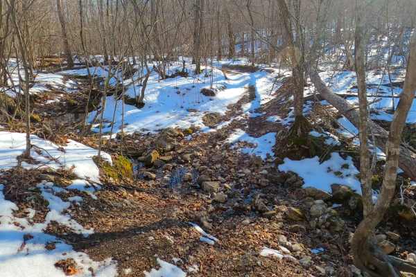
Cooks Spring Road
Cooks Spring Road or North Reynolds County Road 848 is a gravel-dirt mixed road and right-of-way, going through the Mark Twain National Forest Salem Unit, in the Sutton Bluff area. From the peak elevation at Karkanghne Scenic Drive ridge, going south, the track aims towards the valley hosting the Co...
Learn more about Cooks Spring Road
Beginner ATV trails near Centerville, Missouri
Explore ATV-friendly trails near you. These trails are accessible for vehicles up to 50 inches wide, perfect for ATVs and smaller off-road machines.
Crooked Tree - FS 2232
Crooked Tree (FS 2232) is a gravel and dirt terrain Forest Service Road within the Salem Unit of Mark Twain National Forest, open to all vehicles complying with Reynolds County and Missouri state laws. From the beginning where the FS 2232 spurs off the Karkaghne Scenic Drive (or Reynolds County Road...
Learn more about Crooked Tree - FS 2232
Tall Tree - FS 2243
Tall Tree (FS 2243) is a gravel and dirt terrain Forest Service Road within the Salem Unit of Mark Twain National Forest, open to all vehicles complying with Reynolds County and Missouri state laws. From the beginning where the FS 2243 spurs off the Karkaghne Scenic Drive (or Reynolds County Road 90...
Learn more about Tall Tree - FS 2243
Sutton Bluff ATV 8 East - SB 8
Sutton Bluff ATV 8 (East Section), also known as Low Gap (legal/emergency ID SB 8), is a 50-inch and under restricted trail within the Sutton Bluff OHV trail system managed by the Mark Twain National Forest Salem Unit. SB 8 East is a part of the "far east section" of Sutton Bluff OHV. Oriented as a ...
Learn more about Sutton Bluff ATV 8 East - SB 8
Sutton Bluff ATV 9 - SB 9
Sutton Bluff ATV 9, also known as Ronnie (legal/emergency ID SB 9), is a 50-inch and under restricted trail within the Sutton Bluff OHV trail system managed by the Mark Twain National Forest Salem Unit. SB 9 acts as the main entry point to the southeast corner and the large "far east section" of Sut...
Learn more about Sutton Bluff ATV 9 - SB 9
Beginner UTV/side-by-side trails near Centerville, Missouri
Find UTV and side-by-side trails near you. These trails accommodate vehicles up to 60 inches wide, ideal for UTVs, side-by-sides, and wider off-road rigs.
Crooked Tree - FS 2232
Crooked Tree (FS 2232) is a gravel and dirt terrain Forest Service Road within the Salem Unit of Mark Twain National Forest, open to all vehicles complying with Reynolds County and Missouri state laws. From the beginning where the FS 2232 spurs off the Karkaghne Scenic Drive (or Reynolds County Road...
Learn more about Crooked Tree - FS 2232
Tall Tree - FS 2243
Tall Tree (FS 2243) is a gravel and dirt terrain Forest Service Road within the Salem Unit of Mark Twain National Forest, open to all vehicles complying with Reynolds County and Missouri state laws. From the beginning where the FS 2243 spurs off the Karkaghne Scenic Drive (or Reynolds County Road 90...
Learn more about Tall Tree - FS 2243
Turkey Trot - FS 2447
Here's a cleaned-up version:
Turkey Trot (FS 2447) is a semi-maintained gravel Forest Service road within the Salem Unit of Mark Twain National Forest, open to all vehicles complying with Reynolds County and Missouri state law. The road spurs south off Karkaghne Scenic Drive (Reynolds County Road 9...
Learn more about Turkey Trot - FS 2447
Cooks Spring Road
Cooks Spring Road or North Reynolds County Road 848 is a gravel-dirt mixed road and right-of-way, going through the Mark Twain National Forest Salem Unit, in the Sutton Bluff area. From the peak elevation at Karkanghne Scenic Drive ridge, going south, the track aims towards the valley hosting the Co...
Learn more about Cooks Spring Road
The onX Offroad Difference
onX Offroad combines trail photos, descriptions, difficulty ratings, width restrictions, seasonality, and more in a user-friendly interface. Available on all devices, with offline access and full compatibility with CarPlay and Android Auto. Discover what you're missing today!
Open Trail Map