
Beginner Off-Road Trails
Near Ellington, Missouri
Explore All Beginner Trails Near Ellington, Missouri
Beginner Off-Road Trails Near Ellington, Missouri
Discover the best beginner-friendly off-road trails near you. These easier, lower-rated trails are a great place to start — browse trail maps, check difficulty ratings, and find your next adventure.
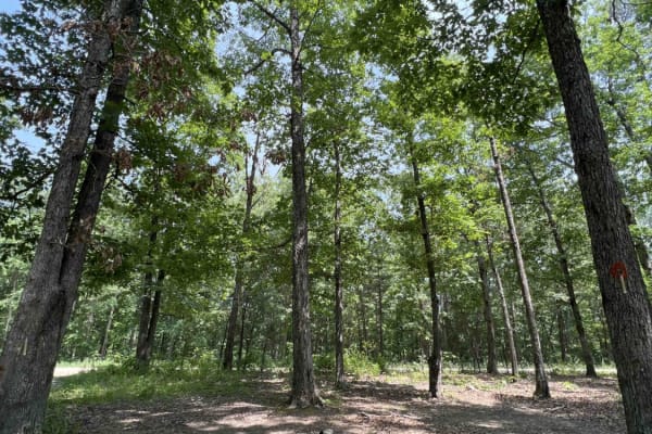
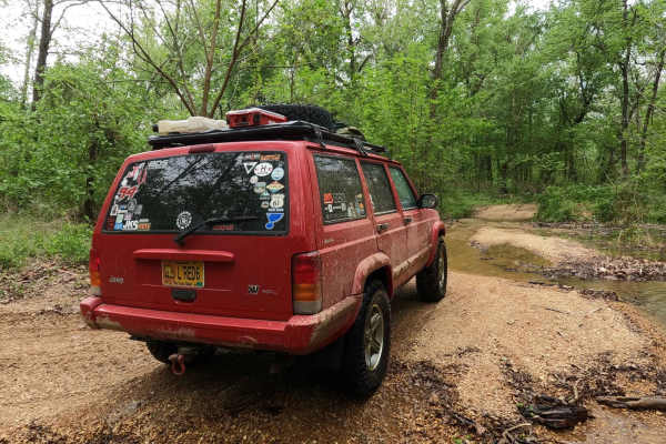
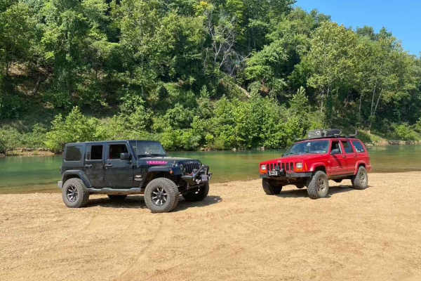
Current River Conservation Area
The Current River Conservation was created by combining Deer Run, Carrs Creek, Cardareva and Paint Rock State Forests combining 28,000 acres. The trail starts as #1 on the map which is provided at the beginning of the trail. Current River Conservation trail leads you down an easy gravel road however...
Learn more about Current River Conservation Area
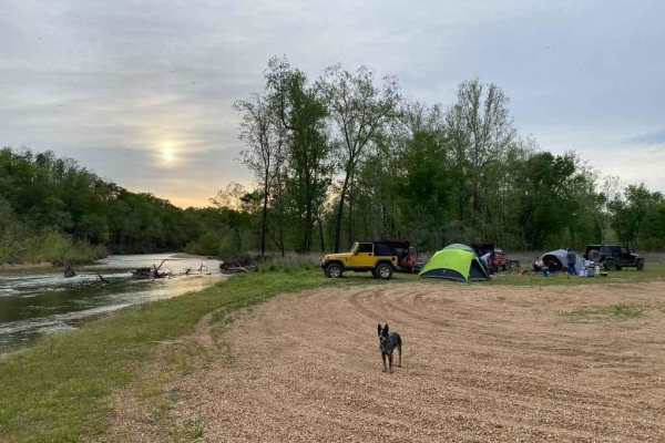
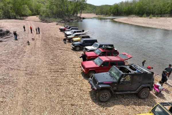
Whizenhunt Bottoms
Whizenhunt Bottoms, also known as Whizenhunt Hollow Trail or simply The Bottoms, is a natural creek/river rock, sand, and dirt, with wooded trails leading to roughly 115 acres of open area along the Riverside Depths route of the Black River Bottoms area within the Clearwater Lake U.S. Army Corps of ...
Learn more about Whizenhunt Bottoms
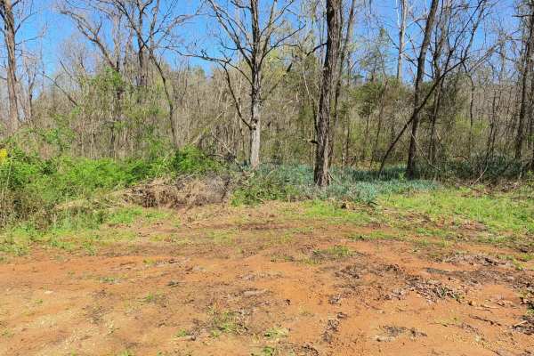
Collins Cemetery Road
Collins Cemetery Road or Beal Road is a gravel and natural-terrain road within Rocky Creek, Missouri Department of Conservation Area, and Ozark National Scenic Riverways Land. The track leaves the Beal Ridge road going downhill to the lowland adjacent to the Current River, where the Collins Cemetery...
Learn more about Collins Cemetery Road
Central Bluffs Trail
Central Bluffs Trail, or Black River Bottoms Central Hub, consists of parts of the Reynolds County Roads 462 and 464 and is a dirt/sand mix and natural creek-bottom rock trail through the center portion of the Black River Bottoms area within the Clearwater Lake U.S. Army Corps of Engineer Land. The ...
Learn more about Central Bluffs Trail
Central Riverside Connector
Central Riverside Connector is a coarse gravel and natural dirt/mud trail through the center portion of the Black River Bottoms area within the Clearwater Lake U.S. Army Corps of Engineer Land. The Central Riverside Connector is so named because it connects the midway points of the North Riverside T...
Learn more about Central Riverside Connector
Stacked Log Trail
Stacked Log Trail, also known as the Spool Bypass or Reynolds County Road 458, is a half coarse gravel road, half natural dirt/small rock trail through the north central portion of the Black River Bottoms area within the Clearwater Lake U.S. Army Corps of Engineer Land. Stacked Log starts at the Cen...
Learn more about Stacked Log Trail
Rollercoaster
Rollercoaster, possibly partially known as Cabin Holler, is a gravel and natural rock/dirt mix road through north-eastern Peck Ranch Conservation Area, leading into the Rocky Creek Conservation Area (former Roger's Creek Natural Area) at Mud Spring Hollow, and ending in the far eastern section of Ro...
Learn more about Rollercoaster
Murphy Cemetery Road
Murphy Cemetery Road, including part of the Reynolds County Road 466, is a coarse gravel road with natural tendencies. It tracks through the southern portion of the Black River Bottoms area within the Clearwater Lake U.S. Army Corps of Engineers, Reynolds County, and "Riverside" Missouri Department ...
Learn more about Murphy Cemetery Road
Charlton Bluff/Seematter Hollow Road
The Charlton Bluff/Seematter Hollow Road is a US Army Corps of Engineers Road that leads down into the eastern shore bottoms of the Black River, where Charlton Bluff sticks out towards the river on the west side shoreline. The road first begins by passing the Seematter Cemetery, right after you turn...
Learn more about Charlton Bluff/Seematter Hollow Road
Funk Branch Delta
Funk Branch Delta Trail, or Funk Shore Access, is a coarse creek gravel and dirt/mud trail through the northern portion of the Black River Bottoms area within the Clearwater Lake U.S. Army Corps of Engineer Land. The trail is an in/out track that features an entry point off the creek bottom section ...
Learn more about Funk Branch Delta
Mann Cemetery Road
Mann Cemetery Road, or Reynolds County Road 456, is a coarse gravel road transforming to a natural dirt road in the northern portion of the Black River Bottoms area within the Clearwater Lake U.S. Army Corps of Engineer Land. This road features views of the valley surrounded by the rolling hills of ...
Learn more about Mann Cemetery Road
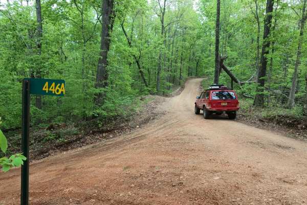
Hackworth Hollow Trail
Hackworth Hollow Trail, also known locally as part of Funk Branch Road or Reynolds County Road 446A, is a coarse gravel road transforming to a creek bottom road and back to a coarse gravel road through the northern portion of the Black River Bottoms area within the Clearwater Lake U.S. Army Corps of...
Learn more about Hackworth Hollow Trail
Long Ridge Road
Long Ridge Road (Reynolds County Road 462 and Iron County Road 151) is a coarse gravel county road providing access to the northeast portion of the Black River Bottoms area within the Clearwater Lake U.S. Army Corps of Engineer Land. The road starts from Missouri Route-BB, 0.1 miles east of the Funk...
Learn more about Long Ridge Road
K-Bridge West
This road starts as an asphalt road (.08 miles) at the K Bridge West entrance. There is a campground to your right and a "day use" area at your left that leads down to the river. This road follows CR 452 until your turn at CR 442. As you come off the asphalt, you will find yourself on a well-maintai...
Learn more about K-Bridge West

Reynolds - CR 468
The Reynolds County Road 468, what could be known as the Lower or South Black River Bottoms Access Road, is a gravel-based county road that makes its way through the US Army Corps of Engineers Land on the east side of Black River. It features scenic views of the hilly river landscape of the area it ...
Learn more about Reynolds - CR 468
Mid Ridge Road
Mid Ridge Road is a natural coarse gravel and dirt-based road within the Roger's Creek Natural Area, Missouri Department of Conservation Land. The road begins at the bottom of the Current River Valley, just northwest of Van Buren, MO. It quickly elevates from the entry off Carter County Road 151, cl...
Learn more about Mid Ridge Road
Clearwater Lake Dam Road
The Clearwater Lake Dam Road is a gravel-to-dirt road that traverses the low-laying bottoms along the Clearwater Lake side of the dam. This is a part of the Piedmont Park Campground Area managed by the US Army Corps of Engineers. The road is short and sweet, offering only a quick taste of what this ...
Learn more about Clearwater Lake Dam Road
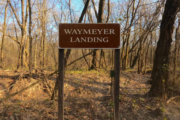
Waymeyer Landing - NPS 215
Waymeyer Landing or National Park Service Road 215 is a sand and natural gravel road to the boat launch area of the same name, located along the Current River within the Ozark National Scenic Riverways. The logistical relevance of this road is undeniable, whether running kayaks, tubes, or rigs from/...
Learn more about Waymeyer Landing - NPS 215
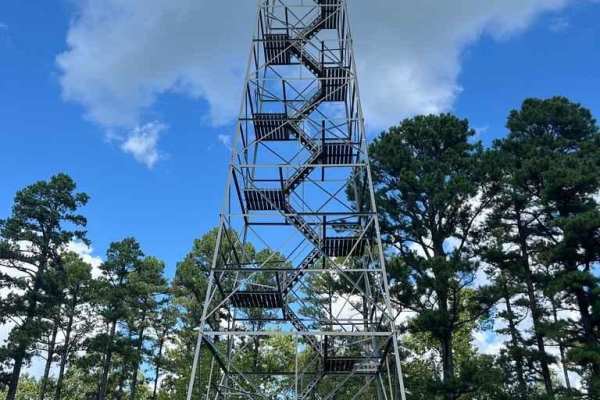
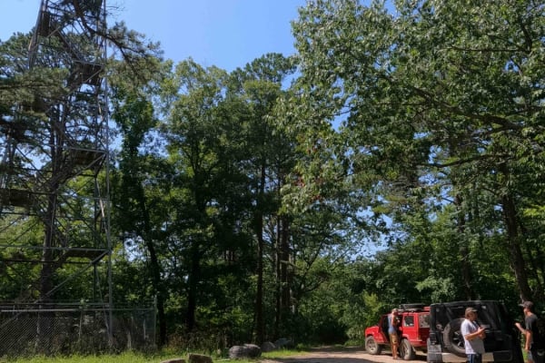
Garwood Tower - RCR 570
Garwood Tower or Reynolds County Road 570 is a gravel road leading to the Missouri Department of Conservation-owned Garwood Fire Tower. It features a unique track with a county road leading up to, and then through, an active logging sawmill, which has a public easement to pass through to connect to ...
Learn more about Garwood Tower - RCR 570
Funk Tower Road
Funk Tower Road is a gravel access road on the Missouri Department of Conservation's Riverside Conservation Area land and is near the neighboring Funk Memorial State Forest and Wildlife Area land, the two plots total 530+ acres of land. The general purpose of the road is to provide access up to the ...
Learn more about Funk Tower Road
Beginner ATV trails near Ellington, Missouri
Explore ATV-friendly trails near you. These trails are accessible for vehicles up to 50 inches wide, perfect for ATVs and smaller off-road machines.
Current River Conservation Area
The Current River Conservation was created by combining Deer Run, Carrs Creek, Cardareva and Paint Rock State Forests combining 28,000 acres. The trail starts as #1 on the map which is provided at the beginning of the trail. Current River Conservation trail leads you down an easy gravel road however...
Learn more about Current River Conservation Area
Whizenhunt Bottoms
Whizenhunt Bottoms, also known as Whizenhunt Hollow Trail or simply The Bottoms, is a natural creek/river rock, sand, and dirt, with wooded trails leading to roughly 115 acres of open area along the Riverside Depths route of the Black River Bottoms area within the Clearwater Lake U.S. Army Corps of ...
Learn more about Whizenhunt Bottoms
Central Bluffs Trail
Central Bluffs Trail, or Black River Bottoms Central Hub, consists of parts of the Reynolds County Roads 462 and 464 and is a dirt/sand mix and natural creek-bottom rock trail through the center portion of the Black River Bottoms area within the Clearwater Lake U.S. Army Corps of Engineer Land. The ...
Learn more about Central Bluffs Trail
Central Riverside Connector
Central Riverside Connector is a coarse gravel and natural dirt/mud trail through the center portion of the Black River Bottoms area within the Clearwater Lake U.S. Army Corps of Engineer Land. The Central Riverside Connector is so named because it connects the midway points of the North Riverside T...
Learn more about Central Riverside Connector
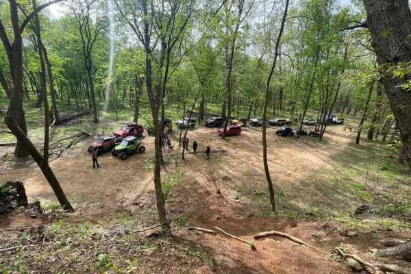
Beginner UTV/side-by-side trails near Ellington, Missouri
Find UTV and side-by-side trails near you. These trails accommodate vehicles up to 60 inches wide, ideal for UTVs, side-by-sides, and wider off-road rigs.
Current River Conservation Area
The Current River Conservation was created by combining Deer Run, Carrs Creek, Cardareva and Paint Rock State Forests combining 28,000 acres. The trail starts as #1 on the map which is provided at the beginning of the trail. Current River Conservation trail leads you down an easy gravel road however...
Learn more about Current River Conservation Area
Whizenhunt Bottoms
Whizenhunt Bottoms, also known as Whizenhunt Hollow Trail or simply The Bottoms, is a natural creek/river rock, sand, and dirt, with wooded trails leading to roughly 115 acres of open area along the Riverside Depths route of the Black River Bottoms area within the Clearwater Lake U.S. Army Corps of ...
Learn more about Whizenhunt Bottoms
Central Bluffs Trail
Central Bluffs Trail, or Black River Bottoms Central Hub, consists of parts of the Reynolds County Roads 462 and 464 and is a dirt/sand mix and natural creek-bottom rock trail through the center portion of the Black River Bottoms area within the Clearwater Lake U.S. Army Corps of Engineer Land. The ...
Learn more about Central Bluffs Trail
Central Riverside Connector
Central Riverside Connector is a coarse gravel and natural dirt/mud trail through the center portion of the Black River Bottoms area within the Clearwater Lake U.S. Army Corps of Engineer Land. The Central Riverside Connector is so named because it connects the midway points of the North Riverside T...
Learn more about Central Riverside Connector
The onX Offroad Difference
onX Offroad combines trail photos, descriptions, difficulty ratings, width restrictions, seasonality, and more in a user-friendly interface. Available on all devices, with offline access and full compatibility with CarPlay and Android Auto. Discover what you're missing today!
Open Trail Map