Trail Overview
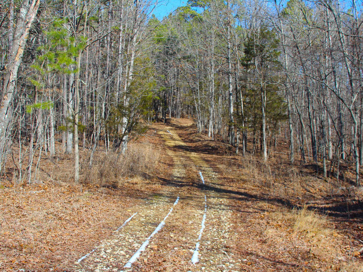
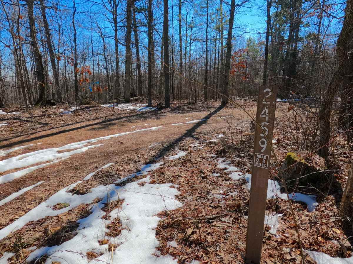
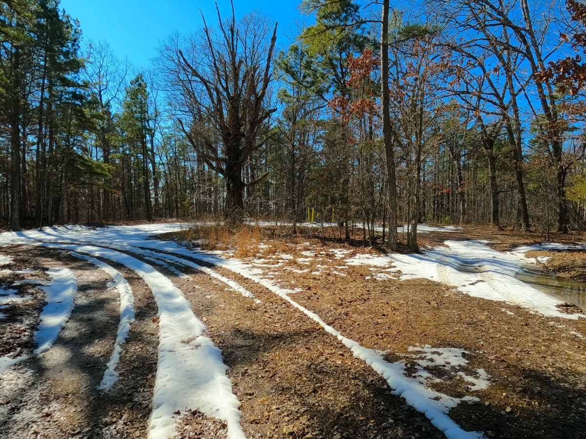
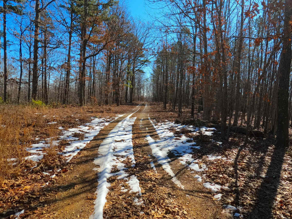
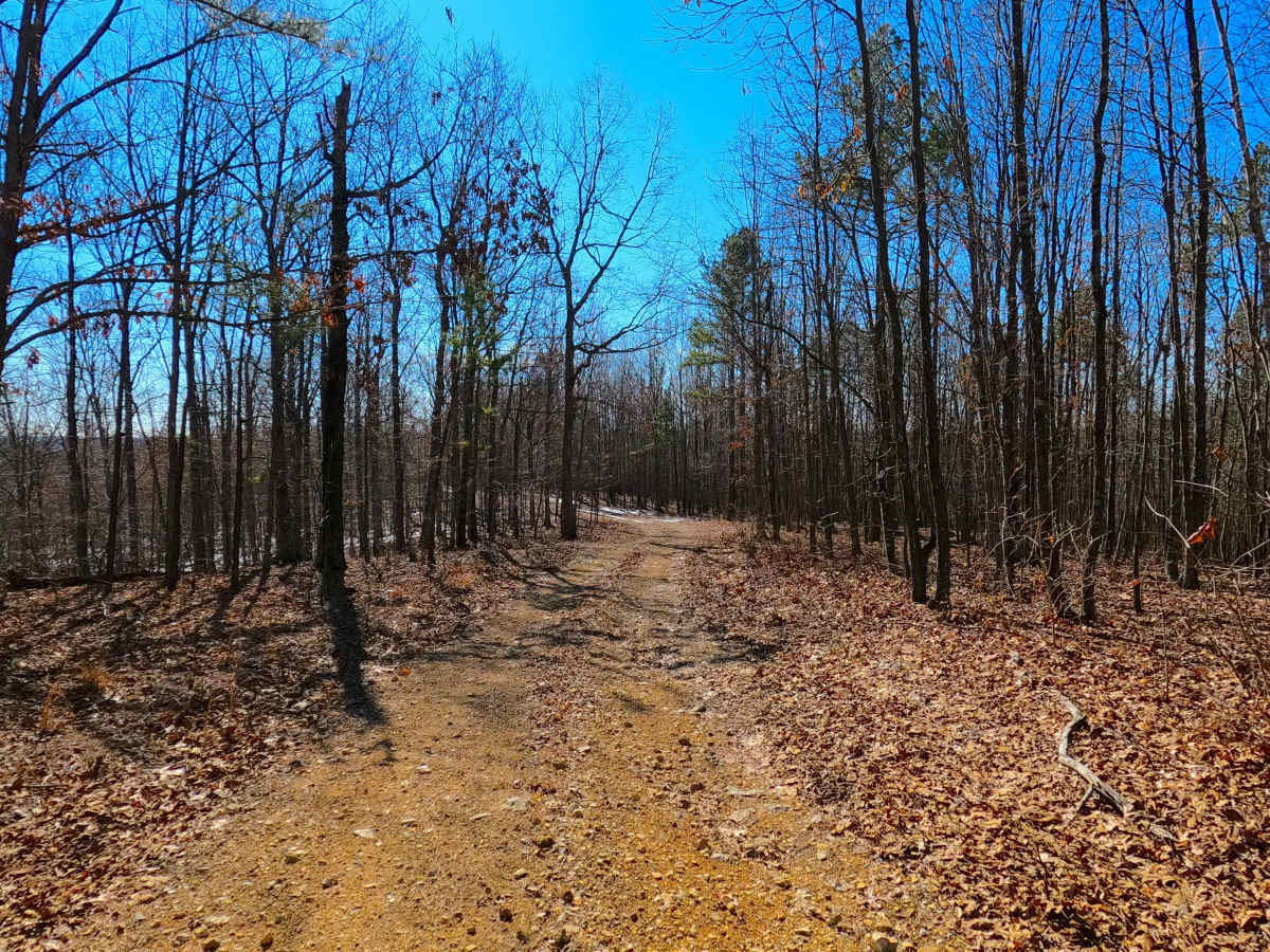
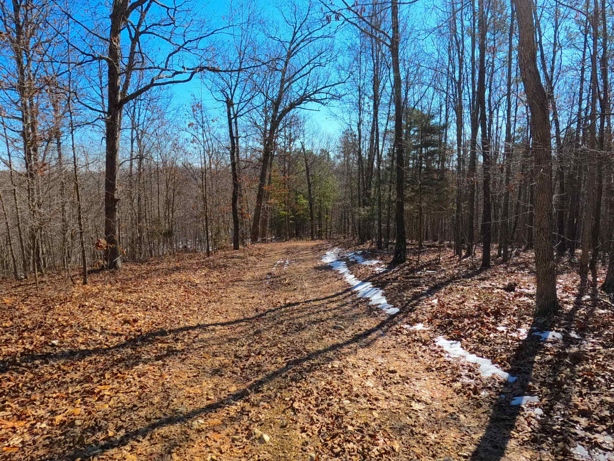
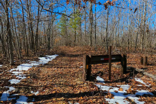
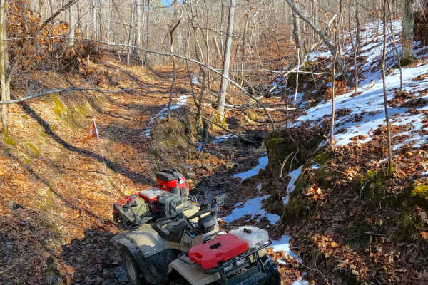
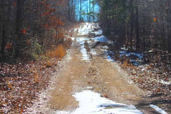
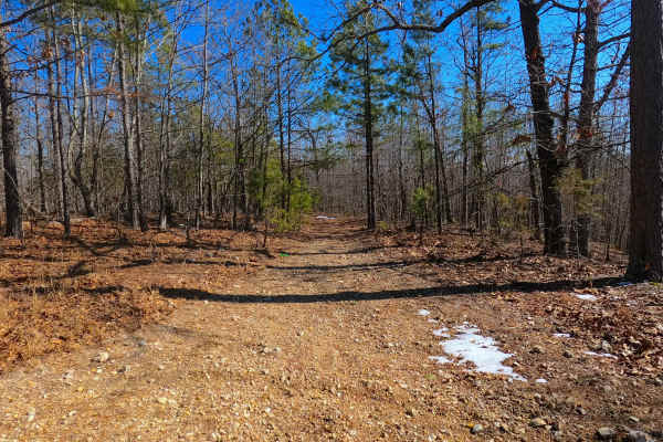
Bear Tick Ridge (FS 2459) is a gravel and dirt terrain Forest Service Road within the Salem Unit of Mark Twain National Forest, open to all vehicles complying with Reynolds County and Missouri state laws. From the beginning where the FS 2459 where it spurs off the Reynolds County Road 849 (or FS 2236), the base terrain is made up of coarse natural gravel, with the features of mild whoops, small erosion ruts, natural cobbles scattered along the path, natural rock poking out at the surface, splash level water collection spots, with the track following along the ridge top spines, through beautiful tree lines, until it meets the safe turnaround at the 3/4 mark of the road at 37.45979, -91.08053, from here going south is where the road turns into a natural path, having fallen trees layting in the path, along with small sapplings growing in the path, with the road narrowing as the edges get more overgrown. until it reaches the final turnaround at 37.4574, -91.0805, where users must turn around and head back the way they entered, as this is the legal end of the MVUM motorized route.
Difficulty
FS 2459 is given a base rating of 2/10, for having a natural coarse gravel, mild graded hills, mild forms of active erosion and ruts, loose 4 to 10-inch cobbles lying in the road, several whoops, and natural rock poking out at the surface, after passing the safe turnaround at the three quarter mark, the trail significant changes to being more natural, and featuring a narrower path, with tighter trees, and overgrown vegitation, this section is not advised for high clearance 4x4, or SXS 60" vehicles. Difficulty can increase from heavy use and a lack of maintenance, large 12-inch-plus fallen trees blocking the trail, in wet or rainy conditions, inclement weather, or from damage sustained from erosion.