
Off-Road Trails
Near Summerside, Prince Edward Island
Off-Road Trails Near Summerside, Prince Edward Island
Discover the best offroad trails near you. Browse trail maps, check difficulty ratings, and find your next adventure — whether you're looking for a quick ride or an all-day expedition.
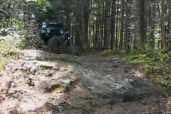
Beaumont Inland Tight Offshoot
Extremely tight trail with moderately sized rock steps and smaller mud puddles. Careful line picking is important, as you could slide into a tree while trying to crawl over the rocks. The smaller the vehicle, the more comfortable you will feel on this trail. Full-size trucks should not attempt, as y...
Learn more about Beaumont Inland Tight Offshoot
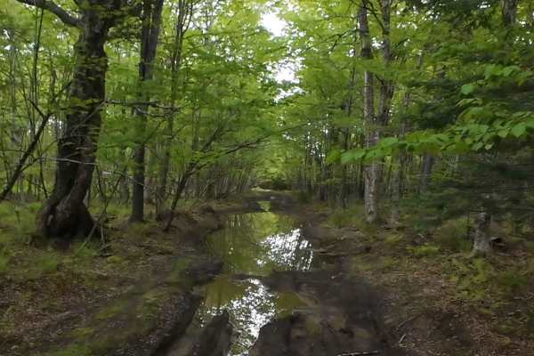
Beaumont Inland Trails
This trail features deep mudholes, some of which are even a little soft, requiring some throttle to get through. This trail can also get very rocky, especially near the "Beaumont Point". There is also some steep climbs, one of which is 16 degrees and has lots of rocks that you need to crawl over; ho...
Learn more about Beaumont Inland Trails
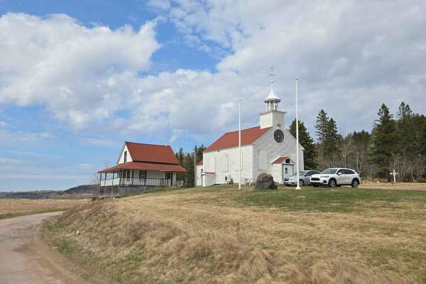
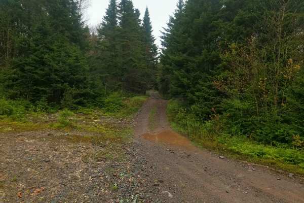
Beaumont Road
Starting at the church, the road turns to dirt, going from two lanes down to a single lane that is marked with waterholes, washouts, and washboard ruts. It leads to a scenic point overlooking the water. This spot is privately owned with allowed use, so respect it, or we will lose it. Nearby, during ...
Learn more about Beaumont Road

Beaumont Horseshoe Trail
This short horseshoe-shaped trail leads you to the famous Beaumont Point. This trail will test your suspension travel as there are very deep washouts and ruts. This trail also tends to get muddy, but doesn't feature any big mud or water holes. The trail is fairly narrow, but with some spots to pull ...
Learn more about Beaumont Horseshoe Trail
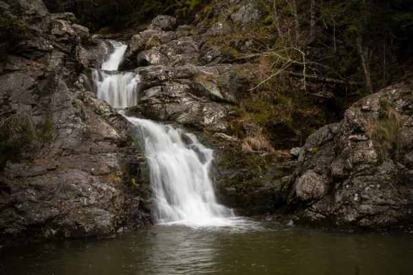
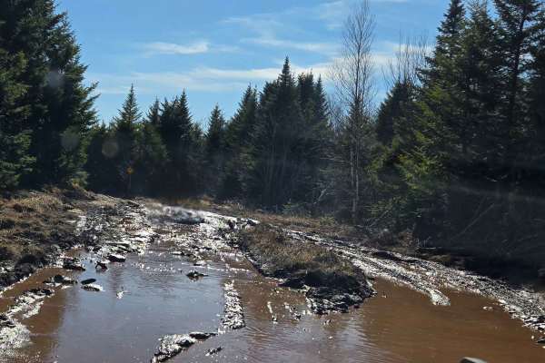
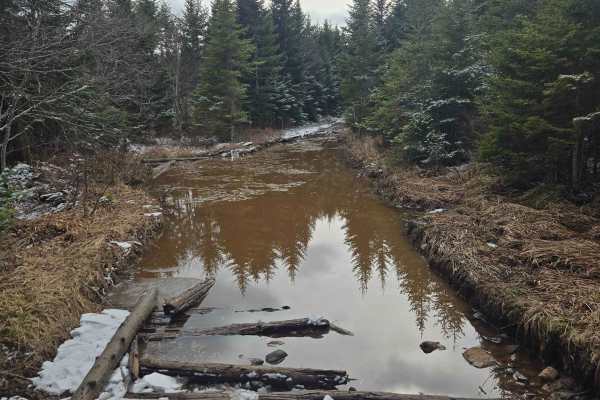
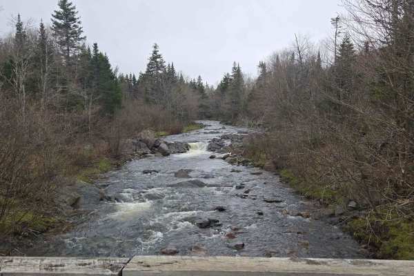
Memel Road
Memel Road is a scenic trail connecting Albert Mines Road to Hopewell Hill, featuring two beautiful waterfalls: Sawmill Creek and Memel. The trail is primarily dirt with some loose rock and puddles, generally less than 12 inches deep. A section of the trail is an uneven, rocky surface that is undula...
Learn more about Memel Road
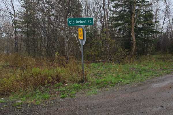
Old Debert Road
Old Debert Road in Westchester Mountain, Nova Scotia, is a scenic, rural route that offers a blend of natural beauty and rugged terrain. The road is primarily gravel and dirt, with sections that can be uneven or washed out, the turns to a rocky single lane trail. It winds through forested landscapes...
Learn more about Old Debert Road

Johnson Lake Castle
The trail begins on a gravel road with washouts, requiring careful tire placement right from the start. As you progress, you'll encounter multiple water holes, some of which can be quite deep--especially after rain. The trail narrows considerably in areas, with tight tree lines, particularly during ...
Learn more about Johnson Lake Castle
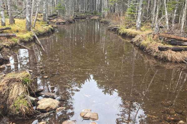
Moosebog
Moosebog, as the name suggests, is known for mud and deep water holes. However, it is mostly all pretty solid and rocky bottom, most of the water and mud holes have lots of rock poking out of them, making it very easy to scrape and or get high-centered. There are a couple of slightly steep hills, bu...
Learn more about Moosebog
Little Snare Lake Trail
Mostly gravel trail with larger rocks mixed in. Expect buried rocks that create ledges and obstacles up to 18 inches from the lowest point. The trail is single-wide with only a few passing areas. Numerous puddles are present, generally under 18 inches deep, though some hide rocks in the center that ...
Learn more about Little Snare Lake Trail
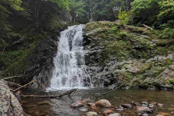
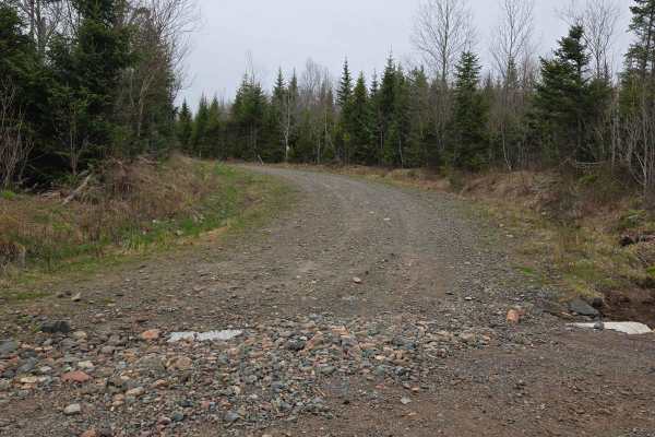
Cottage 2 Lane
The trail begins as a wide gravel road before narrowing to a single lane in places, with several passing areas available. The surface is mostly gravel with a few shallow puddles in low spots, and it connects to other trails in the area. Just off the route is Annandale Falls, a scenic stop worth visi...
Learn more about Cottage 2 Lane
Rocky brook rd
This single-lane trail begins off Rocky Brook Road and offers a rewarding challenge for experienced off-roaders. It starts as a gravel road but quickly turns into a rough dirt trail scattered with large embedded rocks, deep water holes, and muddy sections. Passing opportunities are limited, and navi...
Learn more about Rocky brook rd
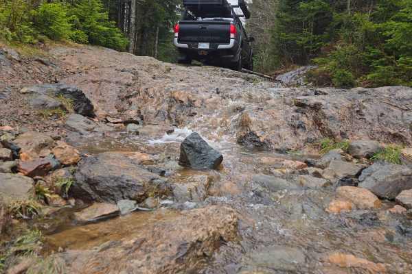
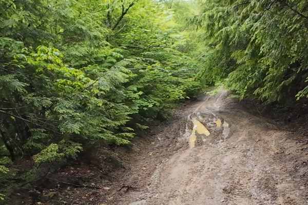
Grist Mill Road - 104
The route begins on gravel roads and gradually transitions into dirt sections with rock shelves, embedded rocks, and uneven terrain. You'll encounter water crossings with submerged logs, muddy patches, and the occasional deep rut--especially after rain. Traction may be limited in wet conditions, and...
Learn more about Grist Mill Road - 104
Shenstone Road
This trail features some moderately steep hills and some interesting obstacles, though not very hard. One of the obstacles was created very recently by the large quarry located at the start of the trail. Water run off from the quarry has been pooling up at one spot and has created a large "bowl" in ...
Learn more about Shenstone Road
Crooked Creek Trail
Discover the Beautiful Forest of Crooked Creek Trail. The Crooked Creek Trail offers a journey from Caledonia Mountain to Riverside-Albert, New Brunswick, winding through the natural beauty of the Caledonia Gorge Crown Land Conservation Area and alongside Crooked Creek. The northern section of the ...
Learn more about Crooked Creek Trail
Farm Lake Trail
A single-vehicle-wide trail with limited areas to pass, featuring larger stones and occasional rock shelves. When conditions are wet, large puddles can form along the route, some of which may conceal rocks beneath the water’s surface. The trail surface varies between firm and muddy, with reduced tra...
Learn more about Farm Lake Trail
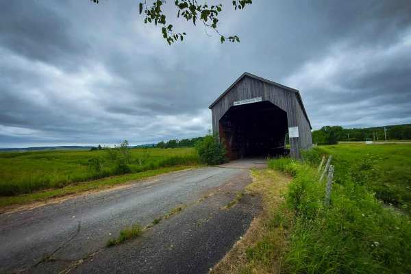
Shepody Dam Road
The Shepody Dam Road offers a scenic journey, stretching from the community of Hopewell Hill, just a stone's throw from the historic Sawmill Creek covered bridge. This well-maintained, two-vehicle-wide dirt road continues its picturesque route all the way to Mary's Point Road, where travelers will d...
Learn more about Shepody Dam Road
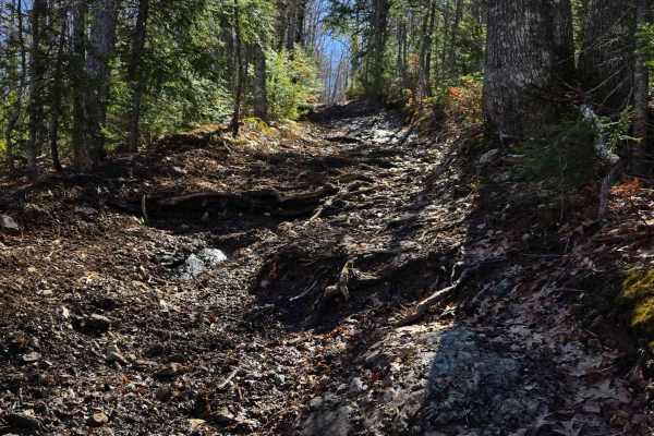
Heart Attack Hill
You will start off the route 910 and turn into a somewhat well-kept dirt road. Things quickly turn to the wild side! You will encounter a hill that is consistently between 15-18 degrees, with loose rock, rock faces, and large tree roots with a big undercut. Some of these obstacles are a struggle for...
Learn more about Heart Attack Hill
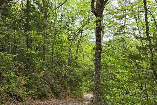
Stuart Mountain
Easy-going scenic trail, small washouts and loose stones, as well as some steep hills. The steepest point is around 16 degrees; you are almost constantly gaining elevation on this trail. It makes for some very beautiful scenery if coming down the mountain. From Dec 15th to April 15th, only snowmobil...
Learn more about Stuart Mountain
Paterson dam trail
The trail begins as a two-lane gravel road before narrowing into a single-lane dirt path. Along the way, you'll encounter minor obstacles under 12 inches and occasional water puddles with firm bottoms. The trail eventually leads to a three-way intersection, offering access to multiple directions. At...
Learn more about Paterson dam trail
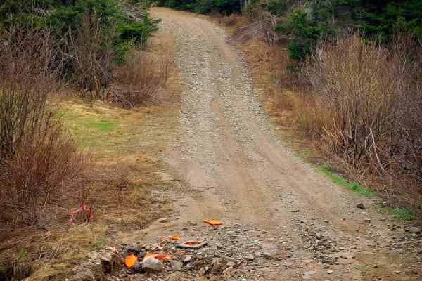
Totten Meadow Trail
This is a single-lane gravel trail with sections of larger gravel mixed in. Numerous pull-off spots allow for passing. The trail leads to a junction point that connects to several other routes and destinations. Cell service is available at one section of the trail.
Learn more about Totten Meadow Trail
ATV trails near Summerside, Prince Edward Island
Explore ATV-friendly trails near you. These trails are accessible for vehicles up to 50 inches wide, perfect for ATVs and smaller off-road machines.
Beaumont Inland Tight Offshoot
Extremely tight trail with moderately sized rock steps and smaller mud puddles. Careful line picking is important, as you could slide into a tree while trying to crawl over the rocks. The smaller the vehicle, the more comfortable you will feel on this trail. Full-size trucks should not attempt, as y...
Learn more about Beaumont Inland Tight Offshoot
Beaumont Inland Trails
This trail features deep mudholes, some of which are even a little soft, requiring some throttle to get through. This trail can also get very rocky, especially near the "Beaumont Point". There is also some steep climbs, one of which is 16 degrees and has lots of rocks that you need to crawl over; ho...
Learn more about Beaumont Inland Trails
Beaumont Road
Starting at the church, the road turns to dirt, going from two lanes down to a single lane that is marked with waterholes, washouts, and washboard ruts. It leads to a scenic point overlooking the water. This spot is privately owned with allowed use, so respect it, or we will lose it. Nearby, during ...
Learn more about Beaumont Road
Beaumont Horseshoe Trail
This short horseshoe-shaped trail leads you to the famous Beaumont Point. This trail will test your suspension travel as there are very deep washouts and ruts. This trail also tends to get muddy, but doesn't feature any big mud or water holes. The trail is fairly narrow, but with some spots to pull ...
Learn more about Beaumont Horseshoe Trail
UTV/side-by-side trails near Summerside, Prince Edward Island
Find UTV and side-by-side trails near you. These trails accommodate vehicles up to 60 inches wide, ideal for UTVs, side-by-sides, and wider off-road rigs.
Beaumont Inland Tight Offshoot
Extremely tight trail with moderately sized rock steps and smaller mud puddles. Careful line picking is important, as you could slide into a tree while trying to crawl over the rocks. The smaller the vehicle, the more comfortable you will feel on this trail. Full-size trucks should not attempt, as y...
Learn more about Beaumont Inland Tight Offshoot
Beaumont Inland Trails
This trail features deep mudholes, some of which are even a little soft, requiring some throttle to get through. This trail can also get very rocky, especially near the "Beaumont Point". There is also some steep climbs, one of which is 16 degrees and has lots of rocks that you need to crawl over; ho...
Learn more about Beaumont Inland Trails
Beaumont Road
Starting at the church, the road turns to dirt, going from two lanes down to a single lane that is marked with waterholes, washouts, and washboard ruts. It leads to a scenic point overlooking the water. This spot is privately owned with allowed use, so respect it, or we will lose it. Nearby, during ...
Learn more about Beaumont Road
Beaumont Horseshoe Trail
This short horseshoe-shaped trail leads you to the famous Beaumont Point. This trail will test your suspension travel as there are very deep washouts and ruts. This trail also tends to get muddy, but doesn't feature any big mud or water holes. The trail is fairly narrow, but with some spots to pull ...
Learn more about Beaumont Horseshoe Trail
The onX Offroad Difference
onX Offroad combines trail photos, descriptions, difficulty ratings, width restrictions, seasonality, and more in a user-friendly interface. Available on all devices, with offline access and full compatibility with CarPlay and Android Auto. Discover what you're missing today!
Open Trail Map