
Off-Road Trails
Near Monteagle, Tennessee
Off-Road Trails Near Monteagle, Tennessee
Discover the best offroad trails near you. Browse trail maps, check difficulty ratings, and find your next adventure — whether you're looking for a quick ride or an all-day expedition.

Powerline to Jumpoff Road
Powerline to Jumpoff Road is a challenging, 2.8-mile unpaved trail located near South Pittsburg Mountain in Marion County, Tennessee, making it an excellent destination for experienced offroaders seeking a technical test of vehicle articulation and clearance. Branching off State Route 156, this rout...
Learn more about Powerline to Jumpoff Road
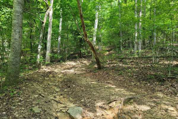
Trail 5
AOP Trail 5 - Lifeform is a peaceful uphill climbing connector trail. Trail 5 features small rocks, exposed roots, and curving bends that bring you out to Trail 3. During the spring and summer, you will have a dense overhead canopy that shades you from the blistering Tennessee heat which makes for ...
Learn more about Trail 5
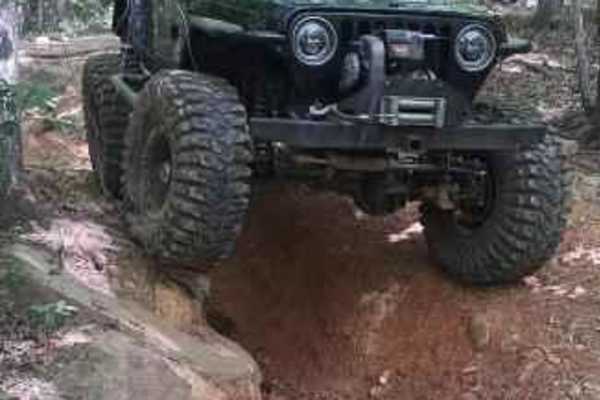
Trail 6
AOP trail 6 - Descension is a mild downhill trail that starts off as a dirt flat, and ends with a deeply rutted and eroded section. The bottom half rut also has an exposed tree root. You have 3 options: Straddle the rut, stay on the high side of the rut if you have a narrow enough wheelbase, or get...
Learn more about Trail 6
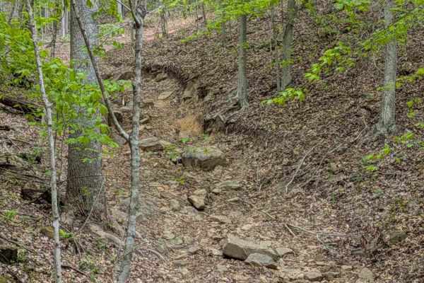
JW1
JW1 is a short, steep trail that connects Trails 4 and 17. Its main obstacle is a deep rut in a turn at the top of the hill. The trail is named after Jeeps and Wrenches, a club based in Nashville that originally cleared this trail. The park rating for this trail is Blue (Moderate). A Park Day-Use Tr...
Learn more about JW1
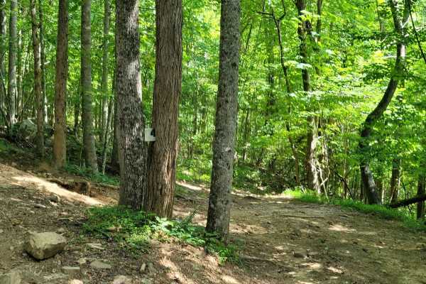
Trail 4
AOP Trail 4 - Mars is a short and simple connector trail that features a hard-packed route with lots of smaller rocks with little to no mud. While Trail 4 - Mars does not have any difficult features, it is a great trail to tie into others to make a good cruising route.
Learn more about Trail 4
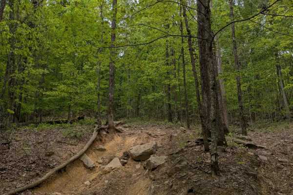
Trail 90
Trail 90 is a steep, winding trail at the top of the park with a lot of rock obstacles approaching 2 to 3 feet tall. The park rating for this trail is Blue (Moderate). A Park Day-Use Trail Pass is required to access this system of trails. Cell service is spotty in places, and trail conditions can ch...
Learn more about Trail 90
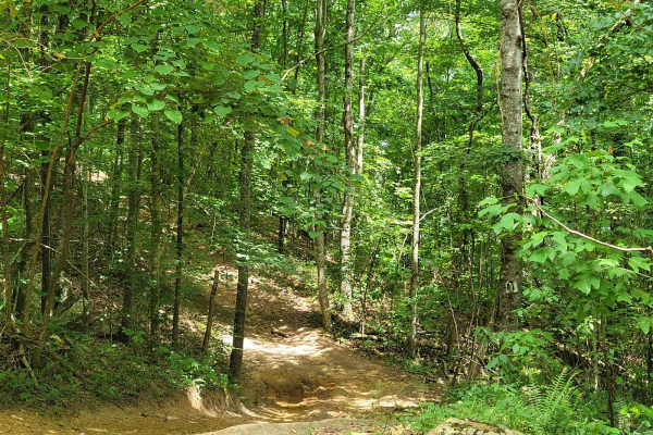
Trail 11
AOP trail 11 - Ground Control is like a child's roller coaster- slightly uphill then back down over and over. Trail 11 - Ground Control has concentrated clusters of rock, however none are difficult to traverse. One section does show some larger rocks that could scuff up the oil pans on a low-clearan...
Learn more about Trail 11
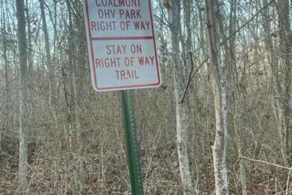
Pumping Station Access
Pumping Station Access serves as an easy, highly convenient connector trail for offroaders looking for a quick cut-through between the Coalmont OHV trail system and Company Farm Road. Spanning approximately 2.5 miles, this point-to-point route features minor elevation changes, dropping from a maximu...
Learn more about Pumping Station Access
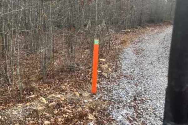
Coalmont Trail 15
Coalmont Trail 15 is an inviting, scenic warm-up loop perfect for novice offroaders and families looking to ease into their adventure at the Coalmont OHV Park. Spanning just under one mile, this beginner-friendly trail begins directly at the primary parking and camping area, looping around to connec...
Learn more about Coalmont Trail 15
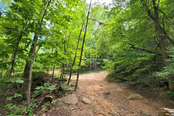
Trail 7
AOP 7 - Ascension can be quite a slippery slope when wet. When the trail is dry it is a fun hill climb for all vehicle types. Trail 7 - Ascension features two uphill climbs with two distinct turns. The first climb and turn is well packed with softball to volleyball-sized rock for increased traction....
Learn more about Trail 7
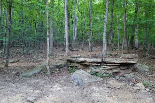
Trail 3
Trail 3, also known as Major Tom, is an approachable 0.9-mile off-road trail located within Adventure Off Road Park (AOP) in South Pittsburg, Tennessee, perfect for beginners and those looking for a scenic, relaxed drive. Featuring an elevation gain of roughly 266 feet and reaching a maximum elevati...
Learn more about Trail 3
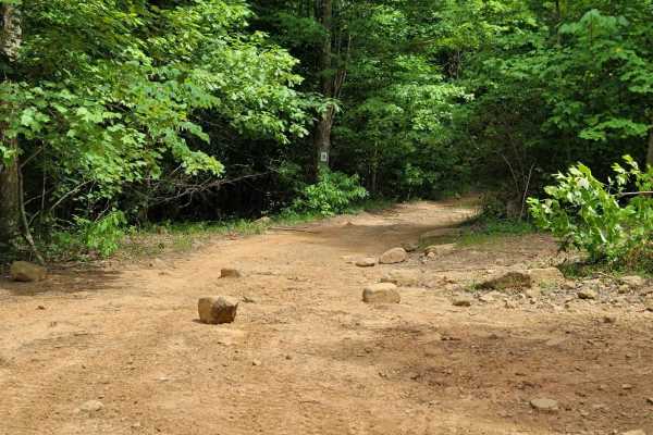
Trail 9
AOP trail 9 - Little Dipper is a full loop trail that connects back to itself, but also connects to a few other more difficult trails. Trail 9 - Little Dipper is mostly flat throughout with little to no obstacles. The loose dirt and light gravel is compact from one end to the other.
Learn more about Trail 9
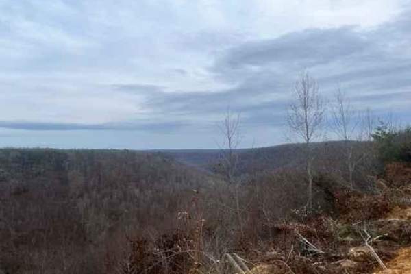
Coalmont OHV Trail 1 (Blue)
Located in the Heart of Grundy County, see what Coalmont OHV is about! This trail begins at a camping and parking area and passes a beautiful overlook right from the start. The overlook on this trail is the best view at Coalmont OHV. It is easily accessed in almost any vehicle. The trail drops off t...
Learn more about Coalmont OHV Trail 1 (Blue)

Trail 2
AOP's trail 2 - Convergence is an easy route that peels off of trail 1 - Launch Pad and curves around towards the buggy side of the park. Trail 2 is a convergence point for water that runs off the mountain and feeds into the nearby Battle Creek. Convergence features a hard-packed dirt, with little t...
Learn more about Trail 2

Trail 8
AOP Trail 8 - Megabit is a root-filled trail from topsoil that has washed down the mountain leaving the toes of the trees exposed throughout. Overall the trail is a very easy connector trail with the exception of one spot in the middle with an exposed rock, and the entrance to the trail that is mild...
Learn more about Trail 8
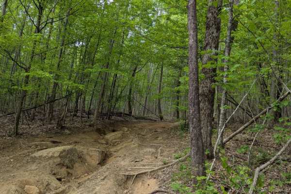
Trail 14
Trail 14 snakes through the top of the park, connecting Trails 1 and 3, and is a mix of rocky climbs and smooth dirt. The park rating for this trail is Green (Easy). A Park Day-Use Trail Pass is required to access this system of trails. Cell service is spotty in places, and trail conditions can chan...
Learn more about Trail 14
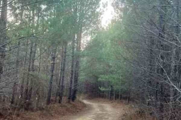
Coalmont Trail 11
Coalmont Trail 11 is an easy-going, scenic connector trail within the Coalmont OHV Park that is perfect for beginners, stock high-clearance 4x4 vehicles, and off-roaders looking for a relaxed ride. Spanning approximately one mile, this trail connects Trail 2 to Trail 13, offering a gentle route with...
Learn more about Coalmont Trail 11
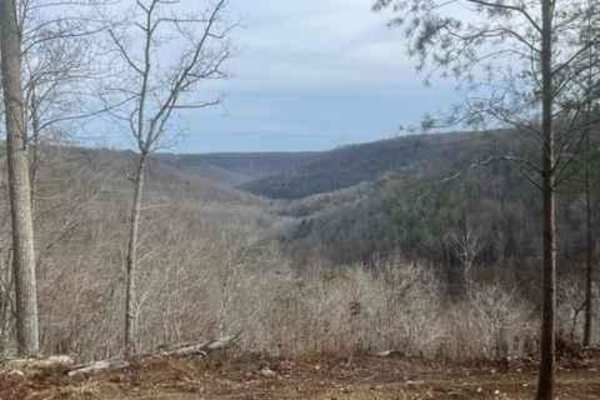
Coalmont Trail 17
Trail 17 goes from Trail 15 to Trail 1. Along the way, you will encounter steep hill climbs and descents. There are rocks up to 18 inches tall to climb over. The trail goes out to the bluff and drops off the hill, where it circles around the bottom and then climbs up to a beautiful overlook. At the ...
Learn more about Coalmont Trail 17
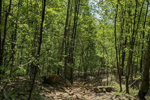
Trail 30
Trail 30 is a rocky trail with some steep climbs that runs roughly parallel to JW4. Many rocks are roughly 2 feet or taller. The park rating for this trail is Blue (Moderate). A Park Day-Use Trail Pass is required to access this system of trails. Cell service is spotty in places, and trail condition...
Learn more about Trail 30
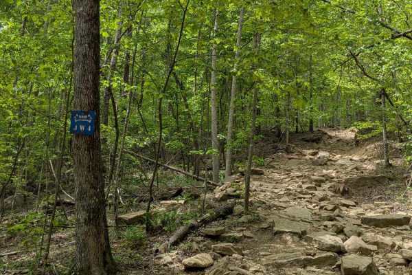
JW4
JW4 The trail is named after Jeeps and Wrenches, a club based in Nashville that originally cleared this trail. The park rating for this trail is Blue (Moderate). A Park Day-Use Trail Pass is required to access this system of trails. Cell service is spotty in places, and trail conditions can change q...
Learn more about JW4
ATV trails near Monteagle, Tennessee
Explore ATV-friendly trails near you. These trails are accessible for vehicles up to 50 inches wide, perfect for ATVs and smaller off-road machines.
Powerline to Jumpoff Road
Powerline to Jumpoff Road is a challenging, 2.8-mile unpaved trail located near South Pittsburg Mountain in Marion County, Tennessee, making it an excellent destination for experienced offroaders seeking a technical test of vehicle articulation and clearance. Branching off State Route 156, this rout...
Learn more about Powerline to Jumpoff Road
Trail 5
AOP Trail 5 - Lifeform is a peaceful uphill climbing connector trail. Trail 5 features small rocks, exposed roots, and curving bends that bring you out to Trail 3. During the spring and summer, you will have a dense overhead canopy that shades you from the blistering Tennessee heat which makes for ...
Learn more about Trail 5
Trail 6
AOP trail 6 - Descension is a mild downhill trail that starts off as a dirt flat, and ends with a deeply rutted and eroded section. The bottom half rut also has an exposed tree root. You have 3 options: Straddle the rut, stay on the high side of the rut if you have a narrow enough wheelbase, or get...
Learn more about Trail 6
JW1
JW1 is a short, steep trail that connects Trails 4 and 17. Its main obstacle is a deep rut in a turn at the top of the hill. The trail is named after Jeeps and Wrenches, a club based in Nashville that originally cleared this trail. The park rating for this trail is Blue (Moderate). A Park Day-Use Tr...
Learn more about JW1
UTV/side-by-side trails near Monteagle, Tennessee
Find UTV and side-by-side trails near you. These trails accommodate vehicles up to 60 inches wide, ideal for UTVs, side-by-sides, and wider off-road rigs.
Powerline to Jumpoff Road
Powerline to Jumpoff Road is a challenging, 2.8-mile unpaved trail located near South Pittsburg Mountain in Marion County, Tennessee, making it an excellent destination for experienced offroaders seeking a technical test of vehicle articulation and clearance. Branching off State Route 156, this rout...
Learn more about Powerline to Jumpoff Road
Trail 5
AOP Trail 5 - Lifeform is a peaceful uphill climbing connector trail. Trail 5 features small rocks, exposed roots, and curving bends that bring you out to Trail 3. During the spring and summer, you will have a dense overhead canopy that shades you from the blistering Tennessee heat which makes for ...
Learn more about Trail 5
Trail 6
AOP trail 6 - Descension is a mild downhill trail that starts off as a dirt flat, and ends with a deeply rutted and eroded section. The bottom half rut also has an exposed tree root. You have 3 options: Straddle the rut, stay on the high side of the rut if you have a narrow enough wheelbase, or get...
Learn more about Trail 6
JW1
JW1 is a short, steep trail that connects Trails 4 and 17. Its main obstacle is a deep rut in a turn at the top of the hill. The trail is named after Jeeps and Wrenches, a club based in Nashville that originally cleared this trail. The park rating for this trail is Blue (Moderate). A Park Day-Use Tr...
Learn more about JW1
The onX Offroad Difference
onX Offroad combines trail photos, descriptions, difficulty ratings, width restrictions, seasonality, and more in a user-friendly interface. Available on all devices, with offline access and full compatibility with CarPlay and Android Auto. Discover what you're missing today!
Open Trail Map